September 4, Wednesday
Debbie and I woke up really early because we wanted to get into the park (Glacier National Park, for those that haven’t been following) and hit a couple of trails. We’d heard that parking was an issue at some of the trailheads, so, an early start it was to be. BUT, when I went out and started the truck, I had a error message that the exhaust filter was overloaded and that I needed to “drive to clean”. Knowing that driving into the park wasn’t going to get the job done, I decided to drive up the highway from the campground towards the nearby Canadian border and back. When this rare event does occur, it usually only takes 15 minutes or so. I drove for an hour and a half! Approximately 60 miles. The message never went away, so back to the campground we went to try and locate a nearby Ford dealership. We found that the nearest dealership in the US was well over an hour away, but also found a dealership in Canada that was only about 30 miles away. We gave them a call and they said they’d get us right in.
So, we head out to the truck, start it up and guess what? The message had changed to “cleaning exhaust filter”. We decided to go ahead and take it to get them to look at it, even though that message normally goes away in about a minute or two. Once again, no change all the way to the Canadian border, so something was still wrong. While passing through the border security, I had to put the truck in PARK, which stops the cleaning process. The message never came back on. Once at the small dealership, the tech checked the truck on the computer and told us that every thing he checked came back normal, but given the symptoms, he suggested we go ahead and do a static (manual, not driving) exhaust filter regeneration. Well, $155 Canadian and I was on my way. That’s like $115 in US.
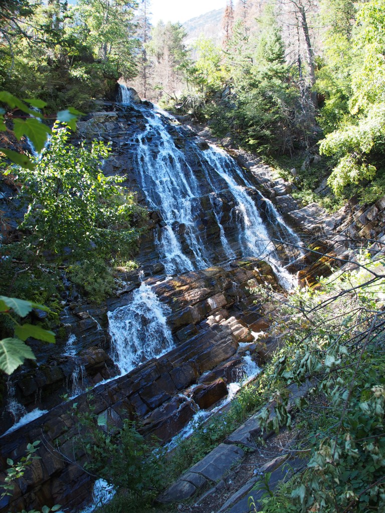
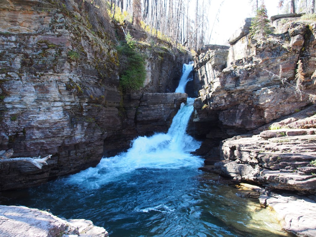
Being in Canada, it made sense to go to Waterton Lakes National Park, which is a sister park to Glacier National Park. We’d planned on going there on Friday anyway, so why not go since we were already so close. Let me just say that Canadian national parks are not as well organized as their US counterparts. They don’t give you any information when you enter the park and signage that would normally give you directions didn’t exist. We did finally find the tiny visitor center which turned out to be in with the post office. What little roads they had were all in the town of Waterton. The only other drives were closed for repair. Pretty much the only thing there was for us to do was one hike to Bertha Falls. Using their “maps”, we finally found the trailhead. It was a very nice hike and the waterfall was pretty nice, but much of the area had been burned out in a fire last year.
Let’s just say that crossing the border back into the US took a little more effort than getting into Canada. They wanted to know where we were from (listed on my passport), what we did for a living, and since we were retired, what we did before we retired. Did we buy anything? Sell anything? Give away anything? Did we have any fruits or vegetables? Alcohol? The young man was steadily firing questions while another border agent looked in our back seat, inside our ice chest, and inspected everything in the bed of the truck. Good think I took out the propane tank and 5 gallon can of diesel fuel that I carry around.
September 5, Thursday
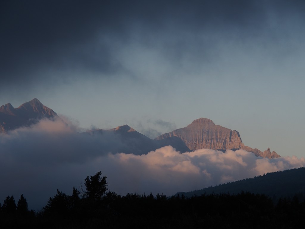
Another early morning to get back into Glacier National Park ahead of the crowds. On Tuesday, the parking lot at the Logan Pass Visitor Center was full by 8:45, so we needed to get out by about 7:00. While loading up the truck, I spotted a spectacular view looking back into the park from our campground. Heavy fog was rolling in and I thought we were going to get washed out, but it hadn’t yet reached fully into the park. Just enough to give me this spectacular scene.
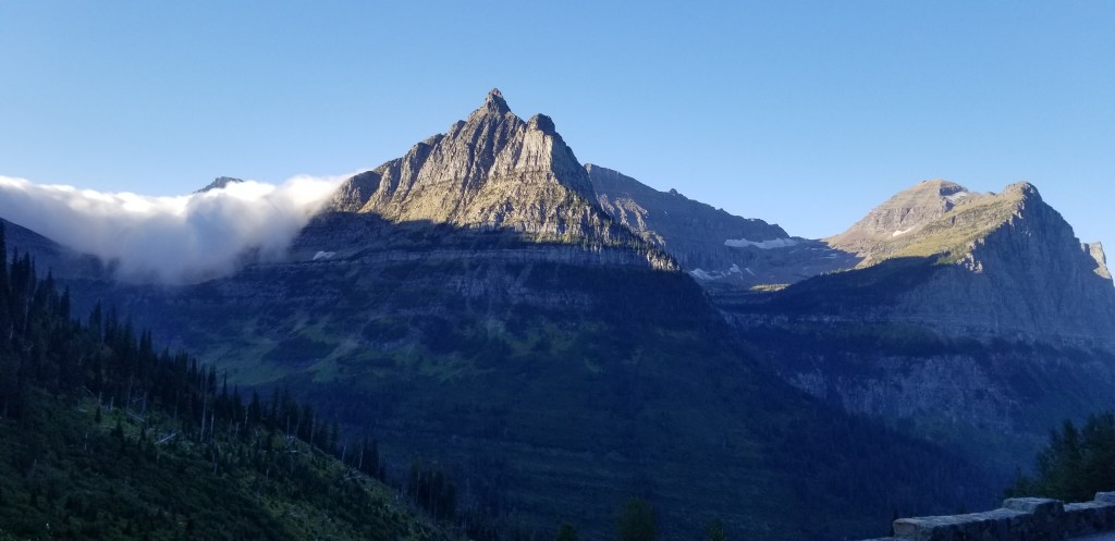
We headed into the park about 7:15 and the fog was horrible all the way from our campground to Logan Pass. We reached the parking lot at 8:10 and managed to get one of the last 2-3 spots in the lot. We walked over to the visitor center in the dense fog and 45 degree temps. This is the only visitor center in the park where Debbie hadn’t received her National Parks Passport stamp. Unfortunately, the visitor center didn’t open until 9:30! We then decided to head over into the west side of the park and try to hike the Trail of the Cedars and Avalanche Lake trails. What we found was that many, many people had decided to use the parking lot at those trailheads to catch the shuttle bus up to Logan Pass. We were very fortunate to even find a space.
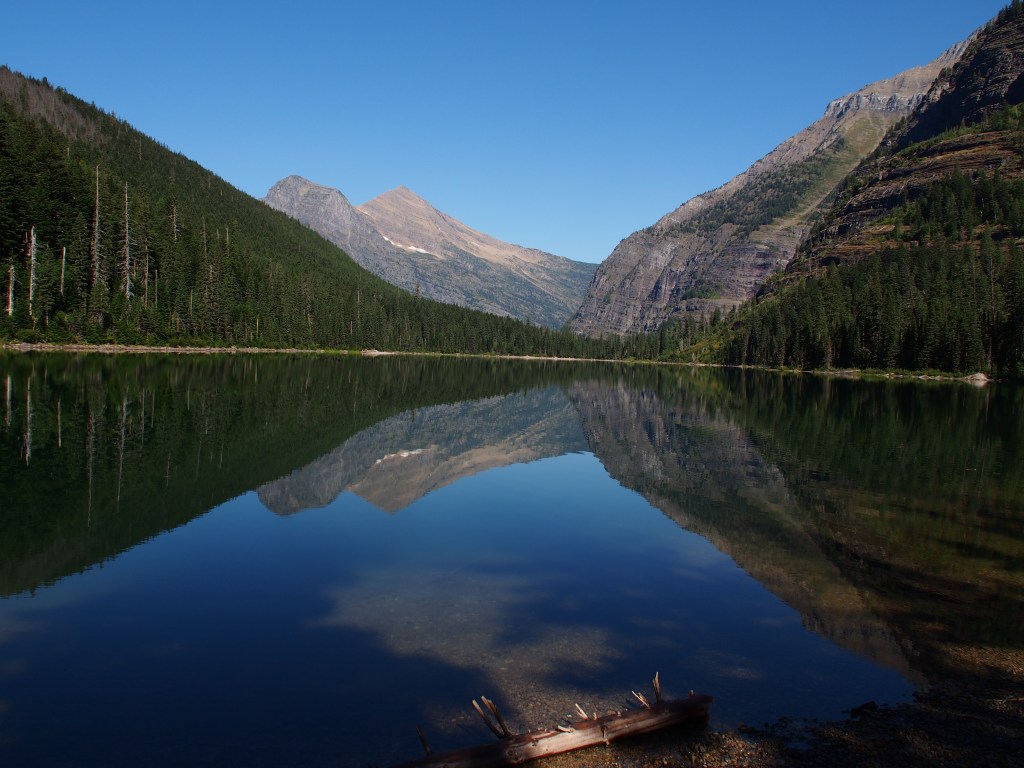
Trail of the Cedars was a pretty easy trail, partially boardwalk, that we nice and flat for those folks that weren’t really into hiking, but wanted to se the sights. We bypassed most of that and put our effort into the longer and more strenuous Avalanche Lake trail. It was a great trail through some large cedar forest, the hundred foot tall kind, and ended at a perfectly calm alpine lake. There were extremely tall two waterfalls at the far end of the lake, but our pictures didn’t work out because the sun hadn’t yet moved high enough to illuminate them. We extended our hike to walk the length of the lake to get some views with the sun behind us and were reworded with some amazing views with the mountains reflecting in the smooth lake, before heading back. Overall, this hike was just over six miles with a pretty good gain in elevation.
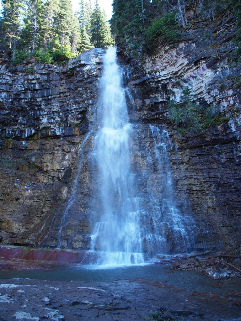
We drove back through the park, stopping briefly for Debbie to run into the Logan pass Visitor Center (while I circled the lot in the truck) to get her passport book stamped. From there, we headed back to the east side of the park to hike three trails to see some waterfalls. We started with the Saint Mary Falls Trail, then the Virginia Falls Trail, then the Baring Falls Trail. The Virginia Falls trail was by far the toughest. Although these three trails all had a named falls at the end, there were numerous beautiful unnamed falls all along the way. This hike ended up being another 5.5 miles, bringing our daily total to around 11.5 miles (over 32,000 steps on Debbie’s Fitbit!).
I think we’re going to take it easy tomorrow. There is a 60-80% chance of rain, plus we want to be fresh for our final day here on Saturday where we plan on hiking the grueling trail to Grinnel Glacier up in the Many Glacier area of the park. It’s going to be an all day hike, so I hope we survive!
