I know. I’m a little late getting this one posted. It’s just that we do so much that I can’t get myself in gear to get the posts done. Not to mention going through SO many pictures just trying to find the right “few” to add here.
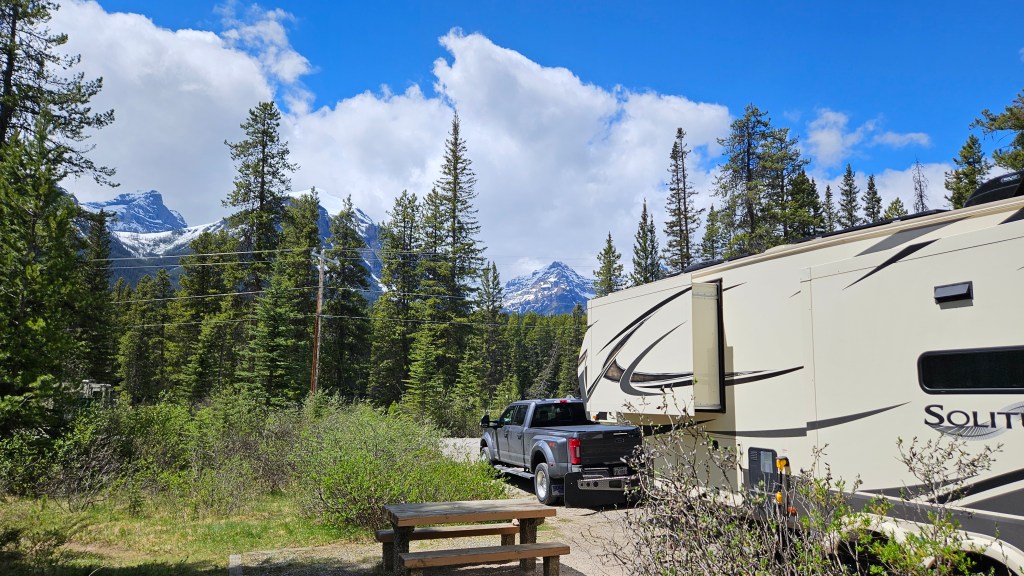
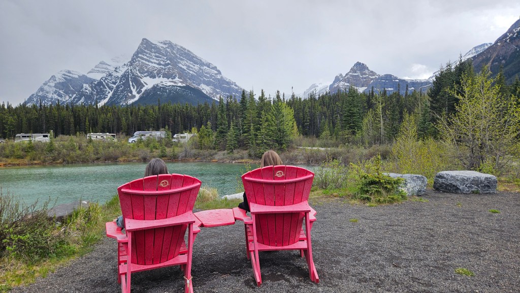
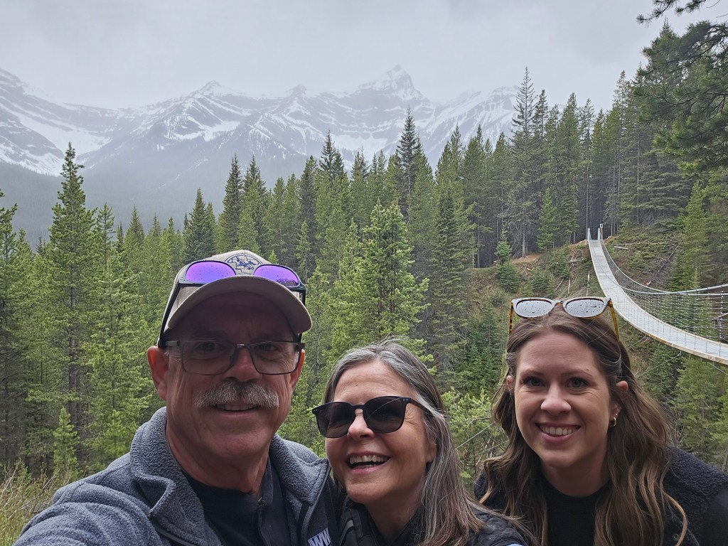
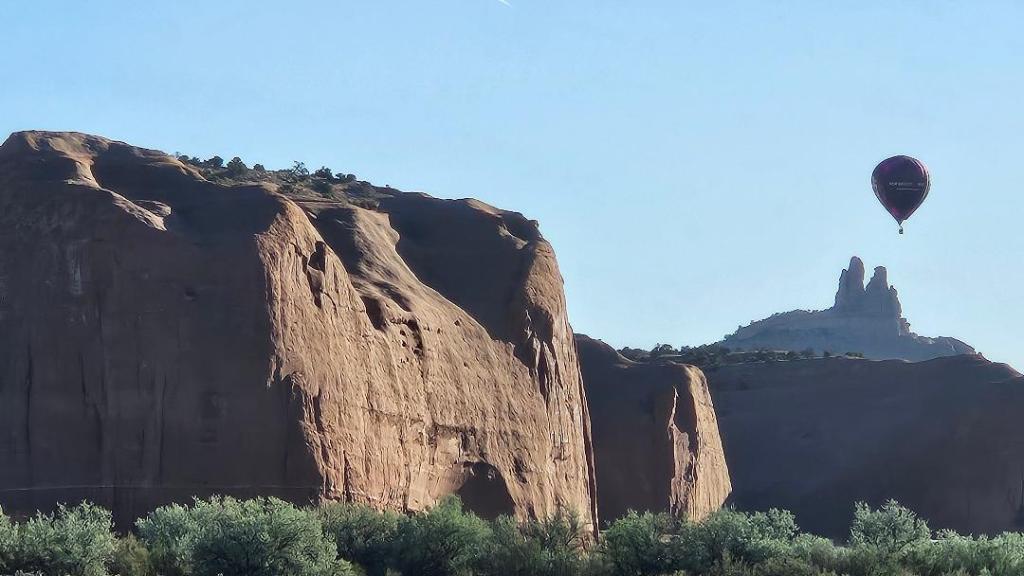
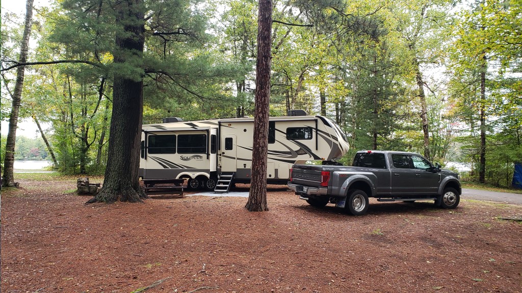
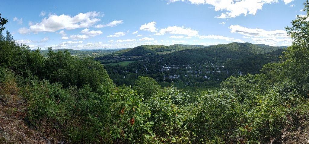
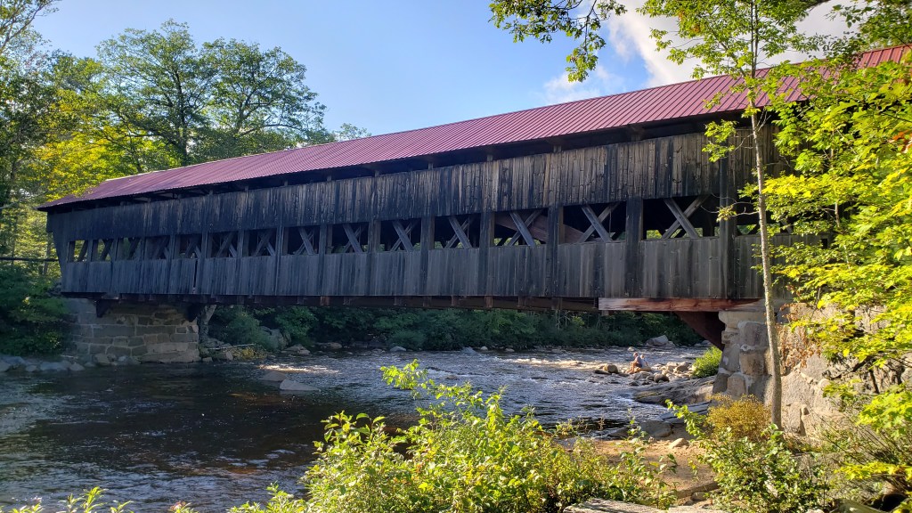
Tuesday was a travel day, moving from just outside of Calgary to the Lake Louise Hard-sided Campground. The campground was located right along the Bow River in the town of Lake Louise. The adjacent Soft-sided Campground is so named because they allow pop-up campers and tents due to the campground being surrounded by an electric fence to protect the campers from bears. Being in a “hard-sided” camper, we didn’t have that protection. Arriving in our site, we found that we had a beautiful view of the snow-covered mountains.
Our campground in Lake Louise. What a view!
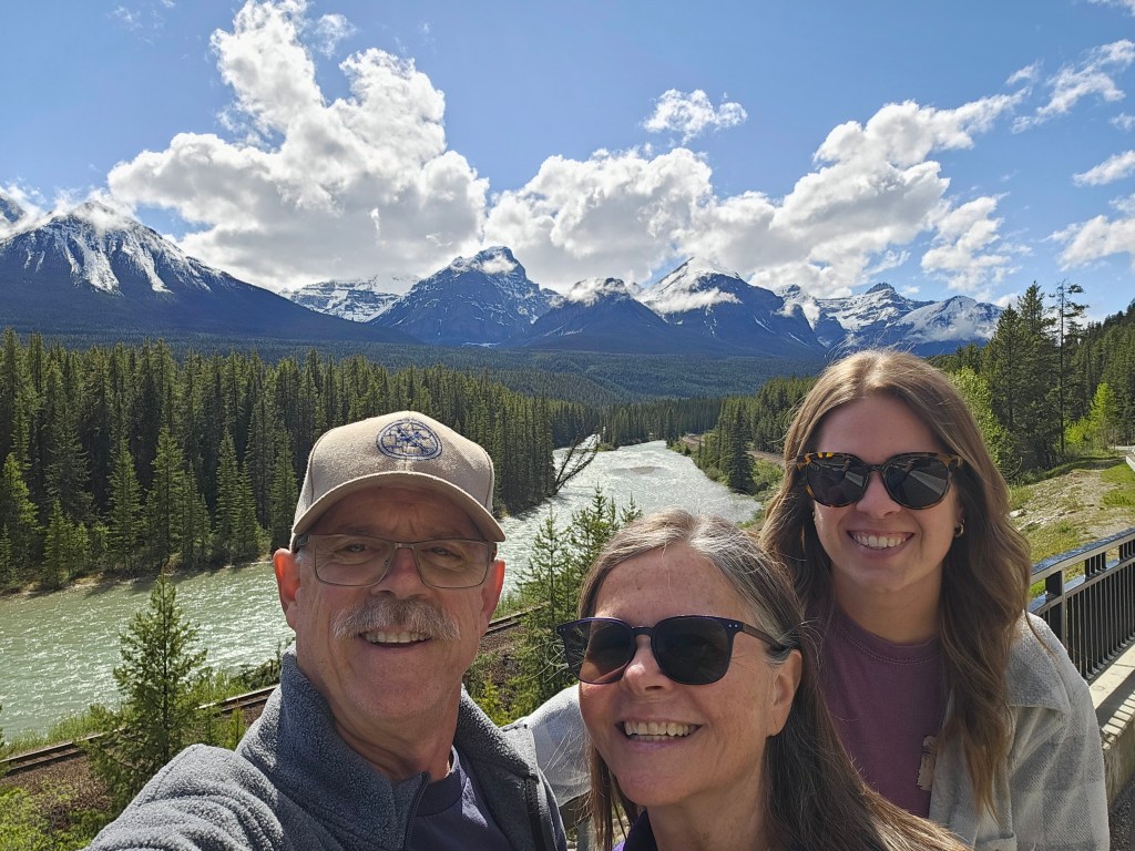
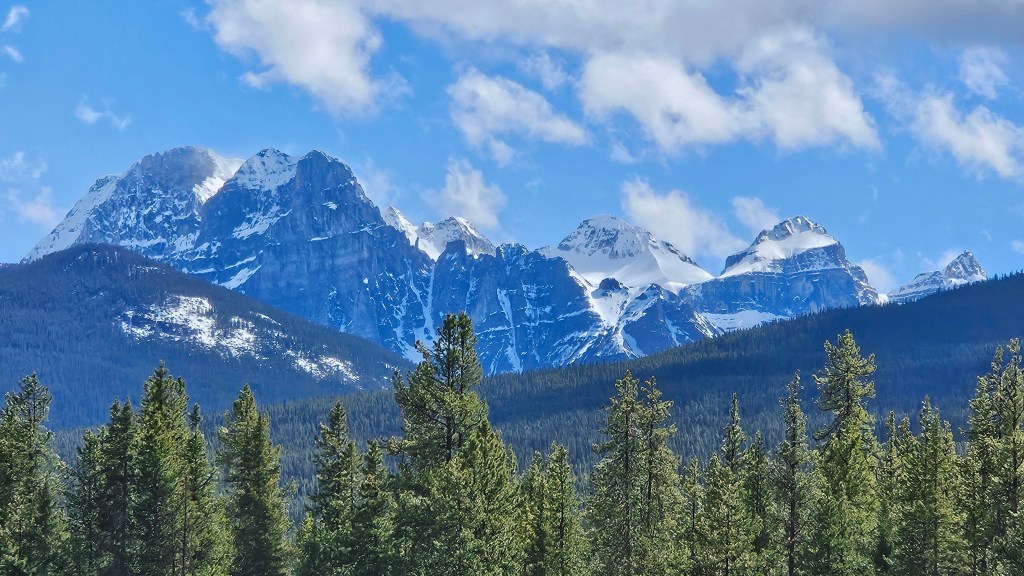
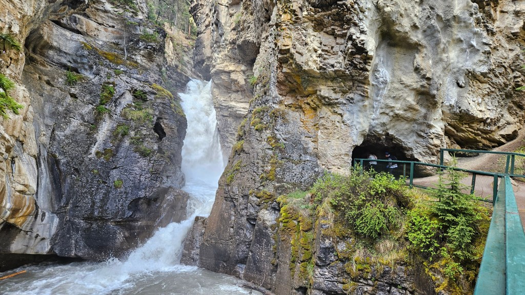
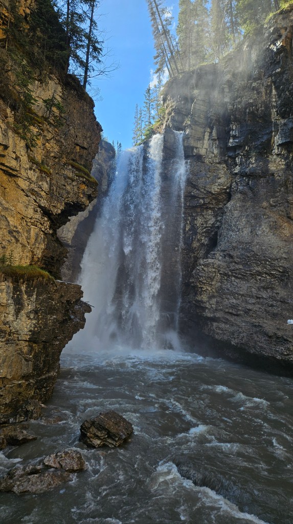
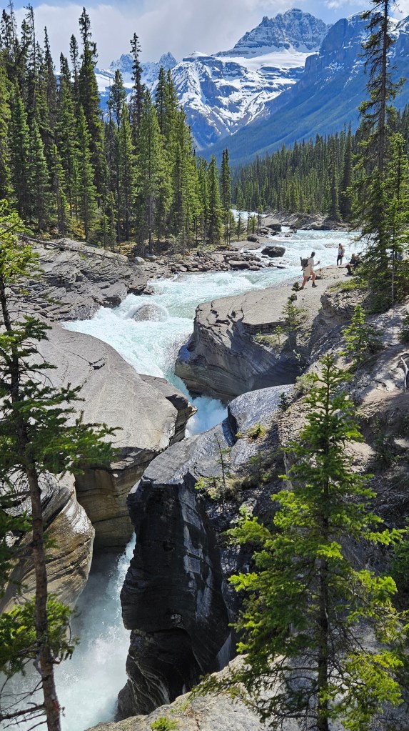
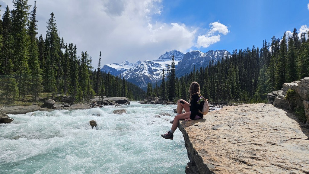
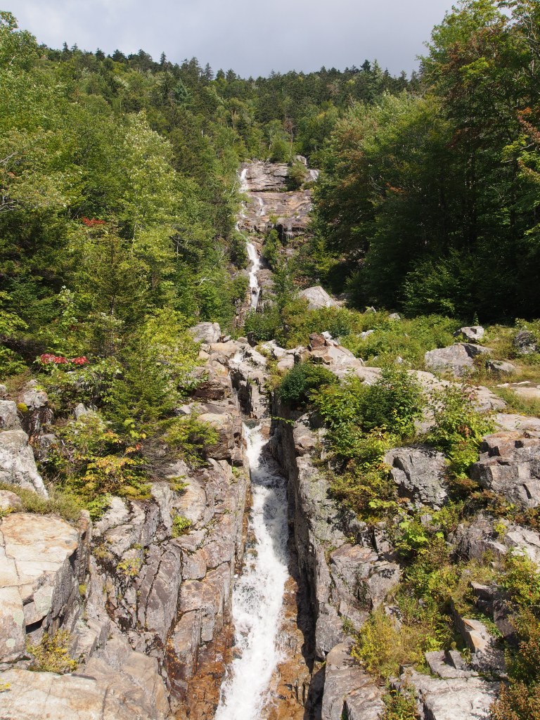
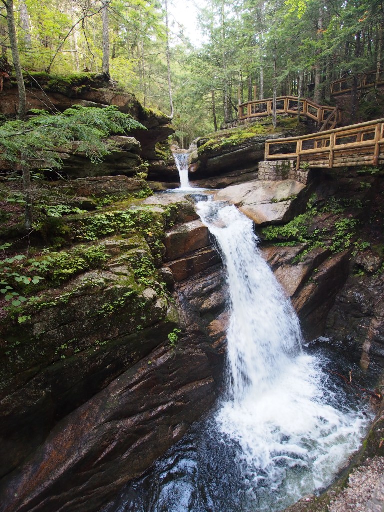
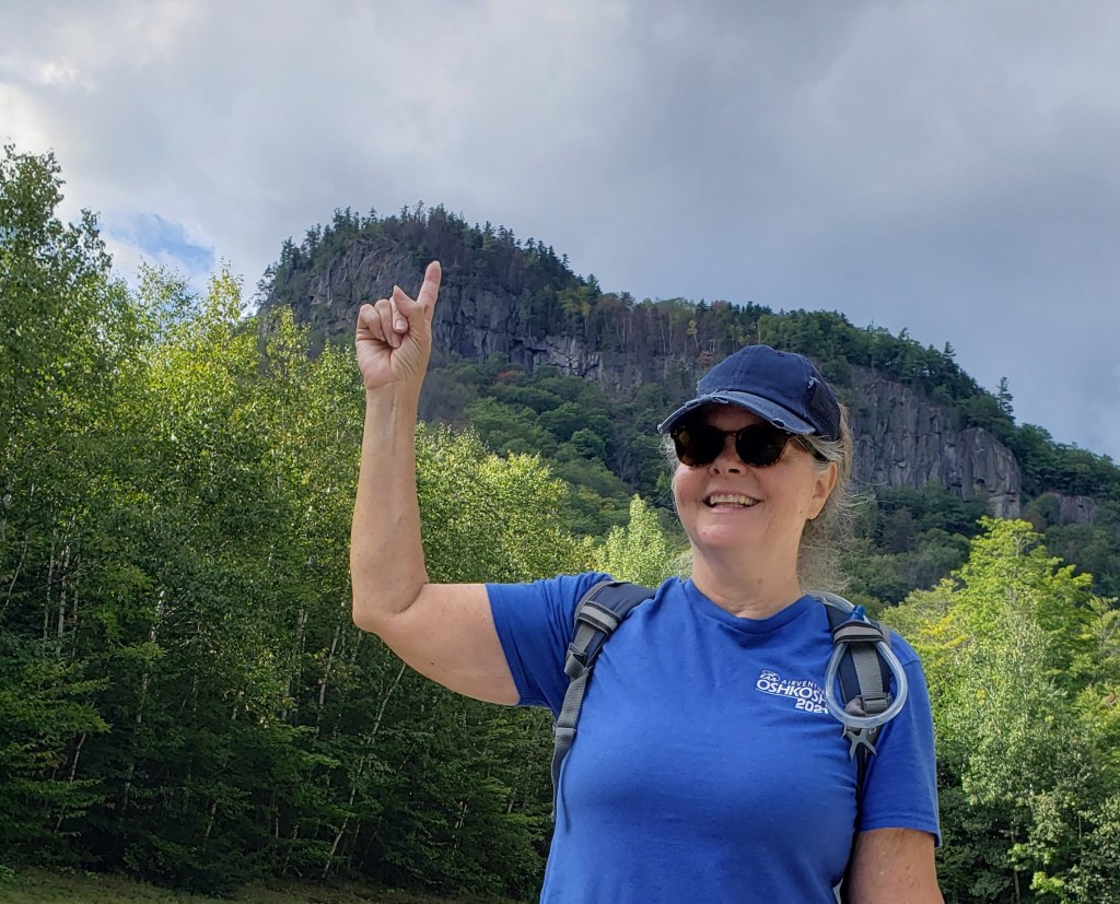
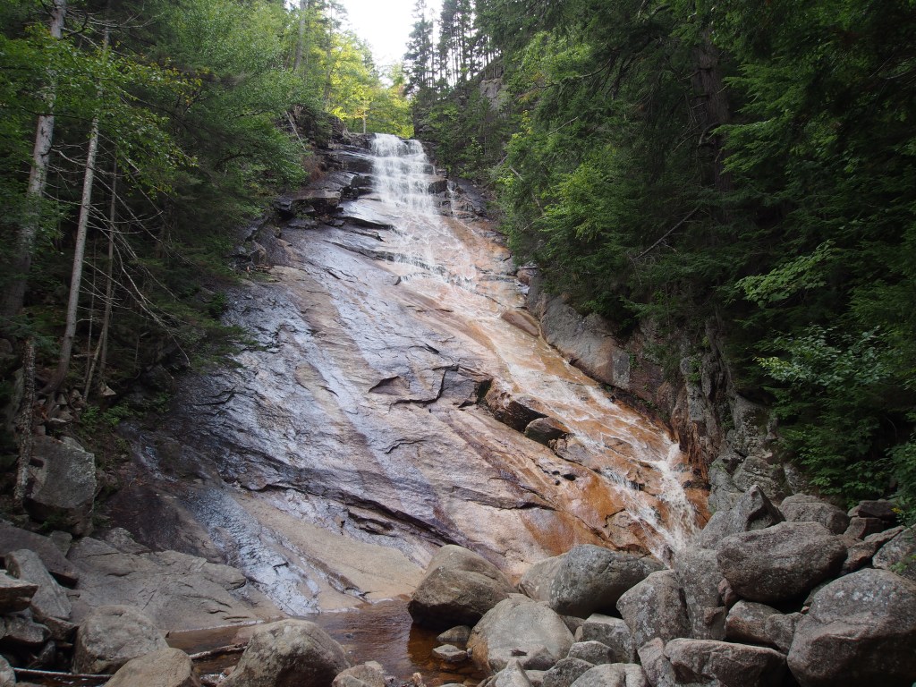
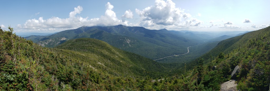
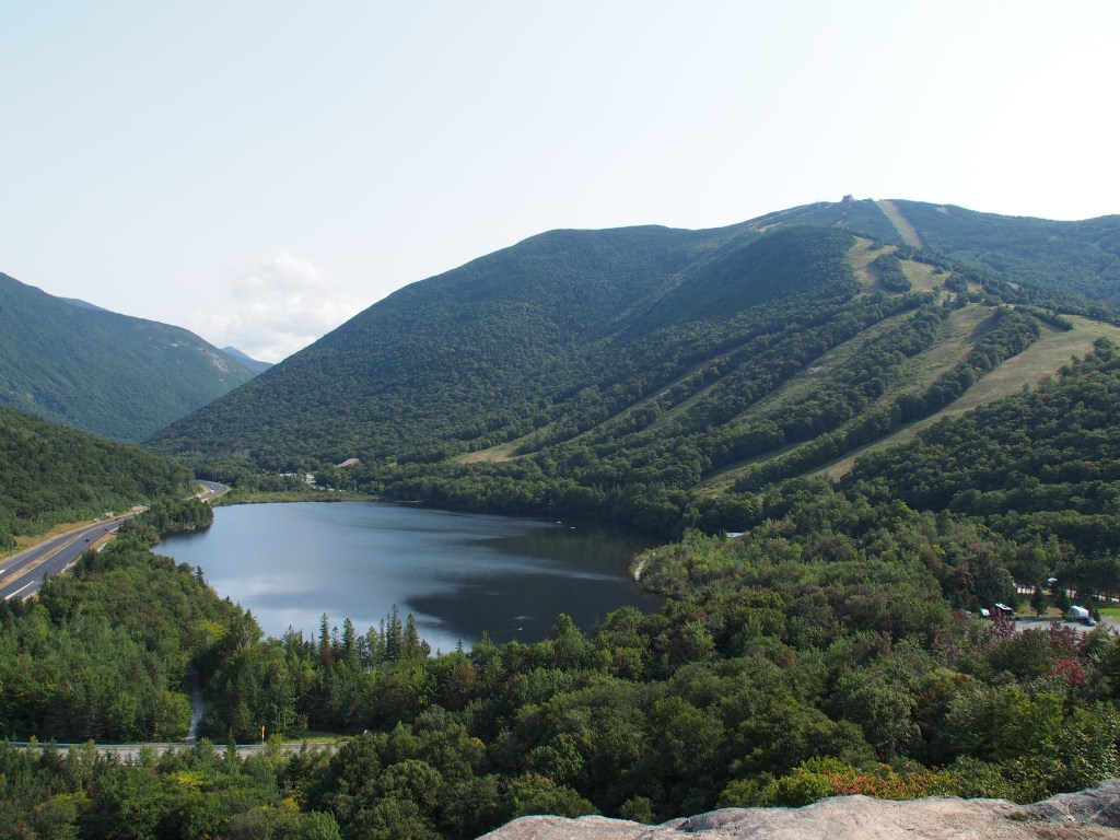
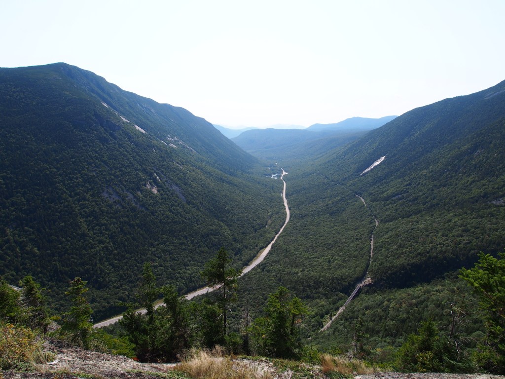
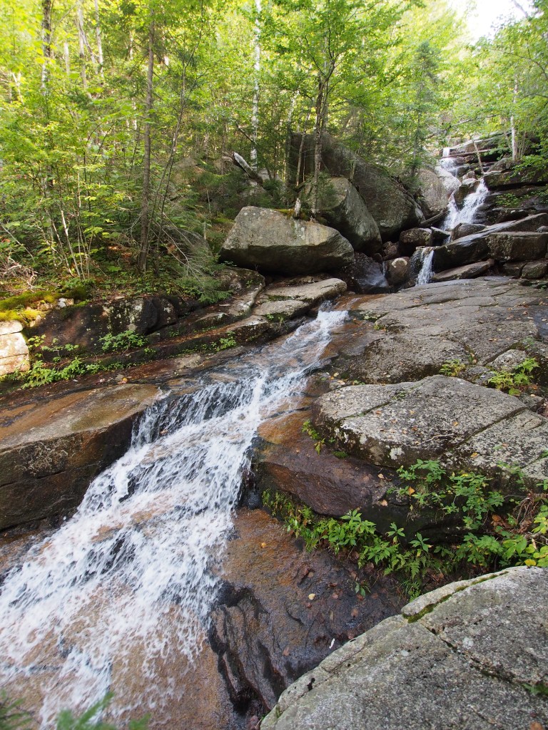
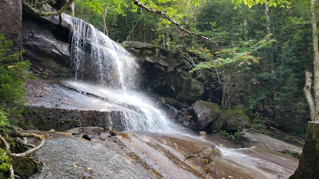
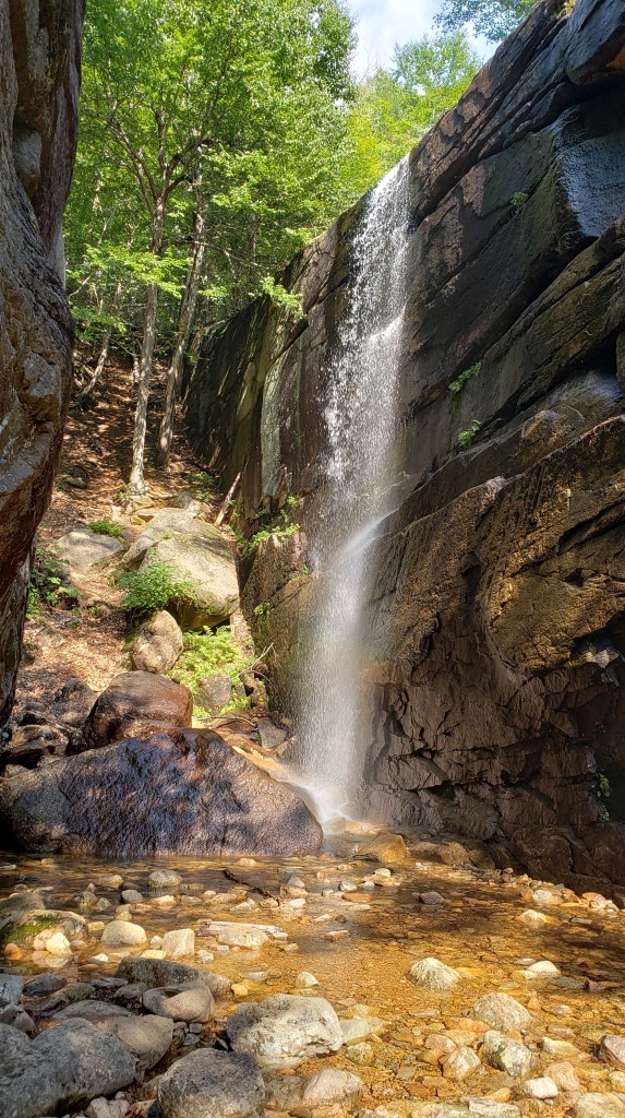
Since most of our day was spent, we decided to just drive around Lake Louise and orientate ourselves to where everything was located. After getting local information at the Banff National Park visitor center and driving up to the major parking area in town where we needed to be for a tour to Banff the next morning, we took an unplanned detour along the Bow Valley Parkway. Not far from town, we came across a stunning viewpoint called the Morant’s Curve. This was an area where both the Bow River and the railroad made a curve with some very beautiful mountain views. After spending a while there, we proceeded on to the Johnston Canyon Trailhead. The trail along Johnston Canyon included several impressive waterfalls and was an unexpected treat.
Morant’s Curve.Another view at Morant’s Curve.One of the waterfalls in Johnston Canyon.
Another of the several waterfalls in Johnston Canyon.
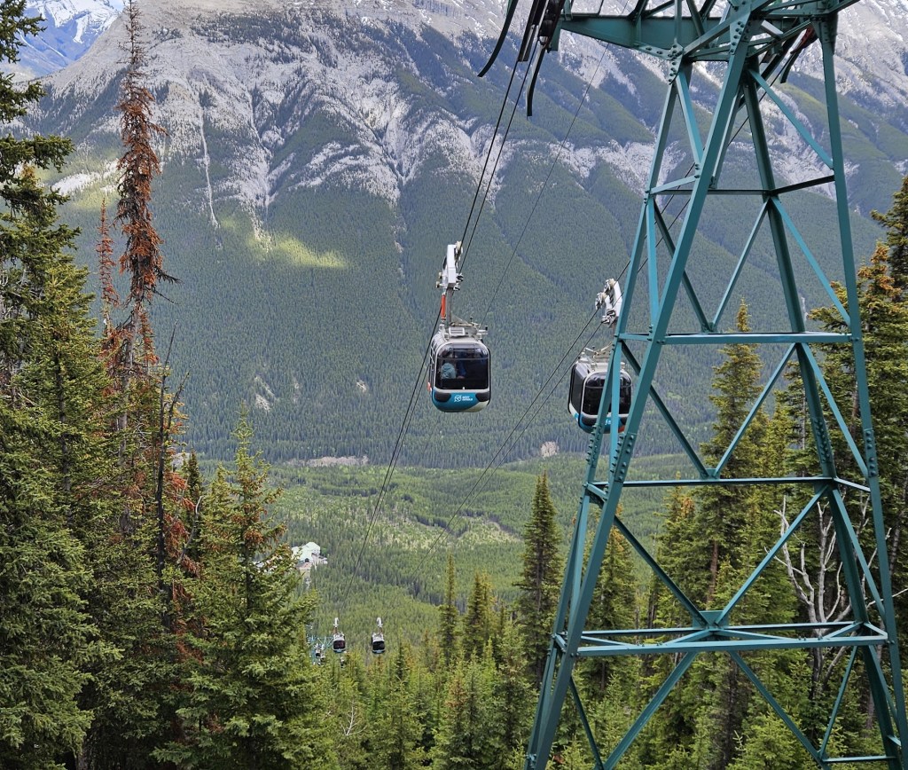
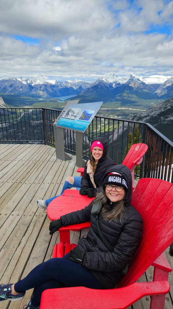
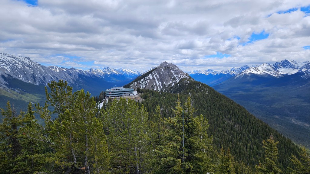
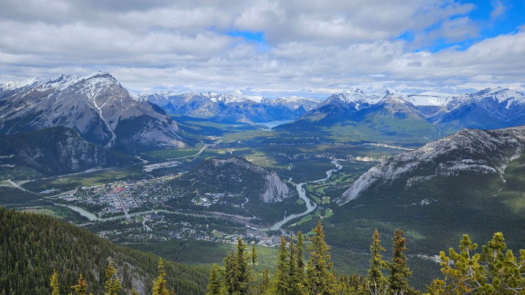
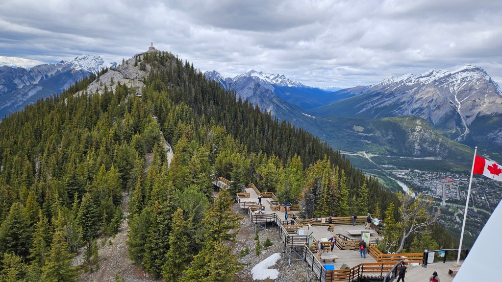
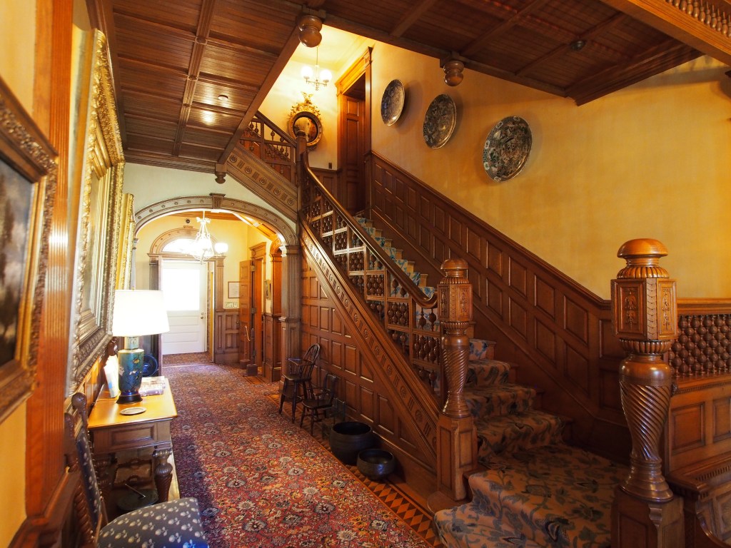
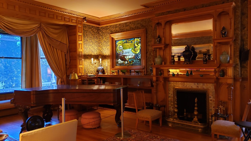
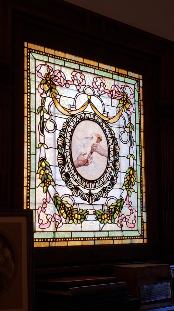
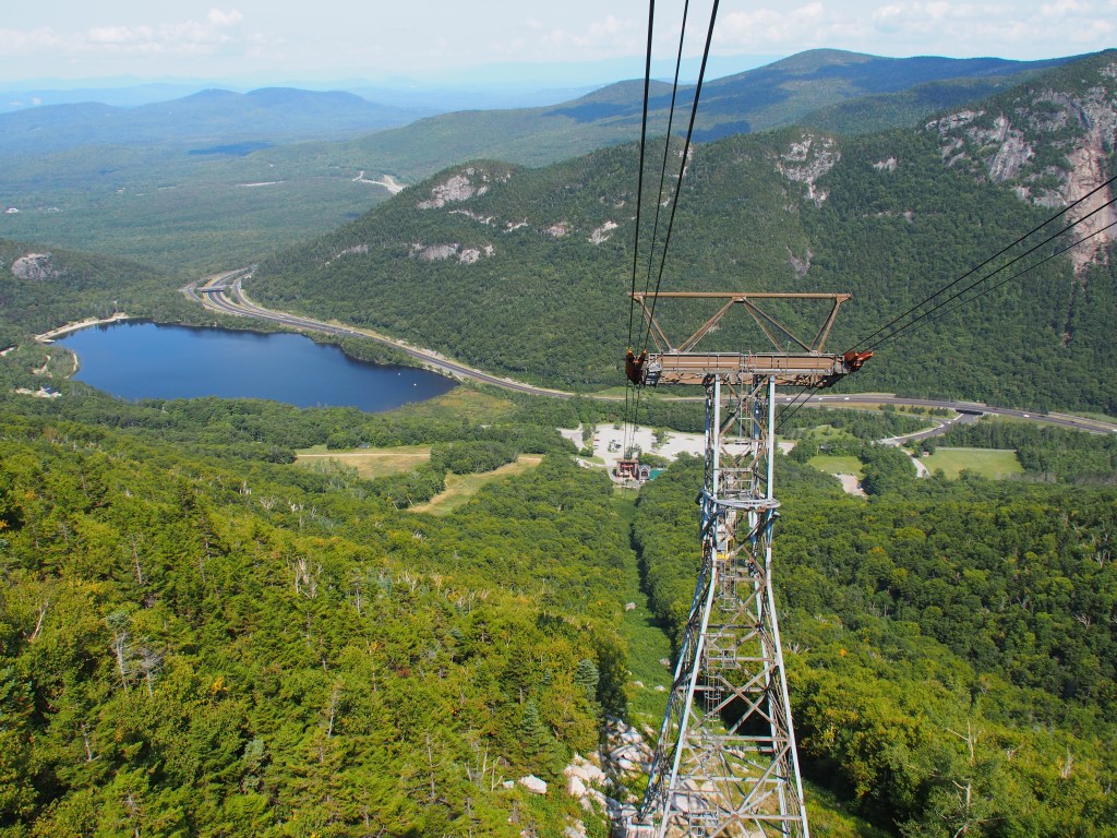
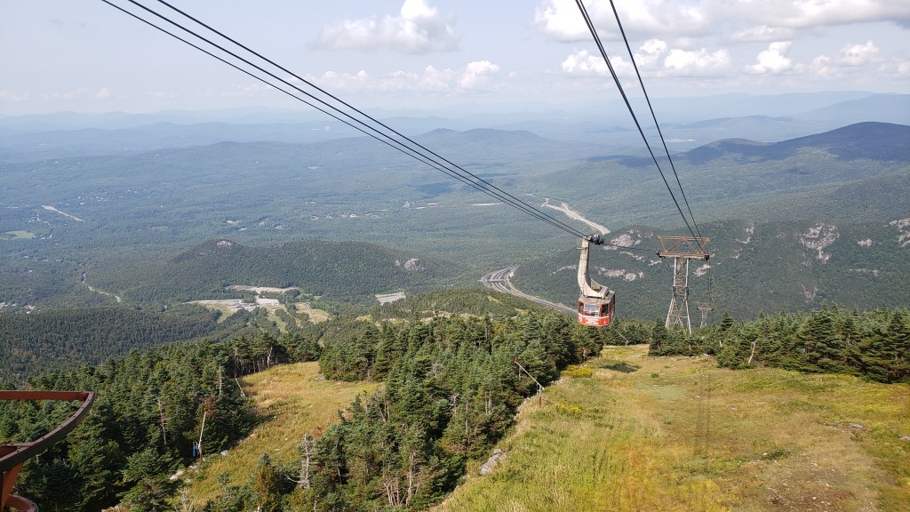
Since the town of Banff is known to be a hard place to find a parking spot, we opted to take a shuttle bus for the 60 km drive. Arriving in Banff town, we found that the parking issue was real and we were very glad that we opted for the bus. As part of our package, we also had free use of the Banff public transportation while in town. The is very handy and we used it to go visit the historic Fairmont Banff Springs Hotel. While the exterior was quite a sight, we were a bit underwhelmed at the inside. From the hotel, we took the bus back into town and then to the Banff Gondola. The ride up was quite scenic, but the views from the top were outstanding. In spite of dressing what we thought was warmly, we found that the temperature at the top of the mountain overlooking the valley and town of Banff was extremely cold and there was a good bit of wind. After walking some of the boardwalk and taking in the scenery, we decided to take the stairs and climb to the top of Sulphur Mountain. There we found the building for the Sulphur Mountain Cosmic Ray Station, built in 1956 in preparation of the International Geophysical Year (1957-1958). After heading back down to town, we found a really nice restaurant with outdoor seating along the sidewalk, where we were able to enjoy the much warmer weather, before catching our bus back to Lake Loise.
Fairmont Banff Springs Hotel.Banff Gondola.
Red Chair view from the top of the Banff Gondola.
Visitor Center at the top of the Banff Gondola.View of Banff.View of the boardwalk to the top of Sulphur Mountain.
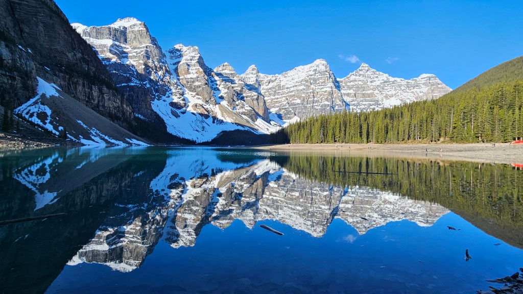
Thursday morning dawned very early for us. We had to catch a 6:00 a.m. shuttle from the campground into Lake Louise to then catch another shuttle up to Moraine Lake. While we weren’t there for sunrise, we did arrive quite early (7:00) and well before most of the crowd had arrived. I keep running out of words to describe the scenery in this part of Canada and only wish that the hundreds of pictures that I’ve taken could do justice to the actual views. We started with the short hike up the “rock pile” for the iconic Moraine Lake views. After taking the time to walk part of the way around the lake, and taking even more pictures, we boarded our transfer bus over to Lake Louise and the Fairmont Chateau Lake Louise Hotel.
Moraine Lake.
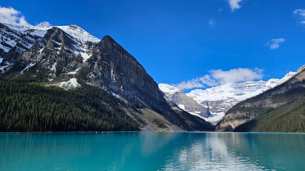
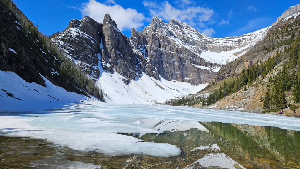
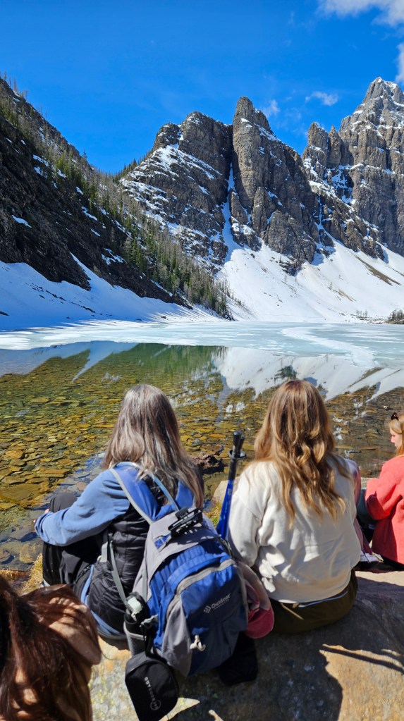
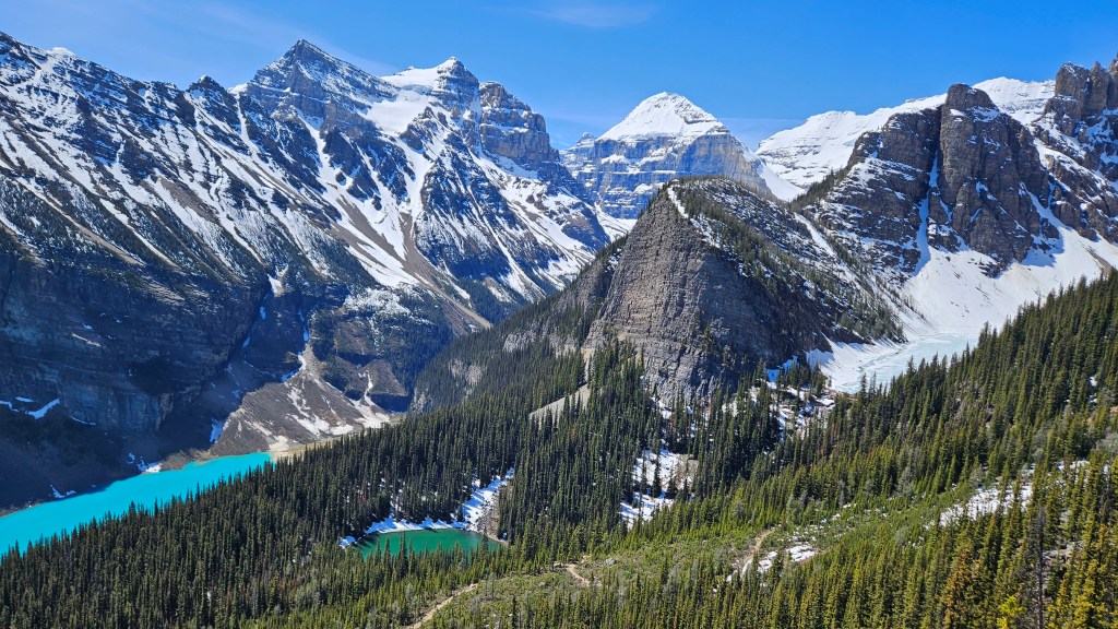
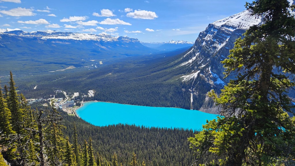
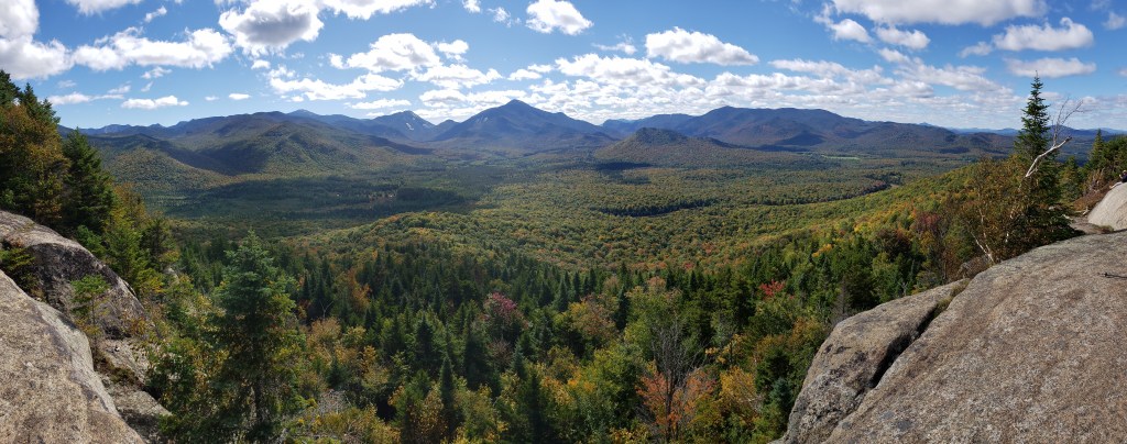
We arrived at the hotel and lake area at 9:00, we found that while there were a fair number of people there, it wasn’t quite as crowded as we’d been led to believe, although that would definitely change later in the day. Our goal for the day, besides taking more pictures, was to take the hike around the Lake Louise and then up the mountain, past Mirror Lake, to Lake Agnes and the teahouse. While at Lake Agnes, we saw a young man strip down to his shorts and do a polar plunge in the lake. Unfortunately, we didn’t get any pictures or video, but when I put my hand in the water, it immediately started to hurt from the cold. From Lake Agnes, we continued up the trail to the Little Beehive overlook. We wanted to do the Big Beehive trail, but it was still snowed in and quite treacherous. The hike wasn’t too bad, although there was a significant elevation gain of just over 1,900-feet over the approximate 2.7-mile trail (each way) from the hotel to the top of Little Beehive. The views from the top were really something to see. From there, we could see all three lakes; the mostly white Lake Agnes, the green Mirror Lake, and the unearthly turquoise Lake Louise. There were several areas of ice and snow that we had to get through on the trail, with one exceptionally snowy section that we had to traverse on the way down. Once we had returned to Lake Louise, we walked part way around to get another view back across the lake to the Chateau, before heading back to catch our shuttle to the campground. The crowds at Lake Louise were significantly larger than they had been earlier in the morning, but still nothing like the pictures that we’ve seen from mid-summer when the place is just crawling with tourists.
Lake Louise.Lake Agnes.
Just enjoying the view at Lake Agnes.
View of all three lakes from Little Beehive. L to R, Lake Louise, Mirror Lake, and Lake Agnes.View of Lake Louise and the Fairmont Chateau Hotel from Little Beehive.
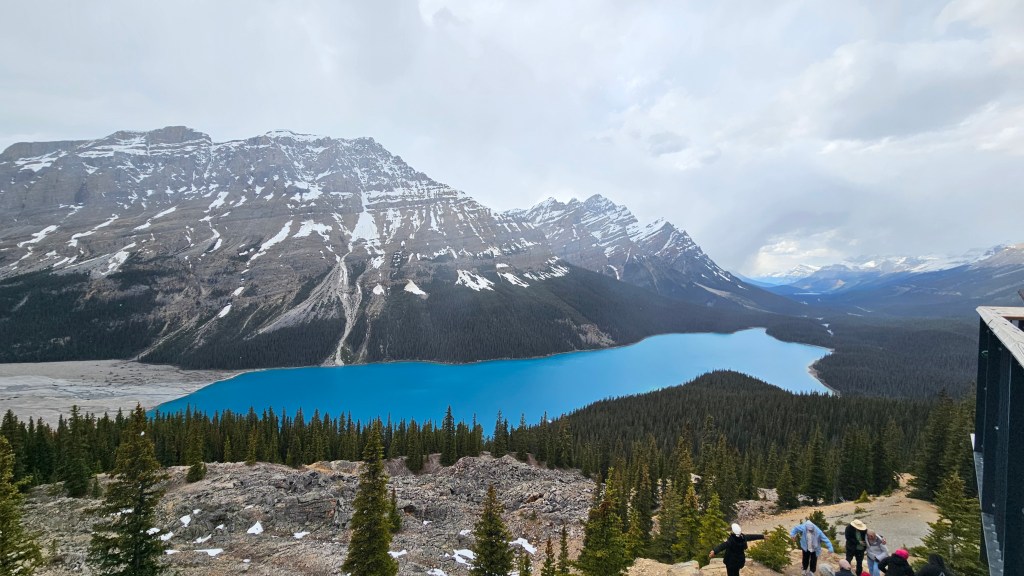
With nothing really planned for the following day, we decided to take a drive north from Lake Louise along the Icefield Parkway. We made several stops along the way at various overlooks, but two stops stood out. The first was a short walk down to the Saskatchewan River at an area called Mistaya Canyon. There was a waterfall and an area where the river had cut though the rocks. The weather was pretty warm, with Ashley wearing shorts, and the sky was mostly sunny. From there, we drove up to Bow Summit and Peyto Lake. Peyto Lake was a royal blue glacier lake, with a high overlook. At the higher altitude, the weather took quite a turn, and the shorts gave way to long pants and coats. While there, it actually began to snow.
Another viewpoint from the red chairs.
Mistaya Canyon falls.
Ashley at Mistaya Canyon.Peyto Lake, before the snow started falling.
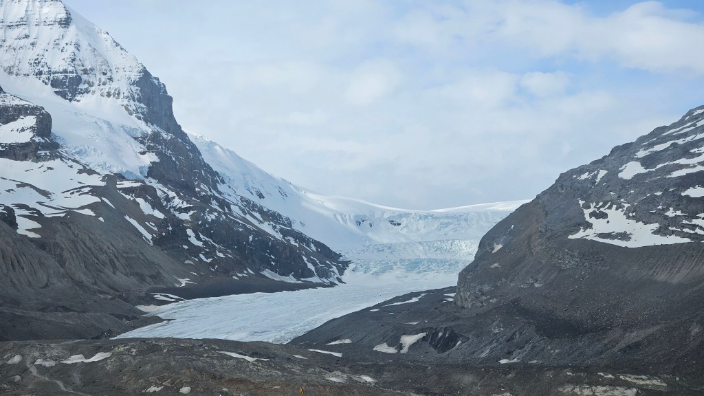
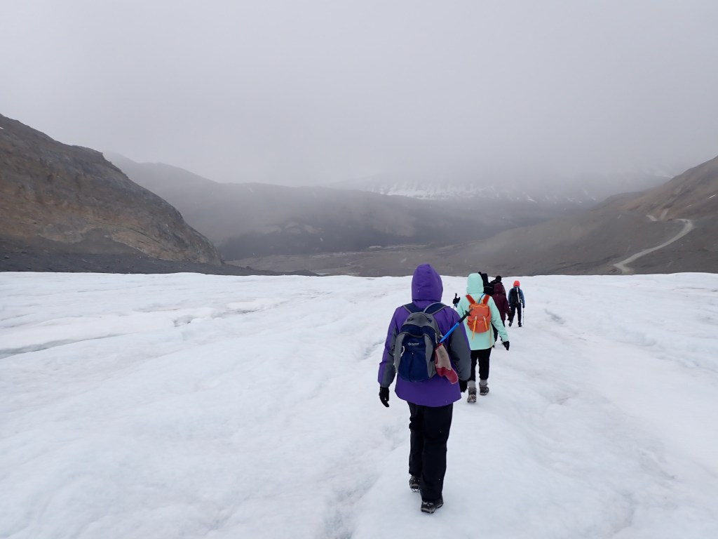
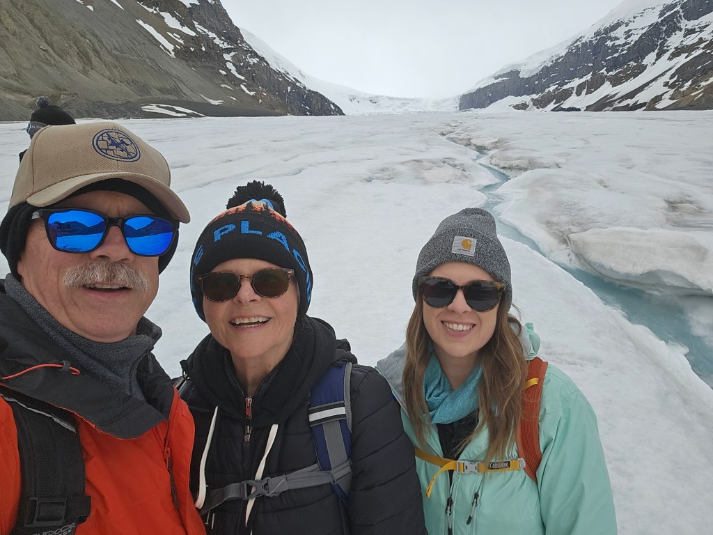
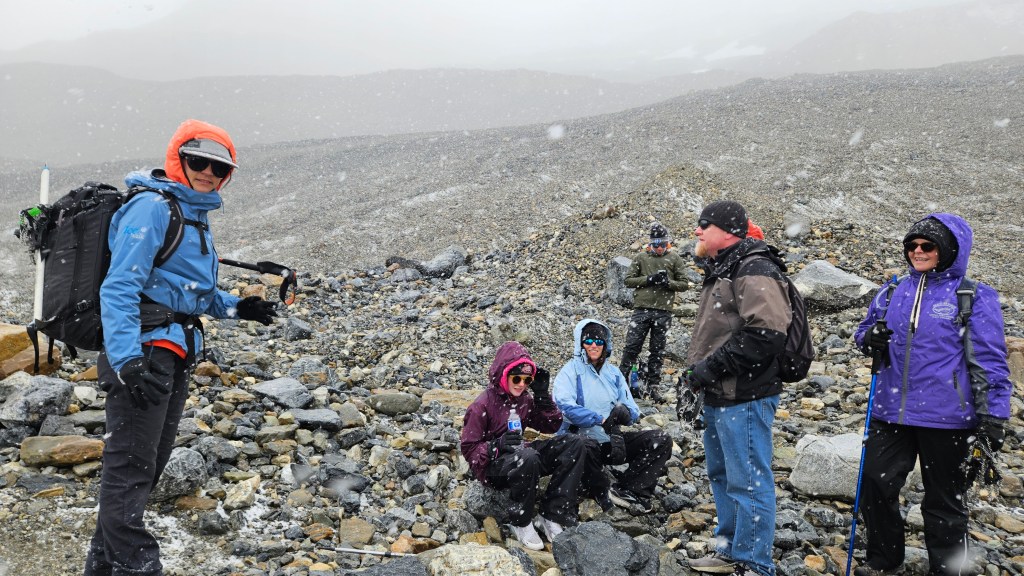
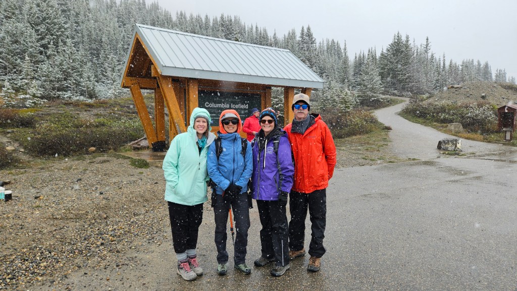
Our last day while based from Lake Louise involved another trip back up the Icefield Parkway to Athabasca Glacier, which is one of the glaciers that flows down from the Columbia Icefield. We had scheduled a three-hour guided “ice walk” on the glacier. It was mostly clear when our group of about a dozen people joined our guide for this trek, and although we were dressed pretty warm, the wind coming down the glacier, along with temperatures right around freezing, made it a pretty cold endeavor. I’ve got to say that this was one of the coolest things we’ve done on this trip. The hike to the toe of the glacier, then approximately two miles up the glacier was nothing like we’d ever experience before. Our guide, Hannah, was very knowledgeable and informative. About the time that we reached our farthest point, clouds rolled over the side of the glacier and it began to snow, and the snow just kept getting heavier and heavier. As we headed back, the snow got heavy enough that we could no longer see the ice fall at the top of the glacier, or the visitor center or parking area down past the toe. We were never in any danger, but the experience was exciting.
Athabasca Glacier from the bottom.Follow the guide and don’t wander off.On the glacier.Back at the bottom, removing our crampons.With our glacier walk guide, Hanna.
Closing out our many adventures in the Lake Louise area, Sunday was another moving day. Retracing our steps up the Icefield Parkway, although while pulling our trailer, we made our way up to Jasper, where we have several things planned for the next few days. More to come on that location next time.
Our move from Spokane into Canada could not have been any smoother or easier. The border crossing took us only about two minutes and was very pleasant. We were asked a few pretty easy and straight forward questions. They wanted to know where we were from, where we were going, how long we were staying in Canada, and where were we staying that night. They also included the obligatory “Do you have any weapons?”, being that we were coming from Texas.
On our way to the border, we heard that the border agents were scheduled to go on strike about two hours before our arrival. While the agents were not permitted to walk off of the job, they would have been able to really slow everything down to a crawl. Luckily for us, they postponed the strike for another few days while negotiations continued, and we were able to get through very easily.
We started off this week with an overnight stop at Moyie Lake Provincial Park near Cranbrook, British Columbia. This was not our original “destination” for the evening as we were planning on boondocking in Cranbrook, but decided to stop at the provincial park and see if there was anything available. Being that it was a Friday evening, we weren’t sure whether there would be any sites, but were surprised to find that they had a number of first come, first serve site.
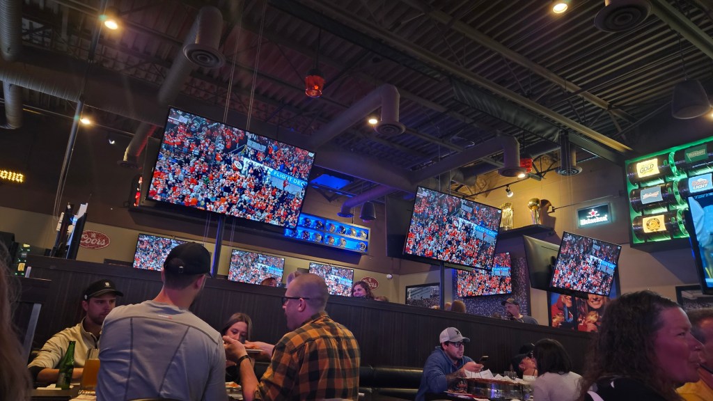
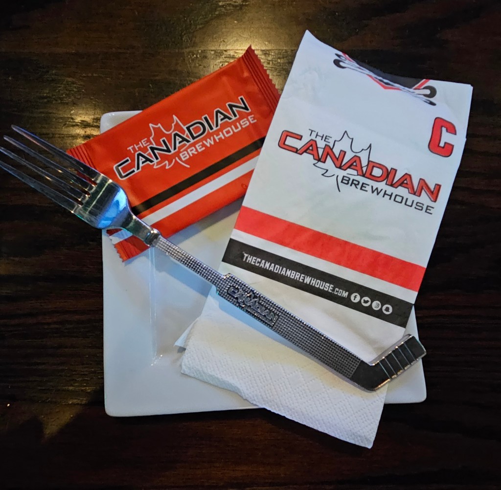
Heading towards Calgary, Alberta, we made our first Canadian fuel stop in Cranbrook. The price was $1.799 CDN per liter, which equated to $4.975 USD per gallon. That’s quite a bit more than we were paying in the US. Our stop ended up being just a short drive from the west side of Calgary, but gave us easy access to the city. We arrived early and decided to find a place for dinner. Almost every restaurant was booked and not taking reservations. We did eventually find one sports oriented restaurant that managed to get us in. That’s when we discovered why there was so little availability. It was the first night of the NHL playoff finals and nearby Edmonton was playing. We did have some good food and the atmosphere was electric with almost every television in the place tuned to the game, until the Oilers fell behind, eventually losing game one. Check out that cool silverware.
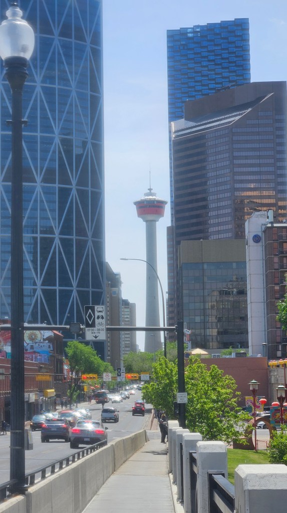
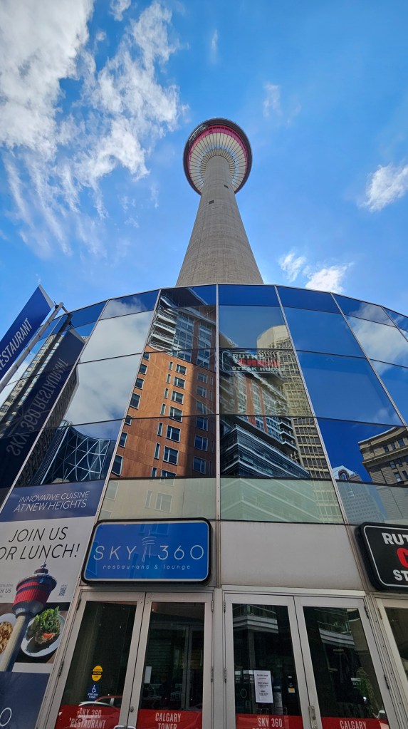
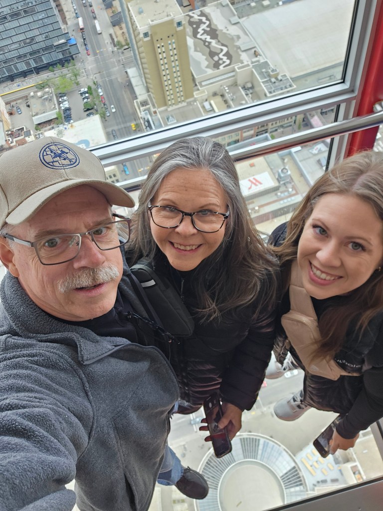
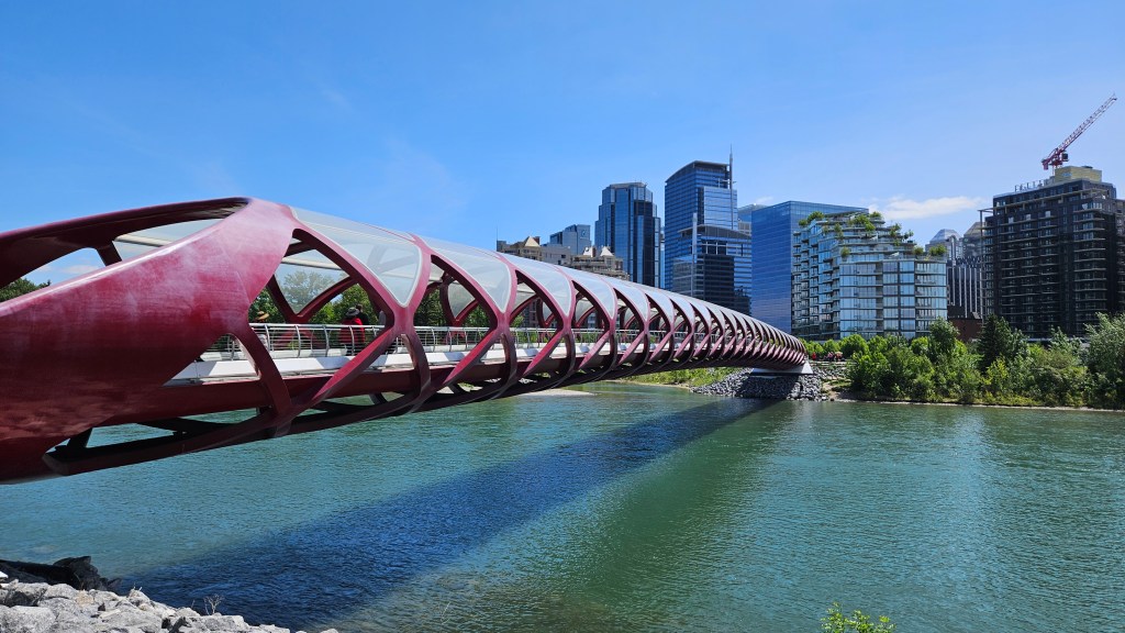
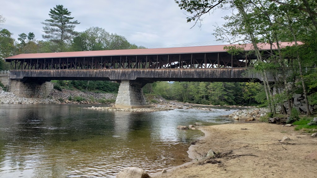
On our first full day in the Calgary area, we drove downtown and started the day with a trip up into the Calgary Tower. The views from there were something to see, and standing on a section of glass floor was a bit challenging from some of our party. From the tower, we walked over to the Peace Bridge, which crossed over the Bow River and is part of a nice park along the river. The design is very unique in that it required no support other than the anchors on each end. After walking back through the Chinatown area of downtown, we found a restaurant with a rooftop patio with a view of the Calgary Tower.
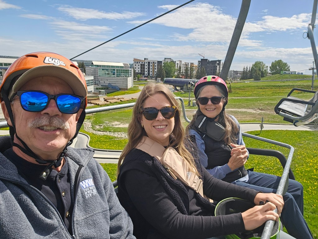
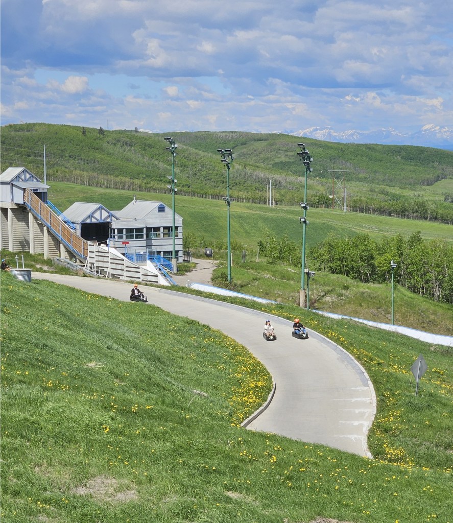
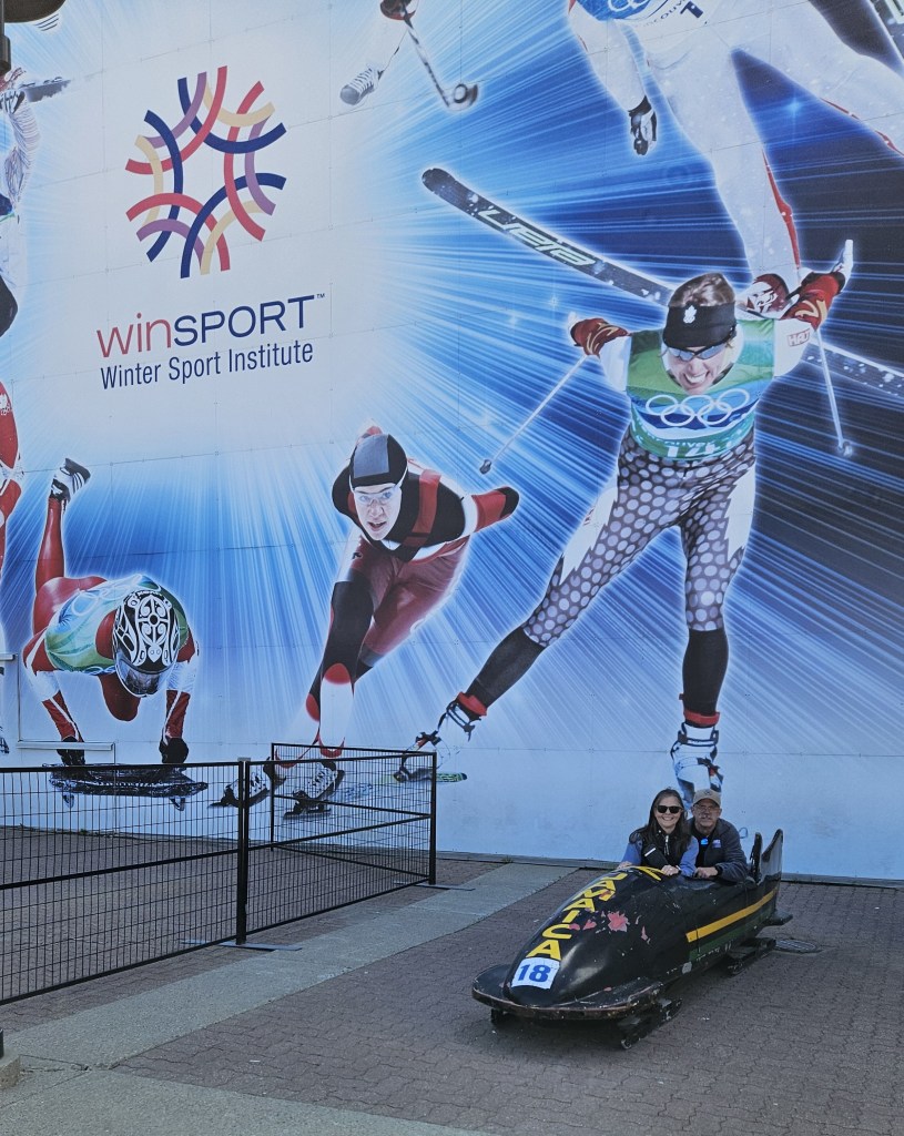
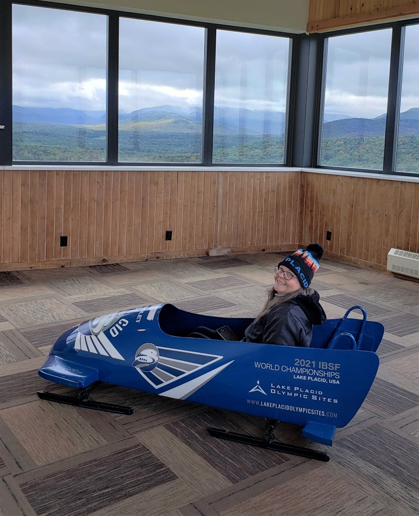
Monday morning was an early start as I had an appointment for an oil and filter change just up the road at the Ford dealer in Cochrane. Everything went smoothly, the price was reasonable, and I was back to pick up Debbie and Ashley by 9:00 a.m. We went to the Olympic Park area and started the day off with several runs on a downhill carting path. After riding a ski-lift to the top of the run, the ride down was exciting and we felt as if we were going much faster than we actually were. On one of our runs, we did see a boy lose control a bit and leave the track. Fortunately, he didn’t crash or get injured in any way. Unfortunately for us, most of the rest of the olympic park was closed, although we did get our picture sitting in the Jamaican bobsled used in the making of the movie Cool Runnings.
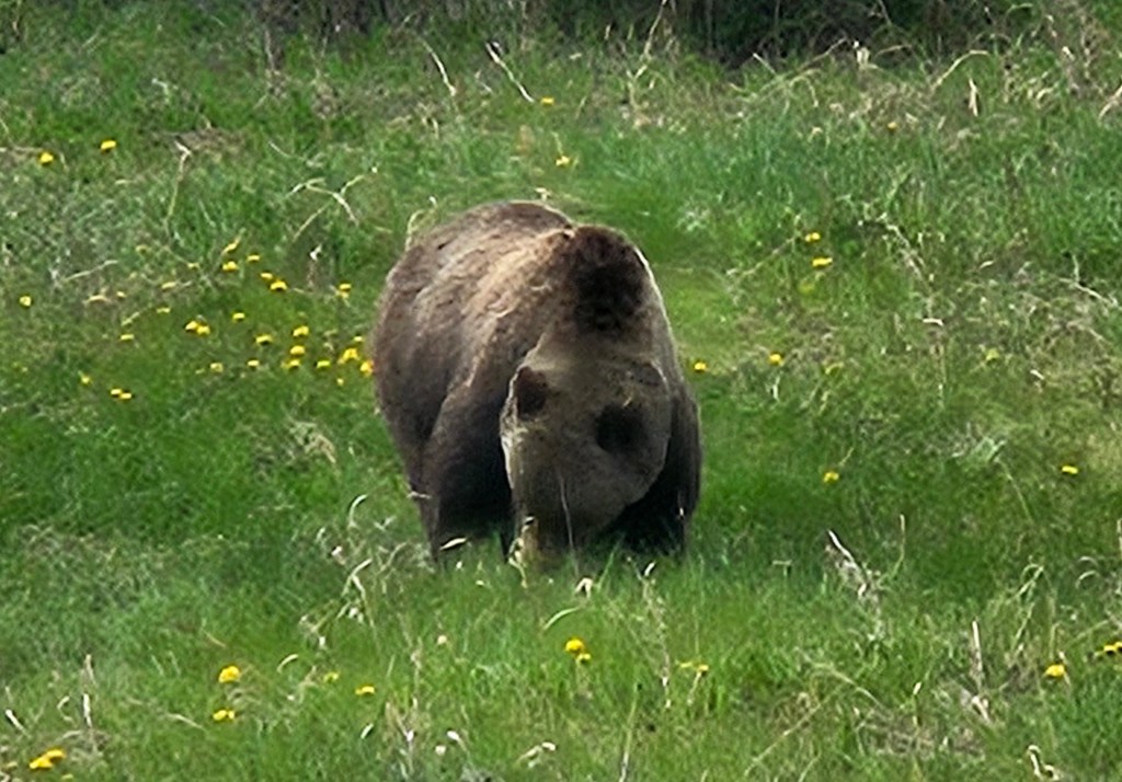
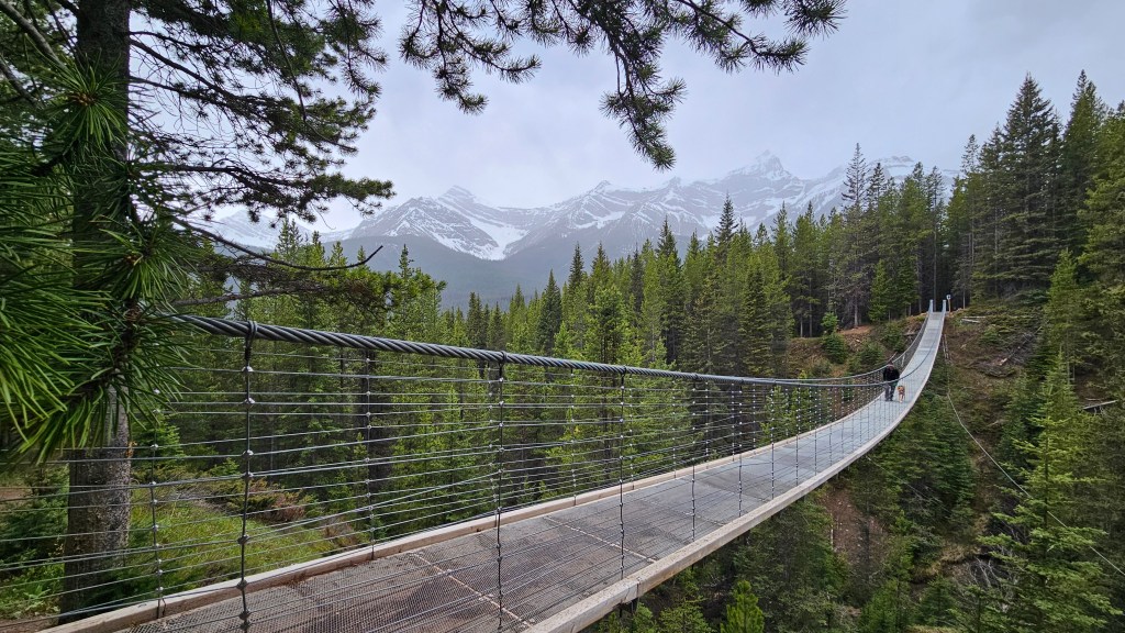
Since it was still fairly early in the day, we decided to take a drive west through Kananaskis Country, which contains several provincial parks. These were our first really closeup views of snow-covered mountains. Other than driving for the views, we had a hike to suspension bridge as our ultimate goal. Along the way, we saw a number of Rocky Mountain sheep, which seemed to like to stand in the middle of the road, and even one grizzly bear. Once to our destination, it was a short hike up to the Black Shale suspension bridge. Of course, just as we got to the bridge, it started to rain. We didn’t let that stop us though. On our way back down from the bridge hike, the weather cleared and we were able to have a great dinner at an outdoor restaurant in Canmore before walking around the town.
Our next stop is at the Lake Louise Hard-sided Campground in Banff National Park. It’s so named because you must have a hard-sided camper because of the bears in the area. There’s much to see and do there, so expect that post later this week.
After saying goodbye to all of our bowling friends in the wee hours of Friday night, actually Saturday morning, we knew that we needed to sleep in before hitting the road. I don’t think we got to bed before 2:00 am. We dumped our tanks, took on some water, and left a very hot Las Vegas to begin our trip to Canada and Alaska in earnest.
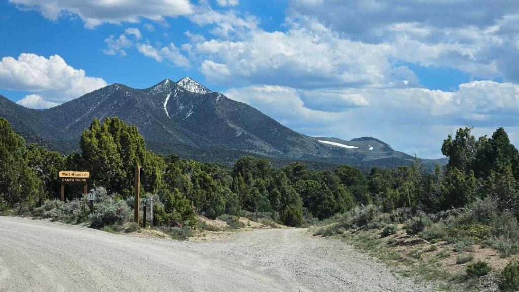
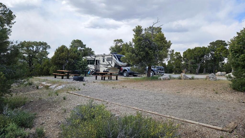
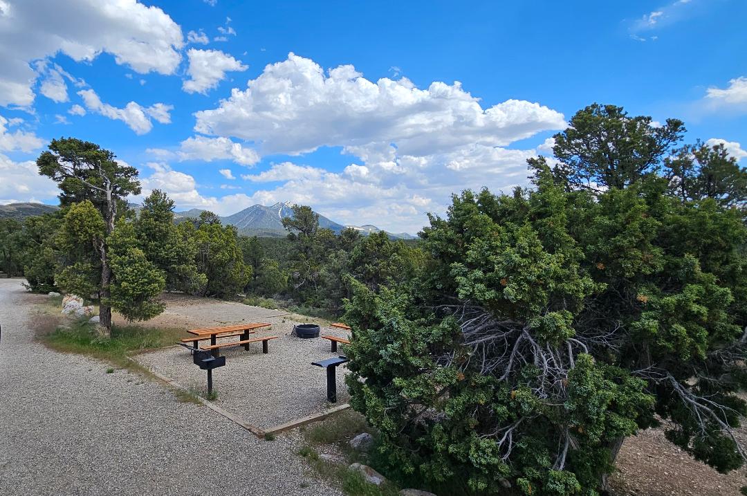
Our next stop was another national forest campground near Ely, NV. Ward Mountain Campground is located in the Humboldt-Yoiyabe National Forest. It had no hookups of any kind, and in fact, they were even having issues with their few water connections, so it was a good thing that we knew to take on some water before leaving Las Vegas. Not knowing anything about this small campground in advance, we were surprised to find some amazing views from our quite spacious site. And, with a senior discounted price of $14 ($6 per night plus an $8 per reservation booking fee), it was an amazing place to spend the evening. It was quite cool there, being at an elevation of about 7,400-feet, so we had no need for air-conditioning. If we’re ever passing through that area again, we may try to stay and take advantage of some of the hiking, along with a trek to the summit of nearby Murry Summit (10,800-feet).
Driving into the Ward Mountain Campground.Ward Mountain Campground site.View from our door at the Ward Mountain Campground.
On Monday, we continued our way north by stopping at a Harvest Host location near Buhl, ID. The Holesinsky Vineyard and Winery was a nice little place and we stayed the night along with three other families. This was the first time that we’d ever stayed the night in our fifth wheel in the state of Idaho. Idaho brought the total number of states we’ve stayed in our trailer to 43, and that’s all since 2018. Prior to this trip, we had only driven through Idaho once on our way to Yellowstone National Park.
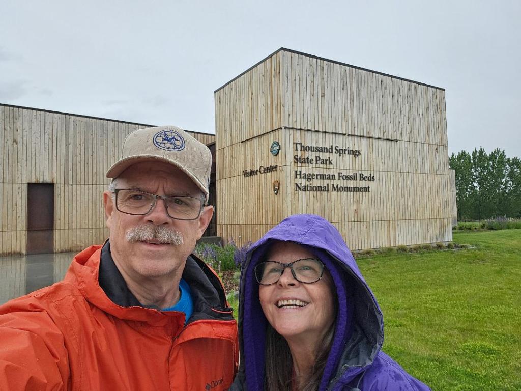
Even with getting a bit of a late start on Tuesday, we managed to find time for a brief, rainy stop at Hagerman Fossil Beds National Monument in Hagerman, ID. Our stop later that night was yet another Harvest Host location. This time it was the Elkhorn Lavender Farm in Baker City, OR. The location was right at the base of the snowcapped Elkhorn Mountain Range. Cliff, the owner, was a retired forestry service employee and had a really interesting presentation that he gave that chronicled his transition into growing and processing lavender. This stay not only added a 44th state to our trailer travels, it also represented the 50th state that both Debbie and I have ever visited.
Obligatory selfie at the Hagerman Fossil Beds National Monument visitor center.
From there, we moved to our last US location just to the west side of Spokane, WA, making this our 45th state to host our trailer for an evening. Here we stayed three nights in a fairly new campground that is owned by the Northern Quest Casino and Resort. The campground is located a block or two from the casino and hotel complex, but we never took the time to go to the casino. We had already been to Las Vegas, so had seen enough casinos for one trip. We had a couple of reasons for staying at this location. The first, was that we wanted a last stop in the States to do laundry, dump tanks, and take on water before heading into Canada.
The second reason for stopping in Spokane was that this is where our niece, Ashley, flew to join us. She’ll be with us for approximately the next six weeks as we travel up through Canada and into Alaska. She’ll be with us until we get to Fairbanks. Her trip to meet us wasn’t without some drama. While she was supposed to leave DFW on Wednesday evening and arrive in Spokane around 8:30 pm, several flight delays caused her to not arrive until about 1:30 a.m. As you can imagine, all of us were pretty tired by the end of it all.
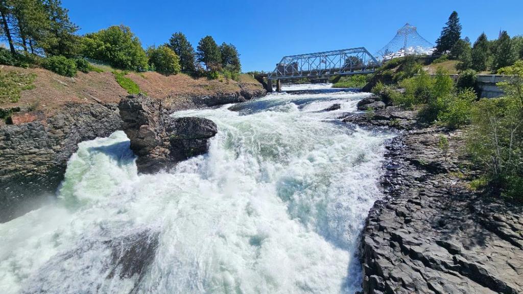
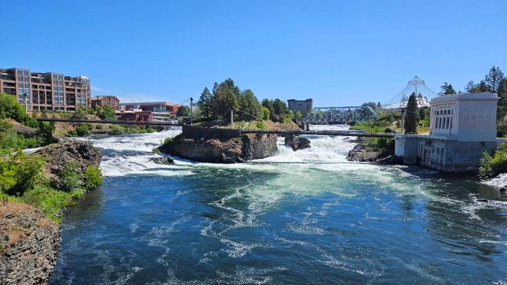
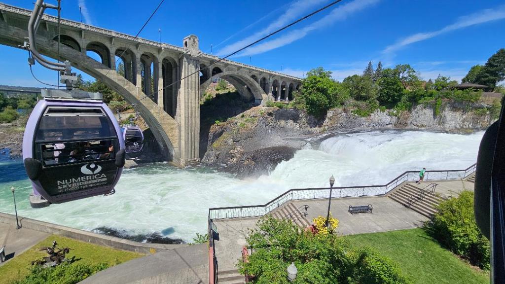
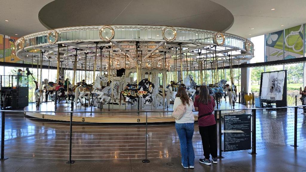
What we didn’t expect to find in Spokane was just how nice the downtown area was, especially all of the park space along the Spokane River. The town was celebrating the 50th anniversary of the 1974 World’s Fair that “put Spokane on the map”. The paved walks, pavilions, and other attractions made for quite an enjoyable morning. The falls along the Spokane River was really pretty and we even took a sky tram ride over the falls. I could see coming back here to spend a little more time. After spending the morning walking along the river, then eating lunch, we decided to take the short drive over to Coeur d’Alene, ID. We had heard so much about how the park and marina area around the lake were quite beautiful, but we didn’t really find it as impressive as Spokane.
Some of the falls on the Spokane River.Lower Falls on the Spokane RiverGondola ride over the falls.Debbie and Ashley watching the 1909 Looff carousel.
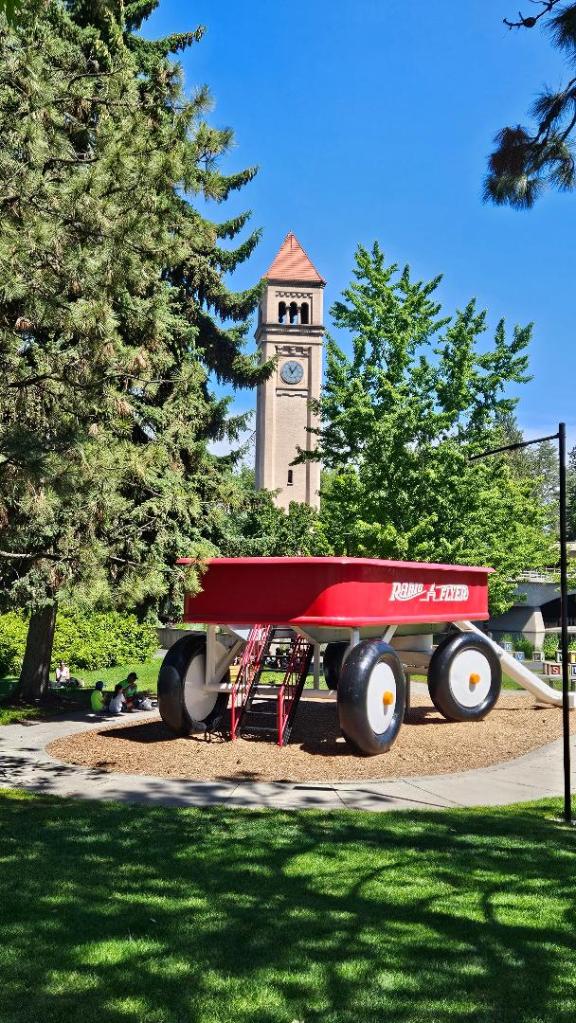
Giant Radio Flyer slide with the Clock Tower in the background.
We’ll be crossing the border into Canada on Friday and we’re really looking forward to taking our trailer into another country for this first time. Follow along as we go on this new adventure.
Since the first week was mostly all travel days, there will be a few less pretty pictures than I hope to share in the future. Hopefully you’ll still find it interesting.
We were all loaded up on Friday morning and started the trip with a slightly longer driving day than we usually prefer, but it was the first day and the excitement of starting this trip made it not so bad. Our destination for the night, Muleshoe, TX was about 330 miles away. We bucked a major headwind the entire way which wreaked havoc on our fuel mileage and caused us to make an unplanned fuel stop along the way instead of making it the whole way to Muleshoe. We were averaging just over 8 mpg. Our stay was at a city park that offered full-hookups for free, although we did drop some money into the contribution box.
The following day we moved to a free dry-camping spot at a Harvest Host in Moriarty, NM. Again, the wind was pretty brutal and our fuel mileage dropped to just 7.7 mpg. I’m really hoping that our mileage will increase throughout this trip as fuel cost will probably be our largest expense. During our stay there, some 40+ mph gusts really rocked the trailer and stirred up a lot of dust, so I didn’t get any pictures of our stop.
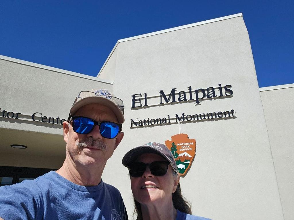
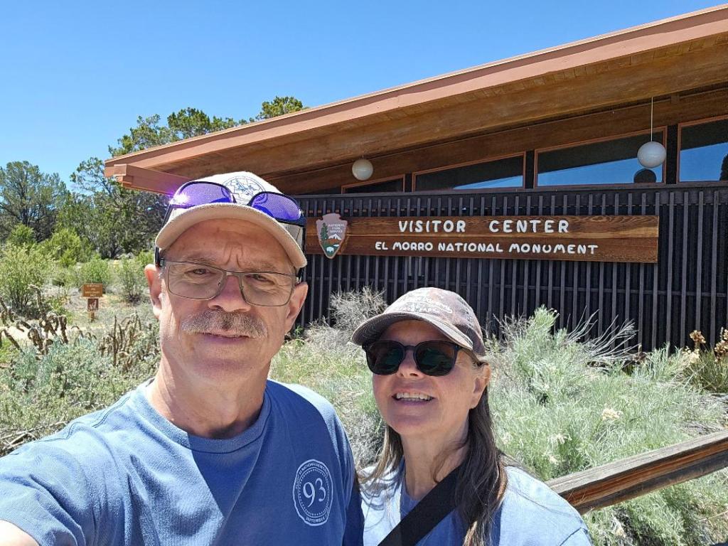
Sunday, we broke up our next move by making stops at two National Monuments; El Malpais Nat’l. Mon. and El Morro Nat’l. Mon., not far from Gallup, NM. Both parks turned out to be big surprises and we’d wished we’d planned an extra day in there to explore them both more thoroughly, especially El Morro. We did watch the park video at both visitor centers, but didn’t have time to do some of the hikes that were available there. We’ve definitely added these parks to our to-do list for our next trip out west.
We stayed the night at the Fire Rock Casino in Gallup. The casino allows RV’ers to stay in their overflow parking for free. The view that we had was amazing and the weather perfect. The only downside was that we were pretty close to a railroad track that BNSF was really making good use of. In spite of the train noise, it didn’t keep either of us from getting a good night’s sleep. With our solar/lithium setup, we had no need for any kind of hookups. This will make traveling on our way through Canada and Alaska much easier and we can travel at our own pace since we don’t really need to make campground reservations. Canada and Alaska have an extraordinary number of free camping sites, which we hope to be able to share with you as we go along.
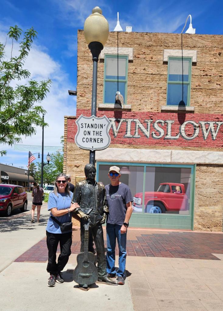
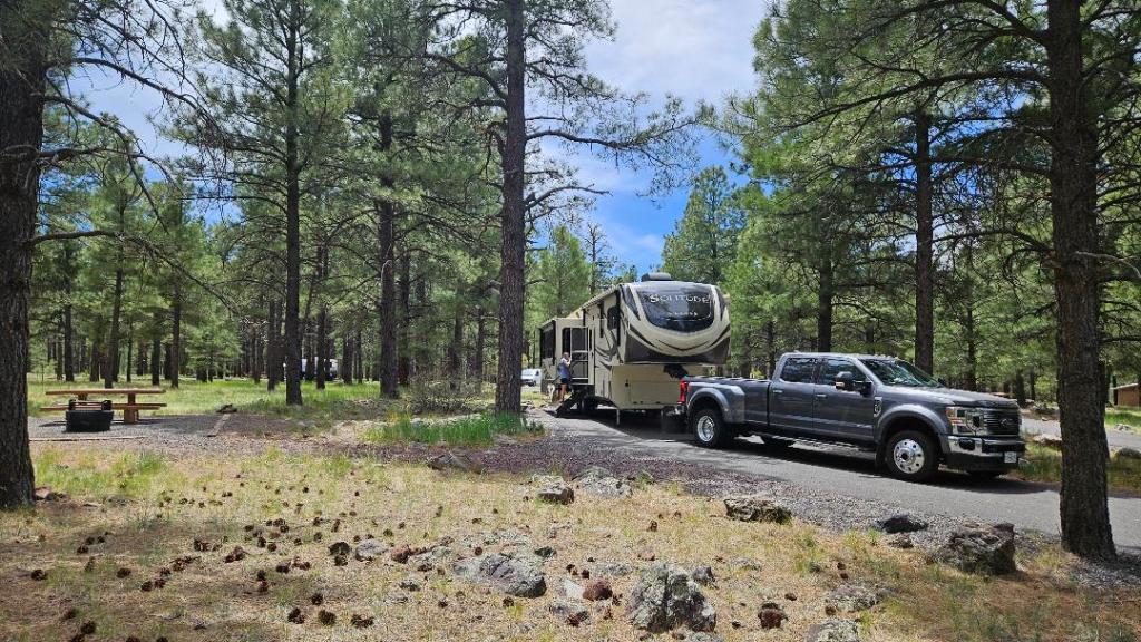
On Monday, Memorial Day, we woke up to a beautiful morning with temps in the upper-30’s, and were able to watch a hot-air balloon rising over the cliffs out of our window while we had coffee. We then continued west on I-40 (which was GREATLY improved since our last trip through this area). We broke up the day with a stop in Winslow, AZ to visit the “Standing on the corner” location. It was one of those touristy things that you just have to do sometimes and it broke up our travel day quite well. Our destination for the day was a National Forest campground just a couple of miles off of the interstate near Williams, AZ. The spot was beautiful, surrounded by tall pine trees. Even though there were no hookups, the cool temperatures meant that we didn’t need to run the A/C. With no hookups at the site, that was a good thing. Also, since we had no cell service, we decided to take a test run of our “new” StarLink. It’s not really new as we bought it over a year ago, but the account has been on hold until we were ready to start out Alaska adventure. It worked flawlessly, even among all of the tall trees.
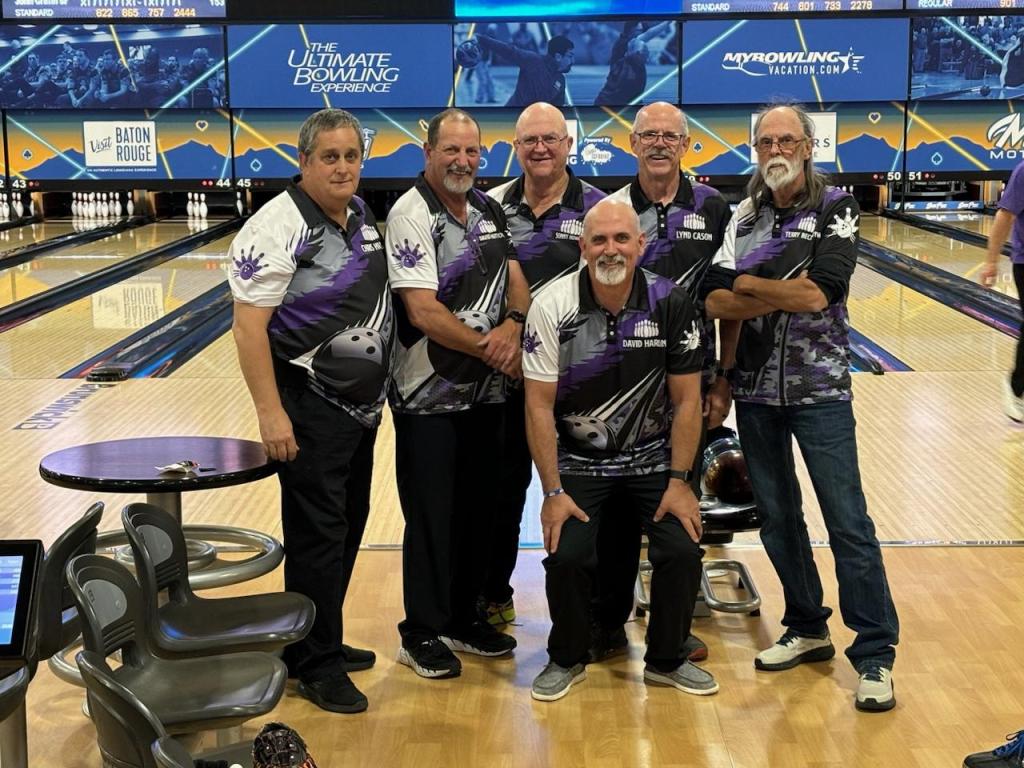
The next morning, we again awoke to temps in the upper-30’s, took our time getting everything ready to roll on to our next stop where we’d be staying for several days; Las Vegas, NV. While I-40 continued to surprise us with how smooth the road was, unlike the teeth-rattling ride it’s been the last couple of times, the drive along US-93 from Kingman, AZ to Las Vegas was absolutely horrible. That road is in need of some major repair, especially the right lane that gets so much semi traffic. We’re staying in Las Vegas for four nights and meeting all of my teammates to bowl in the USBC Open Championships. Not that I’m going to win anything or make a bunch of money, but it’s a fun thing that I’ve been doing for a long time; 31 consecutive years. We bowled the team event on Thursday night, and although we will make a little bit of money, emphasis on “little”, I didn’t bowl well at all. On Friday night, we bowled the doubles and singles events. There was a little redemption, winning back my bracket losses from the previous night. As far as tournament standings go, I’ll cash a small amount of money in the team and doubles events, but not in singles.
We did discover a couple of issues up to this point of our journey. The first was that a section of a blown tire on the highway had taken out a gate valve on our septic outlet. Although it didn’t cause any leaks or anything, it required a trip to the local RV dealer to get a replacement (and a spare, as this has happened before). The second was that we had notice that our water pump in the trailer seem to be struggling to prime itself sometimes. On a couple of occasions, I noticed that the pump would come on for about two seconds every half hour or so. I didn’t really think about it until we got to Las Vegas where we didn’t to use the pump, being hooked up to city water at the campground. Thinking that we might have a small leak in the system, I opened up the storage area, pulled out a section of the wall and found that we definitely had a leak where the plastic check-valve is located at the outlet to the hot water tank. Luckily, I had a spare check-valve that I’d bought a few years ago due to this being a known issue with trailer hot water tanks. Of course, when I disconnected the water line and tried to remove the cracked piece, the whole thing broke off leaving me with nothing to grab ahold of to twist out the remains. A less than fruitful trip to Home Depot, followed by some great help by my bowling doubles partner, David Harlin, and we were finally able to get the broken connection removed and the new metal check-valve installed. So, all is well with the water system, and we’ll finally be heading north on Saturday morning.
We’re very excited (and a bit stressed) to be beginning our epic Alaska adventure tomorrow. It’s been a hectic few days getting everything prepared and loaded up for the trip.
We got our fifth wheel back from the dealership on May 10, about a week ahead of the “we better have it back or she’s gonna kill me” date. McClain’s RV (and especially Brianne) managed to get our rig in and out of their shop in a very timely manner and well ahead of schedule. We had an issue with the bedroom slide-out on our last trip to the southeast US that required a completely new mechanism. Luckily, this was covered by our extended warranty, although we did have to pay to expedite delivery of the part in order to get our trailer back in time for the trip.
Our first week of travel is basically just getting from home to Las Vegas to bowl in the USBC National Open tournament, with a few sightseeing stops along the way. We’ll really start our journey to the Great White North and the 49th State on June 1st.
Post #10: Adirondacks, Lake Placid, NY; September 20 to 25
As has been our normal practice, our moving day turned out to be a rainy day. We moved into northeastern New York to Fish Creek Pond State Park. FCPSP is not far from Lake Placid and is a very large campground with spaces all the way around two lakes with most of the spots backing up to the shoreline. Back when we booked the site, there were almost no spots available, so our site was just across the road from the lake shore. Interestingly enough, the park was only about 15-20% occupied the whole time that we were there. All of the sites are non-hookup, so no water, electric, or sewer, but we’d filled up our water tank and figured that our solar would keep us charged. Unfortunately, our site, like almost all of the 300+ sites in this park, was very tree covered. This meant that we’d need to use our generator for a bit most every day to keep the batteries topped off. The campground limited this to a specific five hours per day, so that did cut into our plans a couple of times. All in all, it was a pretty nice site.
Fish Creek Pond State Park campsite.
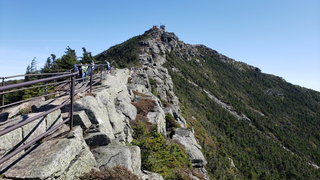
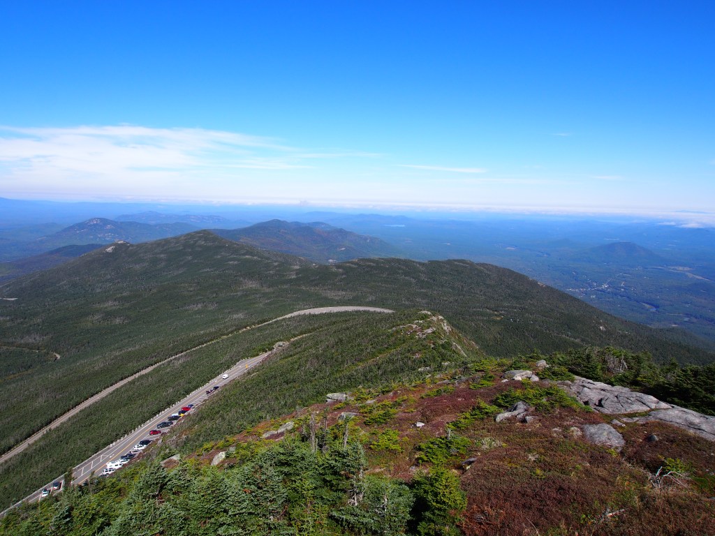
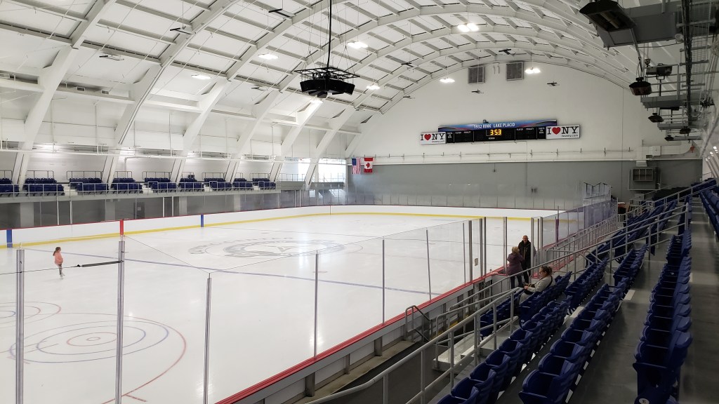
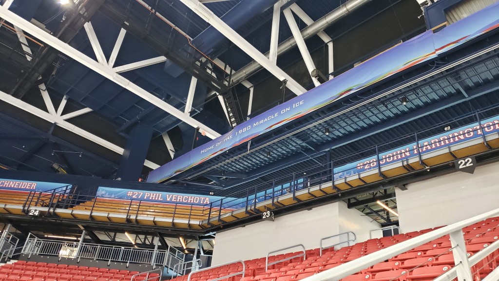
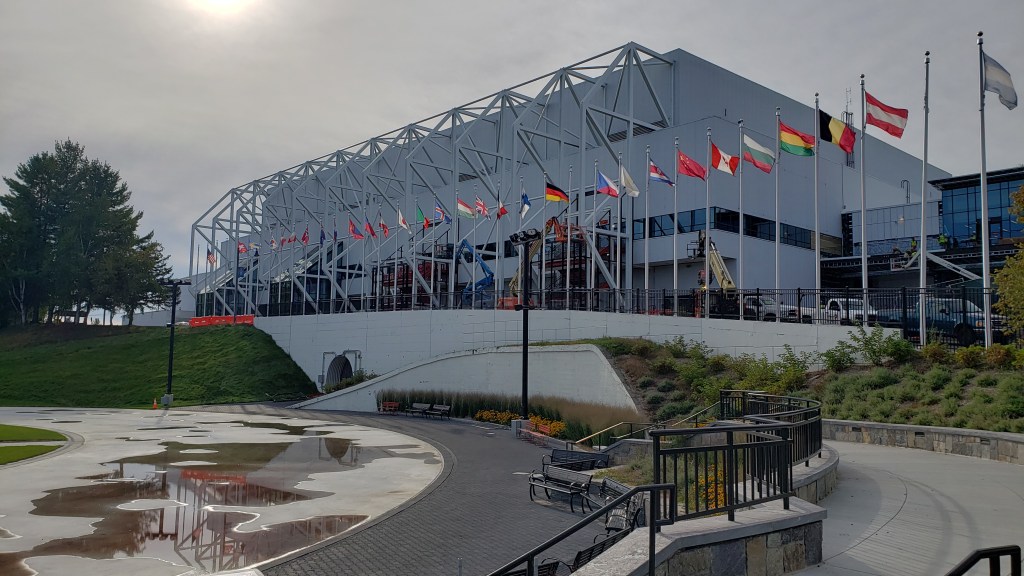
On the 21st, we first visited the Adirondack Visitor Center to pick up some brochures and suggestions for things to do while in the area. From there, we drove up Whiteface Mountain, the fifth highest mountain in New York. From the parking lot, we hiked up the final 1/5-mile, gaining a couple of hundred feet, which gave us a complete 360-degree view of the area. From there, we could see New York, Vermont, and Canada. Instead of walking back, we rode an elevator down through the mountain, then out a 400’+ tunnel bored through the side of the mountain. After the drive backdown the mountain, we went into Lake Placid. There we found that the town was undergoing quite a bit of construction and renovation, from sidewalks to streets to facilities, for the upcoming 2023 FISU World University Winter Games. The volunteer at the visitor center gave us some helpful tips as to what to see in town and what activities were happening that week that we should be sure to enjoy. He directed us to the 1932 Olympic ice rink, where we watched a young girl practicing her figure skating routine, the 1980 “Miracle on Ice” rink where some hockey practice was going on, then to a small, temporary museum covering the 1932 and 1980 Olympic Games. They are in the process of putting in a much larger museum, but we were just a few months early to see it.
Climbing the final stretch to the summit of Whiteface Mountain.View from the top of Whiteface Mountain. See our truck below?1932 Olympic Ice Rink.1980 home of the “Miracle on Ice”.Some of the refurbishment work. Outdoor speed skating rink in the foreground.
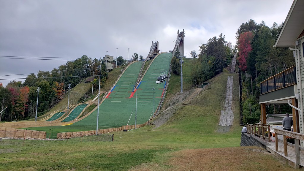
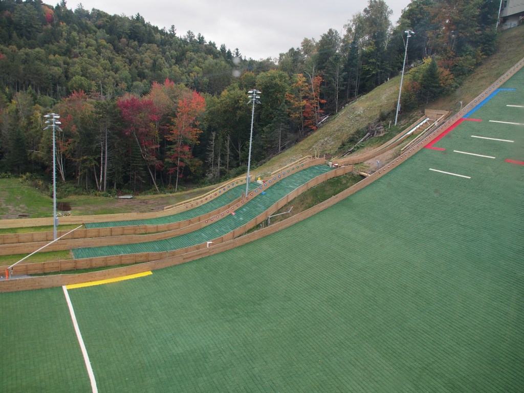
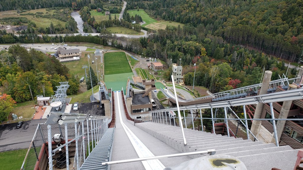
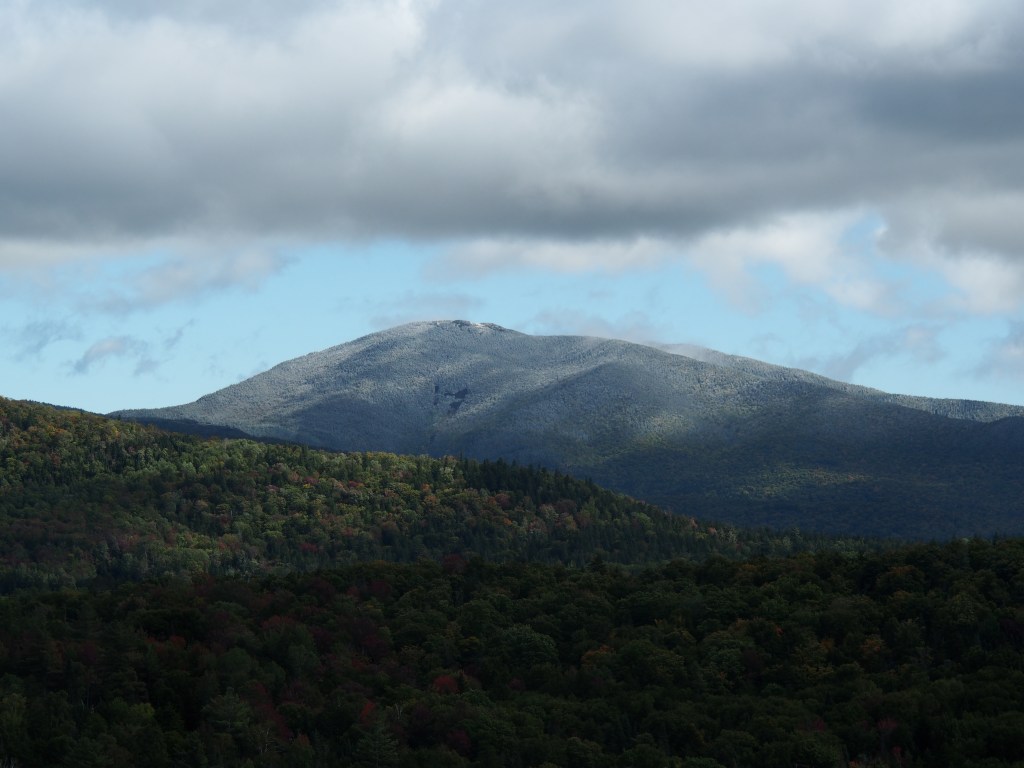
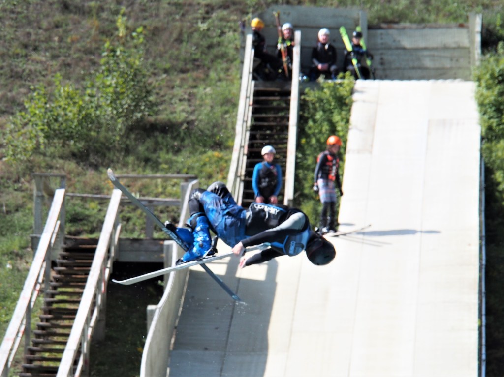
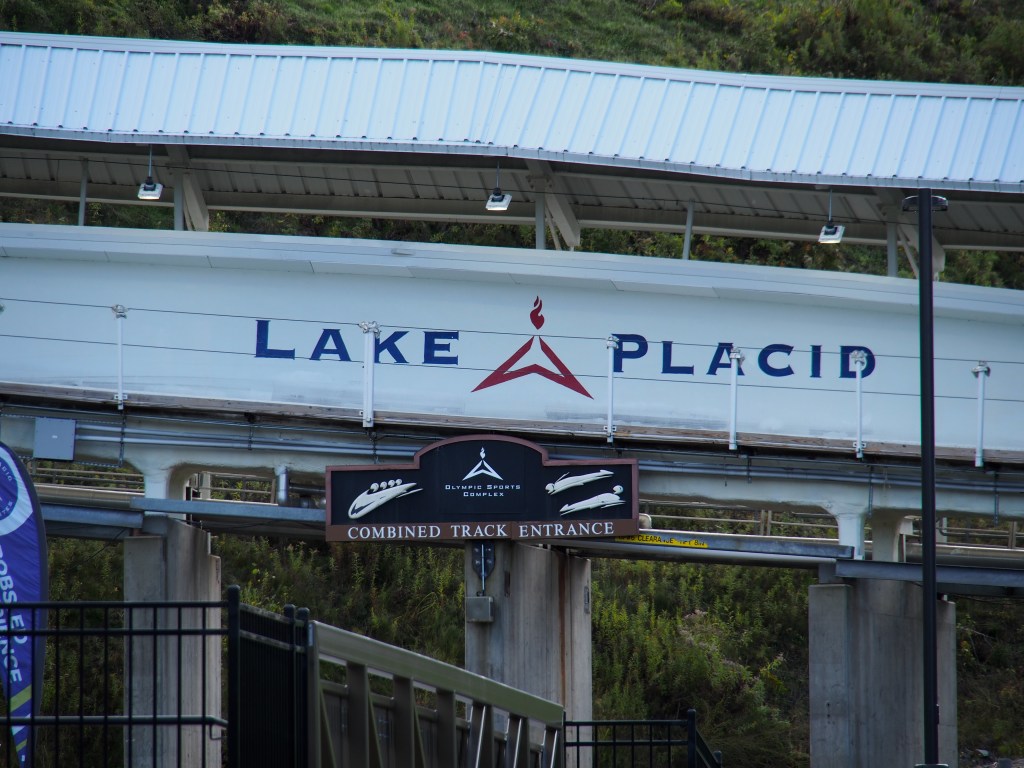
We lost the 22nd to rain pretty much the whole day but were able to get out the following day in spite of the 38-degree temperature that morning. In fact, many of the mountains around Lake Placid had snow that day. We went to the Olympic Jumping Complex and rode the gondola to the base of the jump towers, then the elevator to the top of the 108-meter tower. They have an enclosed observation room at the top of the tallest tower, but you’re still able to walk out to the top of the run. I can’t even imagine going down that hill, much less going off the end of it and flying for 100-meters. The best jumpers are never more than about 12-feet off the snow as they soar down the hill, but that still looked pretty scary to me. I was talking to one of the workers at the gondola and he told me that the current jumpers actually fly, where they dropped like a rock back in his jumping days. They had a pair of smaller hills off to the side and he told me that kids as young as 6 years old jump off that hill. Sounds like a good way to get rid of a child, if you ask me. There were supposed to be practice jumpers scheduled for later that day, so we decided that we’d come back to see that later that afternoon. We were able to go watch the freestyle jumpers fly off their ramps, do their mid-air tricks, then land in a large swimming pool. The temperature was in the 50’s, the wind was blowing, and we were freezing. Leaving there, we drove over to Mount Van Hovenburg which is where the bobsled, luge, skeleton, biathlon, and cross-county skiing events are held. That was a very interesting area to explore and decided to come back later to hike that area. Going back to the jumping site, we found that the ski jumping practice wasn’t happening until Sunday, which was to be our departure day.
Jumping hills and gondola at the Olympic Jumping Complex.Kids jumping hills.Future Olympian!View from the top of the higher jump hill. NOT ME!Snow on one of the surrounding mountain peaks.Freestyle skier practicing by jumping into the pool.
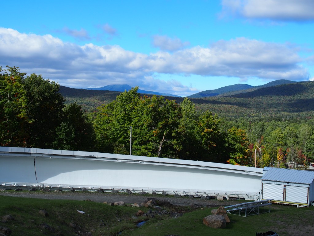
On the 24th, we went back to Mount Van Hovenburg and hiked to the top. It was a little bit wet and muddy, and the roundtrip hike was about 3.6-miles and a climb and decent of almost 1,000′. The three viewpoints were on the back side of the mountain from the sled runs, but the views were amazing.
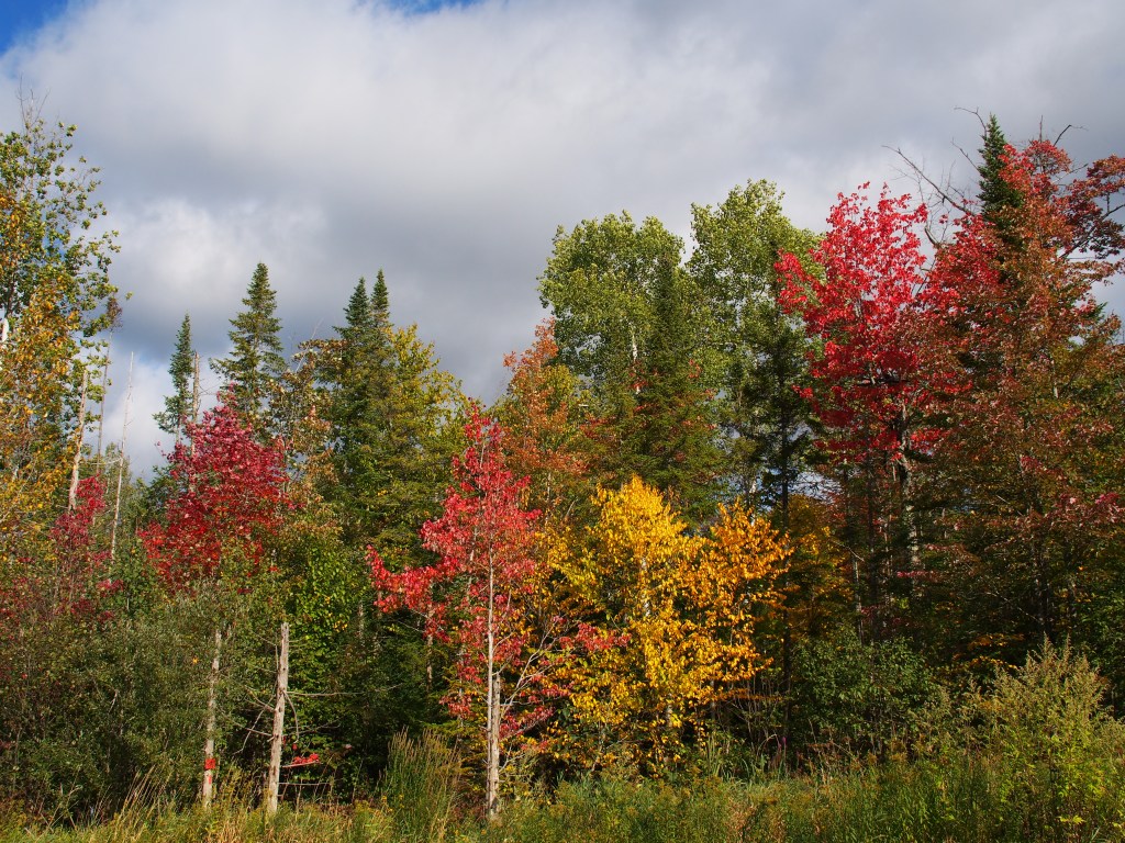
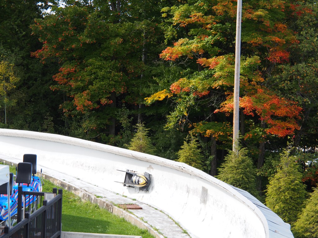
Colors are starting to change, but still only about 30%. We’re a week or two early.Olympic sliding sports complex.Exhibit on the 1932 sliding track.One of the banked turns.Panoramic view from the back side of Mount Van Hovenburg.
On Sunday (25th), we moved a bit south of Albany to Schodack Island State Park. More on that later.
For our Vermont exploration we decided to split the state into two stops, one more southeastern and the other more northwestern. We felt that would give us the chance to visit most of the things we wanted to see without spending all of our time in the truck driving between them.
Our first stop was at a Boondockers Welcome. Ray and Ruth have some property just outside of Windsor, VT, just off the Connecticut River and New Hampshire border. They call the place Just-A-Dubbin. Honestly, I’m not sure what that means, but that’s how they’re listed on the website. In spite of it being another one of our rainy travel days, we managed to get backed into our place beside one of his old barns and maybe 60-70 yards from their farmhouse. The site was very level, especially for a grass site, and the location on their rural dead-end road meant that we’d be having little or no traffic going by. Luckily for us, the rain stayed really light until after we had our trailer all set up. Our plan was to stay there for three nights, counting on our solar to keep us powered, with the generator as backup. Ray was very gracious and stayed around to give us a lot of good information about things to do in the area.
Getting ready to set up at our Boondockers Welcome site, Just-A-Dubbin.
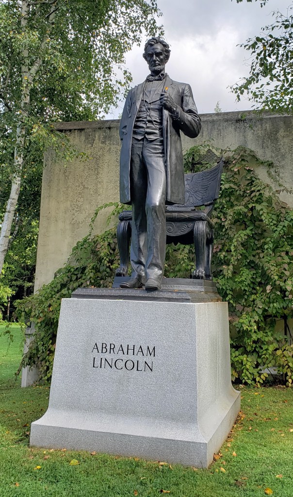
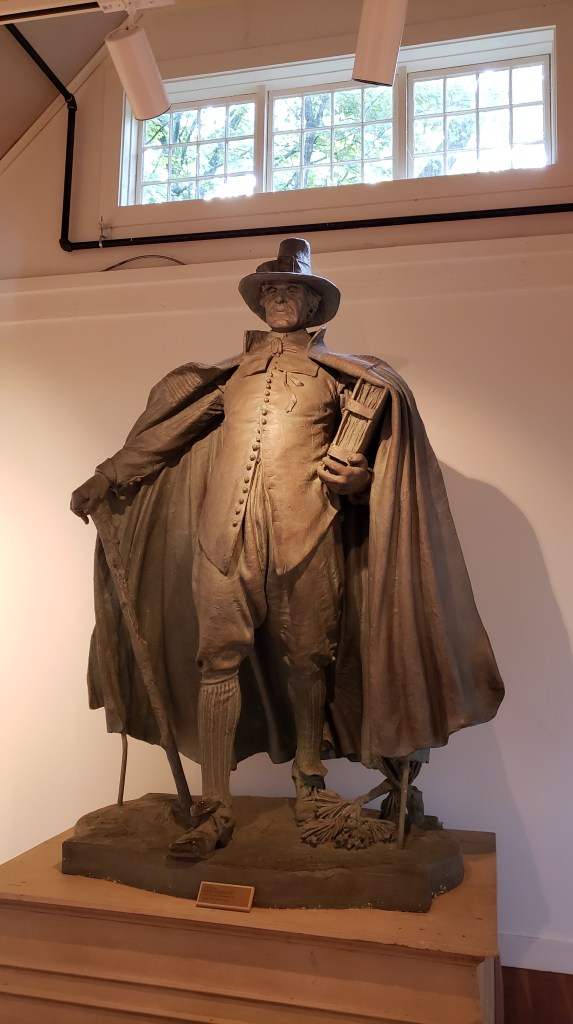
The first of our two full days of “sight-seeing” began with a trip to the Saint-Gaudens National Historical Park which was actually back just across the river in Cornish, New Hampshire. The site was the summer home of Augustus Saint-Gaudens and his family throughout the 1890’s, then their year-round home until his death in 1907. Saint-Gaudens was a sculptor who had learned his craft as an apprentice, initially learning the trade as a cameo cutter. His first major commission was a statue of Civil War Admiral David Glasgow Farragut that unveiled in New York City in 1881. His style was different than most sculptors at the time. It was very realistic and tended to show is subjects “in motion”. Some of his other more well-known sculptures are the General Sherman monument in NYC’s Central Park and a statue of a standing Abraham Lincoln located in Chicago. The details that he added, right down to the stitches in their socks made each one so realistic.
Saint-Gaudins’ statue of Lincoln.
Saint-Gaudins’ home.
Model of The Pilgram.
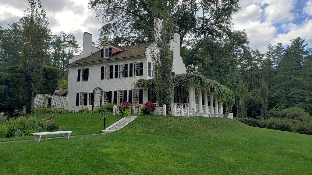
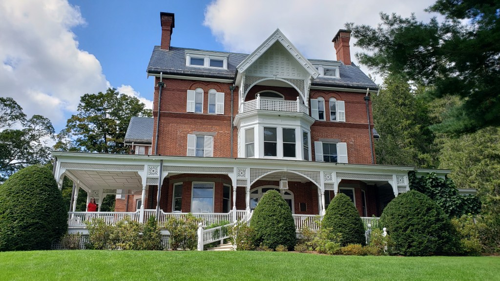
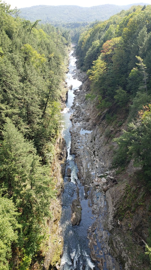
We followed that up with a visit to the Marsh-Billings-Rockefeller National Historical Park in Woodstock, VT. The mansion and grounds were the home for three famous families that were all very influential in the conservation movement of the late-1800 and early-1900’s. The original owner, George Perkins Marsh, grew up in the area and spent a lot of time in the woods around their home. He was impacted by the devastation that first the logging, then the sheep industries brought upon Vermont. We found that by the end of the Civil War, 80% of Vermont had been deforested. That’s hard to believe with the views we see of Vermont today. In 1864, Marsh wrote a very influential book about the interaction with man and his surroundings called Man and Nature that is still in print and studied today. Frederick Billings purchased the Marsh farm in 1869 after returning from the west (think Billings, MT) and finding the desolation that Vermont was suffering, began a project to reclaim the barren land for forests and farmland. He also imported dairy cows and basically started the dairy industry in the state. Billings, followed by his wife, three daughters, and later his granddaughter began replanting trees by the thousands. His granddaughter, Mary French, married Laurence S. Rockefeller in 1934. This brought together two influential families, both with deep commitments to conservation and stewardship of the land. The park was donated to the National Park Service and became the first National Park in Vermont in 1998. From there, we drove over and did the short hike along Quechee Gorge.
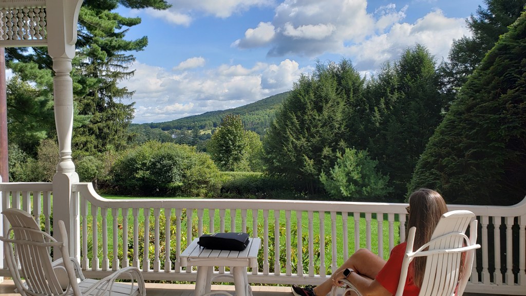
Marsh-Billings-Rockefeller mansion.Debbie soaking up the view from the mansion porch.
Quechee Gorge.
The following day, we returned to the Marsh-Billings-Rockefeller park to do some hiking. Debbie and I hiked up to the top of Mount Tom, via the Precipice Trail, with overlooks of the town of Woodstock. We then hiked some of the carriage roads that the families had built through the areas that they’d reforested between the 1880’s and 1930’s. Our total hike that day was just six miles, but was wound through the forest, around the Pogue Pond, then back down to the visitor center. After a quick picnic lunch, we took a ranger guided tour of the mansion and gardens. The mansion was very interesting with the interaction between the house built in the 1800’s but with televisions and push button telephone.
View from Mount Tom overlooking Woodstock, VT.Taking the road less traveled.The Pogue.Entry and staircase in the mansion.The family room inside the Marsh-Billings-Rockefeller mansion.
Tiffany window, Passing the Torch.
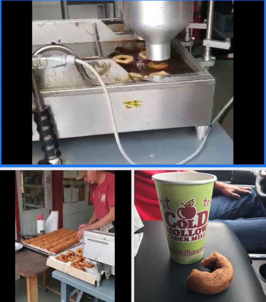
On the 16th, we moved just over 100 miles northwest to the town of Colchester, just to the north of Burlington. On the way, we stopped at the Cold Hollow Cider Mill. It was very crowded, especially given that it was the middle of a weekday. We tested some of their fresh apple cider and bought a dozen of their famous apple cider donuts. I was a bit worried that we wouldn’t eat a dozen of them before they went bad, only to find that we ate them all within a couple of days. They were SO good. We drove from there to our campground which had lots of space and full hook-ups. The site was a perfectly level grass site and we noted just how great of a site that it was. BUT, as we unhooked and started to get the trailer level, we ran into issues with our Ground Control leveling system. After working on it for well over an hour, including two phone calls to Lippert, we finally managed to get all of the legs down and the trailer level. Then Debbie pointed out that our EMS was throwing an error at the power pedestal, showing that we had a live ground on the electric. The EMS wouldn’t let it pass power through to the trailer. After getting the resident electrician and his camp host helper over to work on it for another half hour or so, we discovered that the problem was not with our power pedestal, but with our 90-degree adapter that we use to take the stress off of the trailer connection to the heavy 50-amp cord. After taking that out of the link, everything was working perfectly. After almost two hours of trying to get set up, we were finally able to rest for the remainder of the day. It was a rough day considering that we’d only moved a little over 100 miles.
Finally set up in Colchester.
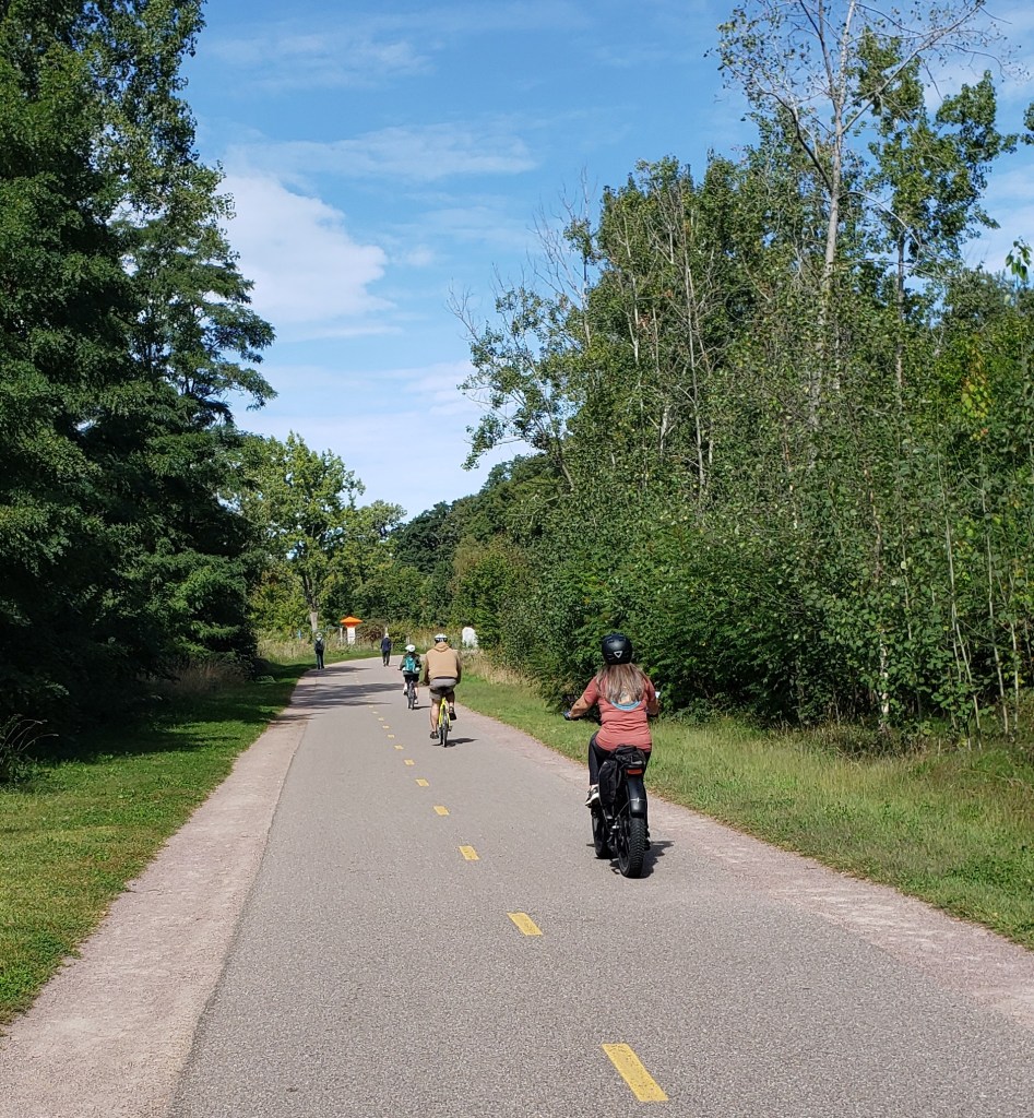
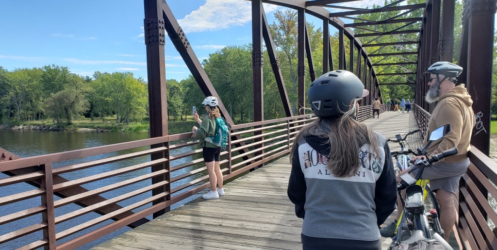
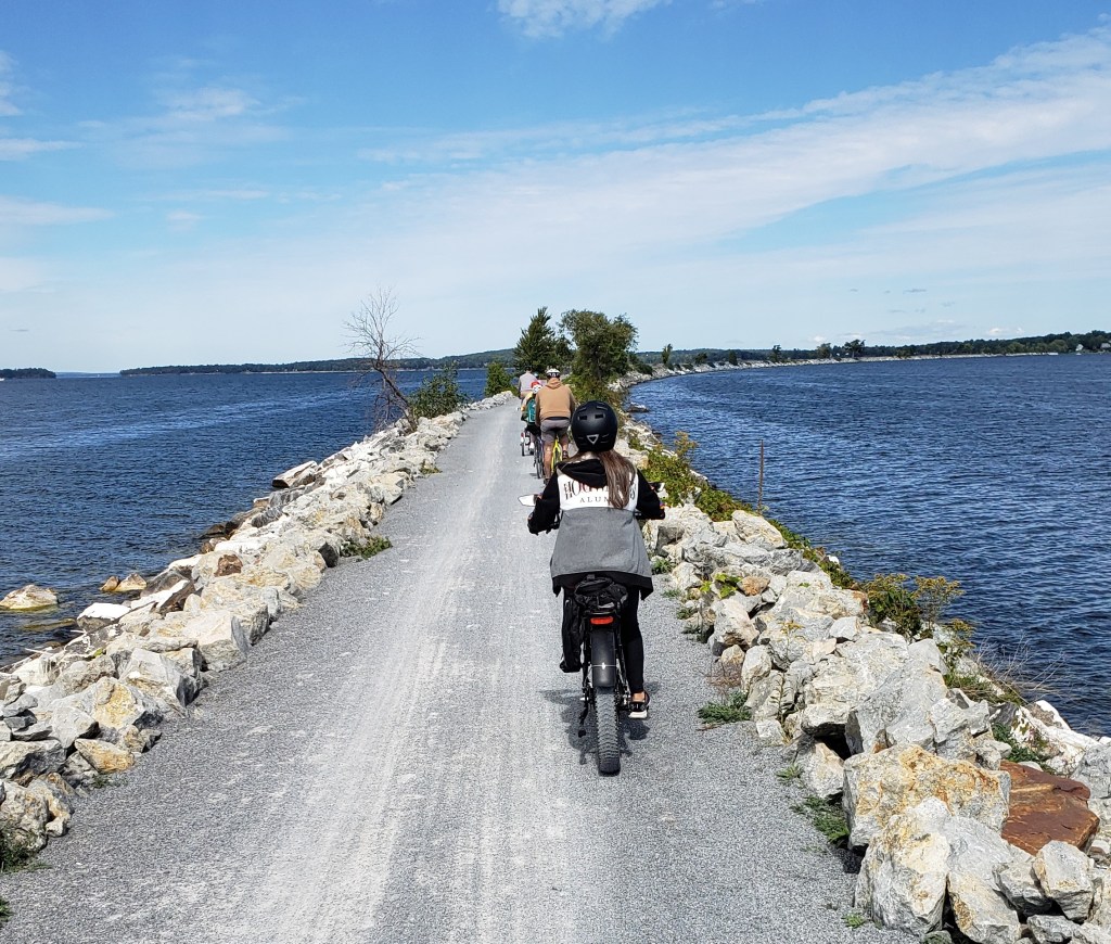
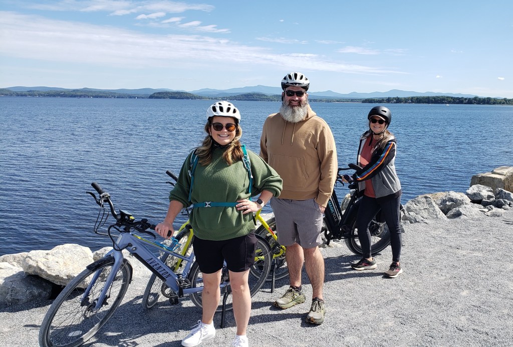
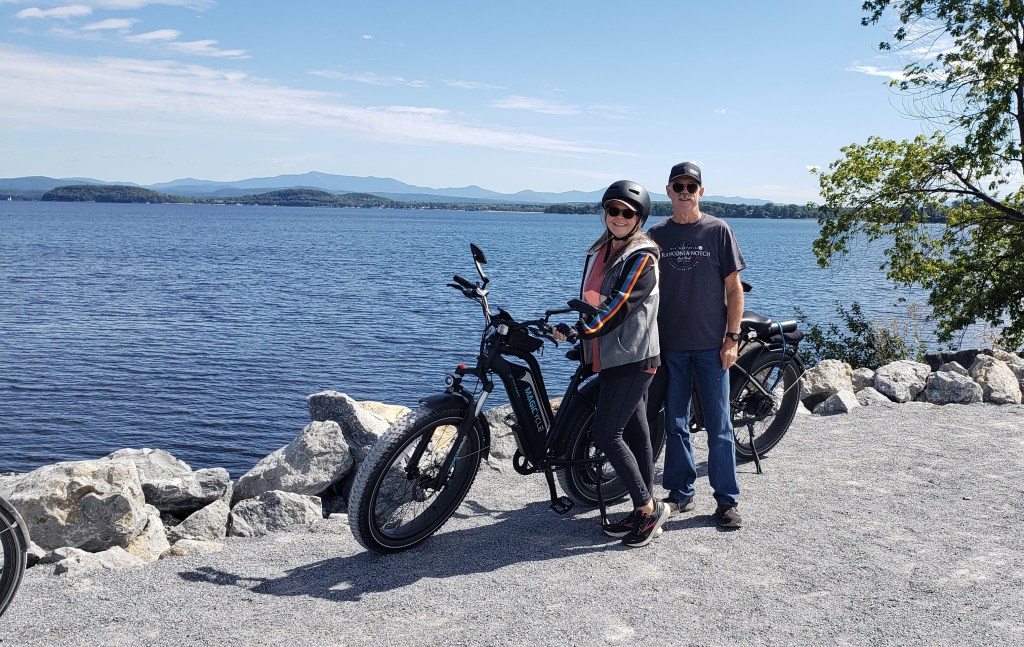
On Saturday, we planned to meet up with Zack and Lindsay Orlicek. We first me Zack and Lindsay back in June at a Harvest Host location in Colorado. Back then, they had just become full-timers in their 25-foot Airstream trailer and have been moving around the country ever since. They work from their trailer all week and do their exploring or move locations on the weekends. We loaded up our electric bikes and met them at a bike rental shop in Burlington. From there, we rode the Island Line Trail north along Lake Champlain up to the Colchester Causeway Trail that cuts out into the lake to a point where you have to take a bike ferry about 50 yards across the channel where it continues over to Grand Isle. Since they were limited on their bike rental, we turned around at that point and rode back to Burlington for a total of 20 miles. We enjoyed a late lunch at a restaurant in Burlington (thanks, Lindsay!) before heading back to our campground.
Riding the Island Line Trail.MUST stop to take pictures!Riding the Colchester Causeway Trail.The biking crew.Debbie and Lynd, enjoying the ride and the view of Lake Champlain.
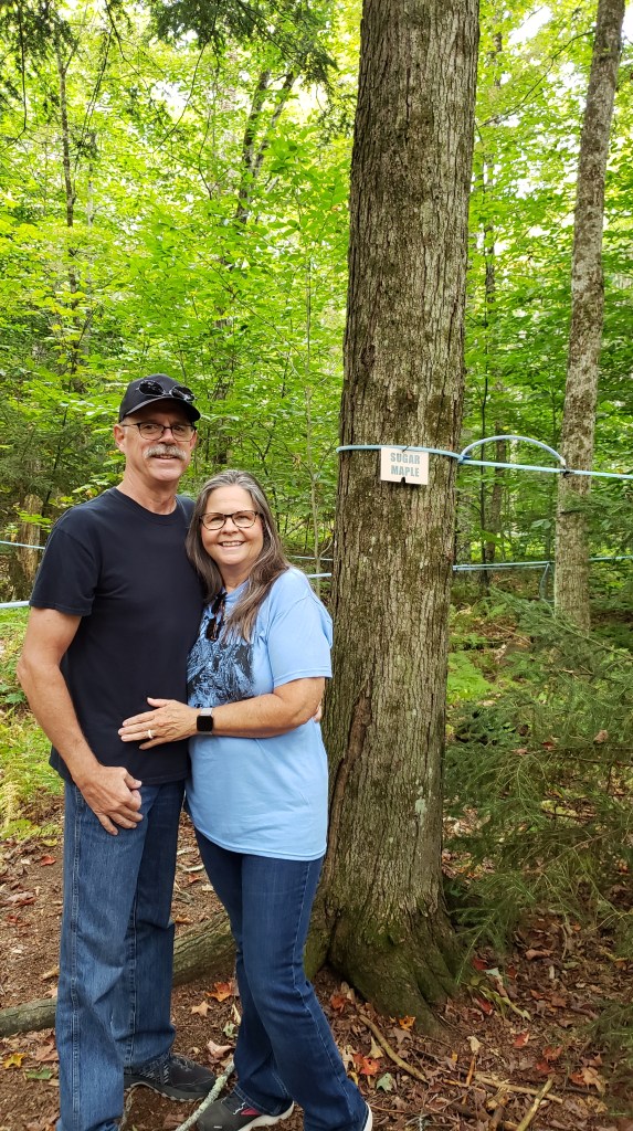
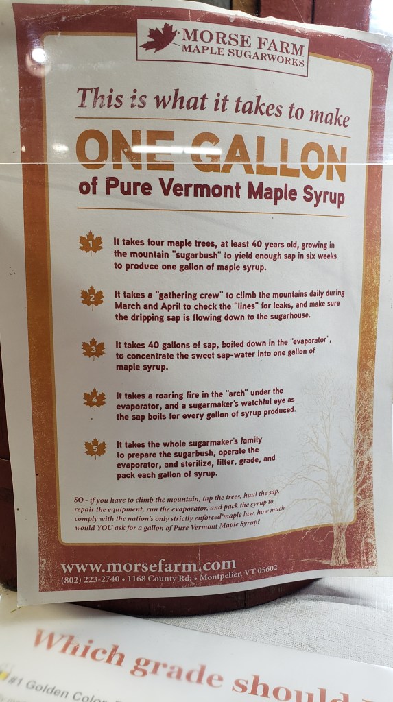
Since we had so much fun with Zack and Lindsay on Saturday, we decided to meet up with them again on Sunday. In spite of the bad weather that rolled in, we still met them at the Morse Maple Sugarworks near the state capital of Montpelier. We were running a little early, so Debbie and I took the time to go by the Vermont State House in Montpelier. The gold dome of the state house was pretty impressive, but the building was closed and there were no tours since it was Sunday. After meeting them at Morse, we took a tour of the sugar works and out among the maple trees to see how they use tubing to tap into 5,000 maple trees every year. We also had the opportunity to taste-test each of the four grades of pure maple syrup. The syrup gets darker with a stronger taste as the sugaring season progresses. We decided that we liked the Grade 2 syrup and picked up a small bottle. From there, we all drove over to Waterbury for lunch at an interesting “smoked meats” restaurant. Since they’d not been there yet, and we were out of donuts, we then drove over to Cold Hollow Cider Mill and drank hot apple cider and ate donuts as the rain really started to come down. We asked one of the guys that was making donuts just how many they made per day. He said that a normal day would be about 6,000 or more, but that 15,000 on a weekend wasn’t unusual. Due to the weather (and the fact that Ben and Jerry’s factory is closed on Sundays), we said our goodbyes to Zack and Lindsay and we headed for the scenic drive up through Stowe and Smuggler’s Notch. Unfortunately, the weather didn’t cooperate, and we were unable to take the gondola to the top of Mount Mansfield as planned. The drive up through Smuggler’s Notch was pretty tight in our dually truck, but we managed to get through on our way back to our campground. Unfortunately, the rain and fog really cut down on the views of the notch.
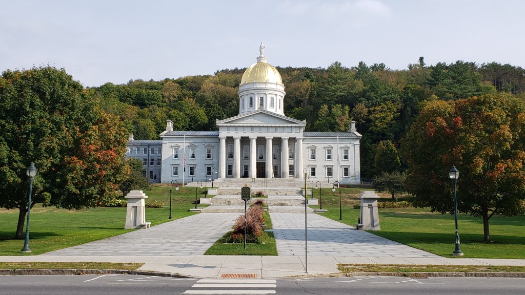
Vermont State House.
Walking among the Sugar Maples.
Interesting facts about the making of real maple syrup.
Best donuts and fresh hot apple cider ever!
Monday was our last day in Colchester, but with the rain and threat of thunderstorms, it turned into a “utility day”. Debbie did laundry while I went to the grocery store to pick up a few things, then to a nearby gas station the GasBuddy said was the cheapest diesel in the area at $4.839 per gallon. The rest of the afternoon was spent watching TV, doing some other chores around the trailer, and writing this blog.
On Tuesday, we head around the north end of Lake Champlain to our next spot near the lake in Saranac Lake, NY where we begin our three-week journey across the state eventually landing in Niagara Falls.
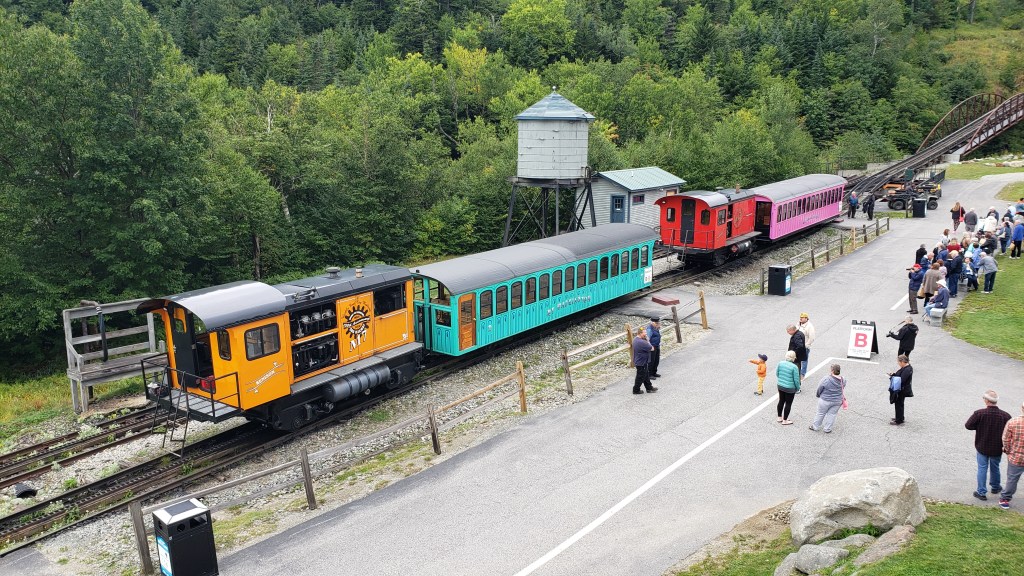
Continuing our travels through New England, we left the Harvest Host in Sidney, ME on Labor Day and moved to a KOA near Lincoln, New Hampshire. As has been the case more often than not, our travel day was also a rainy one. We arrived later than we’d planned due to the traffic on the interstate with people evidently headed home from the holiday weekend. At one point, ON THE INTERSTATE, it took us four hours to travel just 120 miles, even after the rain had stopped. The KOA, which is very near Franconia Notch, would be our basecamp for the next eight nights. The campground was nearly deserted during the week but did fill up on the weekend.
On Tuesday, since we continued to have some rain off and on, we began a little later than usual and mostly did some drive-touring. We did stop at a couple of visitor centers to get maps, brochures, and suggestions as to the best hikes and attractions to explore over the coming week. We also drove through one of the National Forest campgrounds to see if it would accommodate our rig should we choose to come back at some time in the future. With the rain continuing, we decided to head back to the trailer to cook a big pot of taco soup and go over all of the information we’d collected in order to come up with a plan for the rest of the week. We did make online reservations to ride the cog railway to the top of Mount Washington for the following day.
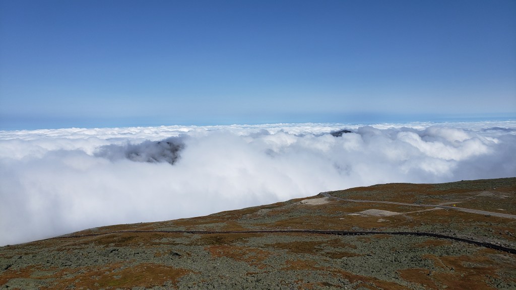
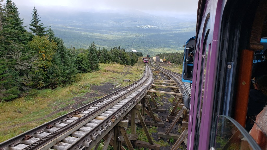
The next day, while on our way to the cog railway, we stopped at a couple of roadside cascades to take a few pictures. Our reservation was for later in the morning, so we had some time to kill. Arriving at the base of Mount Washington, we visited the museum explaining the history of the world’s first ever mountain climbing cog railway. Rides being pushed up the mountain by a coal-powered steam engine had already been sold out, so we climbed the mountain in front of a diesel-powered engine. It was still pretty cloudy that day and we did spend a good bit of the climb in those clouds. Just before reaching the summit, we broke through above the clouds for a spectacular view. We experienced what they call and “undercast”, where you really could not see much except the peak of Mount Washington and a few of the surrounding lower peaks. While beautiful, we’d have preferred to have been able to see more of the surrounding countryside, but at least the top of the mountain wasn’t fogged in like it had been the previous few days. After returning to the bottom, we drove the famous Kancamagus Scenic Highway, stopping along the way at several overlooks, the Albany covered bridge, and taking some short hikes to several waterfalls. Before heading back to the campground, we stopped at a really small Camping World to pick up some things that I needed to do some minor repairs.
Silver Cascade.Loading up the Mount Washington Cog train.Above the clouds atop Mount Washington.The ride down.Albany Bridge.Sabbaday Falls.
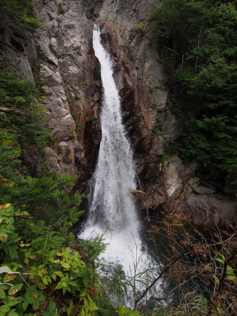
On Thursday, we decided to spend the day hiking. We started with a 5.2-mile loop that began with Frankenstein Cliffs. This trail was one that was a little less traveled but promised to offer some really good views of the valley. The reason that the start of this loop seemed to be less traveled must have had something to do with the 1,637-foot climb! This was quite tricky with some bouldering and rock scrambling, plus several places that were just plain steep and slightly muddy. Once we reached the top and found our way to the top of the cliffs, we were rewarded with quite an amazing view of the valley and the highway far below. We continued along that trail until we reached the Arethusa Falls Trail. Once joining that, we made our way over to the falls, where we sat and had lunch while admiring the view. Once we’d recovered from the first part of the hike, we followed the much easier Arethusa Falls Trail back to the parking lot along the highway. From there we drove over to the Ripley Falls Trailhead and took the quite rocky one-mile round trip hike, with a 305-foot elevation gain, to the falls. This falls, although pretty high, was really more of a long, angled rock face with a small “fall” at the very top. We’d decided that we had reached our climbing limit for the day, so headed back to camp, but not before stopping at the Streatz food truck for dinner.
View from Frankenstein Cliffs.Debbie climbing to the base of Arethusa Falls.Back at the parking lot, pointing to where we’d climbed on Frankenstein Cliffs.Ripley Falls.
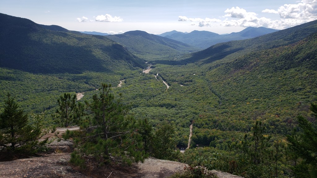
The hiking continued the next day with our first stop being the Flume Trail at the Franconia Notch State Park. This 2.2-mile, 490-foot climb trail took us through a narrow gap in the rock, mostly via steep wooden stairs, before ending with a gradual downhill hike back to the visitor center that included recrossing the river via a covered, wooden footbridge. Driving from the state park, through Franconia Notch, we arrived at our next adventure, the Cannon Mountain Aerial Tramway. At the top of the mountain, we took a short loop trail to a lookout tower that gave 360-degree views of NH, VT, ME, and (had it been clearer) Canada. From there we could see the trail that Debbie wanted to take the next day, called the Mount Lafayette and Franconia Ridge Loop Trail. The more that we looked at it, the easier it was to decide that we didn’t really want to tackle the 9.3-miles and 3,809-foot of elevation gain that would have summitted three different mountains. After our ride back to the bottom, we did decide to take one last trail for the day. This was a 1.5-mile loop, up 436-feet to Artist Bluff where there was a great view of Echo Lake, the ski trails of Mount Cannon, and Franconia Notch.
Walking through the Flume.
Footbridge and The Pool on the Flume Trail.View from almost halfway up.View from the top of Cannon Mountain.The three peaks of the Franconia Ridge Trail, which starts from the road below.The view on the ride back down.View from Artist Bluff of Mount Cannon ski area and Echo Lake.
After Artist Bluff, we decided to make a run to Walmart to pick up a few groceries and other items. This was the strangest Walmart that we’d ever seen! It was like most any Super Walmart, with clothes, sporting goods, automotive, and general groceries, but with one really big distinction. They had NO fresh vegetables or any meats that weren’t pre-packaged. They had things like sandwich meat and Hillshire Farms sausage, but no hamburger, steaks, chicken, etc. at all. And the only vegetables were either canned or frozen. We actually had to go across the street to a supermarket to get fresh meat and vegetables. Strange.
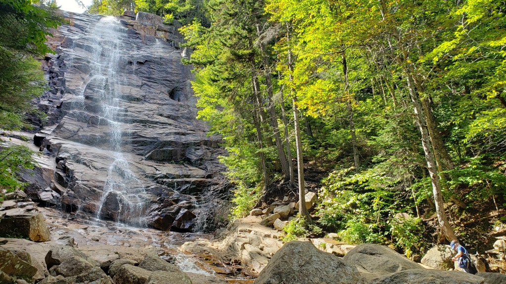
On Saturday, we decided on two hikes. The first was a 900-foot climb to the top of Mount Willard that involved a 3.1-mile round trip. As with almost every hike we’ve taken in New England, the views were great. We followed that up with another 3.1-mile round trip (with 680-foot elevation gain) to Champney Falls. This hike was one that a ranger and the Forest Service information center highly recommended and I can say that we were not disappointed. This trail weaved its way through the forest, crossing the stream three times, to a series of waterfalls that were quite impressive. It had everything from cascades to multilevel drops, and even had one long drop off to one side of the main falls.
View of Pinkham Notch from Mount Willard.Upper section of Champney Falls.Lower section of Champney Falls.
Section of Champney Falls off to the side of the main falls.
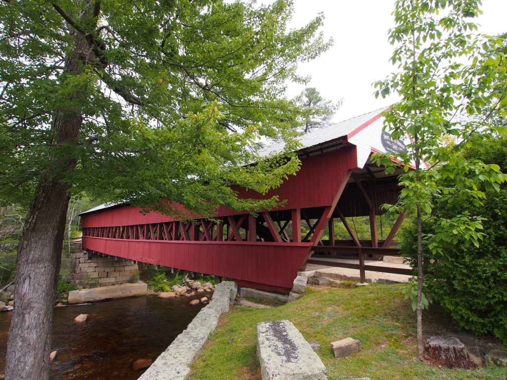
On Sunday, the weather didn’t look to be the best for hiking any long trails in the area, so we decided to just take a road trip to visit a number of covered bridges. We started with the Saco River and Swift River Bridges, then on to the Jackson Bridge. The weather seemed to dry up just a bit, so we did end up taking the very short trail to the Glen Ellis Falls in the Pinkham Notch area. It was really quite an impressive waterfall. We ended the afternoon with dinner at Big Day Brewing in Gorham. Debbie ordered brussel sprouts for an appetizer (which I really don’t like), but they were fried with a maple bacon glaze and a drizzled with a black pepper aioli. I’ve got to say, those were really good. We sat outside and enjoyed our dinner while chatting with another couple that had just finished one of the trails that we’d done earlier in the week. It turned out to be a beautiful afternoon.
Saco Bridge.Swift River Bridge.Glen Ellis Falls.
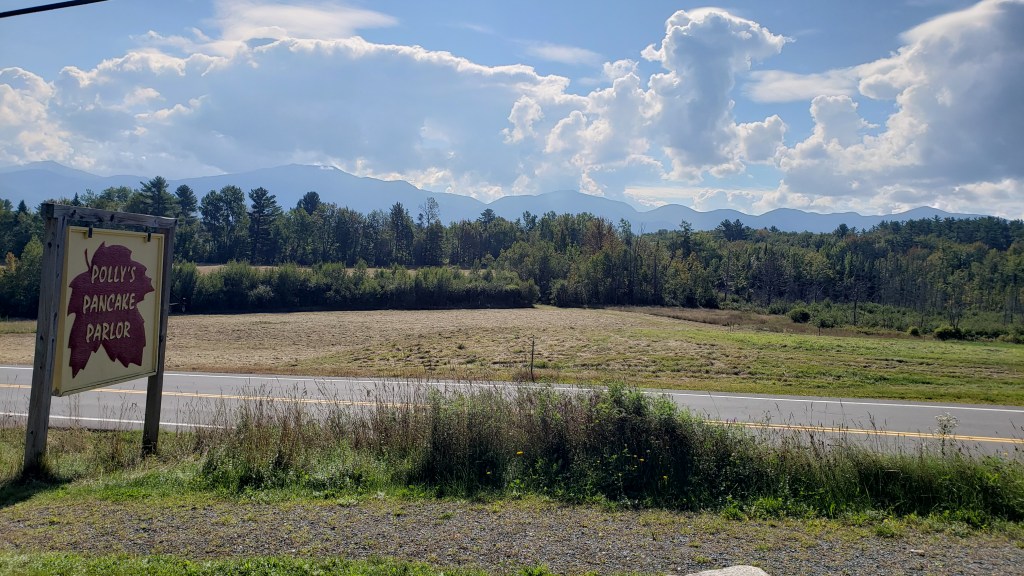
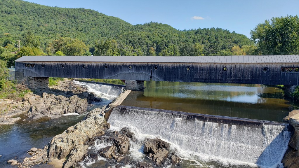
We started the next day with a trip to Polly’s Pancake Parlor. The restaurant has been in existence since 1938 and is still being run by the third and fourth generation of the family. After an amazing breakfast, we decided not to take our planned 18-mile round trip bike ride along the Franconia Notch Path recreational trail because it looked like we were going to get some rain. Instead, we drove another scenic loop that took us to see several other covered bridges, including the Haverhill-Bath Bridge which is the longest covered bridge in New Hampshire. The fact that so many of these covered bridges are still standing after so many years, some over 100-years, still amazes me.
Our mountain view at breakfast.Haverhill-Bath Bridge.
The next morning, being that it was a travel day, we were once again treated to yet another rainy day as we hooked up our trailer and made our way over to our first spot in Vermont. Seems like we may get fog or light drizzle on other days, but we’ve managed to get a pretty good rain every time we try to move.
Post #7: Cobscook Bay, ME and Campobello, New Brunswick, Canada; Aug. 31 to Sept. 4.
On Wednesday, we left the Bar Harbor and Acadia National Park area and drove to far southeastern Maine to Cobscook Bay State Park where we would be dry camping without any water or electric hookups for about five days. We were a bit concerned that we might have too many trees for our solar panels to keep us powered up, but it turns out that we had the perfect spot with open space above albeit with a somewhat limited view of Cobscook Bay. The park was just a few miles from Lubec, ME, the easternmost town in the continental United States.
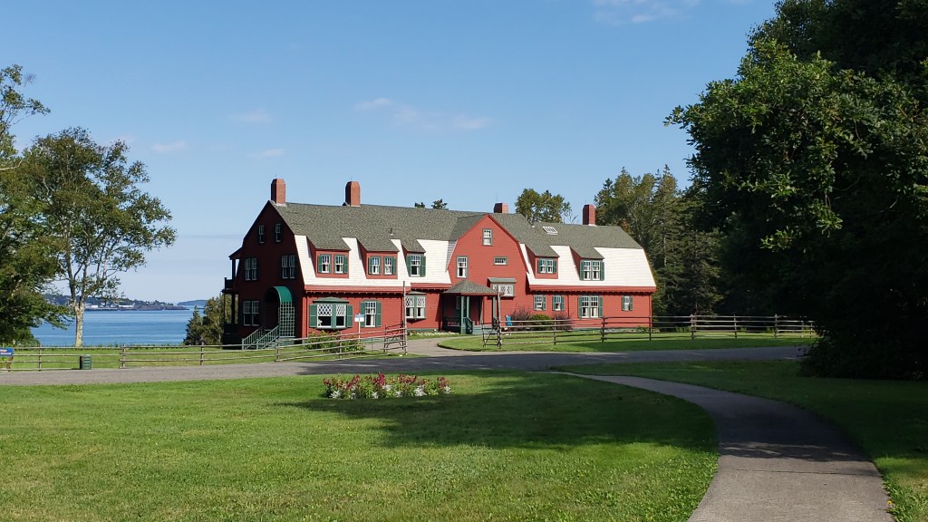
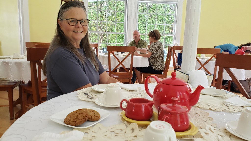
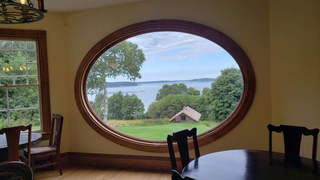
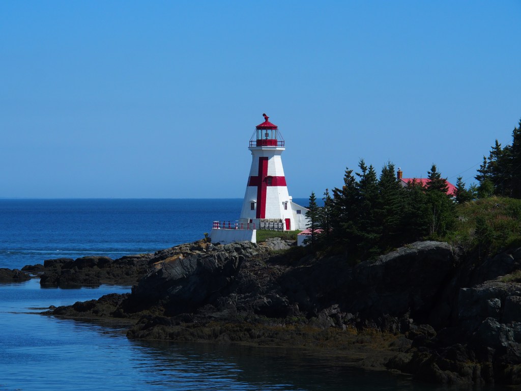
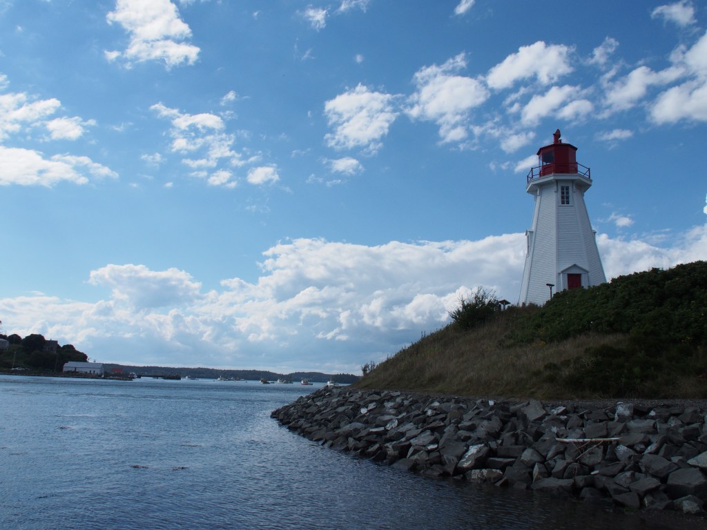
On Thursday (9/1), we grabbed our passports and headed over to Lubec, then across the Roosevelt Memorial Bridge to Campbello Island in the New Brunswick province of Canada. Campobello Island was the summer home of Franklin Roosevelt and his family. The home and surrounding area are part of an International Park, administered by both the US and Canada. While there, we visited the Roosevelt House, another house that was being used by the park service to host Tea with Elanore which we attended, and the neighboring Hubbard Cottage with its large round window overlooking the bay. Tea with Elanore lasted nearly an hour where two young ladies provided a good bit of information regarding the life of Elanore Roosevelt, from childhood up through her life, even after FDR had passed away. All the while, we were treated to a very good hot tea and freshly baked Ginger Snaps. The Hubbard Cottage was home to one of FDR’s neighbors. The wife had found a large round window during some overseas travel and basically built the cottage around that window and its view of the town of Eastport, ME across Cobscook Bay. After touring the houses and having our tea, we drove the ten-mile long island, enjoying views of the area, along with the Harbor Head Light Station and the Mulholland Lighthouse. Unfortunately, we were unable to walk across to the point where the Harbor Head Light Station was located because of the rising 20’+ tide that was quickly coming in. (More about this later.) After driving back across the Roosevelt Bridge, we took a short side trip to the West Quoddy Head Light, located at the far eastern tip of the United States.
Roosevelt House on Campobello Island.Tea with Elanore.Dining room window (and view) from the Hubbard Cottage.Harbor Head Light Station.Mulholland Point Light House.
West Quoddy Head Light.
We got a bit of a late start on Friday but did manage to drive up to visit the St. Croix Island International Historic Site near Calais, ME (which we found was pronounced cal-iss, not cal-lay like in France). St. Croix Island was a small island where a French expedition led by Pierre Dugua tried to establish a settlement over the winter of 1604/1605. It is one of the earliest European settlements in North America. They believed that the small island would be easy to defend, but unfortunately, trapped on the island due to ice, thirty-five, or nearly 1/3 of the settlers, died that winter, probably due to scurvy. That spring, the Passamaquoddy Indians befriended the settlers, brought them food and medicinal plants and began trading with the French. The park had a very interesting exhibit that consisted of over a half dozen statues depicting the French settlers and the Passamaquoddy Indians. From there, we drove into Calais for a “Walmart day”, to pick us some supplies.
The small St. Croix Island.
One of the statues at St. Croix Island Internationa Historic Site.
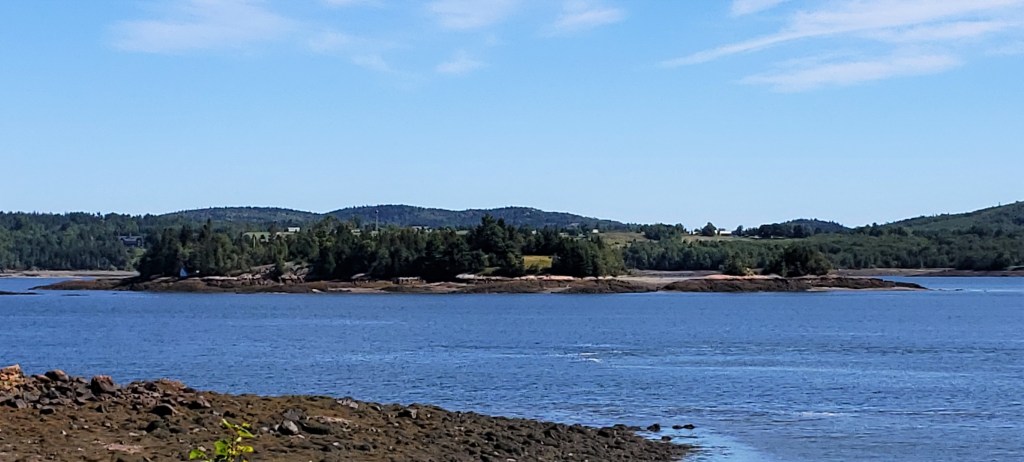
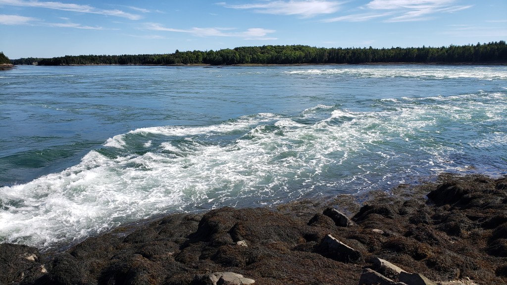
The next day, we toured around the area, visiting a number of small parks in the Lubec area known as Cobscook Shores. This was a system of fifteen waterfront parks that included hiking/biking trails, picnic areas, scenic overlooks, and twelve miles of undeveloped shoreline. The parks and their amenities appeared to be fairly new. After touring many of the parks, we moved over to Reversing Falls State Park. This very unique area of Cobscook Bay was something to see. Due to the extremely high tide in the area (about a 20-foot rise or fall, every 6-1/2 hours), there was an area where some falls or rapids flowed one direction when the tide was coming in and in the opposite direction when the tide was going out. We arrived at the part about 90 minutes before actual high tide and there was a significant flow going from our left to right. I’m unfortunately unable to load a video into this blog, so hopefully the picture below can illustrate just how fast the flow was from the incoming tide. These are not waves, but the actual current caused by the tide flowing in. There were very high rapids and a large whirlpool (over 100-feet across). As we watched over the next couple of hours (it was a beautiful evening) and the tide peaked, the flow slowed down to a complete stop. Within about another half hour, we could see the flow change directions from our right to left, going back out to sea. By that time it was beginning to get dark, so we had to leave before the tide began to fall enough to really see the rapids going back out.
Flow of the tide coming in.
We pulled out of Cobscook Bay State Park on Sunday and started our way back west. We spent the night at another Harvest Host, with four other campers, called Misty Meadow Alpaca Farm in Sidney, ME. While there, Debbie picked up a knitted cap (toboggan) made from alpaca fleece, and I got a pair of gloves. From there we continued west into New Hampshire, which I’ll discuss in my next blog post.
Post #6: Acadia National Park and Bar Harbor, Maine, August 24 to August 31.
Let me just start by saying that Acadia National Park is amazingly beautiful and is now ranked among our top two or three most favorite National Parks. As you can imagine with all of this beauty, my cameras were running nonstop, but the pictures just can’t do it justice. Nevertheless, I’m going to include a lot of those pictures in this edition of the blog anyway. I hope I’m not overwhelming everyone with the number of pictures. I’m going to try a different approach regarding the pictures since there are so many this time. I’m going to put them all at the end of the post, with captions, rather than scattering them throughout. Hopefully that will make for easier reading. Please comment and let me know if you prefer it this way, or if you prefer each picture be placed with the text that mentions it.
From Camden, ME, we traveled just a few hours up the coast to a private campground just outside of both Bar Harbor, ME and the main entrance to Acadia National Park. Debbie had located a nice park that worked completely on a first-come/first-served basis. We were a little leery about being able to get a spot without reservations at a campground so close to the National Park during the peak season. Since it was pretty close to Camden, we were able to arrive at about 11:00 a.m. and were told that there were a few full hookup sites that MIGHT be available. The first two pull-through sites turned out to be occupied and the campers weren’t moving, so we moved on and discovered a pair of back-in sites. We chose the larger of the two and backed in. The campground cost was super reasonable at $50 per night, and since we were staying a full week, we got one night free and the total cost for the week was just $300. As we were unhooking our trailer, a really nice Class A motorhome pulled in and started to unhook their tow car so that they could back into place. While he was unhooking and I was starting to get my cords and hoses out to hook up, yet another camper walked up and asked both of us if we were leaving. Unfortunately for him, we were not leaving, and he walked off with a frown. The early bird catches the worm! It turns out that the couple in the Class A were from San Antonio. He was originally from Belgium and I believe she may have been from England, although I don’t think she ever said. (His accent seemed British to me as well.)
After getting all hooked up, and since it was still early in the day, we decided to go into the National Park just to feel out the situation. We discovered that the free park bus system actually picked up right at our campground, so we took the 7-8 minute ride to the Hulls Cove Visitors Center, which seemed to be the main visitor center in Acadia National Park. After going to the visitor center and talking to the ranger to get advice and suggestions, we boarded the Loop Road bus for a trip around the park, getting off at some of the major stops. It was a good way to feel out their free transportation system that we’d be using all week. I will say that for the rest of the week it was easier for us to just drive to the visitor center from our campground since it was so close, rather than trying to time catching a bus that only came by every hour. The bus Loop Road bus leaves the visitor center every 20 minutes, but there are several other routes around the park where buses leave not only the visitor center, but other key locations on a published schedule. After taking the test ride, we returned to the visitor center, feeling that we had a good handle on what things we wanted to see and do while at the park.
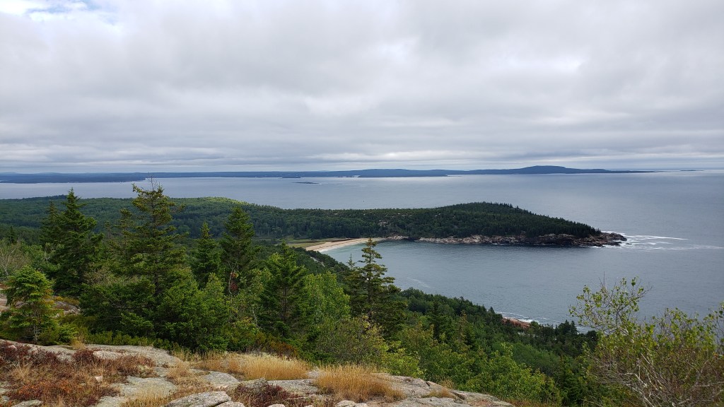
On Thursday morning, we drove over to the visitor center and found plenty of parking available, then caught the Loop Road bus. We made stops at a crowded Sand Beach (where people were swimming in the 55-degree water), the iconic Thunder Hole, and the Jordon Pond House which had gardens, a restaurant, visitor center, and gift shop. We sat and ate a picnic lunch on the shore of Jordon Pond with a great view of the lake and the Bubble Mountains in the background. After lunch, we headed back to pick up our truck and drove over to another portion of the park called Schoodic Point. It turned out that the two visitor centers over there had closed just minutes before we arrived. We were still able to take the scenic drive around the point, making several stops at areas with amazing views of the rocky coastline and the ocean. We also found that section of the park to be much less crowded, almost deserted, and were able to really enjoy some of the scenic areas practically all to ourselves. Thursday night we signed up for a ranger talk down on Sand Beach called Acadia’s Night Sky. There were quite a few people that turned out for that event, but unfortunately just as it was beginning to get dark a cloud bank rolled in and completely blocked out the stars. That didn’t deter the two rangers and they held the event as if the stars were visible, including pointing at various night sky objects with their green laser pointer and telling us all about them. It turned out to be a really fun event.
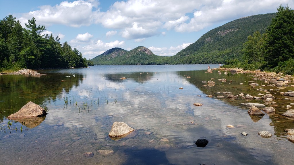
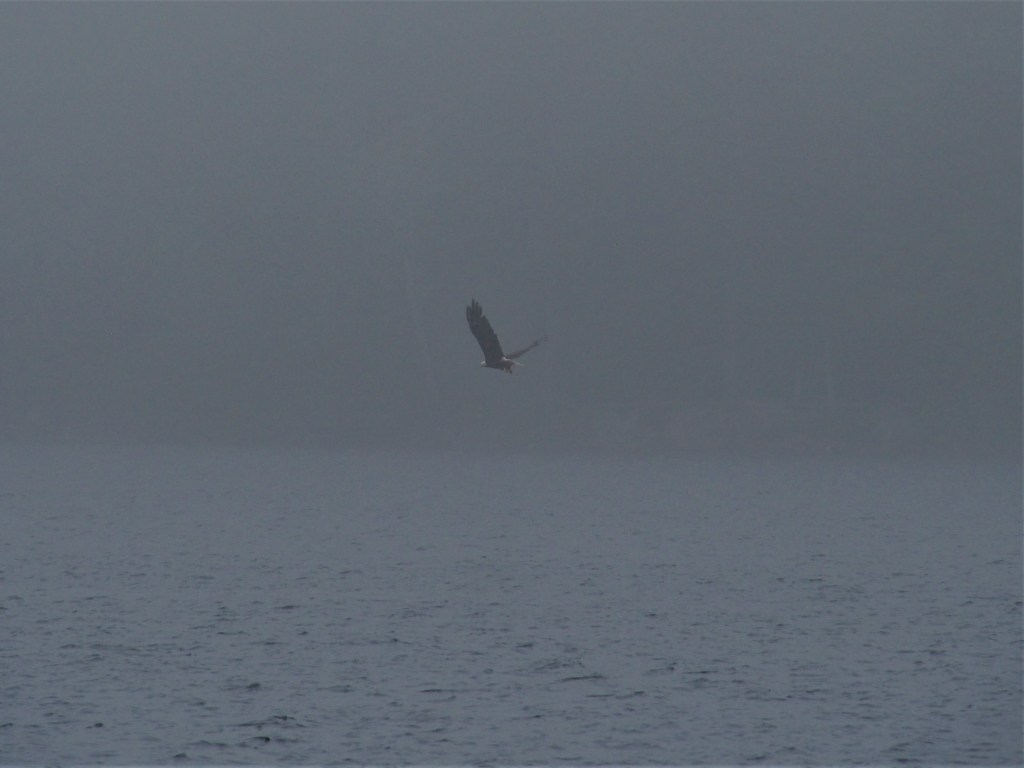
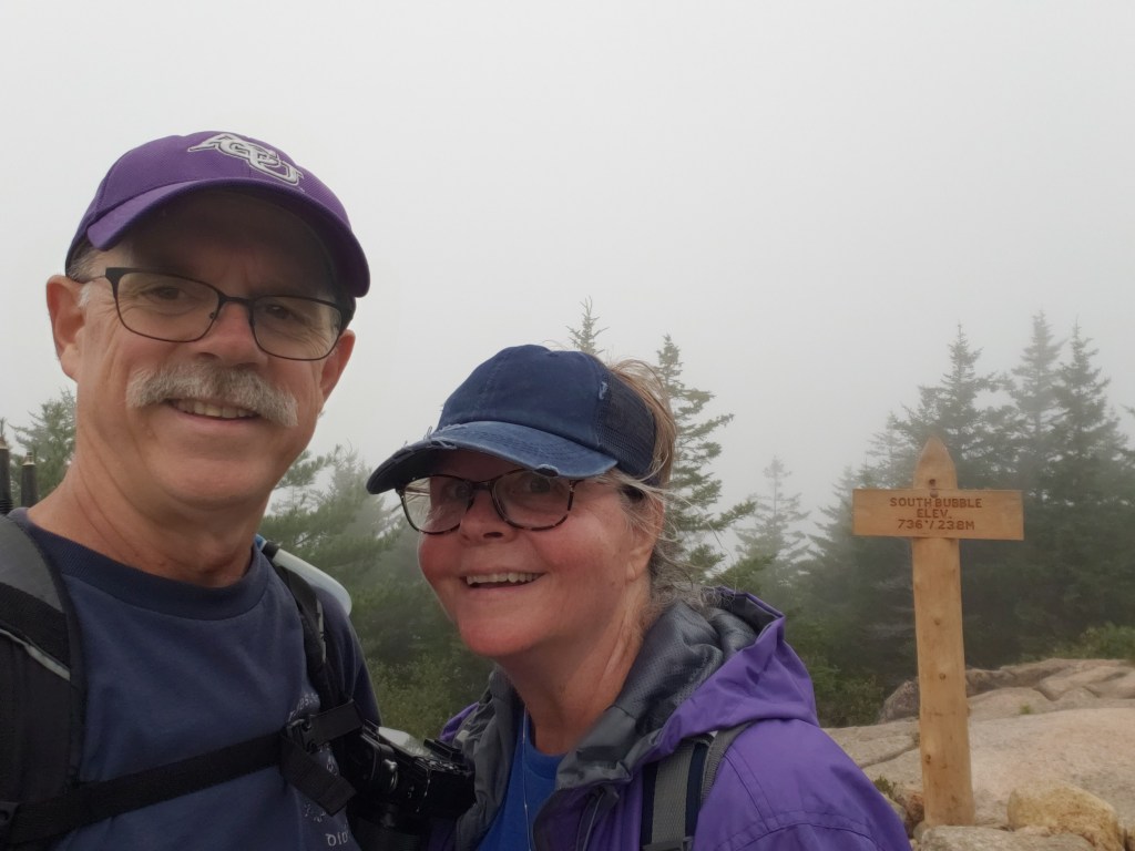
On Friday, we went back to Jordon Pond and hiked halfway around the lake, planning to pick up the trailhead to South Bubble Peak. Along the way we saw a bald eagle as he snatched a fish from the pond, then landed in a tree not far from us. The hike up the South Bubble was much more strenuous than we’d anticipated with several sections that required some bolder scrambling, but we managed to make it. It was very foggy and damp that day, so the views from the top weren’t as spectacular as we’d hoped. We ate a picnic lunch on the summit, hoping the fog would clear, but that just didn’t happen. Regardless, the hike was a good one. After returning to Jordon Pond via the easier northern route, we headed back to our campground.
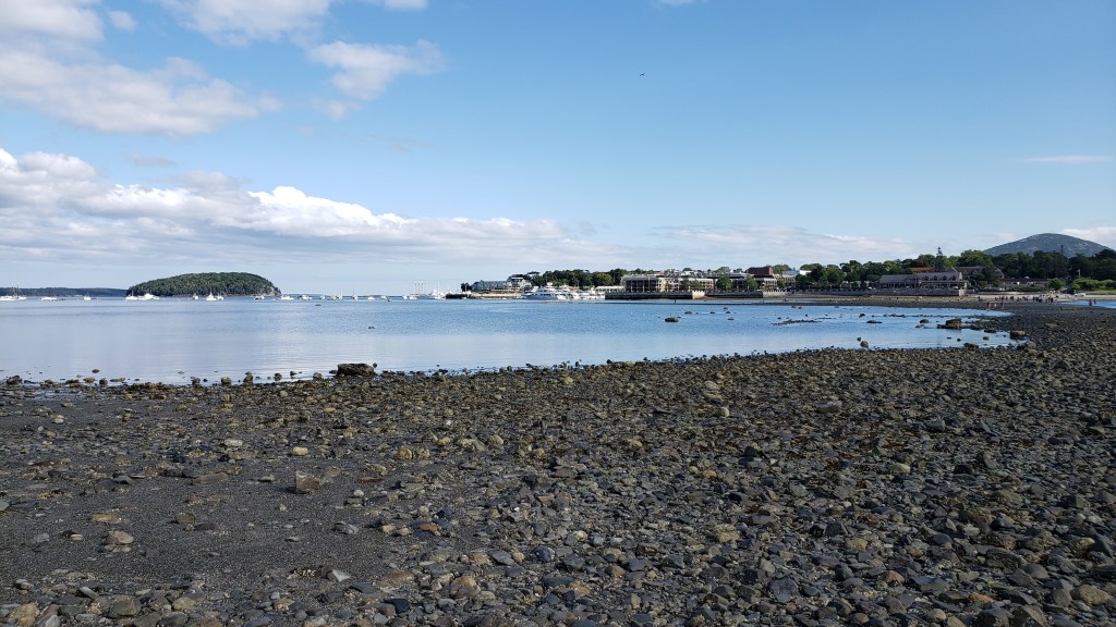
Saturday turned out to be a much better day for both hiking and the views. We met up with Chris and Marci Felker, whom you may recall we met back at the Boondockers Welcome location a week earlier in Biddeford, ME. They’re generally following a similar path to ours on their journey and we agreed to meet up on one of their non-working days to do a hike together. They still work remotely, so their activities tend to be mostly on the weekends. We met them at the visitor center and hopped a bus to Thunder Hole. Luckily, we arrived at Thunder Hold about two hours before high tide, which we’d been told was the perfect time to see and hear the waves crashing into the hole. After admiring that for a bit, we walked about a third of a mile along Ocean Path to pick up the mile long Gorham Trail to the top of Gorham mountain, 525-feet above. That trail, while fairly easy, did have a couple of steep sections. The views from the top were spectacular and we decided to enjoy both the views and the cool breeze while we had a sandwich. After soaking in the sunny morning for a bit, we headed down the north side of the mountain and picked up the less strenuous west side trail to the Beehive. This was opposed to utilizing the narrow ledges and metal rungs of the almost vertical east side of the mountain, of which none of us was too keen on trying. The trail from Gorham Mountain, back up to the Beehive, and back down to the bus stop added another 2-1/2 miles to our overall hike. The Felker’s headed back to their campground to attend to their two dogs. Debbie and I hopped aboard the Bar Harbor Road shuttle at the visitor center and headed into the town of Bar Harbor. Once there, since it was low tide, we were able to walk across the land bridge from Bar Harbor to Bar Island. It seemed to be one of the most “touristy” things to do, so we did it. After that, we had an early dinner at a small place in Bar Harbor called the Thirsty Whale. The seafood there was very good and very plentiful. I’d recommend it. Since we had big plans for Sunday morning, we caught the shuttle back to the visitor center, then headed back to our campground for an early evening.
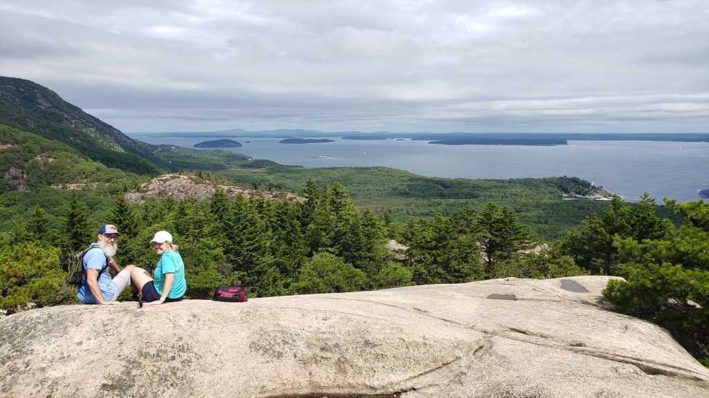
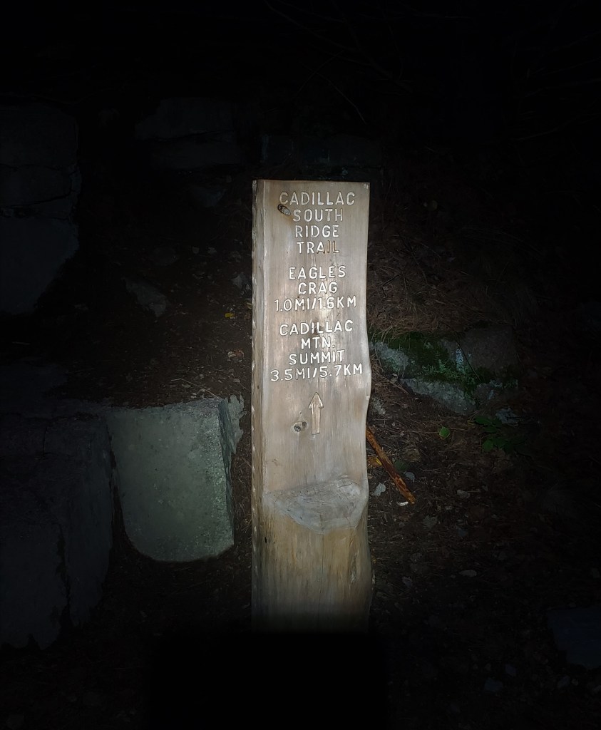
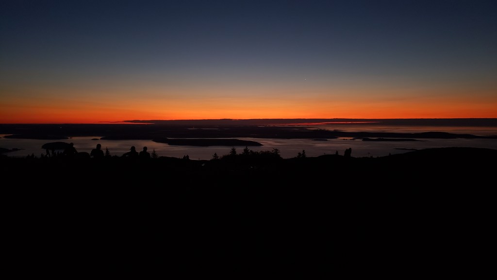
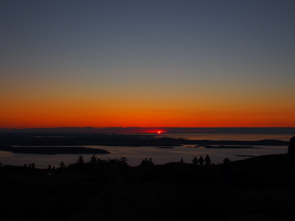
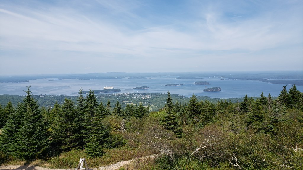
Sunday was to be our most ambitious day at Acadia. We wanted to witness the sunrise from the top of Cadillac Mountain, the highest mountain along the north Atlantic seacoast and the point where the sun first strikes the continental United States from October to early-March. Since we were unable to get reservations to drive up the mountain before sunrise, we opted to hike up in the dark. The shorter northern route, about 2-1/2 miles long, posed two problems for us. First, the parking there, even in the early morning hours, is almost nonexistent. The second issue is that it’s pretty steep and required some bouldering, which we didn’t relish doing in the dark. The other options, which we took, was to walk up the 3-1/2 mile long south ridge to the 1,530-foot summit. To accomplish that feat, we chose to give ourselves a little bit of extra climbing time and left our campground at 1:30 a.m. so that we could hit the trail around 2:00. Mind you, this just happened to be only a day or two after the new moon, so the only light in the woods at the bottom of the trail and the rocks at the top of the trail were from a couple of headlamps that we bought at Walmart on Saturday. With only a couple of short wrong turns that we were able to quickly correct with the help of the All-Trails app, we managed to reach the summit just after 4:30 a.m., 2-1/2 hours later. Surprisingly, even though it was still nearly an hour and a half before sunrise, there was already a distinct line of orange glow along the eastern horizon. There were quite a few people that were already there, having “cheated” by driving up the mountain. We found a very good location to sit in the cool predawn air and drank some mostly hot coffee while we waited for sunrise. As sunrise got closer, more and more people arrived and it actually got fairly crowded, but our spot had a large roped off area between us and ledge, so our view was pretty much unobstructed. Well, at approximately 5:45, the sun broke over the horizon, just under a narrow cloudbank on the horizon. The view was breathtaking! The pictures just don’t do it any justice at all. Once a majority of the people began to get in their cars to take the drive back down the mountain, Debbie and I began our 3-1/2 mile trek back down the South Ridge trail to our truck. It sounds like a crazy thing to do, but the experience will be one of those that we’ll be talking about for many years to come.
After the epic adventure we’d undertaken on Sunday, we decided that we’d not do any hiking on Monday, but would instead spend the day driving to several locations around the park, basically so that Debbie could get the rest of her National Park Service Passport book stamps for Acadia National Park. With two visitor centers and the store at the top of Cadillac Mountain having been closed when we were there earlier in the week, driving back to those locations would make for a good “rest day”. Our bodies were still trying to recover from tackling the South Bubble on Thursday, Gorham Mountain and the Beehive on Saturday, and Cadillac Mountain on Sunday. It was hard enough just to climb the three steps in our trailer! We started out by driving over to the Seewall Campground and the Bass Harbor Head Lighthouse in the western portion of the park for a couple of Debbie’s stamps. Then we again drove back over to the far eastern portion of the park on the Schoodic Peninsula to the Schoodic Woods Campground and the Schoodic Institute visitor centers. After again completing the scenic loop drive around the Schoodic Peninsula, Debbie was able to book a slot to drive to the top of Cadillac Mountain. Times to take the drive were available pretty much all day, except for the early morning. Those times are booked weeks if not months in advance. After getting the stamps in her book at these locations, that pretty much got all of them from Acadia.
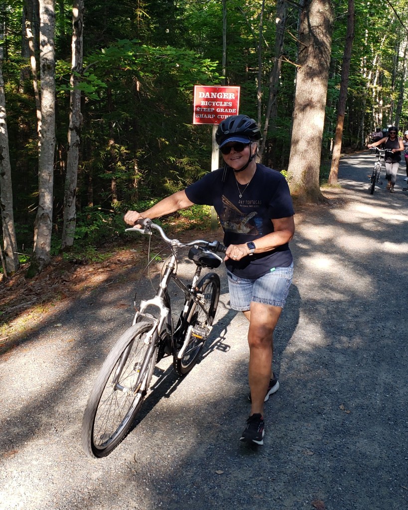
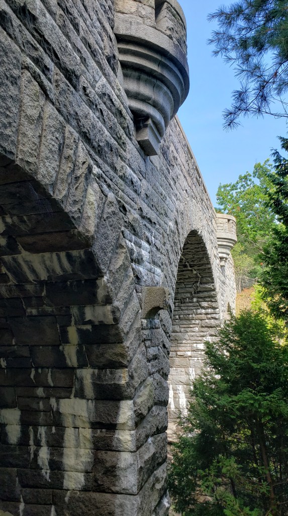
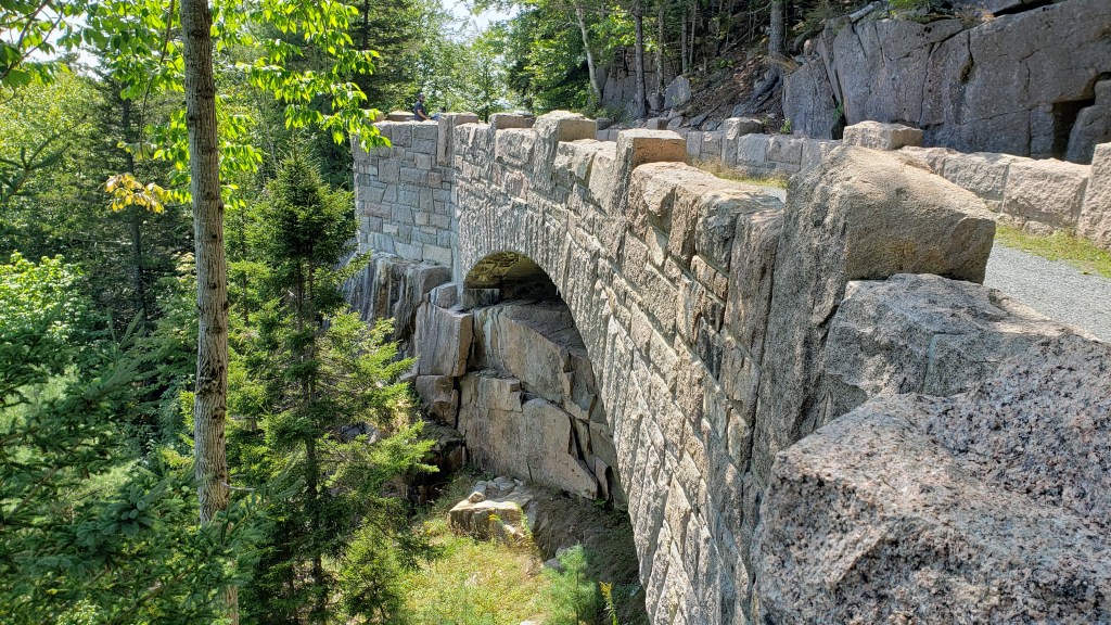
Tuesday’s morning began with a drive back to the main Visitor Center at Hulls Cove to take a six-mile, ranger-led bike tour on a portion of the Carriage Roads in the park. The 45 miles of carriage roads had been a gift from John D. Rockefeller Jr. and his family. The construction took from 1913 to 1940 to complete. Rockefeller also financed 16 of the 17 stone bridges and two gate houses that were needed along to roads. When the construction was complete, all environmental damage that had occurred was relandscaped to its natural state so that the roads looked as if they’d always been there. A stipulation that Rockefeller made, that still is in effect today, was that the roads were never to be used by motorized vehicles. They were a place to get away from the hustle and bustle of the cities, so they were meant for horses and carriages, as well as those that wanted to walk or bike the roads. While the carriage roads were reasonably flat, there were still quite a few hills and valleys that tried the abilities of some of our fellow bikers. Everyone was required to walk their bikes up the first quarter mile or so due to the steep incline, but after that the hills weren’t too awfully bad. After completing the six-mile, 2 1/2 hour ride, which did include frequent stops for the ranger to provide information about the carriage roads and the park, we ended back at the visitor center. Since we’d really only seen two of the bridges on the bike tour, I wanted to see some of the others, so we hopped on the shuttle bus back down to Jordon Pond for a walk along some more of the carriage roads. Unfortunately, we misjudged the route that we’d chosen and ended up walking almost five miles along the roads with some pretty significant climbs along the way. We were completely beat after that and headed back to our campground.
I will say that even with all of the hiking and biking, driving and shuttle-riding, there were still some trails that I’d like to hike and some mountains here that I’d like to climb, but our week just wasn’t long enough to do all of the things that there are here. The views are breathtaking, and the weather had been almost perfect, especially when compared to the heat of home. If you’ve never been to Acadia National Park, I highly recommend it. As I said, I believe it’s one of our two or three most favorite National Parks.
Next stop, we traveled to the most eastern point in the United States. I’ll give you something to think about regarding that statement. The most eastern point in the United States is actually in the Aleutian Islands of Alaska.
Schoodic PointA crowded Sand Beach.Jordon Pond and the Bubble Peaks.Bald Eagle flying in the mist over Jordon Pond.Foggy summit of the South Bubble.View of Sand Beach from the summit of Gorham Mountain.View from Beehive Mountain, with co-hikers Chris and Marci Felker.View of Bar Harbor, walking across the low tide land bridge to Bar Island.Starting a 3-1/2 mile hike up a mountain at just after 2:00 a.m.45 minutes before sunrise from atop Cadillac Mountain.Sunrise at 5:47 a.m.Cadillac Mountain summit marker.View from the South Rim Trail coming back down from Cadillac Mountain.
Bass Harbor Lighthouse.
Schoodic Institute and visitor center.View of Bar Harbor from Cadillac Mountain in the afternoon.Not all bike rides involve actual “riding” (read the sign).
Duck Brook Bridge on the Carriage Road bike ride.
Another Carriage Road bridge during our unplanned hike.