Post #8: New Hampshire, September 5 to 13.
Continuing our travels through New England, we left the Harvest Host in Sidney, ME on Labor Day and moved to a KOA near Lincoln, New Hampshire. As has been the case more often than not, our travel day was also a rainy one. We arrived later than we’d planned due to the traffic on the interstate with people evidently headed home from the holiday weekend. At one point, ON THE INTERSTATE, it took us four hours to travel just 120 miles, even after the rain had stopped. The KOA, which is very near Franconia Notch, would be our basecamp for the next eight nights. The campground was nearly deserted during the week but did fill up on the weekend.
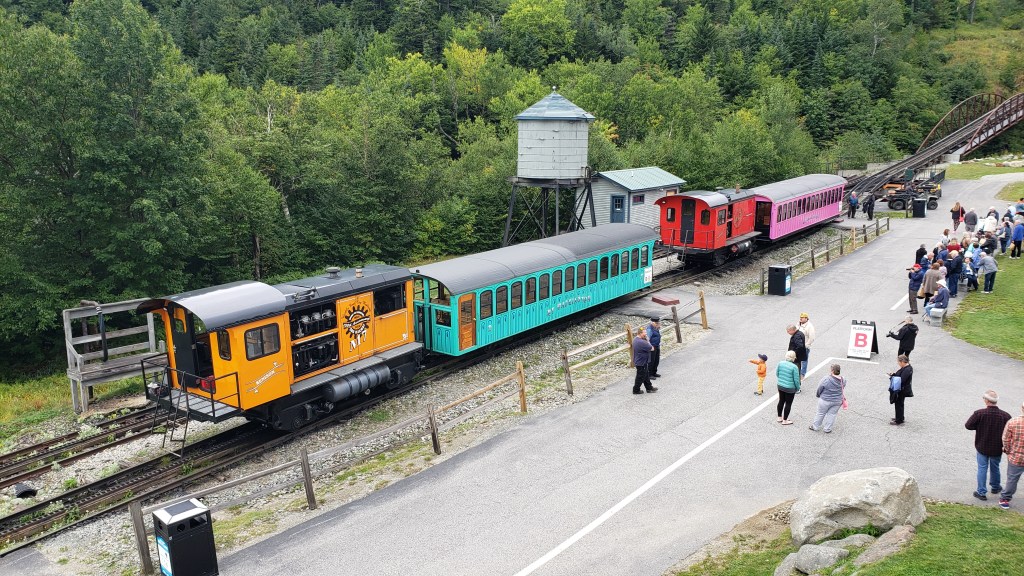
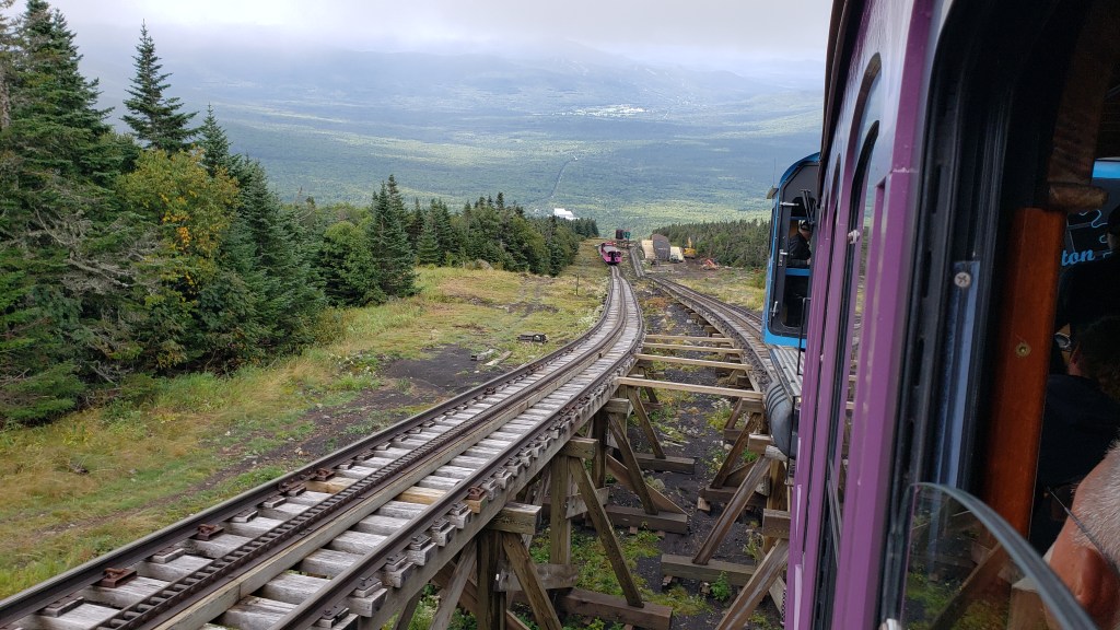
On Tuesday, since we continued to have some rain off and on, we began a little later than usual and mostly did some drive-touring. We did stop at a couple of visitor centers to get maps, brochures, and suggestions as to the best hikes and attractions to explore over the coming week. We also drove through one of the National Forest campgrounds to see if it would accommodate our rig should we choose to come back at some time in the future. With the rain continuing, we decided to head back to the trailer to cook a big pot of taco soup and go over all of the information we’d collected in order to come up with a plan for the rest of the week. We did make online reservations to ride the cog railway to the top of Mount Washington for the following day.
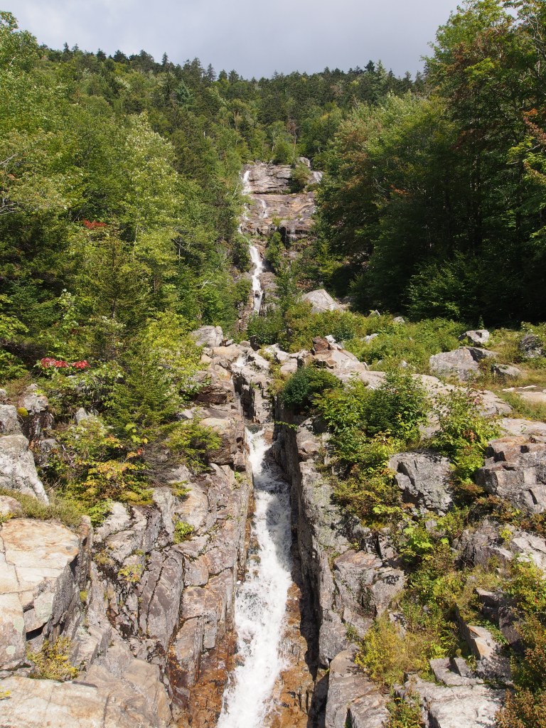
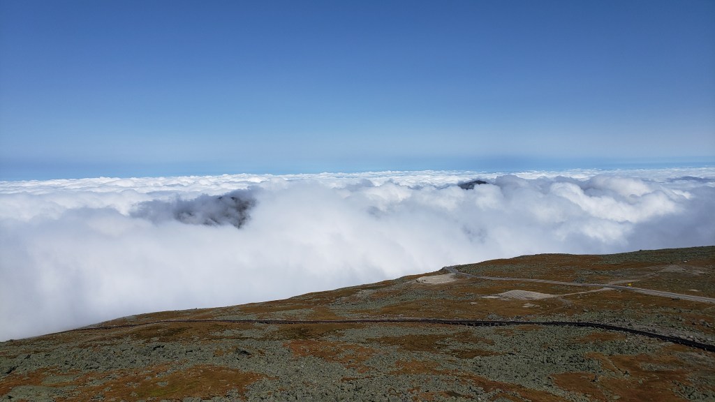
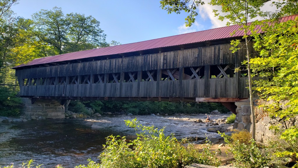
The next day, while on our way to the cog railway, we stopped at a couple of roadside cascades to take a few pictures. Our reservation was for later in the morning, so we had some time to kill. Arriving at the base of Mount Washington, we visited the museum explaining the history of the world’s first ever mountain climbing cog railway. Rides being pushed up the mountain by a coal-powered steam engine had already been sold out, so we climbed the mountain in front of a diesel-powered engine. It was still pretty cloudy that day and we did spend a good bit of the climb in those clouds. Just before reaching the summit, we broke through above the clouds for a spectacular view. We experienced what they call and “undercast”, where you really could not see much except the peak of Mount Washington and a few of the surrounding lower peaks. While beautiful, we’d have preferred to have been able to see more of the surrounding countryside, but at least the top of the mountain wasn’t fogged in like it had been the previous few days. After returning to the bottom, we drove the famous Kancamagus Scenic Highway, stopping along the way at several overlooks, the Albany covered bridge, and taking some short hikes to several waterfalls. Before heading back to the campground, we stopped at a really small Camping World to pick up some things that I needed to do some minor repairs.
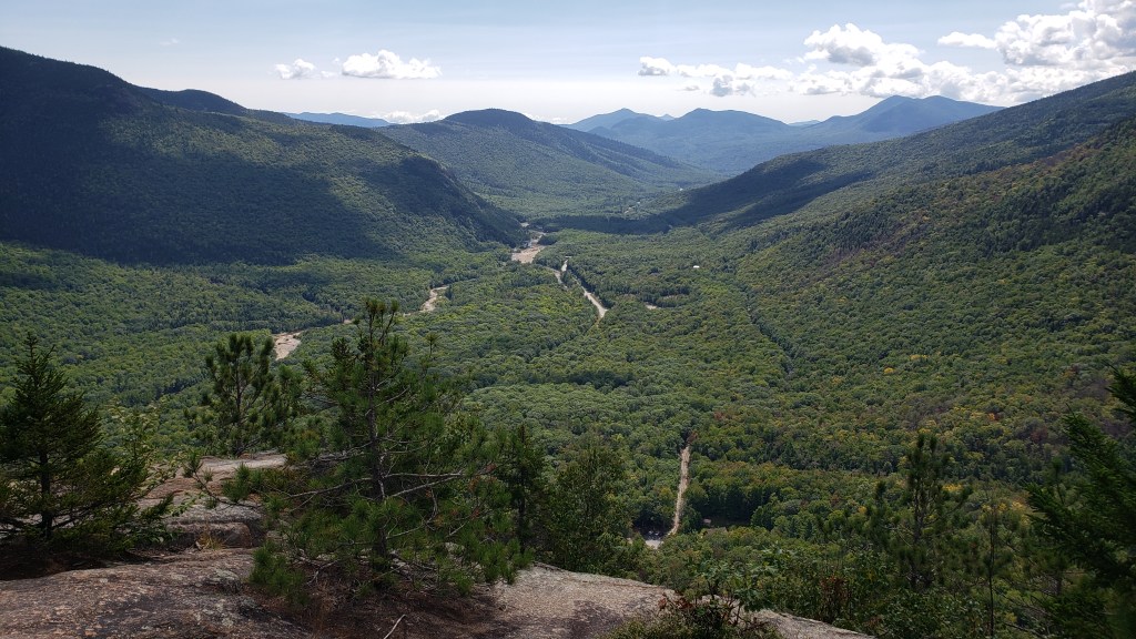
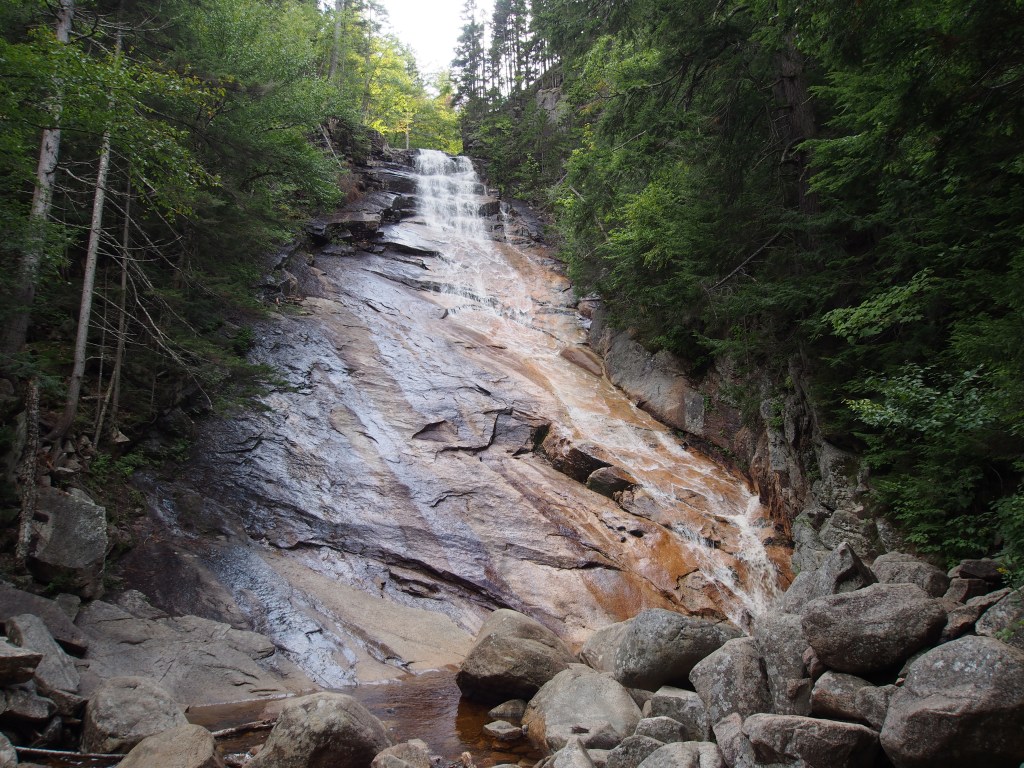
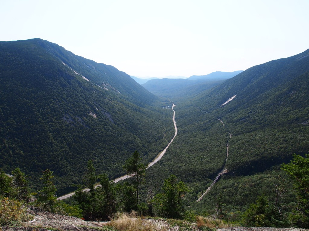
On Thursday, we decided to spend the day hiking. We started with a 5.2-mile loop that began with Frankenstein Cliffs. This trail was one that was a little less traveled but promised to offer some really good views of the valley. The reason that the start of this loop seemed to be less traveled must have had something to do with the 1,637-foot climb! This was quite tricky with some bouldering and rock scrambling, plus several places that were just plain steep and slightly muddy. Once we reached the top and found our way to the top of the cliffs, we were rewarded with quite an amazing view of the valley and the highway far below. We continued along that trail until we reached the Arethusa Falls Trail. Once joining that, we made our way over to the falls, where we sat and had lunch while admiring the view. Once we’d recovered from the first part of the hike, we followed the much easier Arethusa Falls Trail back to the parking lot along the highway. From there we drove over to the Ripley Falls Trailhead and took the quite rocky one-mile round trip hike, with a 305-foot elevation gain, to the falls. This falls, although pretty high, was really more of a long, angled rock face with a small “fall” at the very top. We’d decided that we had reached our climbing limit for the day, so headed back to camp, but not before stopping at the Streatz food truck for dinner.
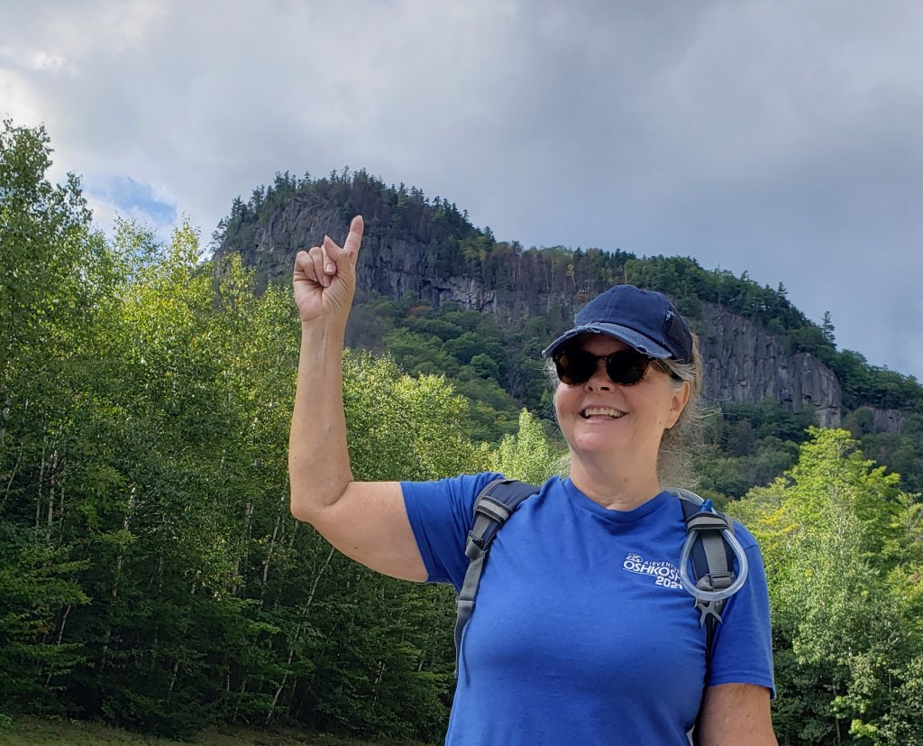
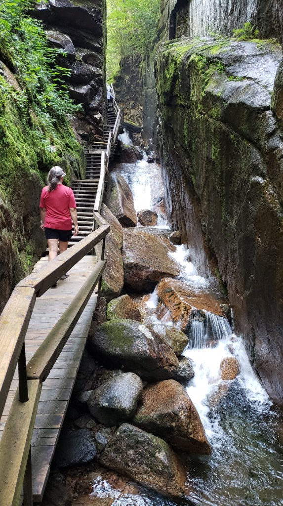
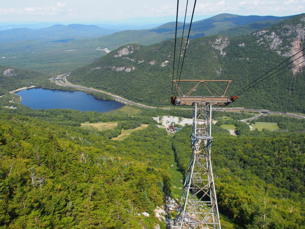
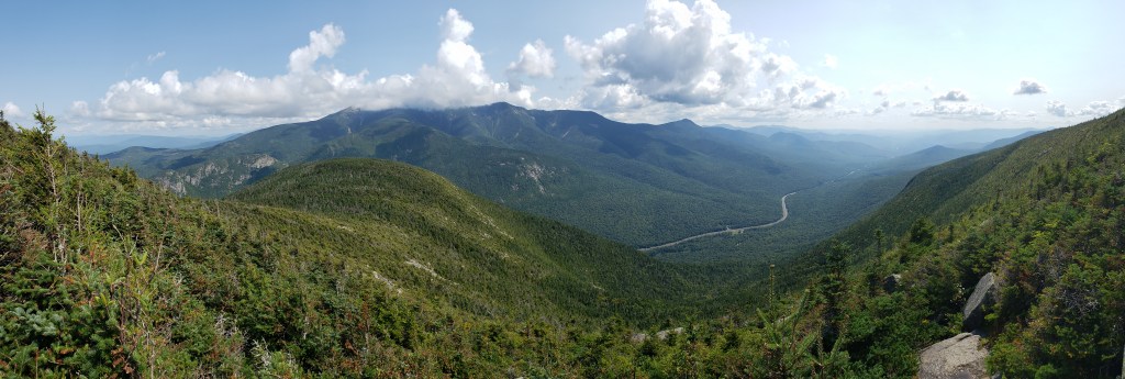
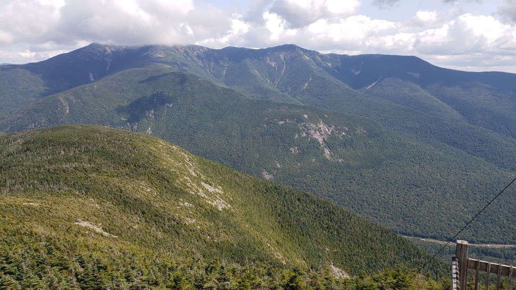
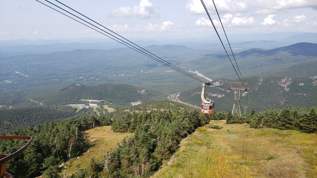
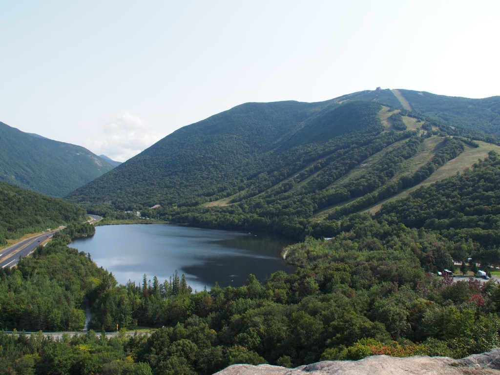
The hiking continued the next day with our first stop being the Flume Trail at the Franconia Notch State Park. This 2.2-mile, 490-foot climb trail took us through a narrow gap in the rock, mostly via steep wooden stairs, before ending with a gradual downhill hike back to the visitor center that included recrossing the river via a covered, wooden footbridge. Driving from the state park, through Franconia Notch, we arrived at our next adventure, the Cannon Mountain Aerial Tramway. At the top of the mountain, we took a short loop trail to a lookout tower that gave 360-degree views of NH, VT, ME, and (had it been clearer) Canada. From there we could see the trail that Debbie wanted to take the next day, called the Mount Lafayette and Franconia Ridge Loop Trail. The more that we looked at it, the easier it was to decide that we didn’t really want to tackle the 9.3-miles and 3,809-foot of elevation gain that would have summitted three different mountains. After our ride back to the bottom, we did decide to take one last trail for the day. This was a 1.5-mile loop, up 436-feet to Artist Bluff where there was a great view of Echo Lake, the ski trails of Mount Cannon, and Franconia Notch.
After Artist Bluff, we decided to make a run to Walmart to pick up a few groceries and other items. This was the strangest Walmart that we’d ever seen! It was like most any Super Walmart, with clothes, sporting goods, automotive, and general groceries, but with one really big distinction. They had NO fresh vegetables or any meats that weren’t pre-packaged. They had things like sandwich meat and Hillshire Farms sausage, but no hamburger, steaks, chicken, etc. at all. And the only vegetables were either canned or frozen. We actually had to go across the street to a supermarket to get fresh meat and vegetables. Strange.
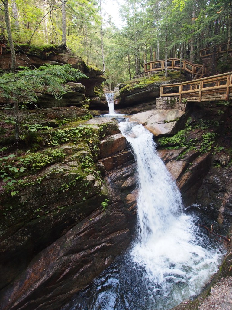
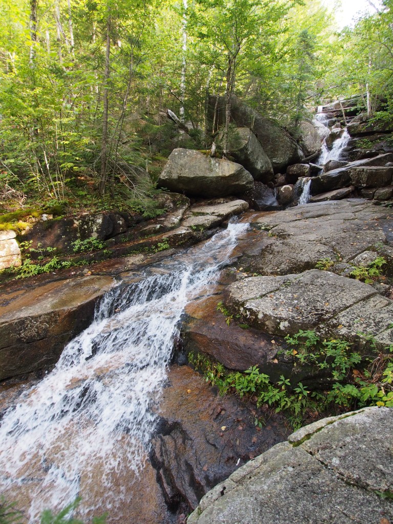
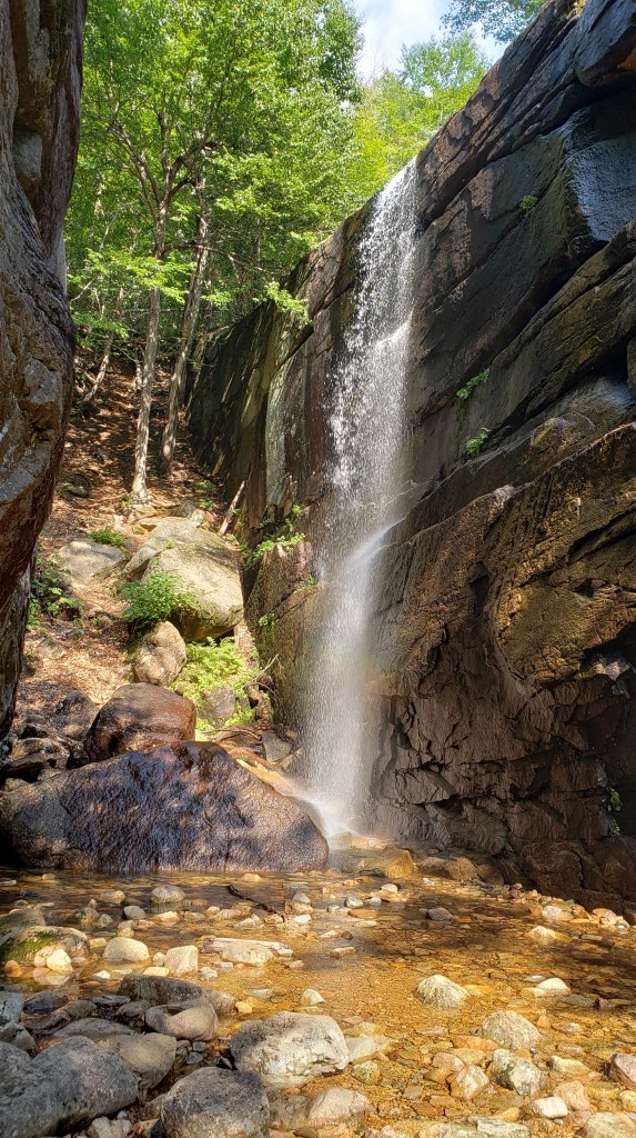
On Saturday, we decided on two hikes. The first was a 900-foot climb to the top of Mount Willard that involved a 3.1-mile round trip. As with almost every hike we’ve taken in New England, the views were great. We followed that up with another 3.1-mile round trip (with 680-foot elevation gain) to Champney Falls. This hike was one that a ranger and the Forest Service information center highly recommended and I can say that we were not disappointed. This trail weaved its way through the forest, crossing the stream three times, to a series of waterfalls that were quite impressive. It had everything from cascades to multilevel drops, and even had one long drop off to one side of the main falls.
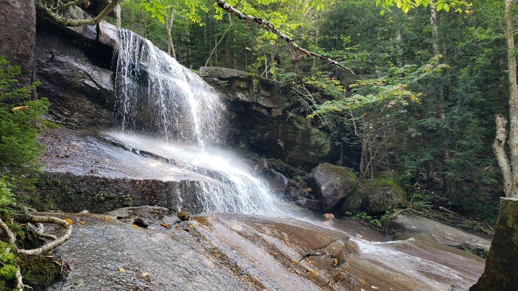
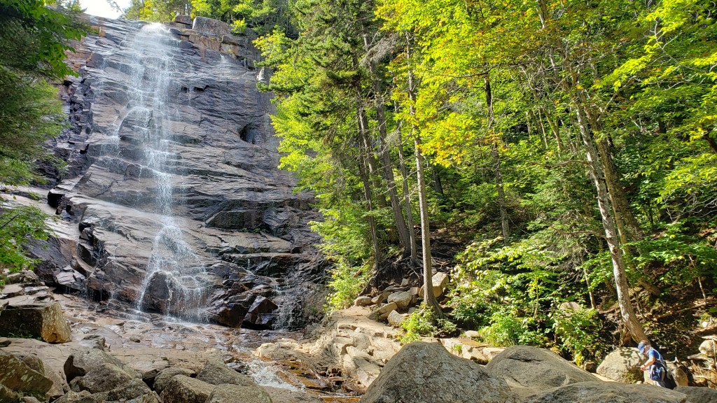
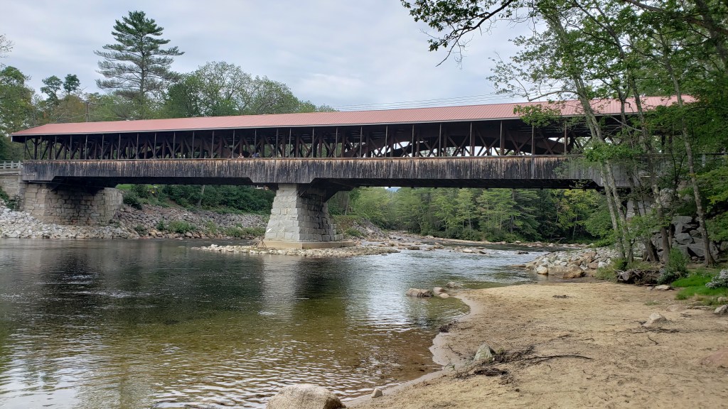
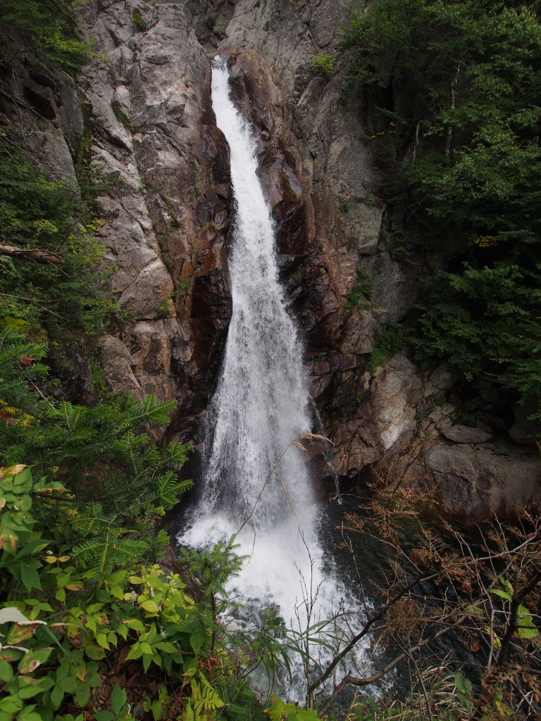
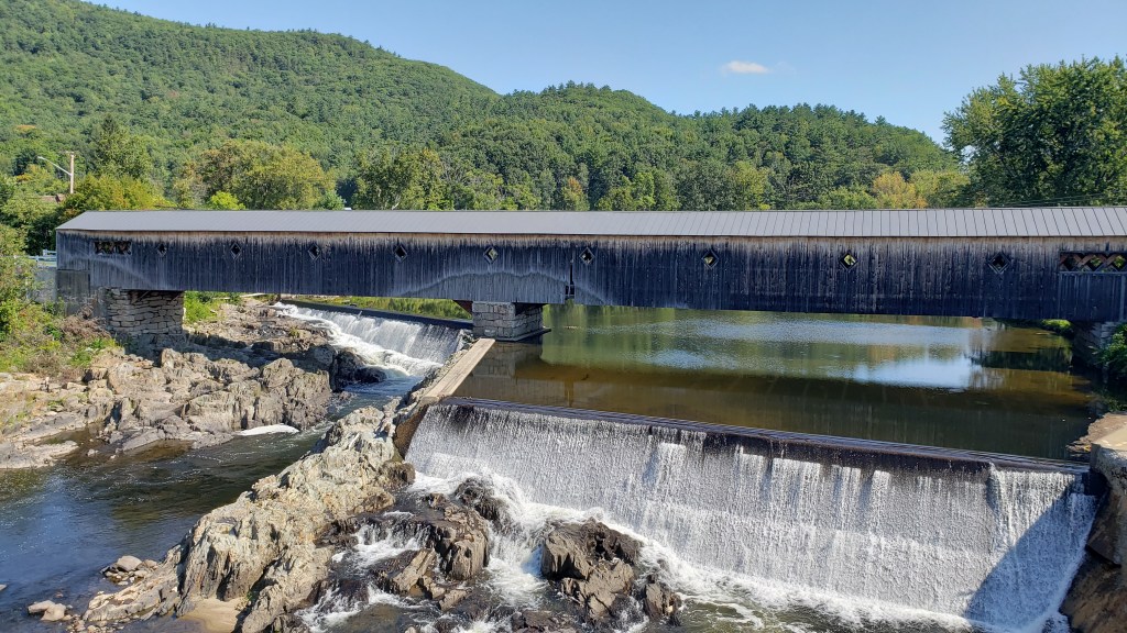
On Sunday, the weather didn’t look to be the best for hiking any long trails in the area, so we decided to just take a road trip to visit a number of covered bridges. We started with the Saco River and Swift River Bridges, then on to the Jackson Bridge. The weather seemed to dry up just a bit, so we did end up taking the very short trail to the Glen Ellis Falls in the Pinkham Notch area. It was really quite an impressive waterfall. We ended the afternoon with dinner at Big Day Brewing in Gorham. Debbie ordered brussel sprouts for an appetizer (which I really don’t like), but they were fried with a maple bacon glaze and a drizzled with a black pepper aioli. I’ve got to say, those were really good. We sat outside and enjoyed our dinner while chatting with another couple that had just finished one of the trails that we’d done earlier in the week. It turned out to be a beautiful afternoon.
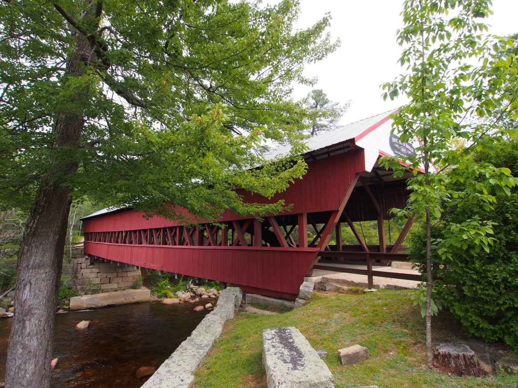
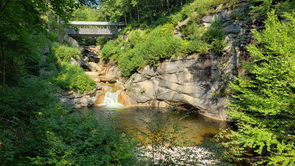
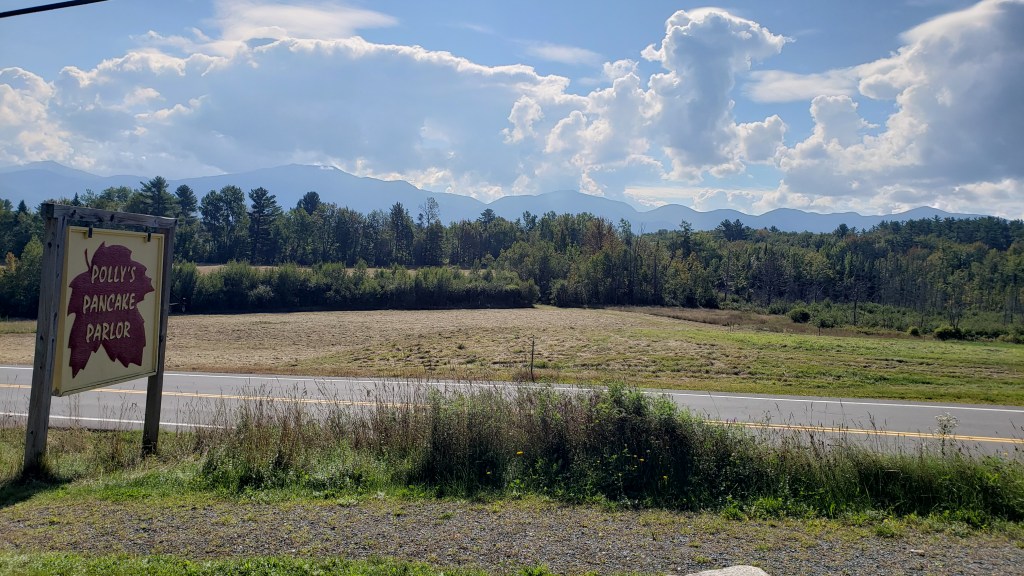
We started the next day with a trip to Polly’s Pancake Parlor. The restaurant has been in existence since 1938 and is still being run by the third and fourth generation of the family. After an amazing breakfast, we decided not to take our planned 18-mile round trip bike ride along the Franconia Notch Path recreational trail because it looked like we were going to get some rain. Instead, we drove another scenic loop that took us to see several other covered bridges, including the Haverhill-Bath Bridge which is the longest covered bridge in New Hampshire. The fact that so many of these covered bridges are still standing after so many years, some over 100-years, still amazes me.
The next morning, being that it was a travel day, we were once again treated to yet another rainy day as we hooked up our trailer and made our way over to our first spot in Vermont. Seems like we may get fog or light drizzle on other days, but we’ve managed to get a pretty good rain every time we try to move.
