Benson, AZ; Kartchner Caverns State Park; Feb. 27 – Mar. 2
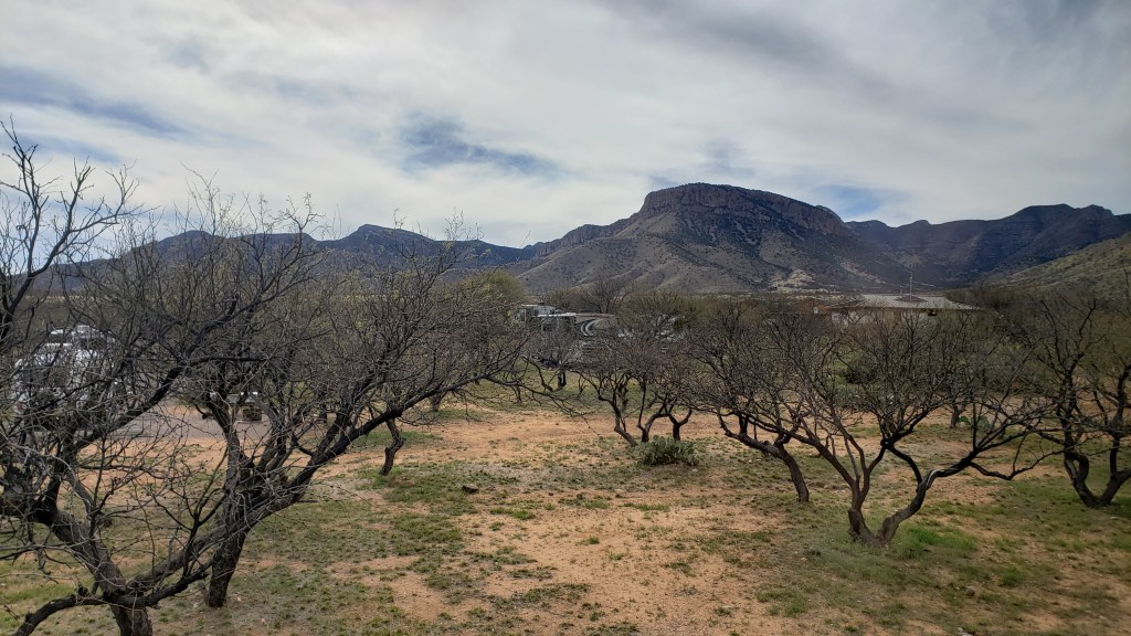
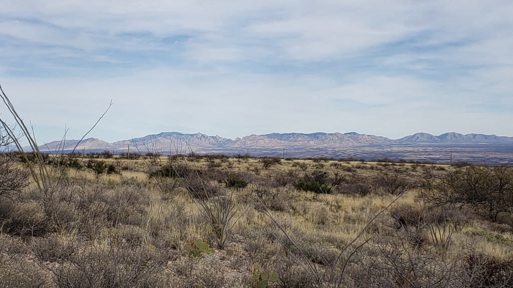
We had a very short drive on Thursday from Deming, NM to Benson, AZ on I-10, then south just a few miles to Kartchner Caverns State Park. This is a very nice campground with plenty of space between spots. Since we’d arrived so early, we decided to go for a hike behind the campground and visitor center. The Foothills Loop was three miles, beginning at the campground and running up to the base of the mountains and back down through a canyon. We opted to take an additional spur, 0.3 miles each way, UP the Mountain Viewpoint trail. Let’s just say that not having hiked since November left us a bit exhausted by the time we got back to camp, but the view of the valley and the Chiricahua Mountains made it worth the effort.
On Friday morning, we had reservations to take one of the cave tours here at the park. I highly recommend the hour and a half tour to anyone staying in the area just east of Tucson. The discoverers of the caverns, the property owners, and the State of Arizona did an excellent job of protecting the cave. They spent several years interviewing the operators of several of the other cave systems around the country in order to find out all of the things they’d change if they could. Then, Arizona incorporated those ideas into preserving this spectacular cave. Unfortunately, they make all visitors store their cell phones, cameras, etc. in lockers prior to entering the cave, so I don’t have any pictures to share.
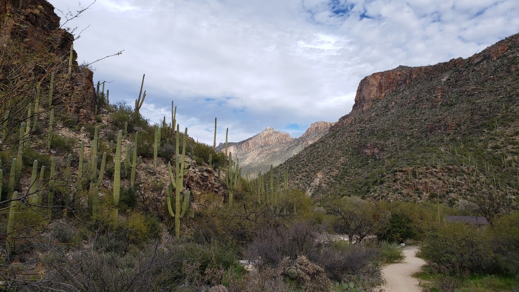
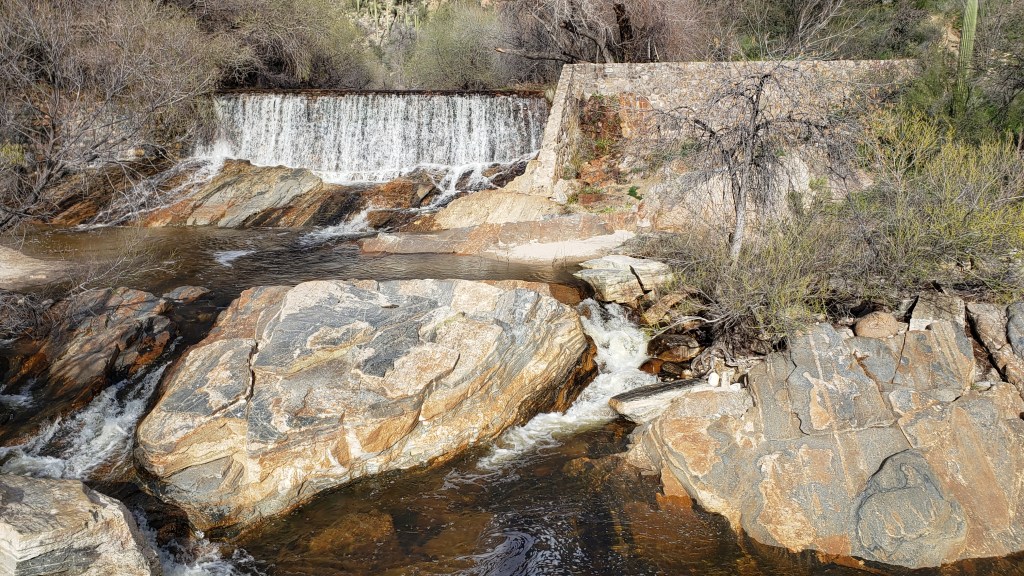
After our early cave tour, we drove over to the Sabino Canyon Recreation Area. This is a spectacular area among the mountains and canyons to the northeast of Tucson. There are many hiking trails for everyone from the novice “path walk” hiker to the very experienced backpacker. The area borders the Pusch Ridge Wilderness and many of the trail extend outside the recreation area and into the wilderness area. We opted to connect several shorter trails into an approximate 4.3 mile “moderate” hike.
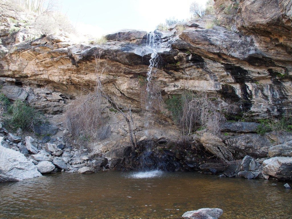
On Saturday, we headed over to the eastern section of the Saguaro National Park, also known as the Rincon Mountain District. After watching the video at the visitor center and letting Debbie get her Park Passbook stamped, we drove the Cactus Forest Loop, which was a one-way, paved road with several pull-offs with really amazing views. After that, we took a fairly strenuous hike of about six miles round trip, with about 1,000 feet of elevation gain, up to Bridal Wreath Falls. We were told how spectacular the falls were, but we found it a bit disappointing after such a hard hike. It was a pretty falls, but just not awe inspiring. Saturday was a beautiful day, with sunny skies and a high in the upper-70’s. But, as we got back to our campground, the wind picked up and it blew pretty hard all night long.
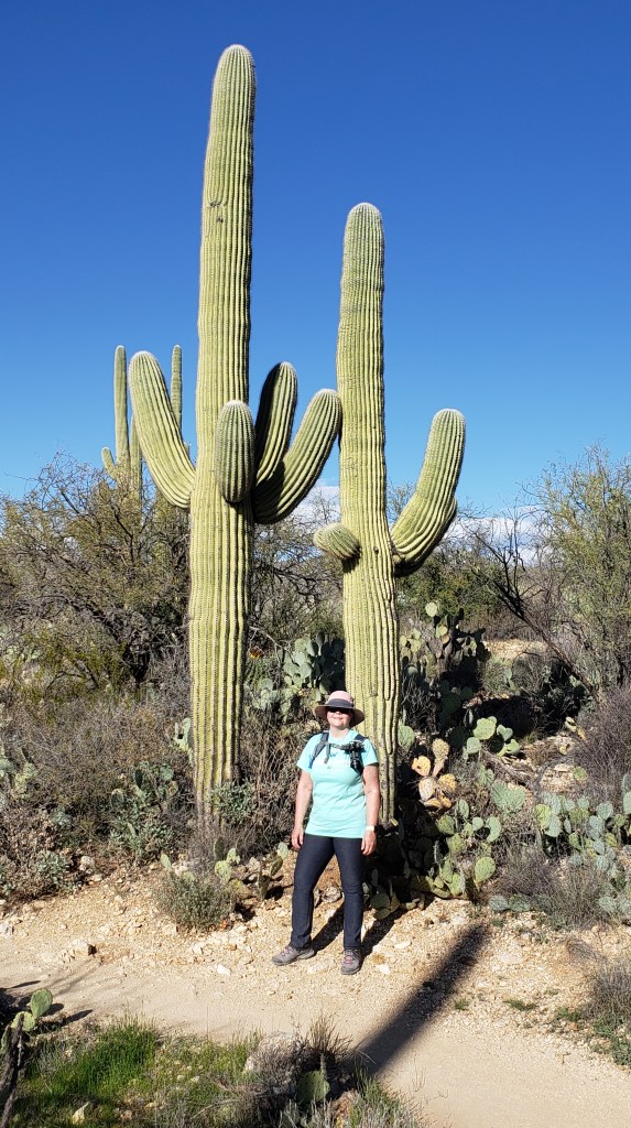
Sunday morning turned out to be mostly cloudy and the temperature never got above the low 60’s. We drove an hour or so over to the western district of Saguaro National Park; also known as the Tucson Mountain District. This smaller section of the national park is known for having a higher concentration of Saguaro cactus than the eastern district and we found that to be accurate. We started with the Red Hills Visitor Center’s movie, which was very interesting in how it related the desert and its life to the lives of the Native Americans in the area, and to all people visiting the park. They had a spectacular ending where the screen raised up and the curtains opened to reveal a huge window looking out onto a very densely packed “forest” of Saguaro cactus.
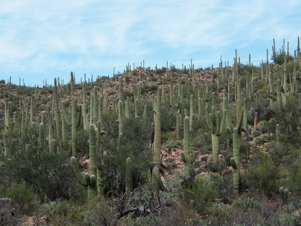
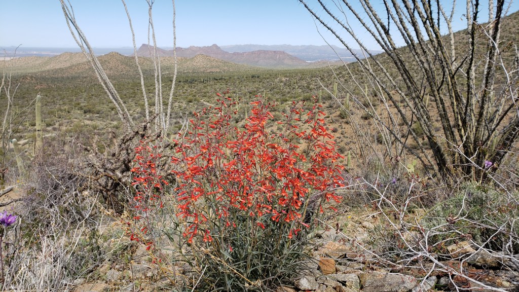
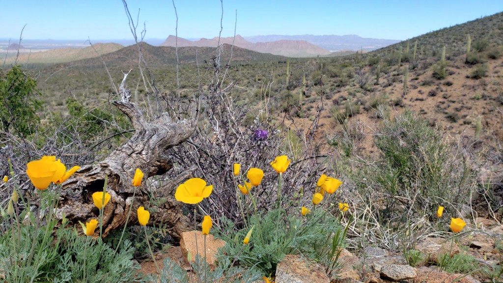
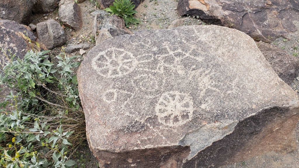
We followed that with a drive along an unpaved road that circled through a small portion of the park. At about the halfway point, we parked and took a hike of about 3.4 miles, round trip, with an elevation gain of approximately 750 feet. Most of the elevation gain took place in the last quarter mile or so. (Debbie just LOVES switchback trails.) The view from the top was very nice and we were able to view the valleys on both sides of the mountain. There were many more wildflowers in this park than in the eastern district portion of the park. There were all the colors you can think of, but yellow seemed to dominate. On our way out of the park, we stopped for a short walk up to see the Signal Hill Petroglyphs, which were carved there by the prehistoric Hohokam people. We finished off the day by returning to camp and grilling a nice ribeye for dinner. Tomorrow, we’re off to Ajo, AZ for a couple of days.