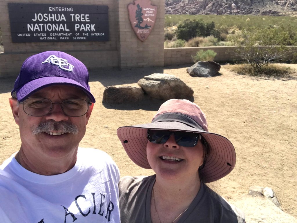
March 4/5/6; Desert Hot Springs, CA; Joshua Tree National Park
Since we’re in the Joshua Tree area for several days, I thought it best to break this stay down into at least two parts. This will give me a chance to bore you to death twice, instead of just once.
We pulled out of Ajo, AZ on Wed., Mar. 4 and headed to KOA in Desert Hot Springs, CA, just outside of Palm Springs. We arrved just after lunch and found the park about half full. When we arrived at our spot, we found that it was only about as long as our trailer. Since we were able to get it into the spot and since we had a large opening on our camp side, we decided to just hang onto the one we had. We got hooked up, everything worked, and we had a great view of the mountains over Palm Springs. We settled in and started making our plans for the next few days of adventures.
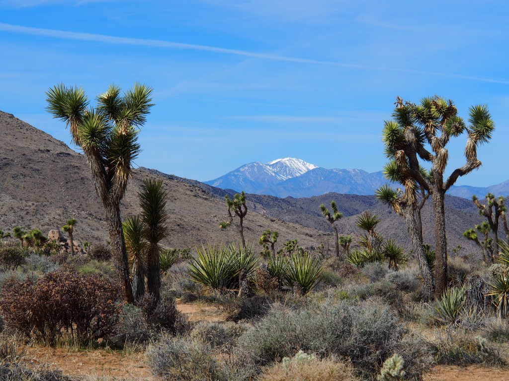
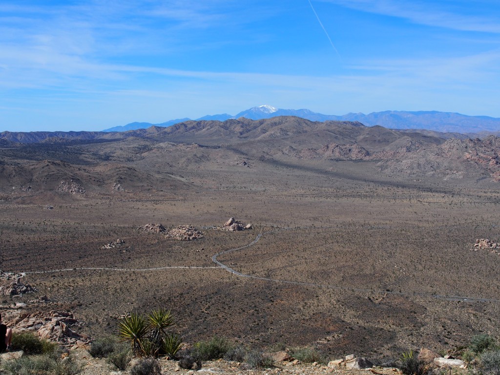
We got started on Thursday morning by driving around to the other side of Joshua Tree National Park, which took almost an hour. Our first stop was the west entrance, a.k.a. Joshua Tree Visitor Center in the town of Joshua Tree. After Debbie got her book stamped, we spoke wth an older gentleman that was a volunteer for the park service. He gave us a lot of information regarding the hikes that met our desired profile. Since we were fairly fresh, we decided to take on one of the more strenuous hikes first. This was the Ryan Mountain Trail. A nice little three mile round trip that started on the valley floor and climbed approximately 965 feet to the top of the mountain. The views along the way were really nice, but the 360 degree view from the top was spectacular. Ryan Mountain is one of the 3-4 highest peaks in the whole park.
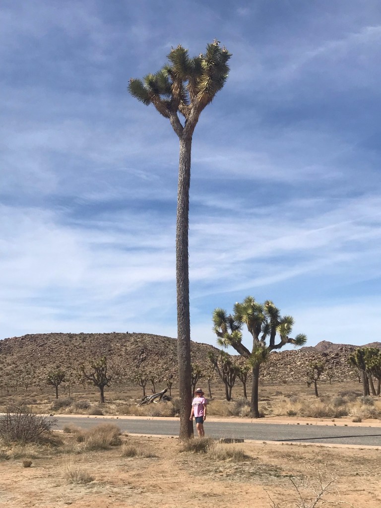
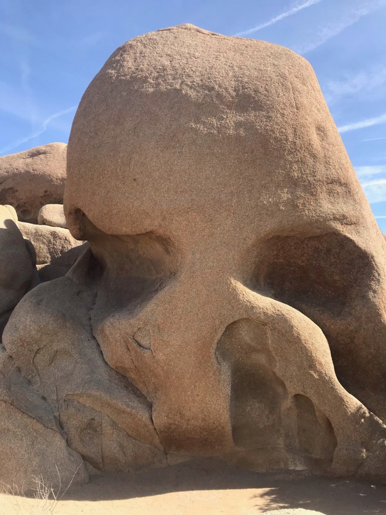
After getting that three hour hike under our belt, we decided that we really didn’t want to tackle anything else too strenuous that day. The rest of our day was mostly covered by car or by short little walks. Our first stop was at the Barber Pole Joshua Tree. This is the tallest Joshua Tree in the world, which at 47′ tall is almost twice as tall as the other trees in the park. It’s estimated to be over 300 years old. We also went to the obligitory Skull Rock and Split rock formations, two of the more popular stops since they were located either right beside the road or parking lot. We followed that up with a drive out the north entrance of the park in Twentynine Palms, CA. After a stop at the Oasis Visitor Center for another book stamping, we took a short loop walk out to the palm oasis that gave the town it’s name. Then, on the way back to our campground, we made a final stop at the Black Rock Ranger Station for, you guessed it, another stamp in Debbie’s book.
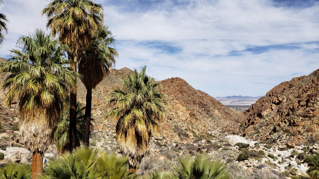
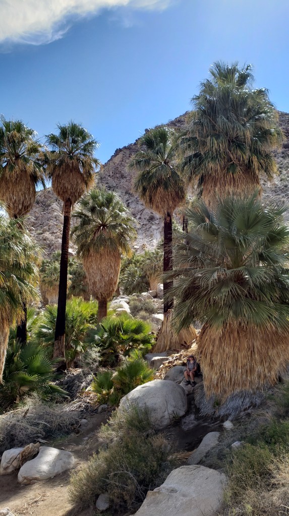
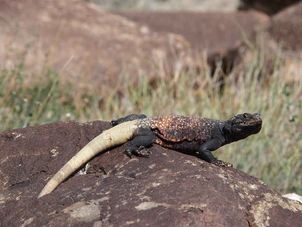
On Friday morning, we set out with a specific set of hikes in mind. We started with a 3.3 mile round trip on the Fortynine Palms Oasis Trail. This hike was very interesting in that the trailhead and the destination were at approximately the same elevation, but involved climbing over a 362′ high ridge. The destination was a true oasis in the desert; a group of very large palms trees, in a canyon, in the middle of a very rocky and pretty much barren area of the park. One the way out, we encountered a couple of decent sized lizards; the largest which I believe was a Chuckwalla. After getting back to the truck, we then drove back through the north entrance and down to the first of two short hikes back in the main portion of the park.
The first of our shorter hikes was the Barker Dam Trail. This relatively flat, 1.3 mile hike was into a rocky outcropping where an early settler to the area had built a dam across the canyon to create a watering hole for his cattle. The second of these was the Hidden Valley Trail. This valley got its name because another rancher had found an area completely surrounded by rocks that contained some lush foliage that he wanted to make accessible to his cattle. So, just a few months before the park opened in the 1930’s, the rancher blew a hole in one of the rock walls to give his cows access to the area.
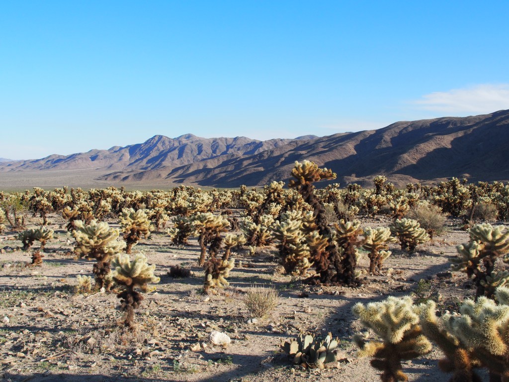
We then drove up to an overlook called Keys View, which at almost 5,200′ in elevation, looked down at Palm Springs and Indio in the valley below, which are near seal level. From there, we drove towards the south entrance of the park through the Pinto Basin. While on that drive, we crested a small hill and found ourselves in the middle of an area called the Cholla Cactus Garden, a huge area of densely packed Teddy Bear Cholla. Although we’d seen quite a few of these in both the Saguaro National Park and Organ Pipe Cactus National Monument last week, those were no where as densely populated at this area.
We have three days left in this area, but we’re just going to play those by ear. We still have a couple of medium length trails on our to-do list inside the park, plus some things we want to do in Palm Springs. You’ll just have to hear about those in a few days.
