March 7/8/9; Desert Hot Springs, CA; Joshua Tree National Park
We knew that Saturday would be a really busy day at the park, so we decided to just hang out around the campground and get some things done. Mostly cleaning and maintenance. Nothing really special. Debbie decided to use the crockpot to cook a pot roast, which turned out GREAT. Who says you can’t eat well while camping?
On Sunday, we decided to drive down to the southeast portion of the park, which is supposedly not as heavily visited. We pulled into the Cottonwood Visitor Center to get information regarding a couple of hikes that were nearby. Of course, Debbie got her park book stamped before we headed to the first of what we figured would be a couple of hikes that we’d tackle on my birthday.
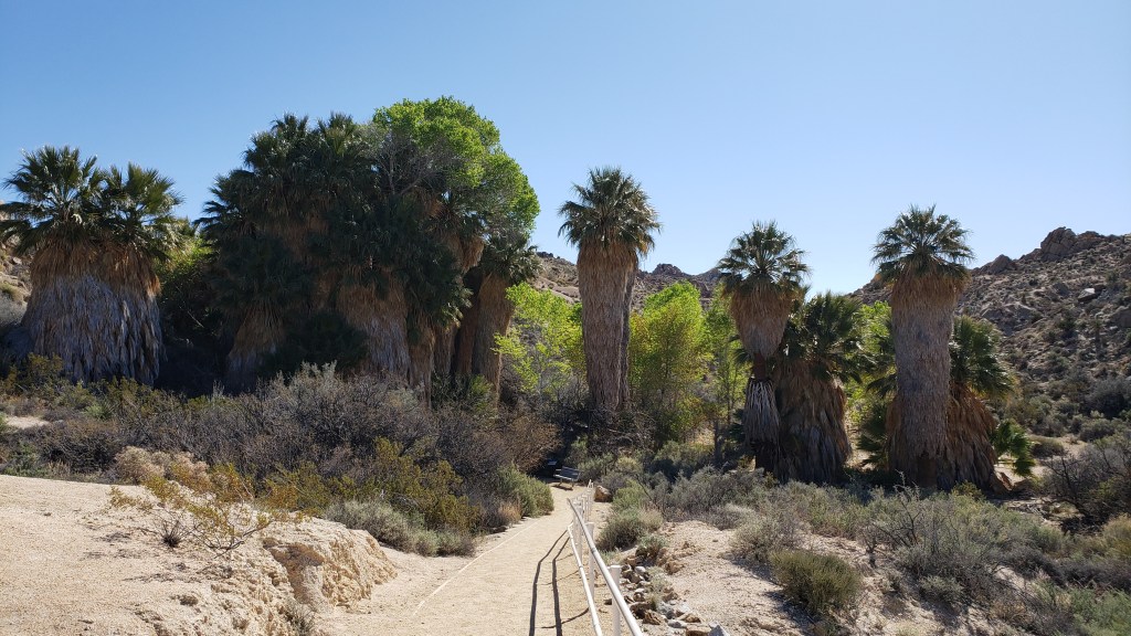
Just down a short road behind the visitor center was the trailhead for a couple of hikes that were listed in the guide as “strenuous”. We figured after hiking to the top of Ryan Mountain a few days earlier that nothing could be any more strenuous than that 1,050′ climb. Right at the trailhead was the Cottonwood Spring. It contained several large palm trees, along with quite a few cottonwood trees, giving it it’s name. That first portion was paved, although it did have some stairs, so there were quite a few people around. We had decided on the 7.5 mile, round trip hike to Lost Palms Oasis since it was listed as only having a 500′ elevation change along the way.
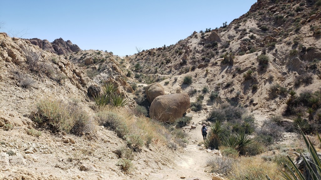
The Lost Palms Oasis trail started out with a slow climb out of the canyon that held Cottonwood Spring and moved right into a typical desert trail. Due to the lower elevation of the easern portion of the park, there were no Joshua Trees in the area. This portion of the park, below 3,000′, is part of the Colorado Desert rather than the Mojave Desert of the western area of the park. About 0.7 miles into the hike was the start of the Mastodon Peak Trail, which was a 3.0 mile loop back to the parking lot that we thought we’d try on our way back since it only had an elevation gain of about 375′.
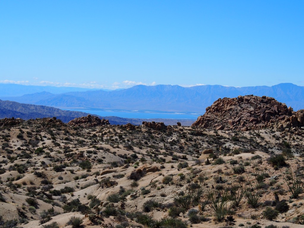
At one point along the trail, we could see the Salton Sea in the distant valley below. The Salton Sea is an approximate 450 square mile “sea” that was a accidently created in the early 1900’s when a levee broke on the Colorado River. The river flooded a basin at an elevation of about 200′ below sea level. Just like the Dead Sea in the Middle East, the only way for water to leave the sea is through evaporation. That leaves a very briney water behind; 50% saltier than the Pacific Ocean. It has become a recreation area for the Palm Springs valley.
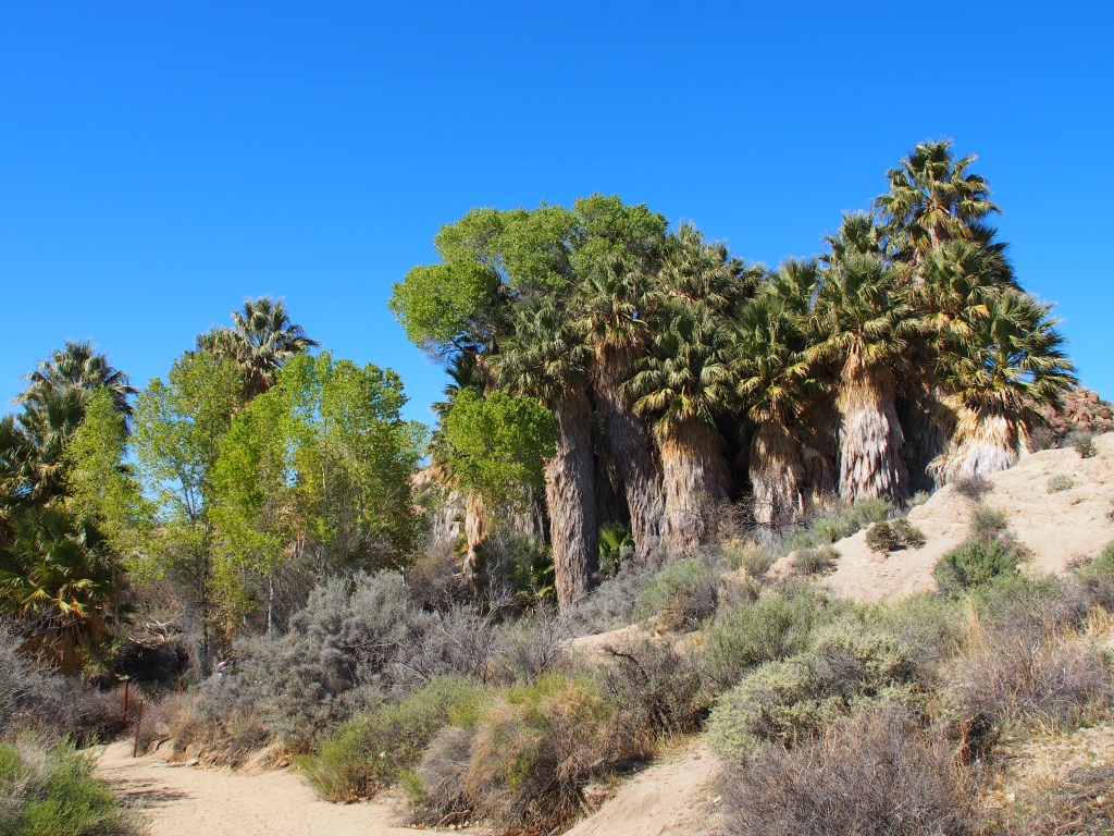
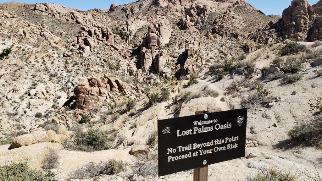
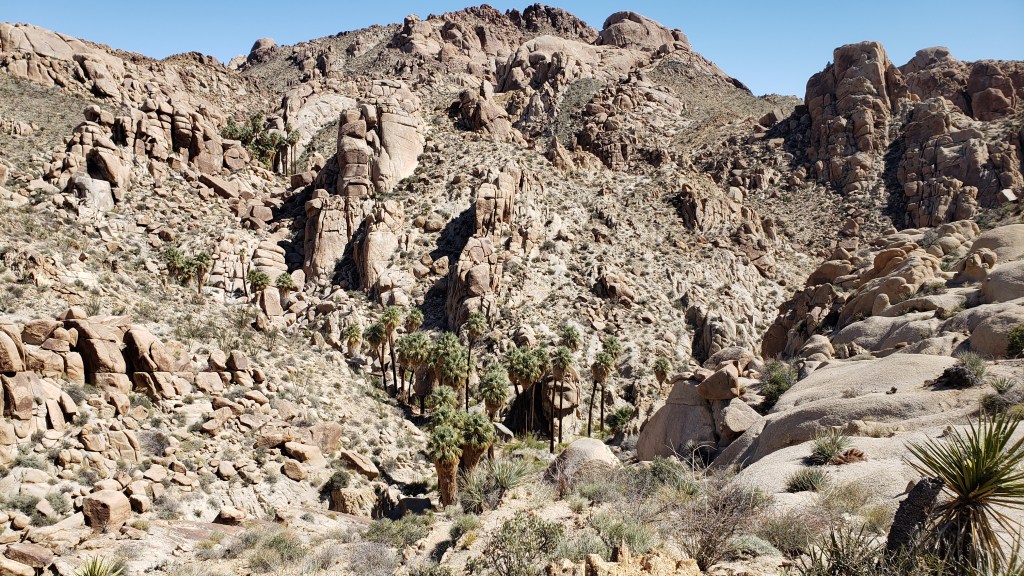
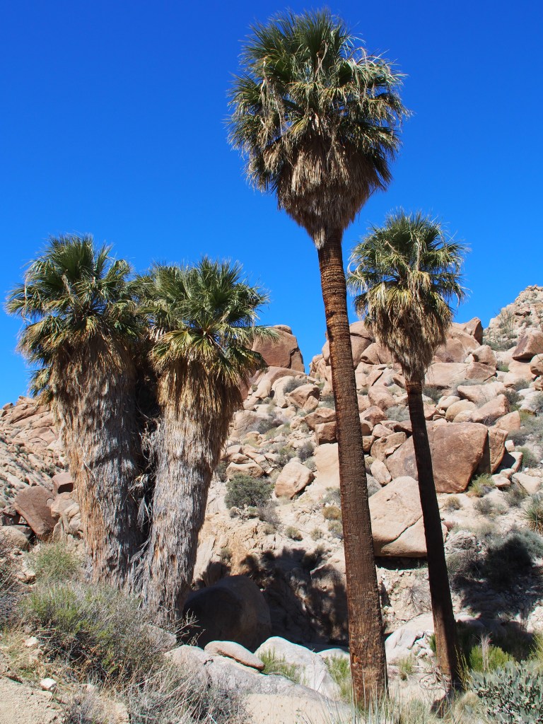
As we continued on along the Lost Palms Trail, we realized that there was a small misunderstanding concerning the elevation change along this trail. The lowest portions were not only at both ends of the trail with the highest point in the center, but there were quite a few ridges and ravines that we had do traverse. More on the actual numbers in a bit. At the end of the trail, we could see quite some huge palm trees down in the canyon. But, at that point there was a sign that said, “No Trail Beyond this Point. Proceed at Your Own Risk.” I could see that there was somewhat of a trail down into the canyon, and I could hear some people talking, so I decided to see how hard it would be to go down there. Debbie waited at the top. While the going was tough in places, it really wasn’t that bad going down. I took a few pictures and started back up the steep side of the canyon. The climbing up was MUCH tougher than the trip down. As I got almost to the top, I came across Debbie working her way down. In spite of having just down that 70-80′ climb, we reversed course and headed back down. Once down there, the palm trees were beautiful and the air was cool. We sat and enjoyed a snack before heading back out of that ravine.
The hike back seemed to be up hill the whole way, but the views of the mountains and valleys of the area made it worth it. When we got back to the trailhead of the Mastodon Peak Trail, we talked with some people that had just made their way down. They said that the hike wasn’t bad (even though it was also listed as strenuous) and that we should take it. We were pretty tired after about three hours of hiking along this hilly trail, so contemplated the additional 3 mile loop. About that time, I saw some people high up on the trail. It looked like they were WAY up there and that it was going to be a very steep climb to get to where they were. We looked at each other and both pointed back along our previous course towards the parking area. All in all, it was a nice 3-1/2 hour hike, but definitely a strenuous one. Once back at the truck at the end of the hike, Debbie’s FitBit recorded that we had actually climbed a total of 1,389′! So, when a trail guide gives you and “elevations”, just remember that is only the difference between the highest and lowest points along the trail, NOT the total amount of climbing that you’ll be doing.
Once back at our “basecamp” in Desert Hot Springs, a check of the forecast showed that we were going to get rain on Monday afternoon that was predicted to be heavy on Tuesday morning, our scheduled departure date. Knowing that breaking down camp and getting everything put away in the rain wasn’t exactly my idea of a fun morning, we decided to go ahead and leave a day early. Luckily, our space at the RV park in Pahrump, NV was open and we could get in on Monday, Debbie’s birthday.
All-in-all, our trip to Joshua Tree National Park was really nice. Like every National Park and National Monument that we’ve visited so far, it is beautiful in it’s own unique way. We walked a total of about 19 miles over our three days of hiking. We hiked seven trails, which included several thousand feet of climbing. It’s a big park and we also drove about 400 miles both to, and throughout, the park. Our next stop, where we’re staying all next week, will be Death Valley National Park.