March 12, -14; Pahrump, NV; Death Valley National Park
We returned to Death Valley National Park on Thursday with a general idea of the area we wanted to see and what we wanted to do that day. We decided to stick with the area south of the main visitor center at Furnace Creek, along Badwater Road.
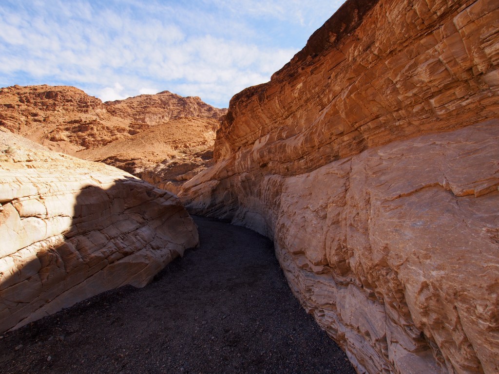
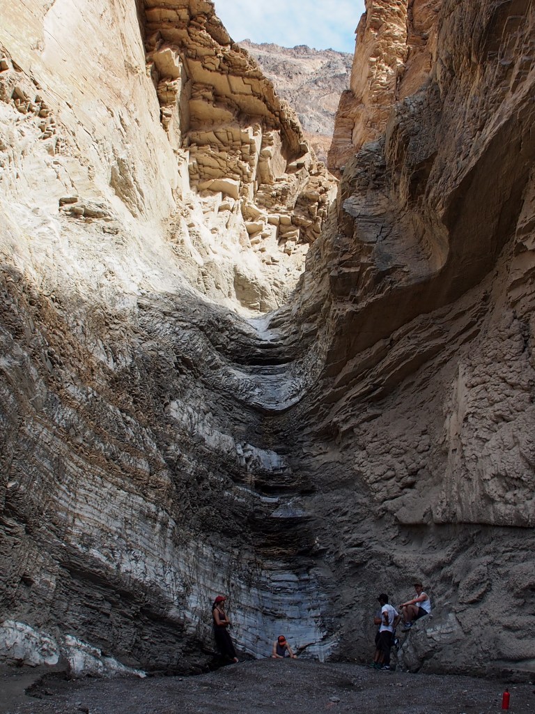
We started with a 7-3/4 mile long loop hike that included Golden Canyon Trail, Red Cathedral Canyon, Badlands Loop Trail, and Gower Gulch Trail. The trail started out with a 1.5 mile hike up Golden Canyon to a side canyon that lead to Red Cathedral Canyon. The Red Cathedral Canyon was a half mile long spur (each way) to a massive red stone wall. I don’t think the pictures really do justice to just how red the rocks were. At the end of that spur there were some narrow rockfalls that required a little bit of scrambling to get up to some great views back down the valley.
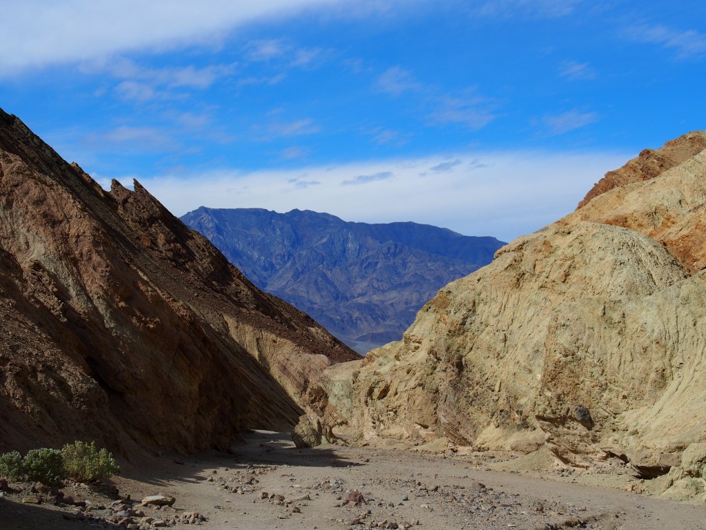
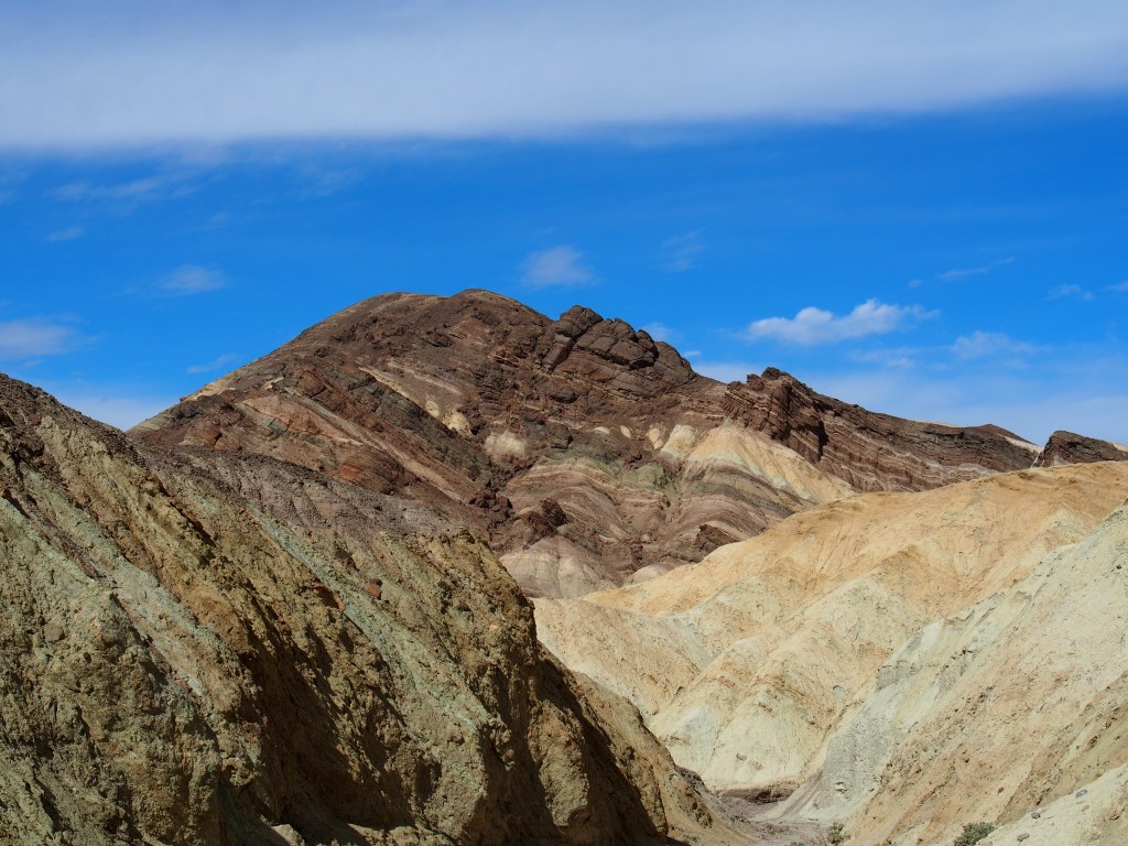
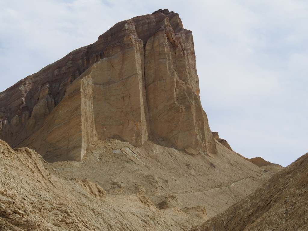
After backtracking that half mile down to the junction with Golden Canyon, we made a turn onto a section of the Badlands Loop Trail. The first half mile or so included a really drastic climb up to the base of Manly Beacon, a huge rock that Debbie said reminded her of Half Dome in Yosemite National Park. That climb was brutal, but we were glad that we decided to do the loop in that direction. More on that in a bit.
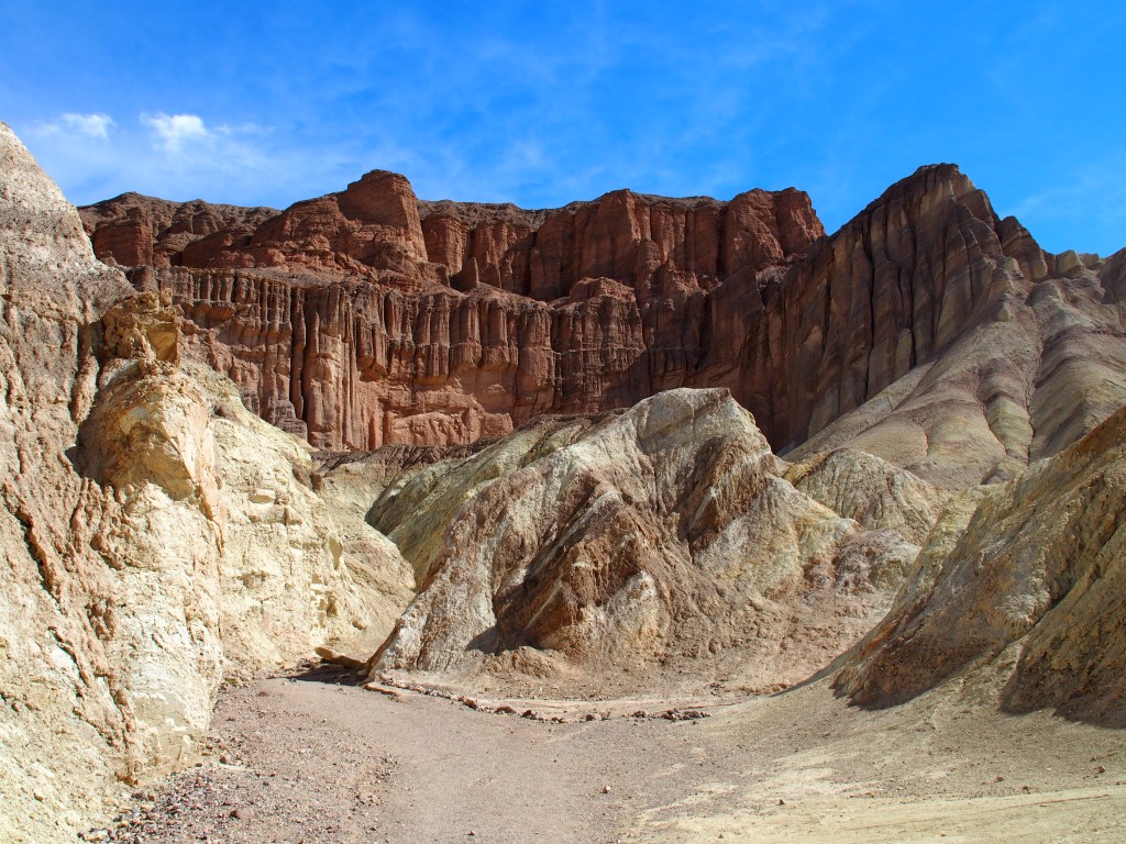
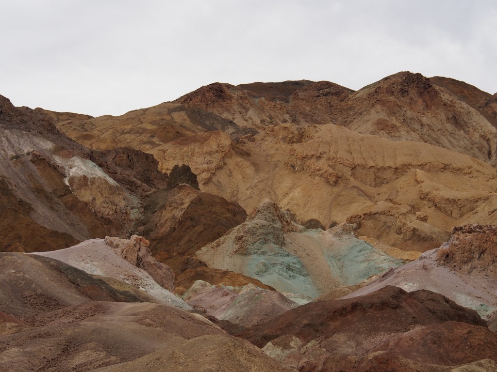
Beyond Manly Beacon, the Badlands Loop Trail began to drop down into Gower Gulch. The Gower Gulch Trail wound its way back down to the valley floor. The final 2.2 miles through Gower Gulch was a slow descent, but was a pretty consistent downhill walk for the entire length of the trail. I really wouldn’t have wanted to do this hike in that direction. The hillsides and canyons on this trail had a huge variety of colors.
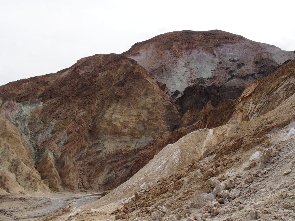
From that trail, we drove a little bit farther south to a short, one-way paved drive along Artists Drive. The winding route takes you through an area called Artist Palette where the hillside is covered with splashes of all kinds of colors that you’d never expect to see. The drive, while paved and in really good shape, is limited to vehicles 25-feet long or shorter due to the many twists and turns.
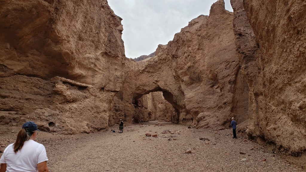
Continuing south along Badwater Road, we pulled off to the small parking area for a short one mile round trip trail into a wide slot canyon. This was the aptly named Natural Bridge Trail. The bridge was formed when water from a number of waterfalls combined to force their way down the canyon with enough power to break through and create the bridge.
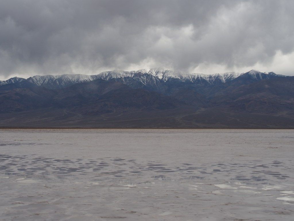
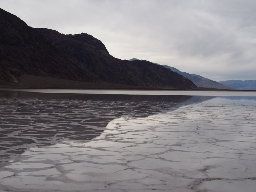
Finally, we drove to the most southerly point that we went within the park, Badwater Basin. This is not only the lowest point within the park, but the lowest point in North America at 282 feet below sea level. This is probably the area that most people think of when they imagine Death Valley. We decided to walk out onto the salt basin. The farther we walked, the whiter the salt became, but also the wetter it became. The salt layer on the basin is actually fairly thin and sits on a thick layer of wet ground. Walking on it was a weird sensation. It was a hard crust, but had a cushioned feel to it. In the center of the basin, there is a shallow layer of water that looks like a large lake. We were able to walk out onto the “lake” and found that the water was only about a half inch deep. The reflection of the snow-capped Panamint mountains on the water was amazing.
That pretty much finished off our day, except for the hour and a half drive back to Pahrump where it had started to rain. The rain lasted all night, so we spent Friday at the RV doing laundry and going to the grocery store. Walmart was kind of crazy, but we were able to get everything we needed except for toilet paper and pasta. It seems that those were two of the hot items for people who are hunkering down and trying to avoid the Corona virus. We were able to find pasta, but trips to five stores didn’t score any toilet paper. Hopefully we have enough to get us back home.
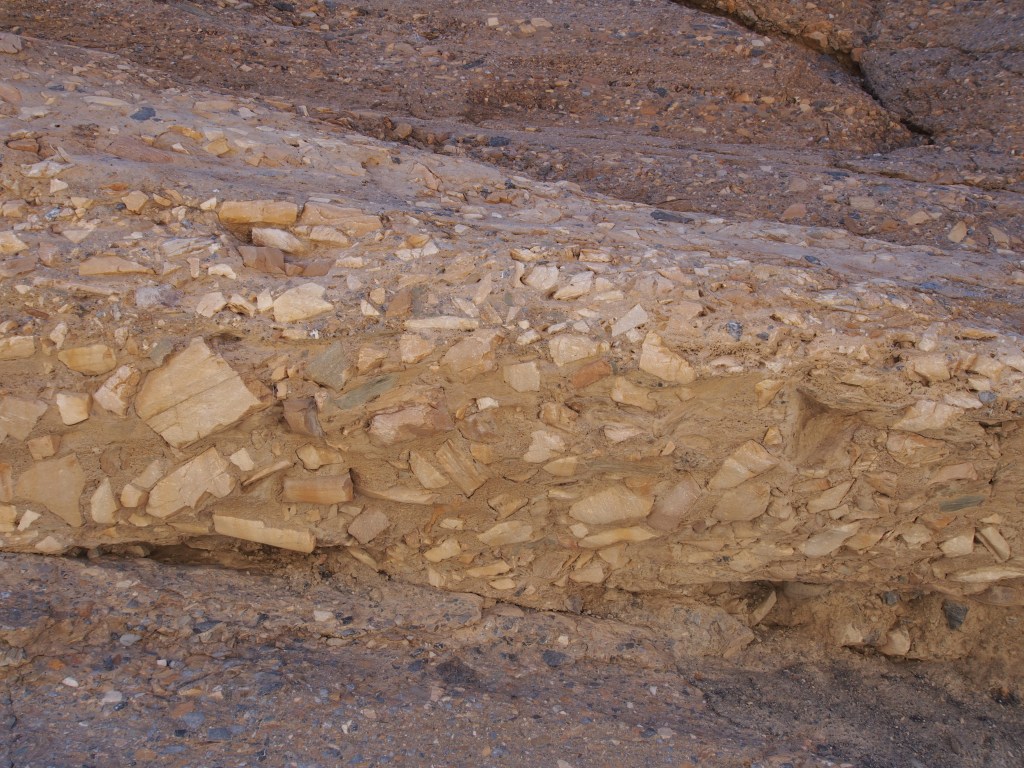
On Saturday, we went back to the park for another couple of hikes. The weather was perfect and one of the clearest days we’d had. After stopping at the Stovepipe Wells Ranger Station for Debbie to get her book stamped and where we got some hiking information from a ranger, we started with the Mosaic Trail, which like so many of the trails we took, was a hike up a canyon and back. There was a 2-1/2 mile drive up a narrow gravel road to the parking area. This trail was a 4.0 mile round trip hike that gained about 1,000 feet of elevation, although Debbie’s Fitbit registered about 1,200 feet of climb due to some places where we had to go down hill before going back up again. In places the canyon was quite wide, but was very narrow and slot like in others. The trail got its name from a layer of rocks that resembled a mosaic (see picture). But, quite a bit of the trail had polished walls and floor that were very slick and resulted in my first fall of the day. Along the way there were several places where we had to climb slick grooves that would have been small waterfalls had there been any water. At the end of the trail was a very high wall that would have been a spectacular waterfall in wet weather. Unfortunately, I had an issue with my camera and I don’t think I captured the view very well. And, as usual, we saw many amazing views on the way back down the trail that we missed on the hike into the canyon.
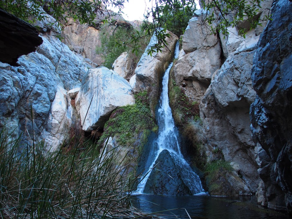
From there, we drove up and over the Panamint Mountains and down through Panamint Valley. Off in the distance, at the north end of the valley, we could see the Panamint Sand Dunes, one of six sets of dunes in the park. It would have been a pretty substantial hike to get up to them, so we drove on through Panamint Springs to another gravel turn off. After 2-1/2 miles up that rough road, we came to the parking area for the Darwin Falls Trail. This was a 2.0 mile round trip, 450 foot climb up yet another canyon, but this time most of the way was filled with vegetations. There were quite a few trees and bushes and grasses growing in this canyon due to the waterfall that was at the end of the trail. As we got nearer to the falls, we had to scramble over a few ledges and cross the stream a few times. The wet rocks along the way resulted in my second slip and fall of the day. Both resulted from walking across rocks that were highly polished from years of running water. Once we reached the falls and took a few pictures, we headed the one mile back to the truck.
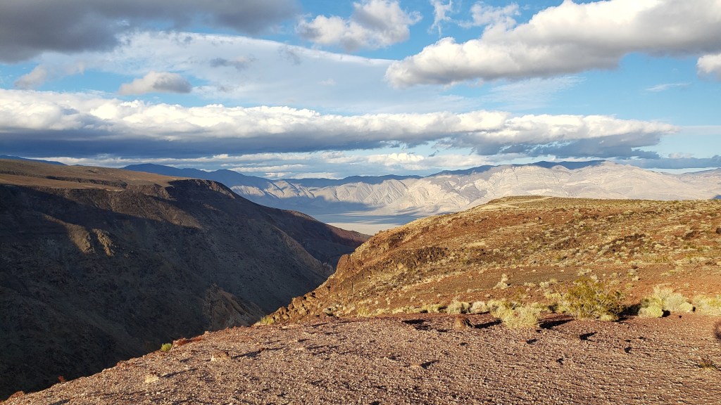
We decided to end our day by driving just a bit farther to the west to a place called the Father Crowley Vista Point. It looked to be only a couple of miles up he road, but little did we know that it was going to entail a highly switch-backed drive that climb over 3,200 feet above Panamint Valley. The overlook had great views of both the valley below and an area called Rainbow Valley. We could tell that the colors of Rainbow Valley would have been great, but by the time we got there the sun had already dropped behind the Inyo Mountains, so the colors weren’t as vibrant. I punched the address for our campground in Pahrump into the GPS and found that we were 128 miles from camp! Did I mention that Death Valley National Park is the largest national park in the lower 48 states? We didn’t get back until well after 9:00.