Episode 5, Banff National Park, June 11 – 15
I know. I’m a little late getting this one posted. It’s just that we do so much that I can’t get myself in gear to get the posts done. Not to mention going through SO many pictures just trying to find the right “few” to add here.
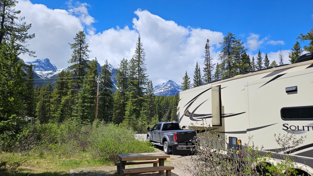
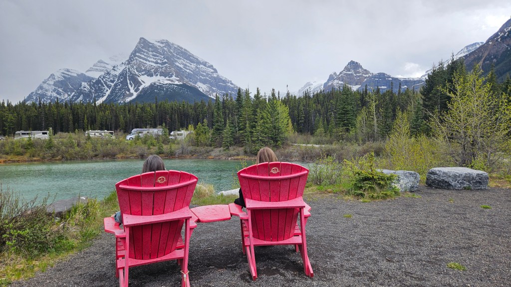
Tuesday was a travel day, moving from just outside of Calgary to the Lake Louise Hard-sided Campground. The campground was located right along the Bow River in the town of Lake Louise. The adjacent Soft-sided Campground is so named because they allow pop-up campers and tents due to the campground being surrounded by an electric fence to protect the campers from bears. Being in a “hard-sided” camper, we didn’t have that protection. Arriving in our site, we found that we had a beautiful view of the snow-covered mountains.
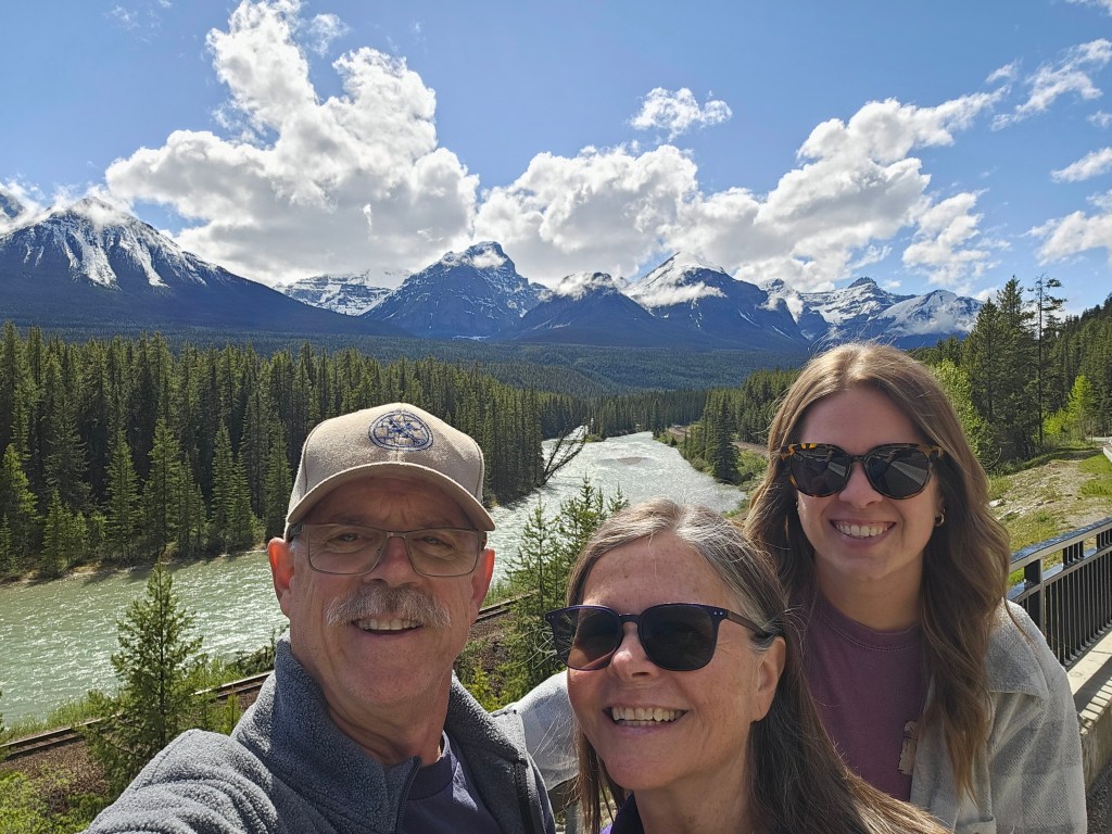
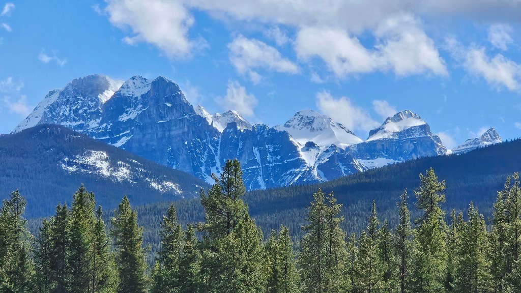
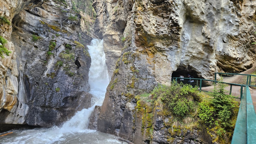
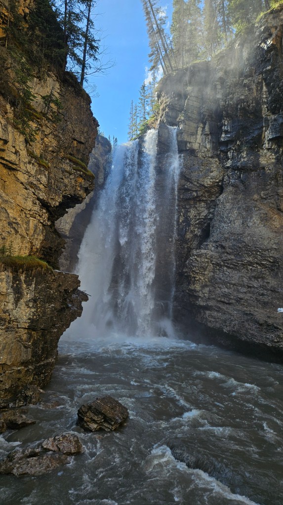
Since most of our day was spent, we decided to just drive around Lake Louise and orientate ourselves to where everything was located. After getting local information at the Banff National Park visitor center and driving up to the major parking area in town where we needed to be for a tour to Banff the next morning, we took an unplanned detour along the Bow Valley Parkway. Not far from town, we came across a stunning viewpoint called the Morant’s Curve. This was an area where both the Bow River and the railroad made a curve with some very beautiful mountain views. After spending a while there, we proceeded on to the Johnston Canyon Trailhead. The trail along Johnston Canyon included several impressive waterfalls and was an unexpected treat.
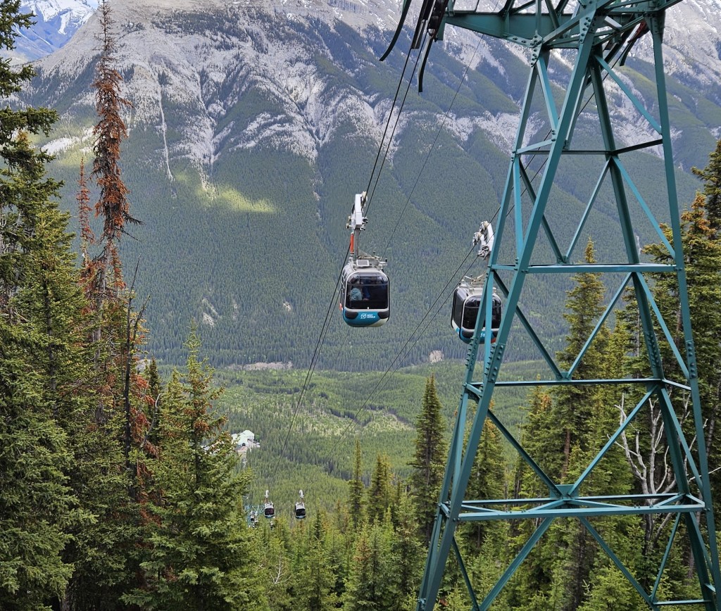
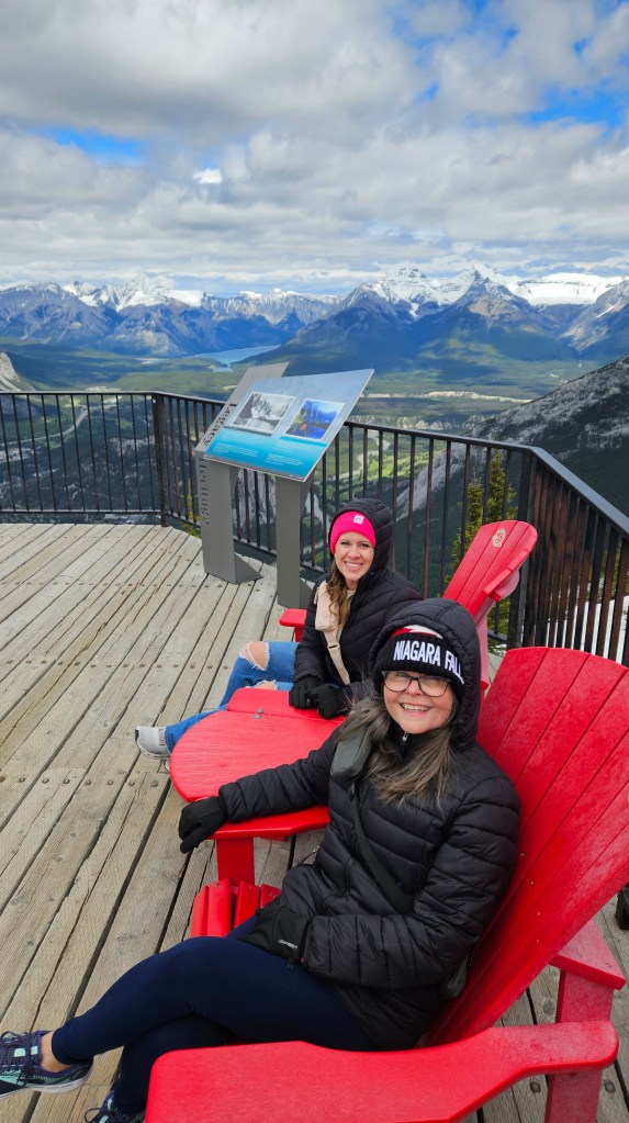
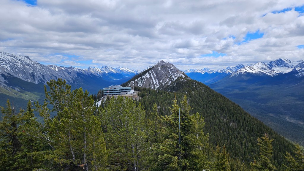
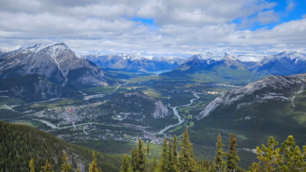
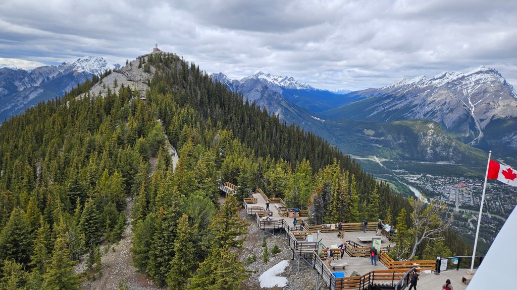
Since the town of Banff is known to be a hard place to find a parking spot, we opted to take a shuttle bus for the 60 km drive. Arriving in Banff town, we found that the parking issue was real and we were very glad that we opted for the bus. As part of our package, we also had free use of the Banff public transportation while in town. The is very handy and we used it to go visit the historic Fairmont Banff Springs Hotel. While the exterior was quite a sight, we were a bit underwhelmed at the inside. From the hotel, we took the bus back into town and then to the Banff Gondola. The ride up was quite scenic, but the views from the top were outstanding. In spite of dressing what we thought was warmly, we found that the temperature at the top of the mountain overlooking the valley and town of Banff was extremely cold and there was a good bit of wind. After walking some of the boardwalk and taking in the scenery, we decided to take the stairs and climb to the top of Sulphur Mountain. There we found the building for the Sulphur Mountain Cosmic Ray Station, built in 1956 in preparation of the International Geophysical Year (1957-1958). After heading back down to town, we found a really nice restaurant with outdoor seating along the sidewalk, where we were able to enjoy the much warmer weather, before catching our bus back to Lake Loise.

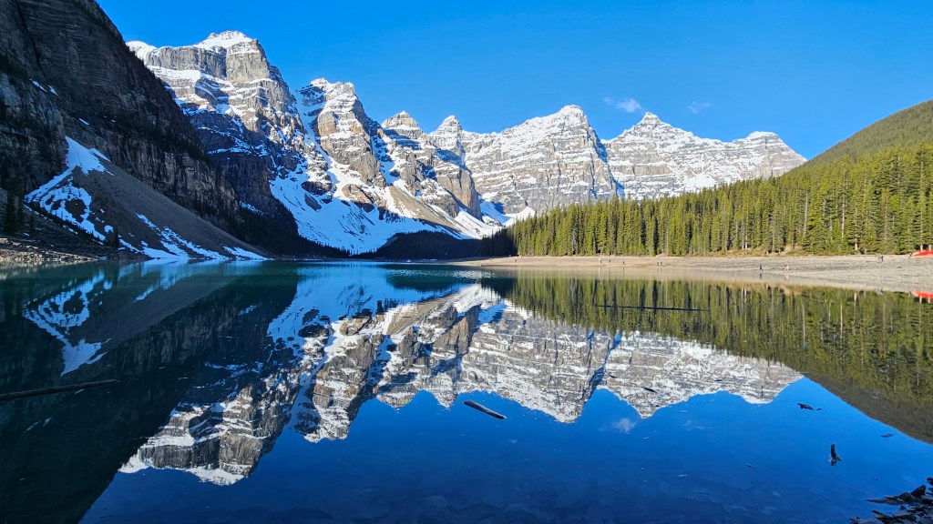
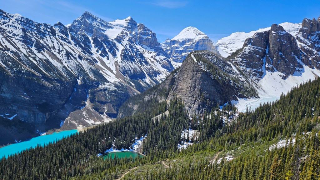
Thursday morning dawned very early for us. We had to catch a 6:00 a.m. shuttle from the campground into Lake Louise to then catch another shuttle up to Moraine Lake. While we weren’t there for sunrise, we did arrive quite early (7:00) and well before most of the crowd had arrived. I keep running out of words to describe the scenery in this part of Canada and only wish that the hundreds of pictures that I’ve taken could do justice to the actual views. We started with the short hike up the “rock pile” for the iconic Moraine Lake views. After taking the time to walk part of the way around the lake, and taking even more pictures, we boarded our transfer bus over to Lake Louise and the Fairmont Chateau Lake Louise Hotel.
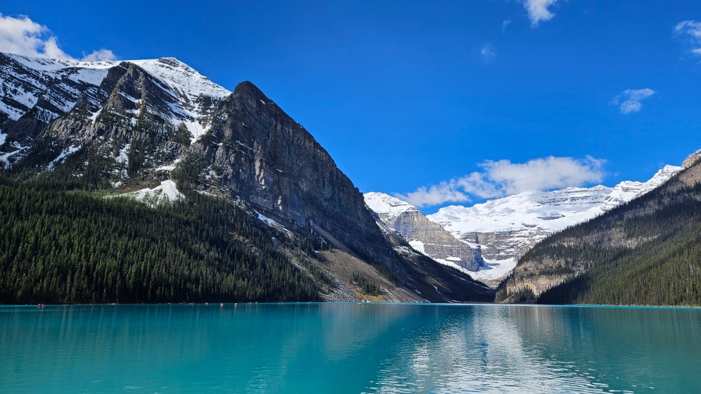
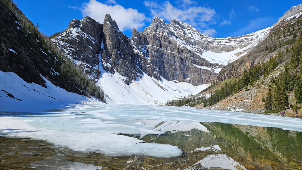
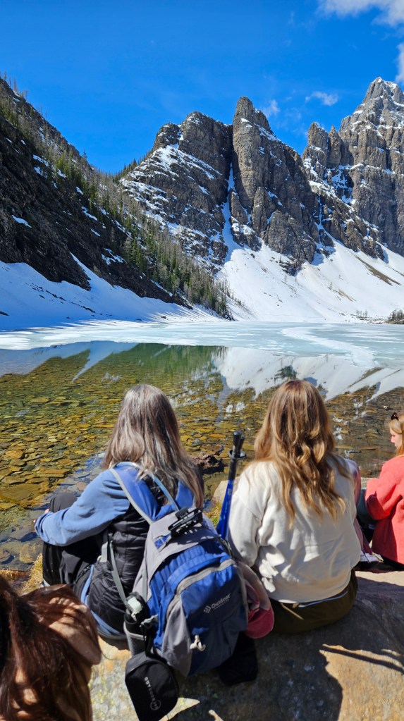
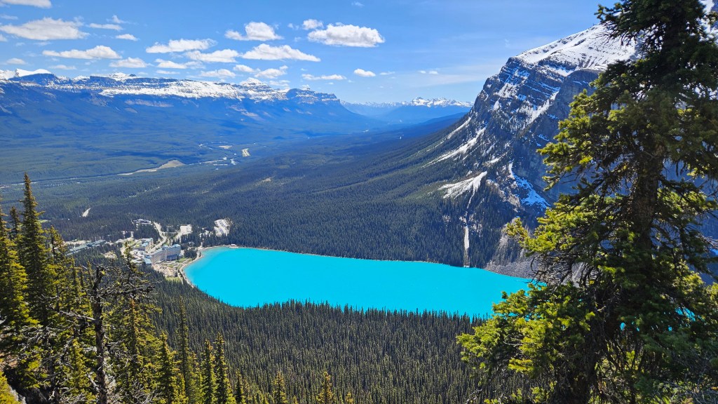
We arrived at the hotel and lake area at 9:00, we found that while there were a fair number of people there, it wasn’t quite as crowded as we’d been led to believe, although that would definitely change later in the day. Our goal for the day, besides taking more pictures, was to take the hike around the Lake Louise and then up the mountain, past Mirror Lake, to Lake Agnes and the teahouse. While at Lake Agnes, we saw a young man strip down to his shorts and do a polar plunge in the lake. Unfortunately, we didn’t get any pictures or video, but when I put my hand in the water, it immediately started to hurt from the cold. From Lake Agnes, we continued up the trail to the Little Beehive overlook. We wanted to do the Big Beehive trail, but it was still snowed in and quite treacherous. The hike wasn’t too bad, although there was a significant elevation gain of just over 1,900-feet over the approximate 2.7-mile trail (each way) from the hotel to the top of Little Beehive. The views from the top were really something to see. From there, we could see all three lakes; the mostly white Lake Agnes, the green Mirror Lake, and the unearthly turquoise Lake Louise. There were several areas of ice and snow that we had to get through on the trail, with one exceptionally snowy section that we had to traverse on the way down. Once we had returned to Lake Louise, we walked part way around to get another view back across the lake to the Chateau, before heading back to catch our shuttle to the campground. The crowds at Lake Louise were significantly larger than they had been earlier in the morning, but still nothing like the pictures that we’ve seen from mid-summer when the place is just crawling with tourists.
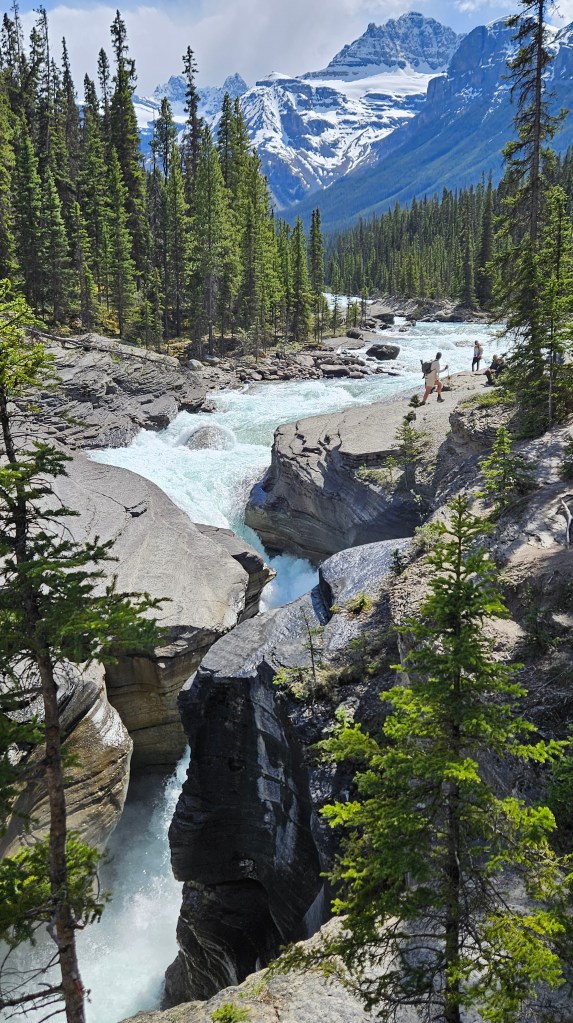
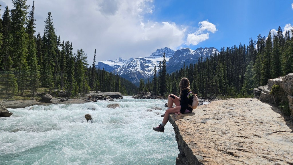
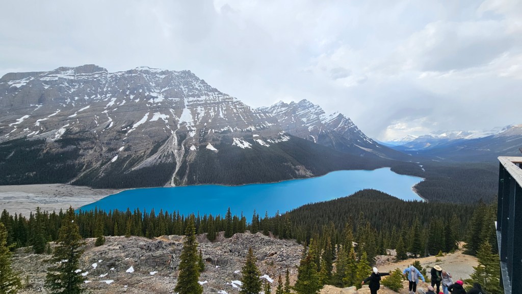
With nothing really planned for the following day, we decided to take a drive north from Lake Louise along the Icefield Parkway. We made several stops along the way at various overlooks, but two stops stood out. The first was a short walk down to the Saskatchewan River at an area called Mistaya Canyon. There was a waterfall and an area where the river had cut though the rocks. The weather was pretty warm, with Ashley wearing shorts, and the sky was mostly sunny. From there, we drove up to Bow Summit and Peyto Lake. Peyto Lake was a royal blue glacier lake, with a high overlook. At the higher altitude, the weather took quite a turn, and the shorts gave way to long pants and coats. While there, it actually began to snow.
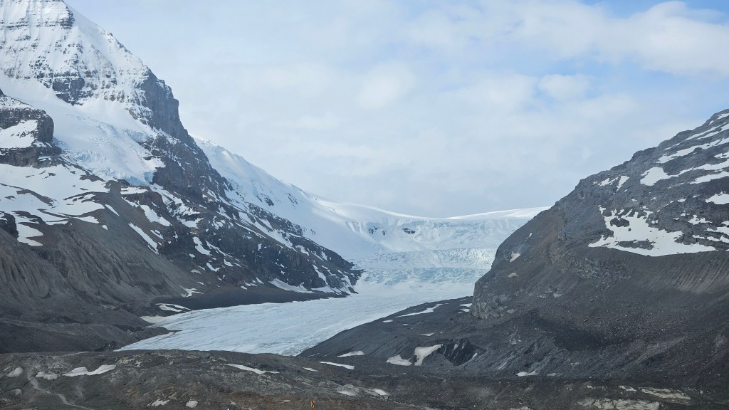
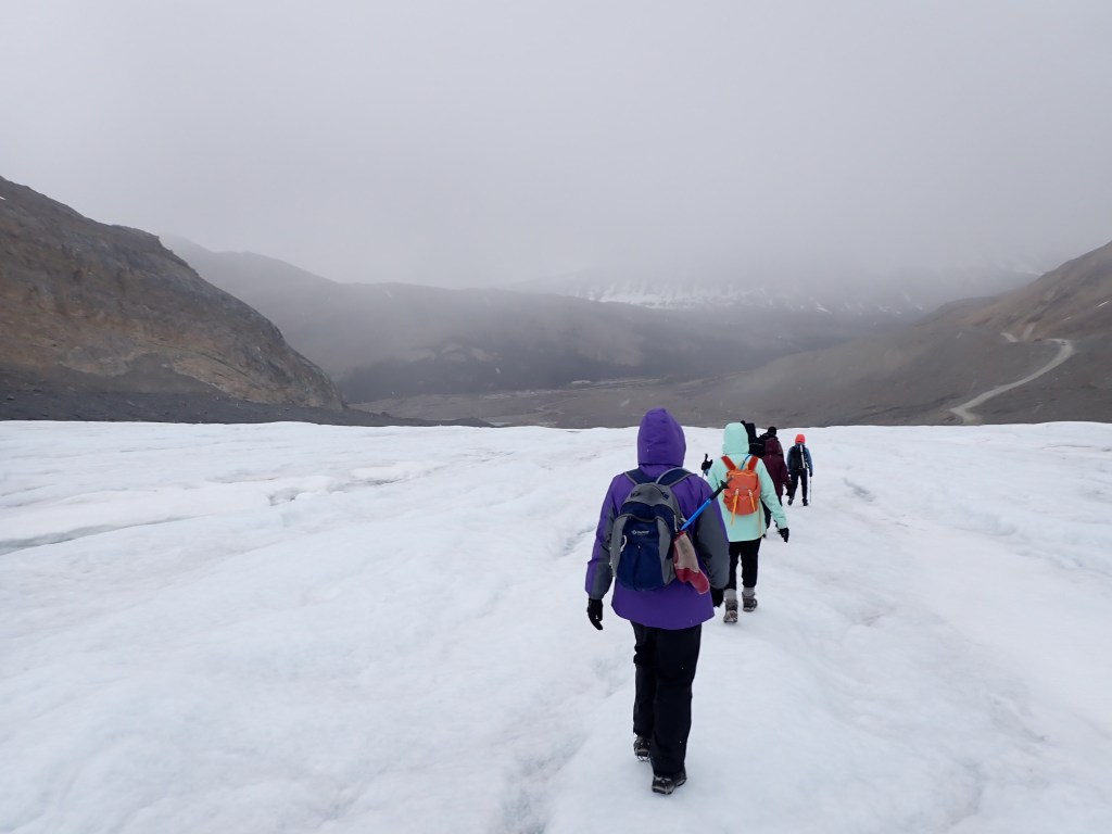
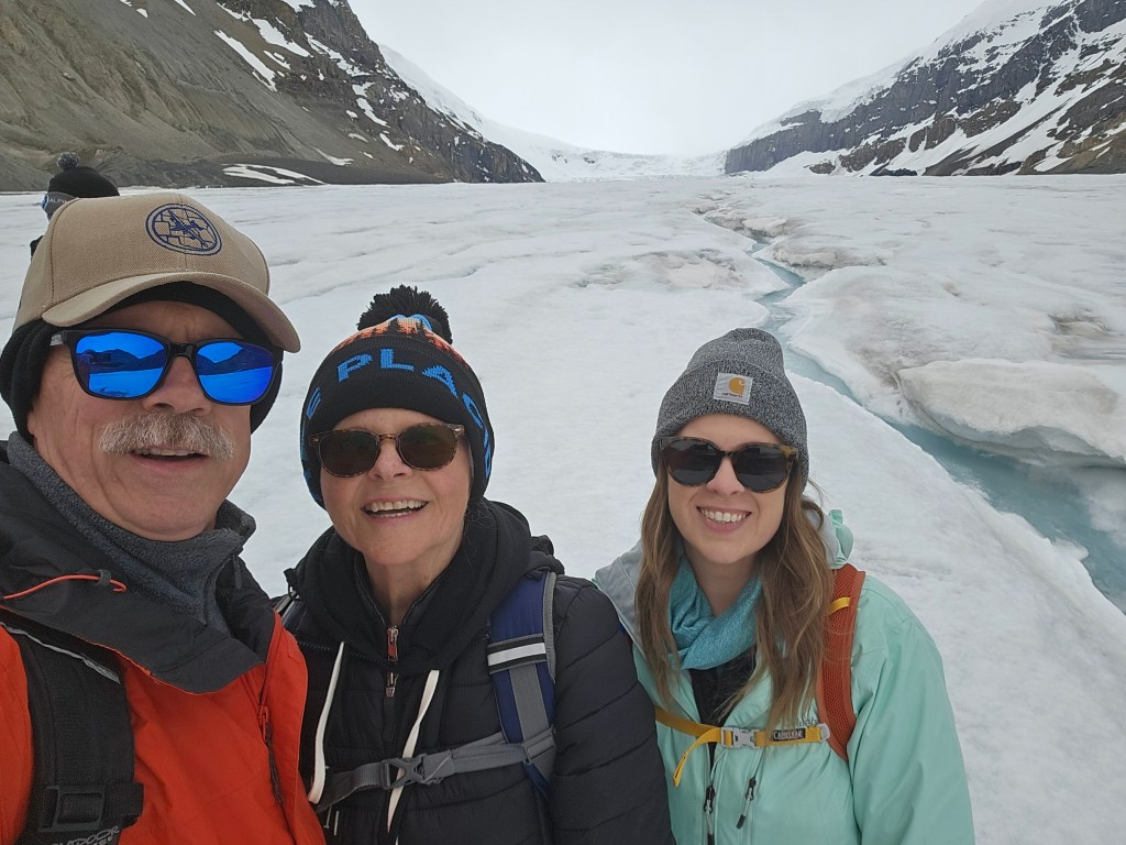
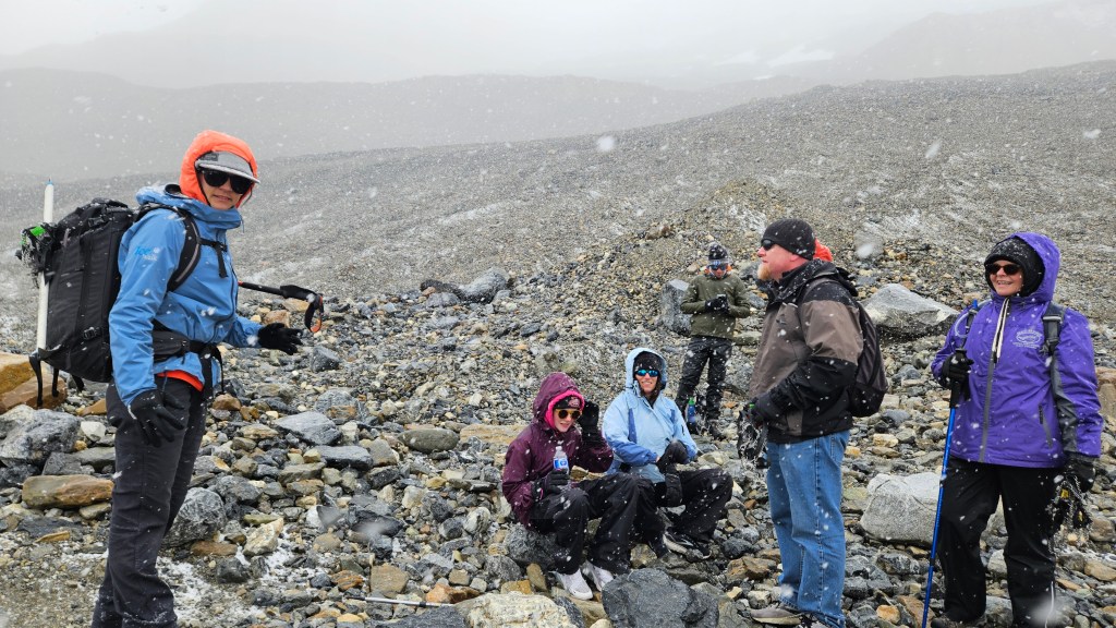
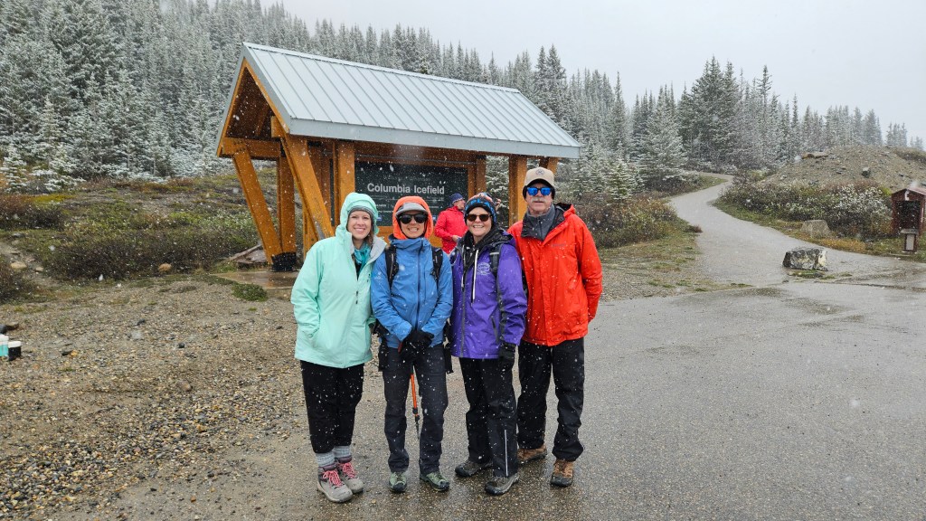
Our last day while based from Lake Louise involved another trip back up the Icefield Parkway to Athabasca Glacier, which is one of the glaciers that flows down from the Columbia Icefield. We had scheduled a three-hour guided “ice walk” on the glacier. It was mostly clear when our group of about a dozen people joined our guide for this trek, and although we were dressed pretty warm, the wind coming down the glacier, along with temperatures right around freezing, made it a pretty cold endeavor. I’ve got to say that this was one of the coolest things we’ve done on this trip. The hike to the toe of the glacier, then approximately two miles up the glacier was nothing like we’d ever experience before. Our guide, Hannah, was very knowledgeable and informative. About the time that we reached our farthest point, clouds rolled over the side of the glacier and it began to snow, and the snow just kept getting heavier and heavier. As we headed back, the snow got heavy enough that we could no longer see the ice fall at the top of the glacier, or the visitor center or parking area down past the toe. We were never in any danger, but the experience was exciting.
Closing out our many adventures in the Lake Louise area, Sunday was another moving day. Retracing our steps up the Icefield Parkway, although while pulling our trailer, we made our way up to Jasper, where we have several things planned for the next few days. More to come on that location next time.
