NM, AZ, UT, CO National Parks; June 12 – July 6, 2019

The final days of this trip take us out of Moab, UT and over to Ridgway, CO, back to Angel Fire, NM, then to Palo Duro Canyon State Park near Canyon, Texas.

July 1-2, Ridgway, CO

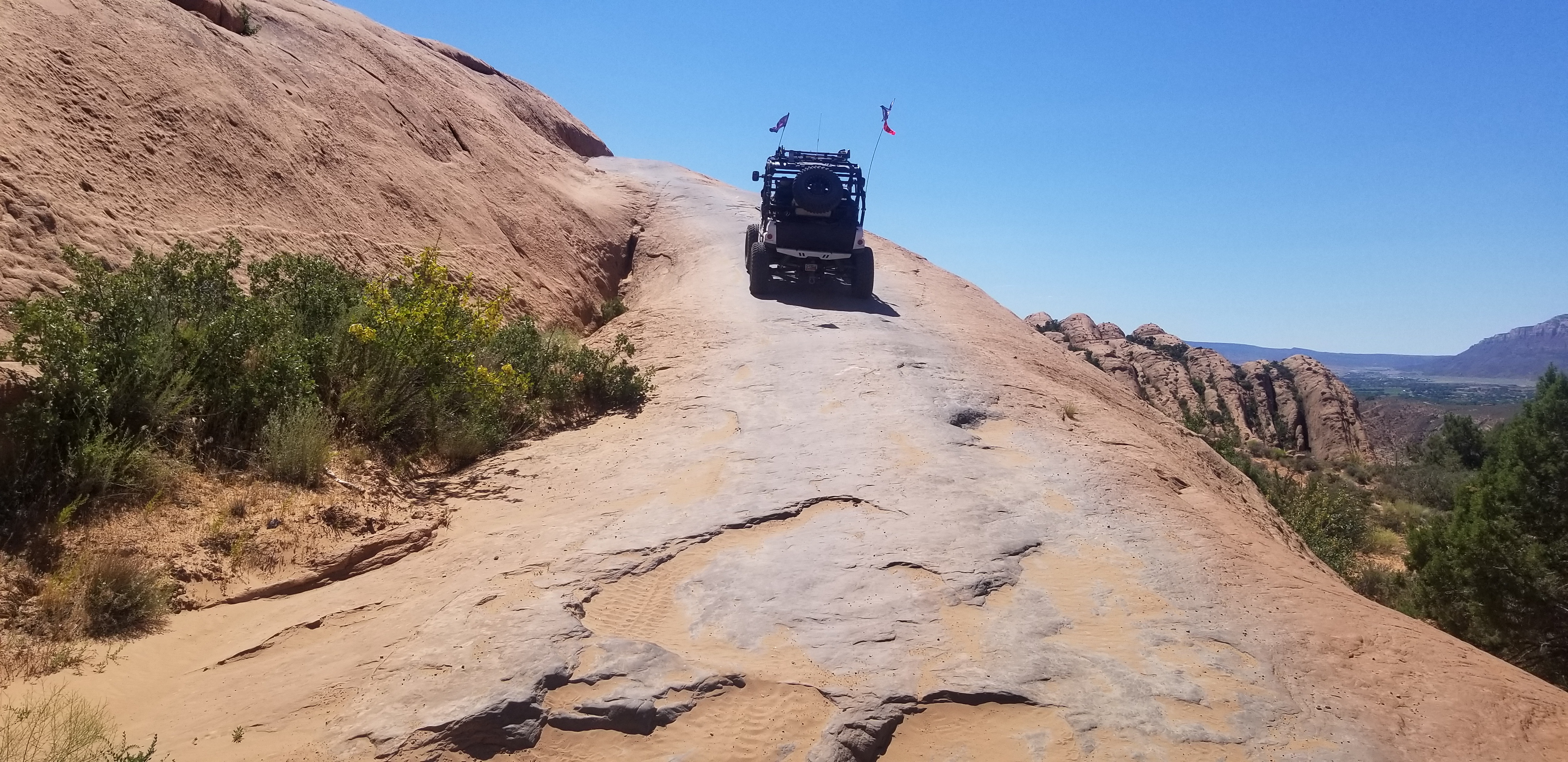
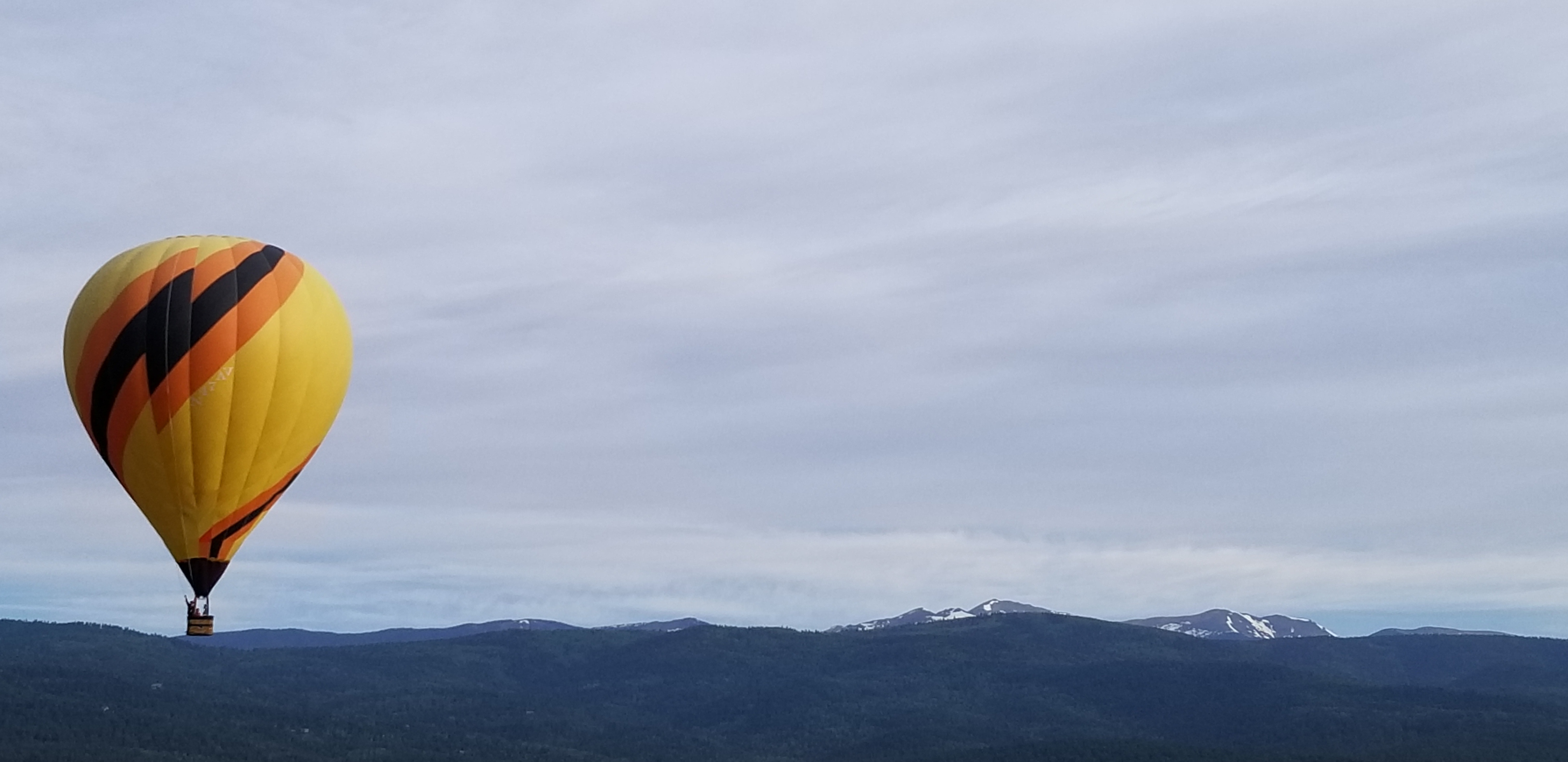
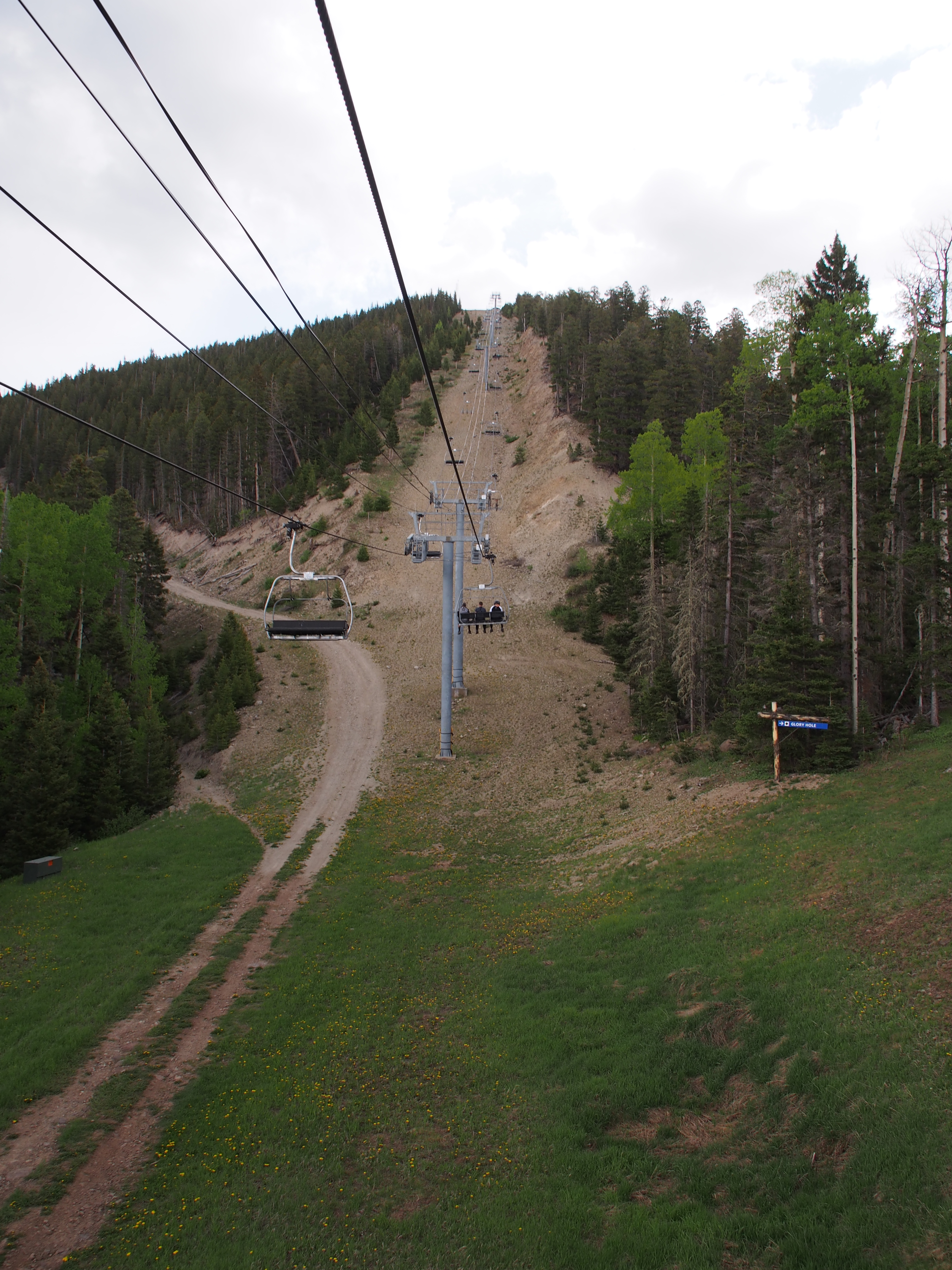
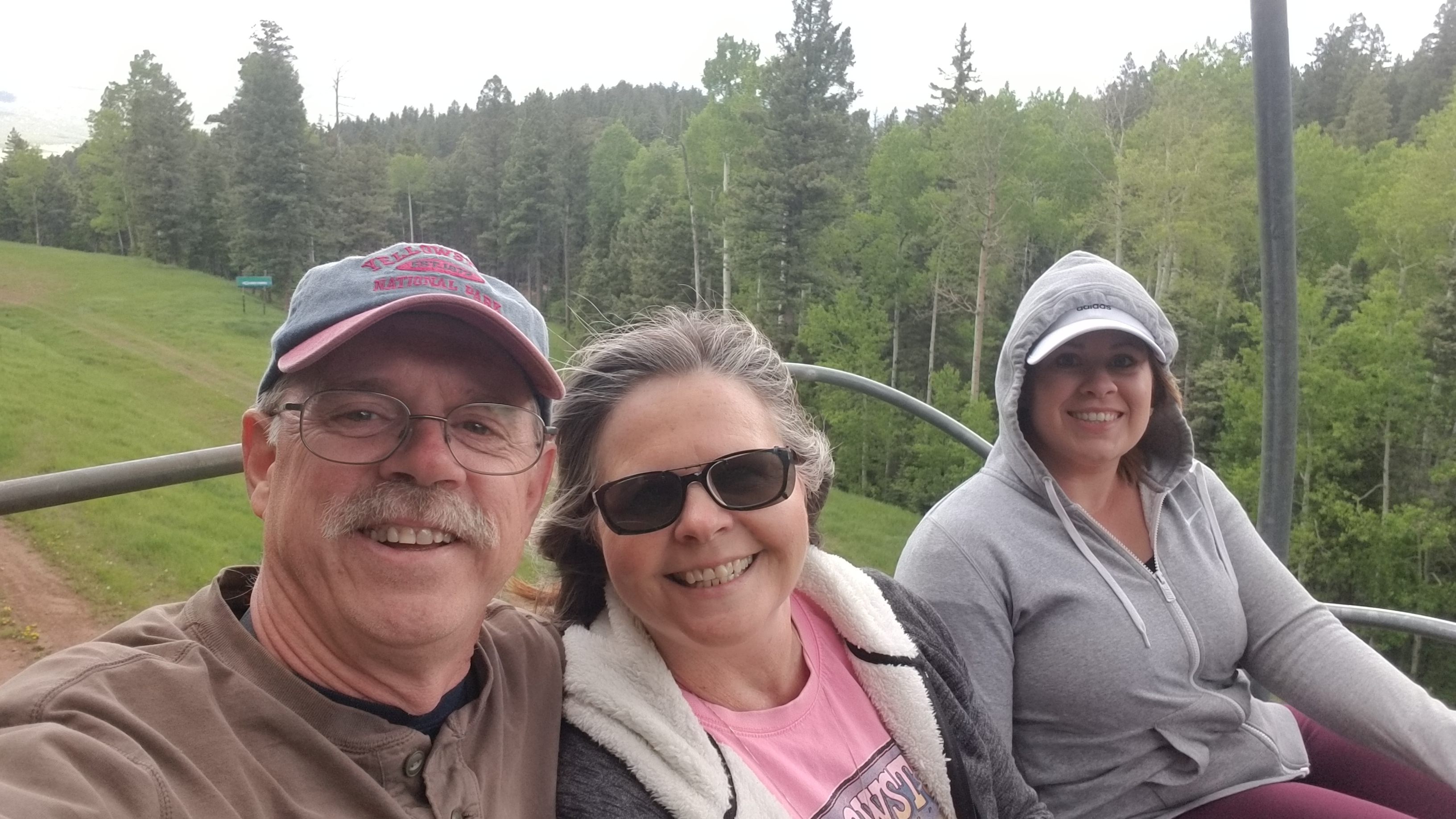
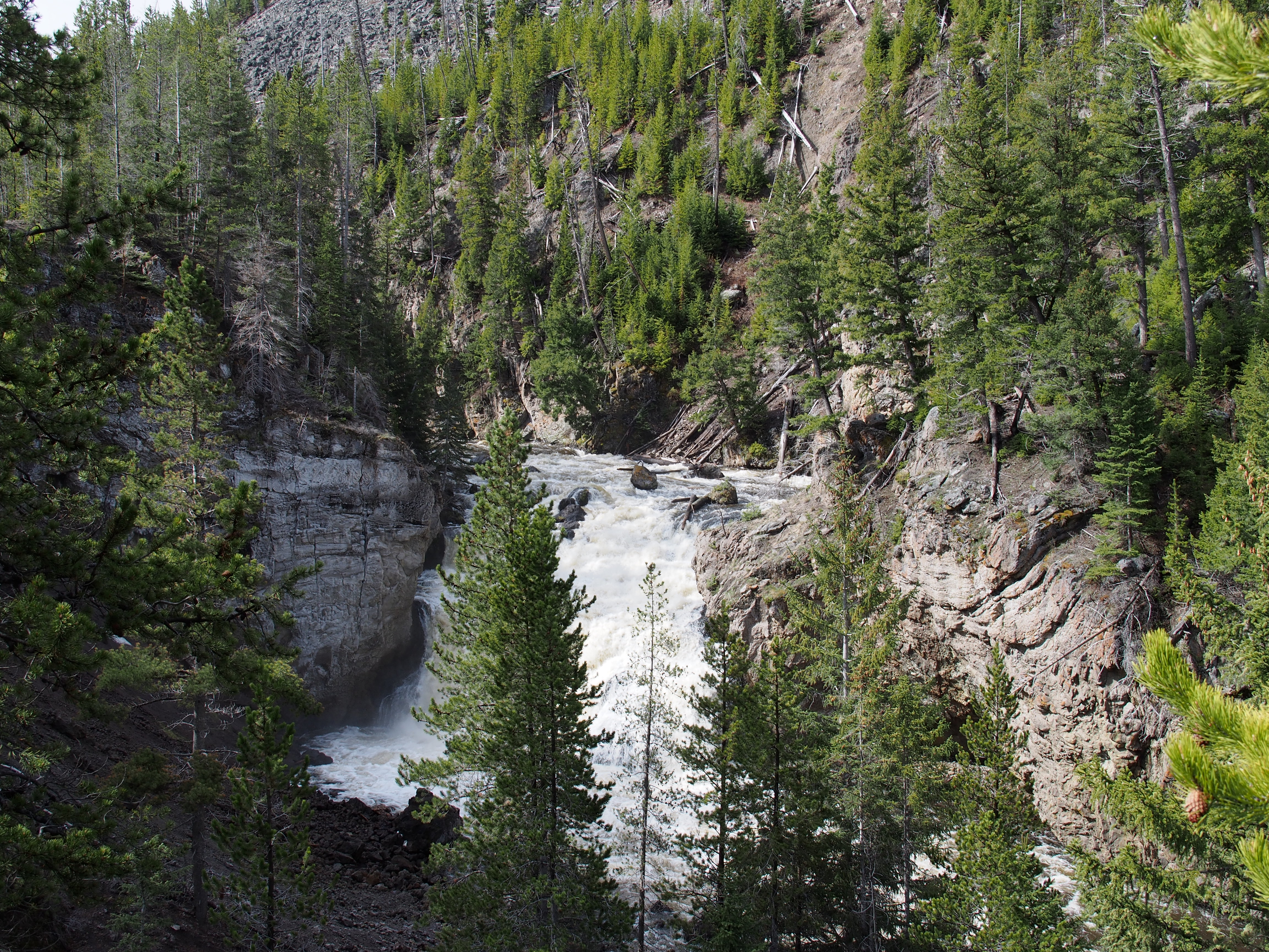
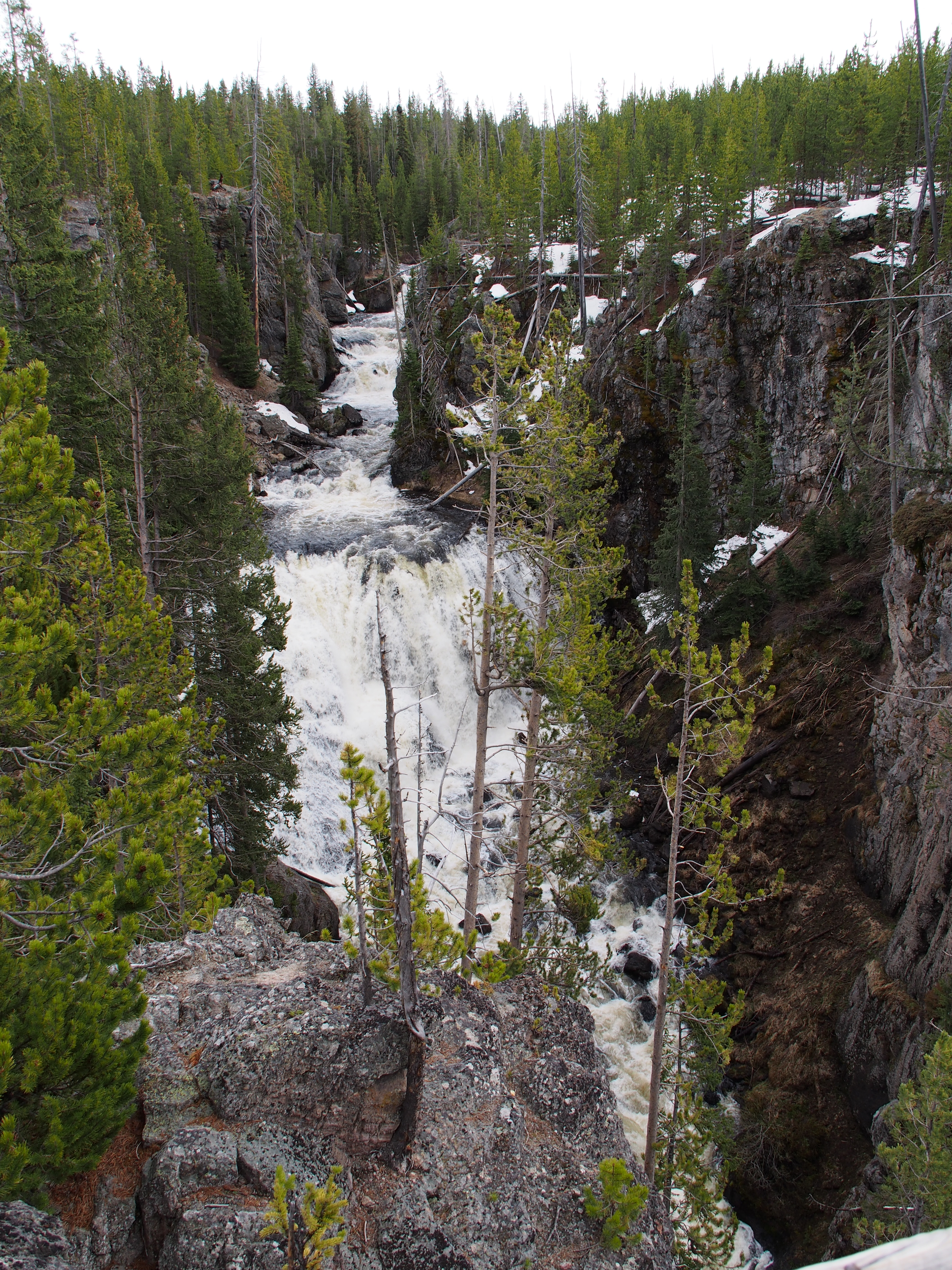
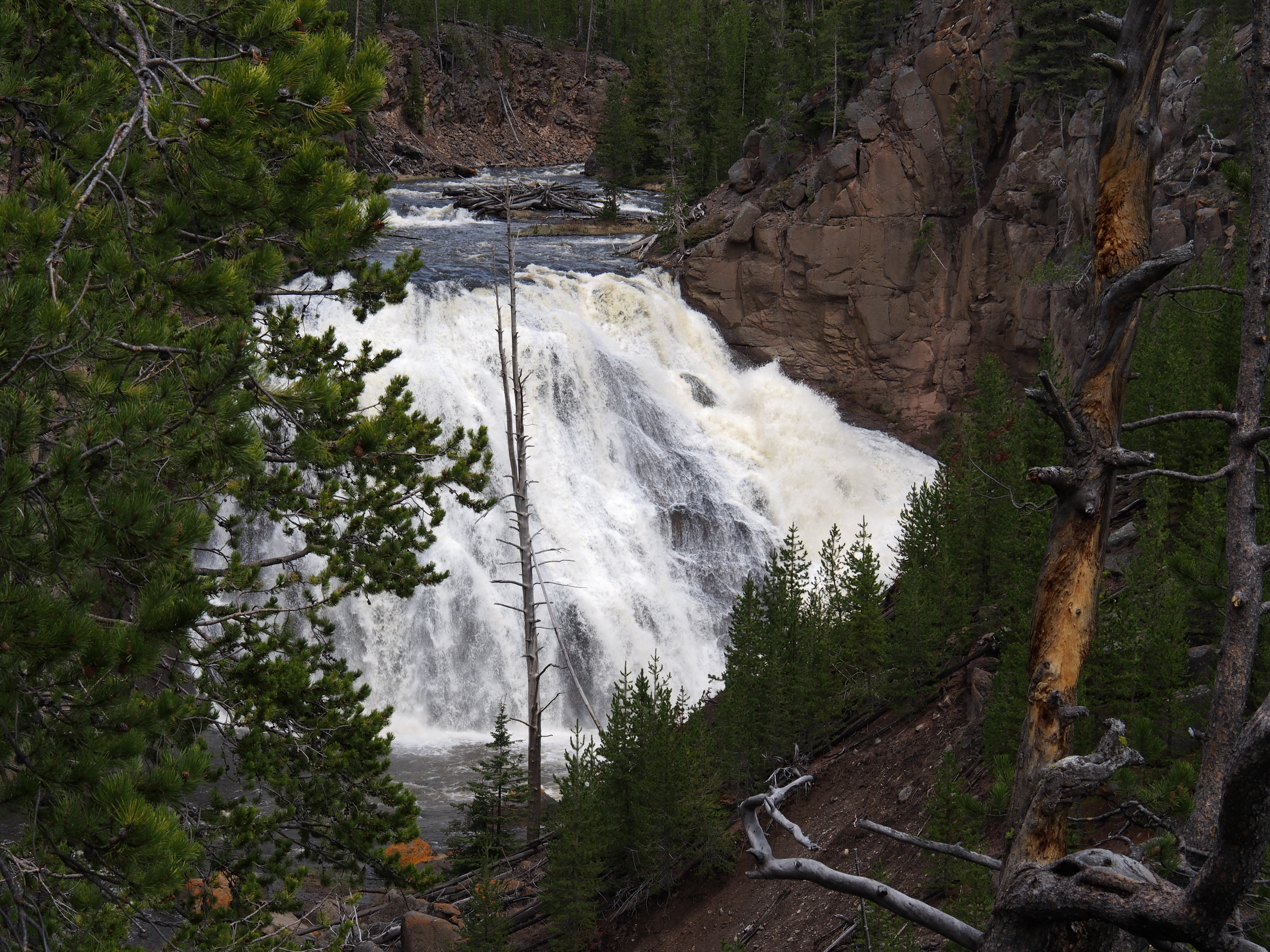
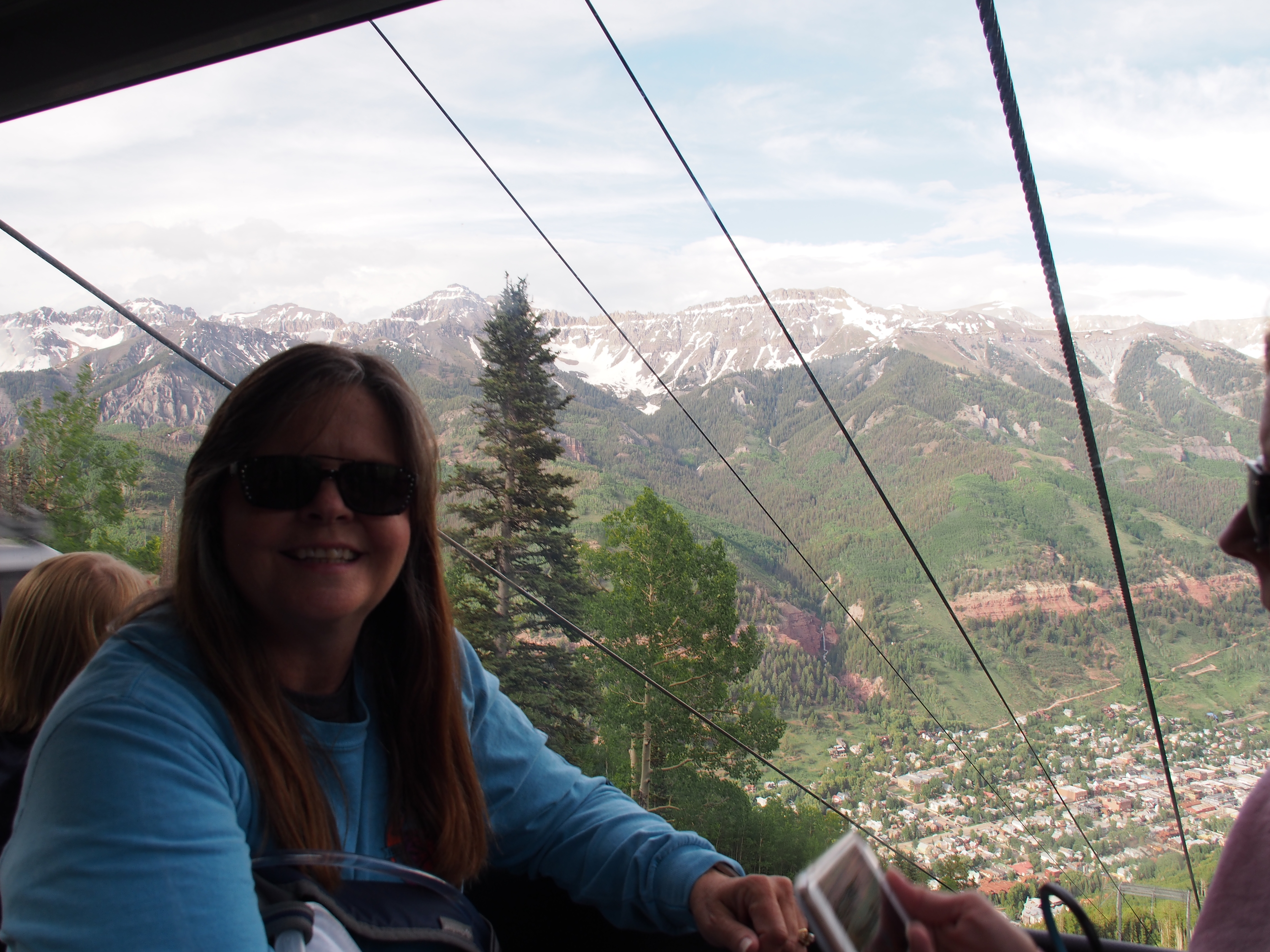
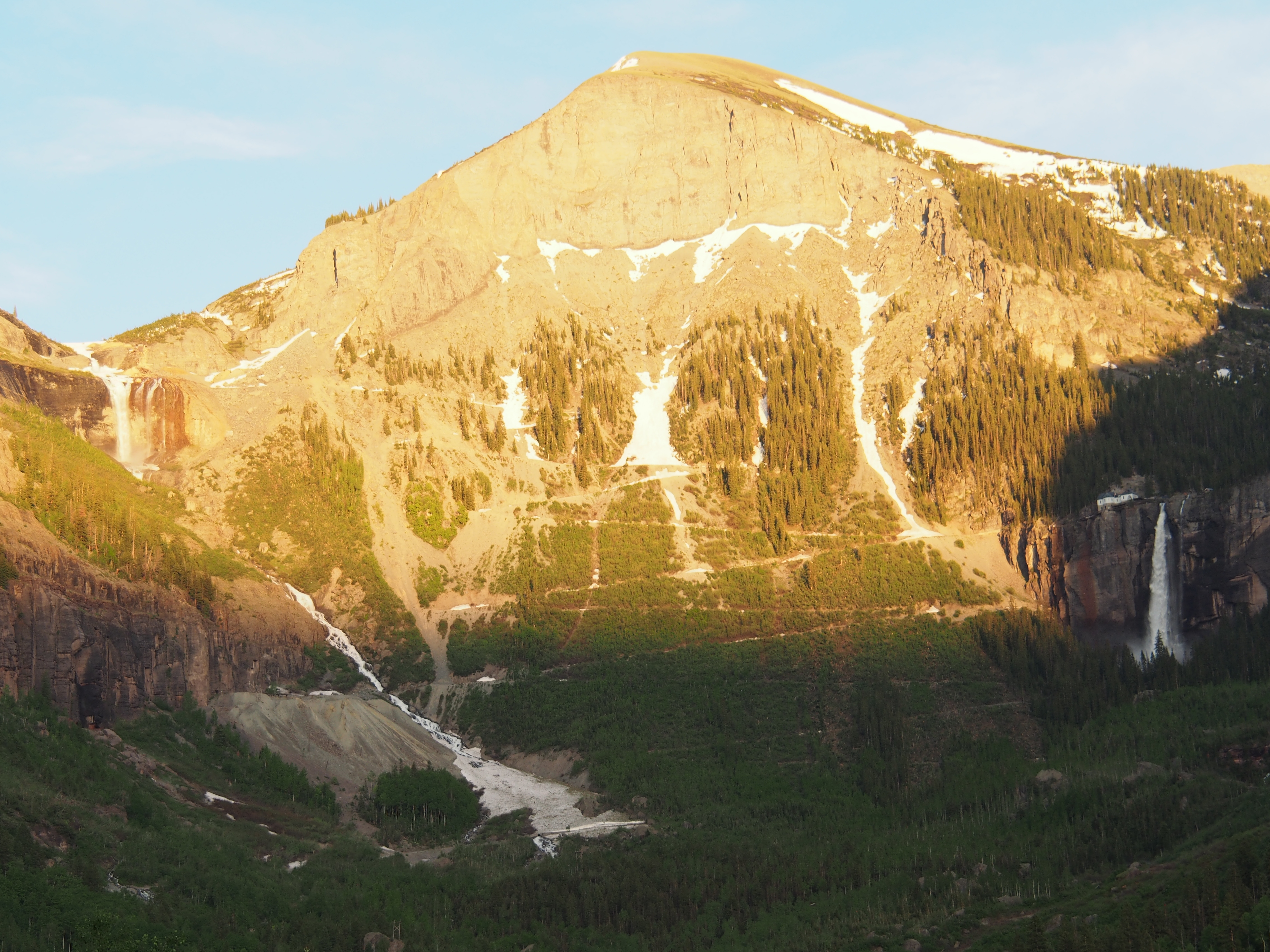
The drive from Moab, UT over through Grand Junction, CO and Montrose, CO down to Ridgway, CO was a pretty easy one. We were able to get into Ridgway State Park and get all hooked up by noon which gave us time to drive down to Telluride, CO for the afternoon. The drive there was really nice and we found the cool to be quite a relief from the high temps of Moab. We walked around town and explored some of the stores (t-shirts have been priority on this trip) before catching a ride on the free gondola over the mountain to the resort town of Mountain Village. After spending time over there, we headed back across to Telluride, then drove to the end of town to see two beautiful waterfalls; Bridal Veil Falls and Ingram Falls. There was a lot of water coming over the falls due to the snowmelt from a heavy snowfall this winter. A little afternoon rain prevented us from hiking up to the falls.

Riding the Telluride Gondola.
Ingram and Bridal Veil Falls near Telluride, CO.

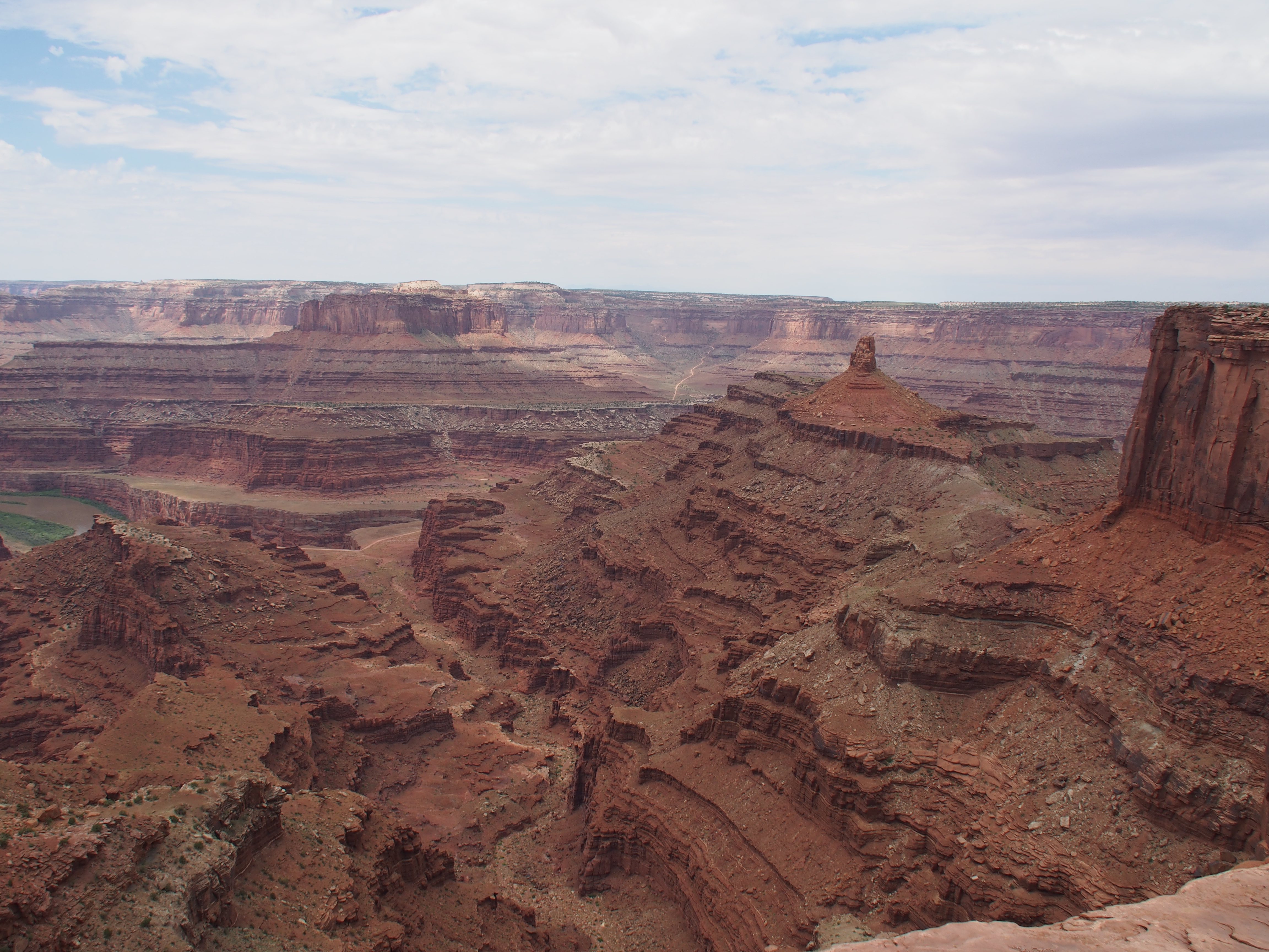
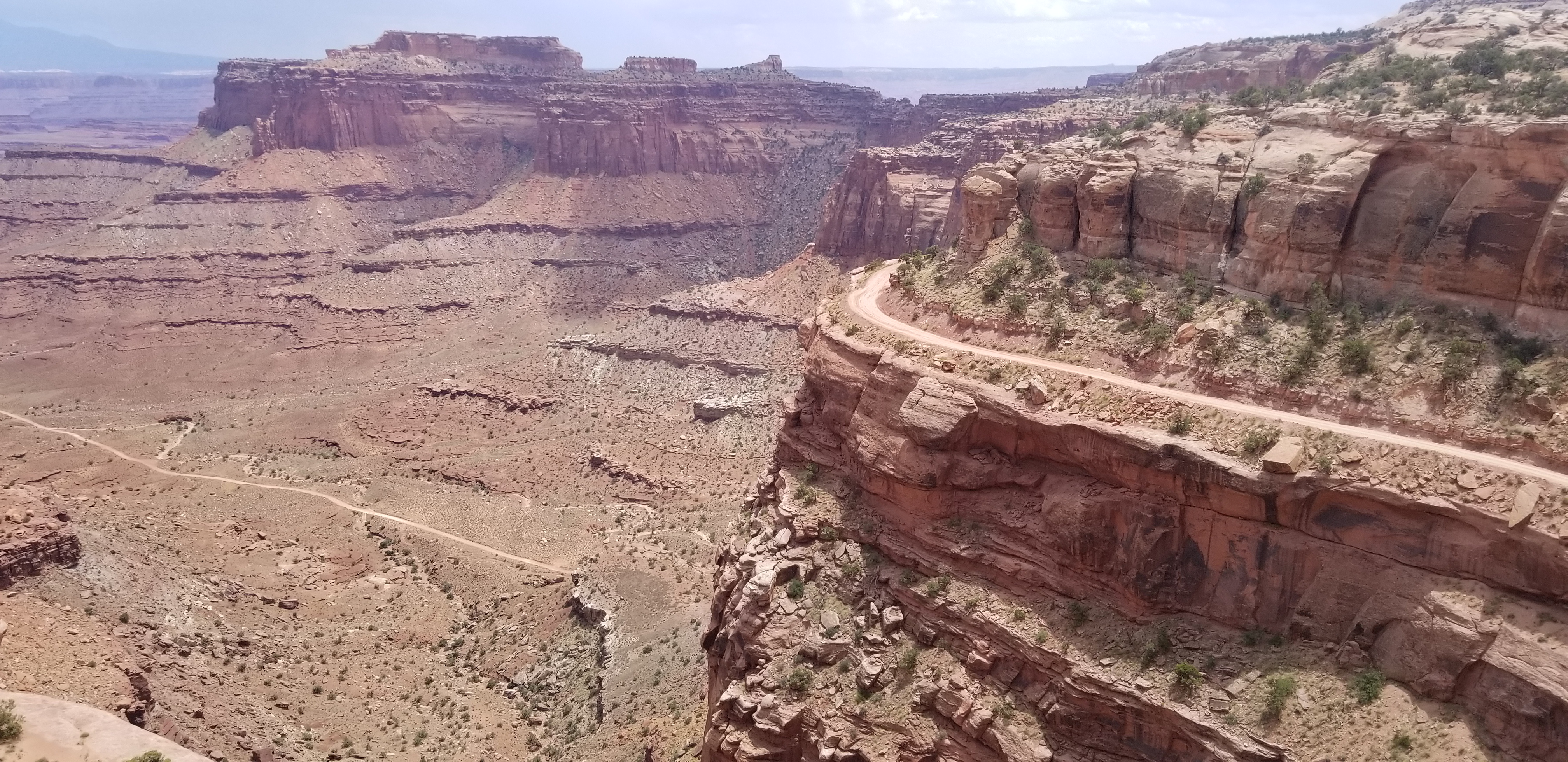
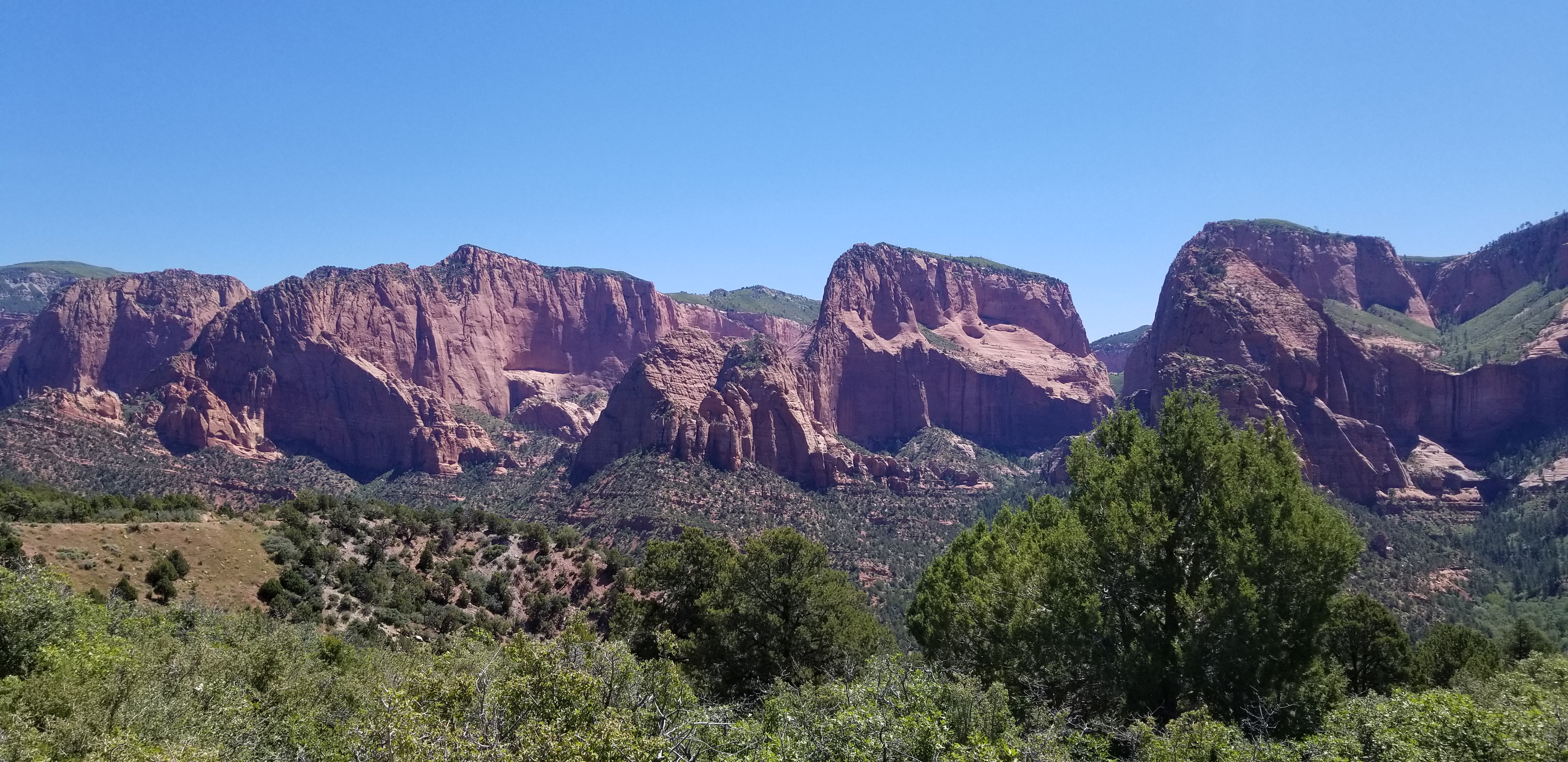
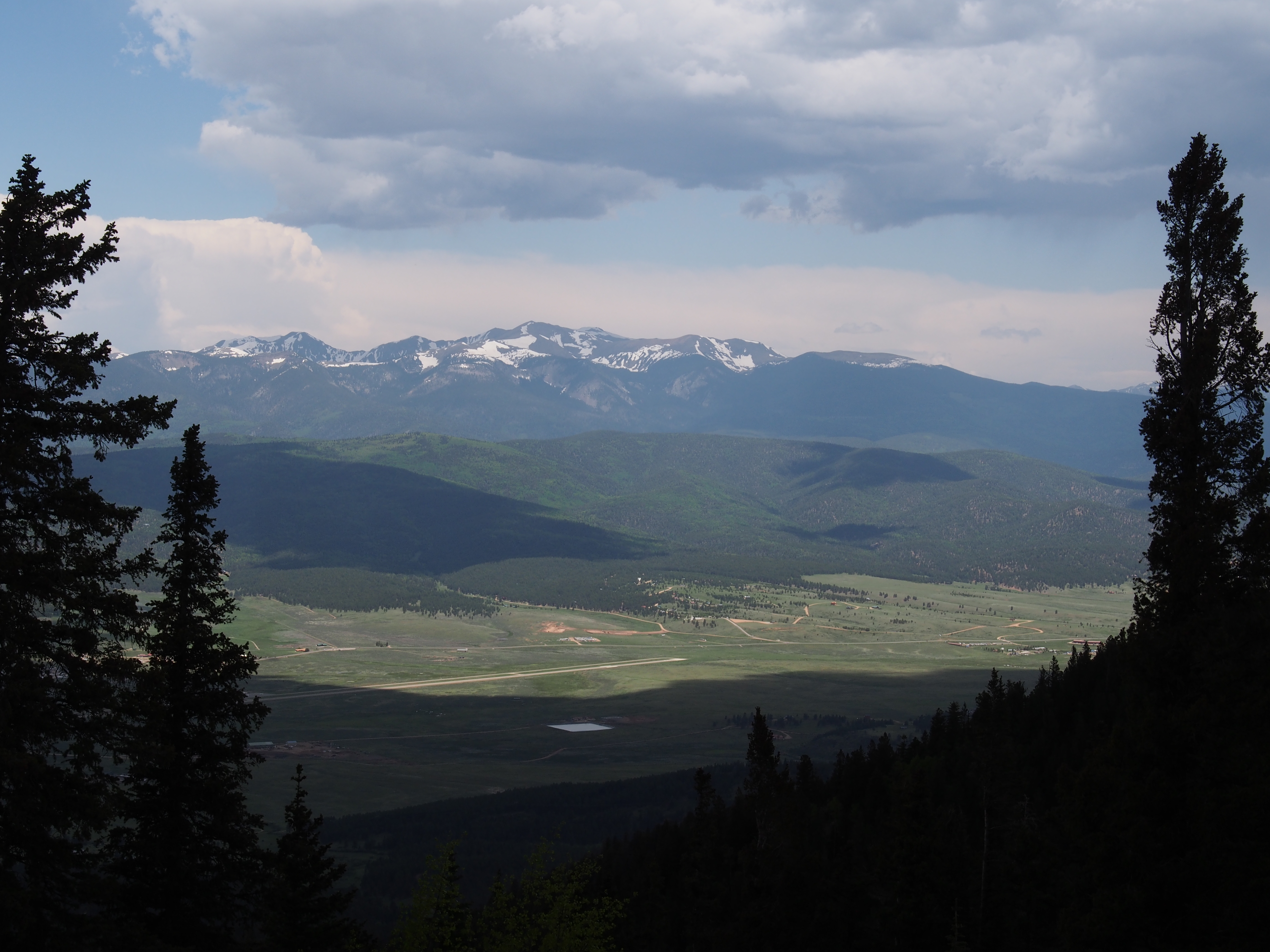
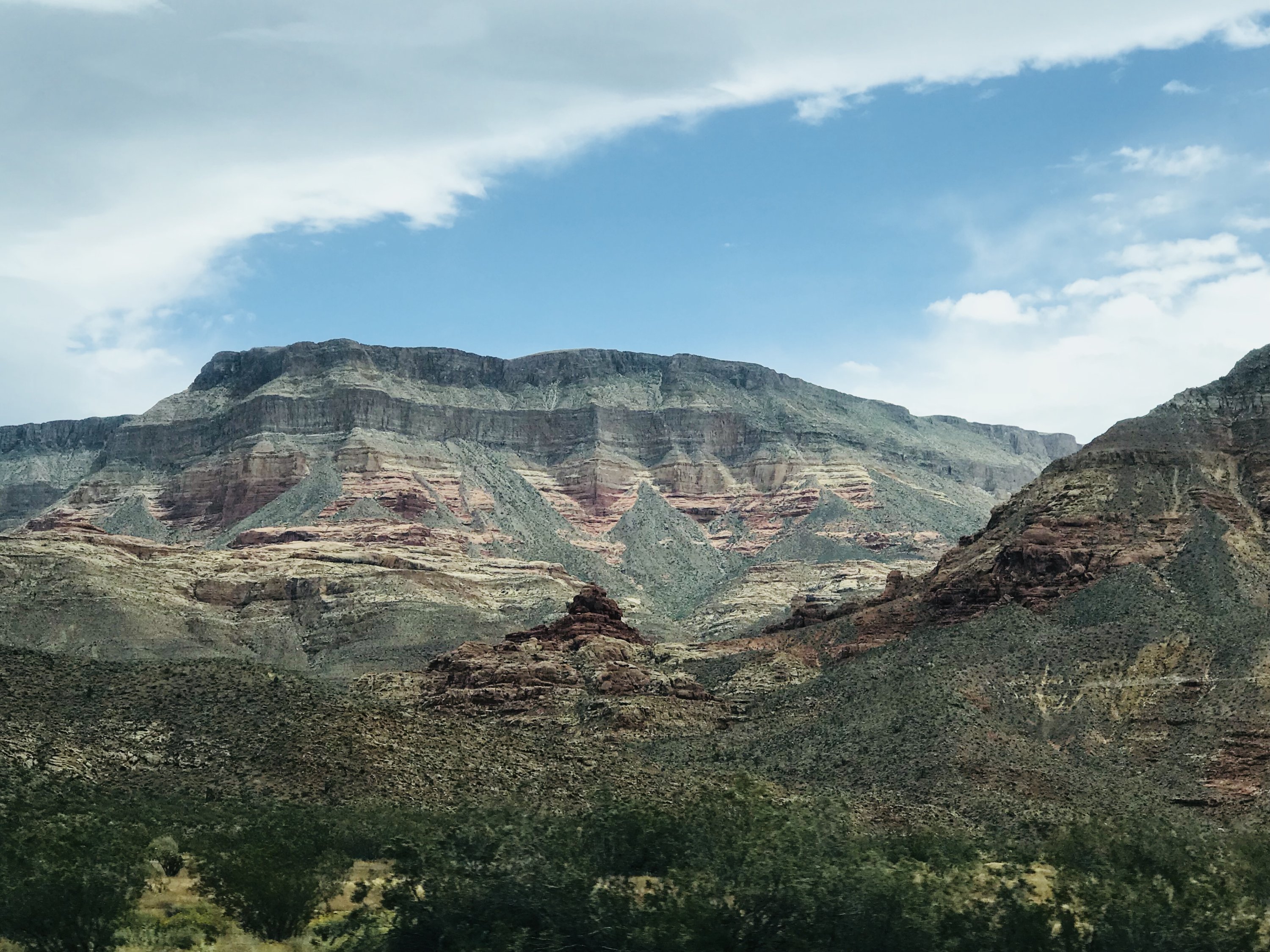
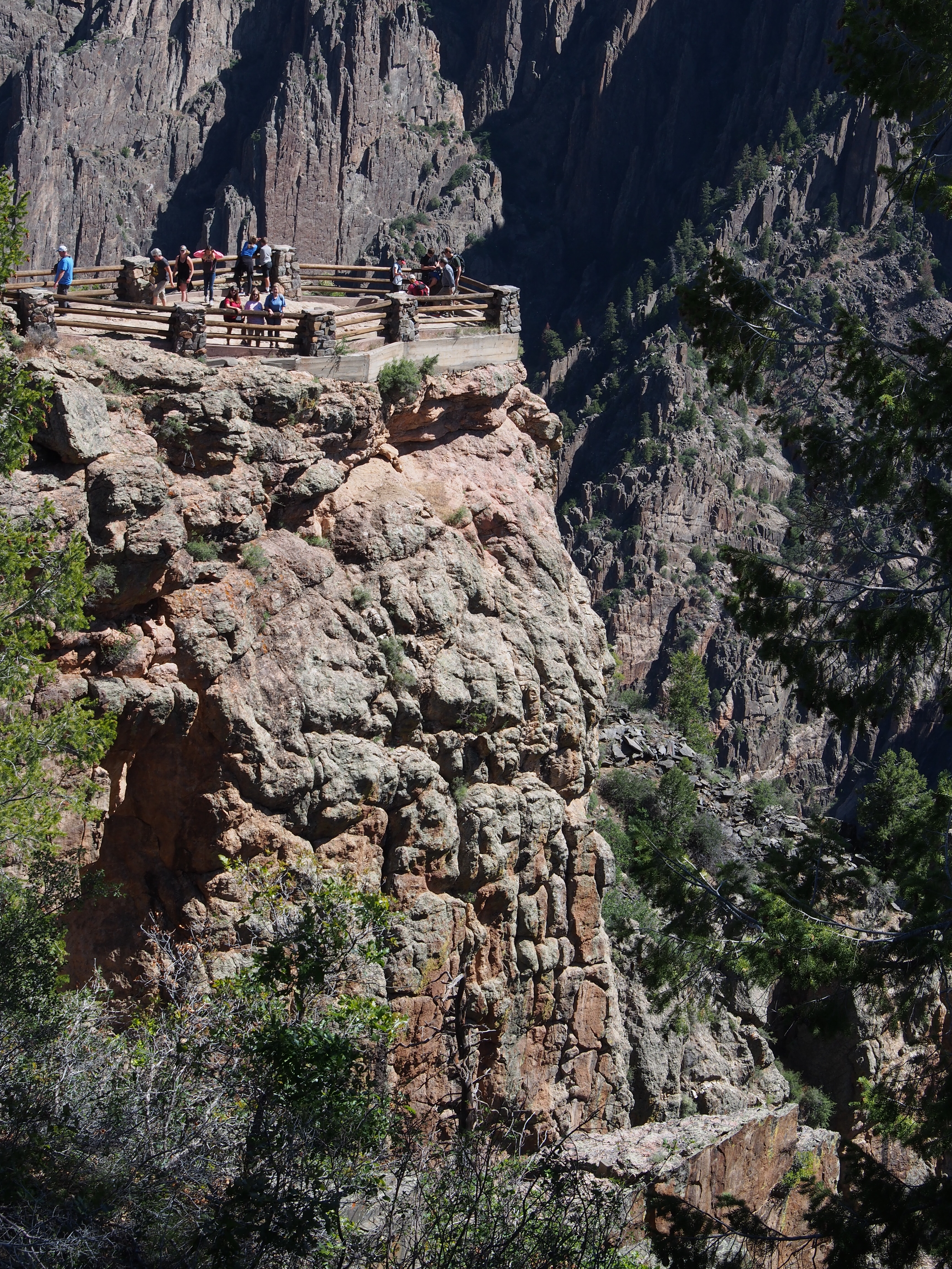
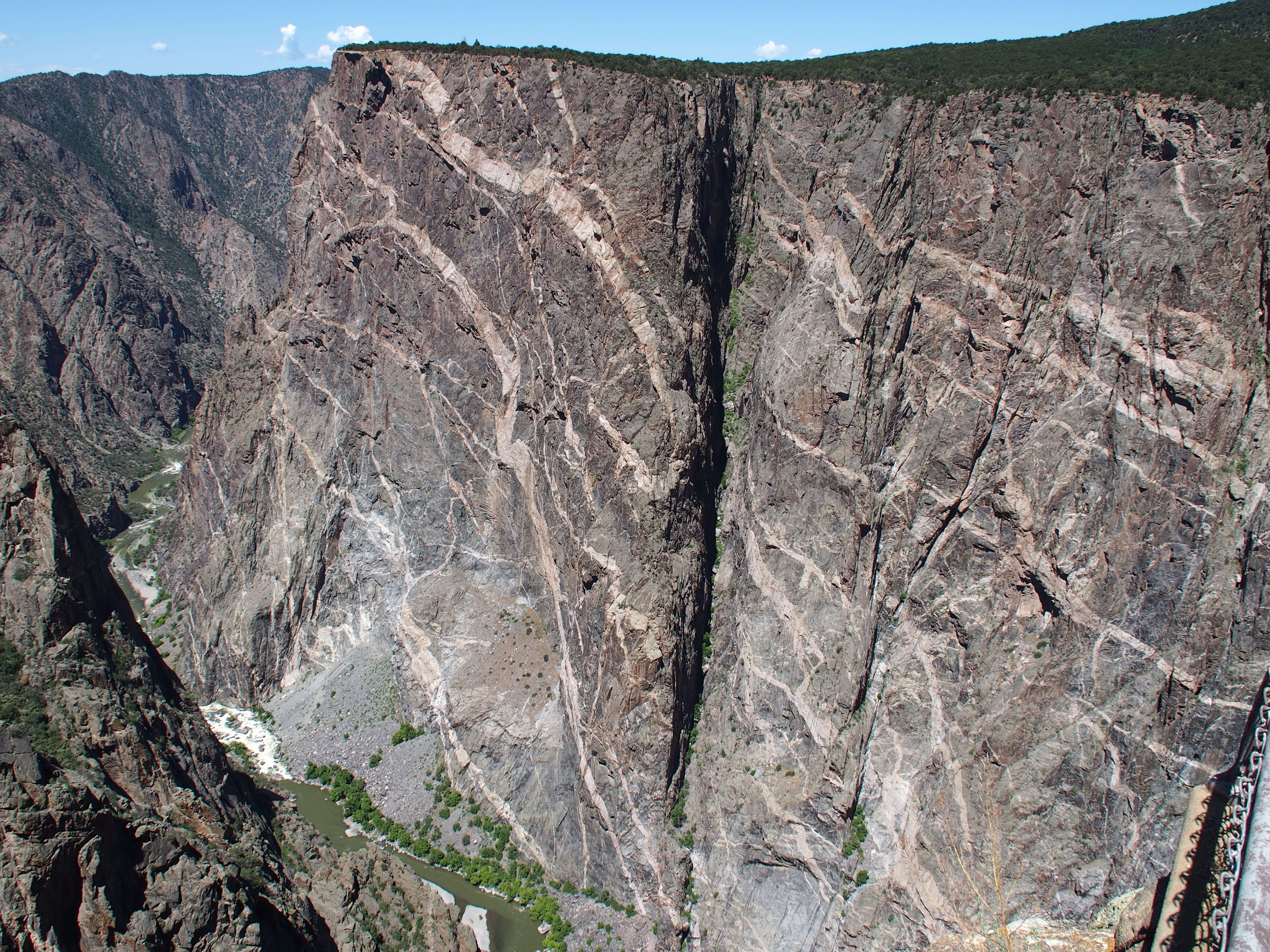
The next morning, we drove up to Black Canyon of Gunnison National Park. Although Debbie and I visited it last year, Julie and Ashley had never had the chance to really enjoy the views that we had. Arriving at the entrance, we realized that our National Parks Pass had expired at the end of June, so we purchased a new one. We certainly had more than paid for the previous pass. We just needed a new one until next March when I’ll be eligible to buy a lifetime pass for the price of a normal annual one.

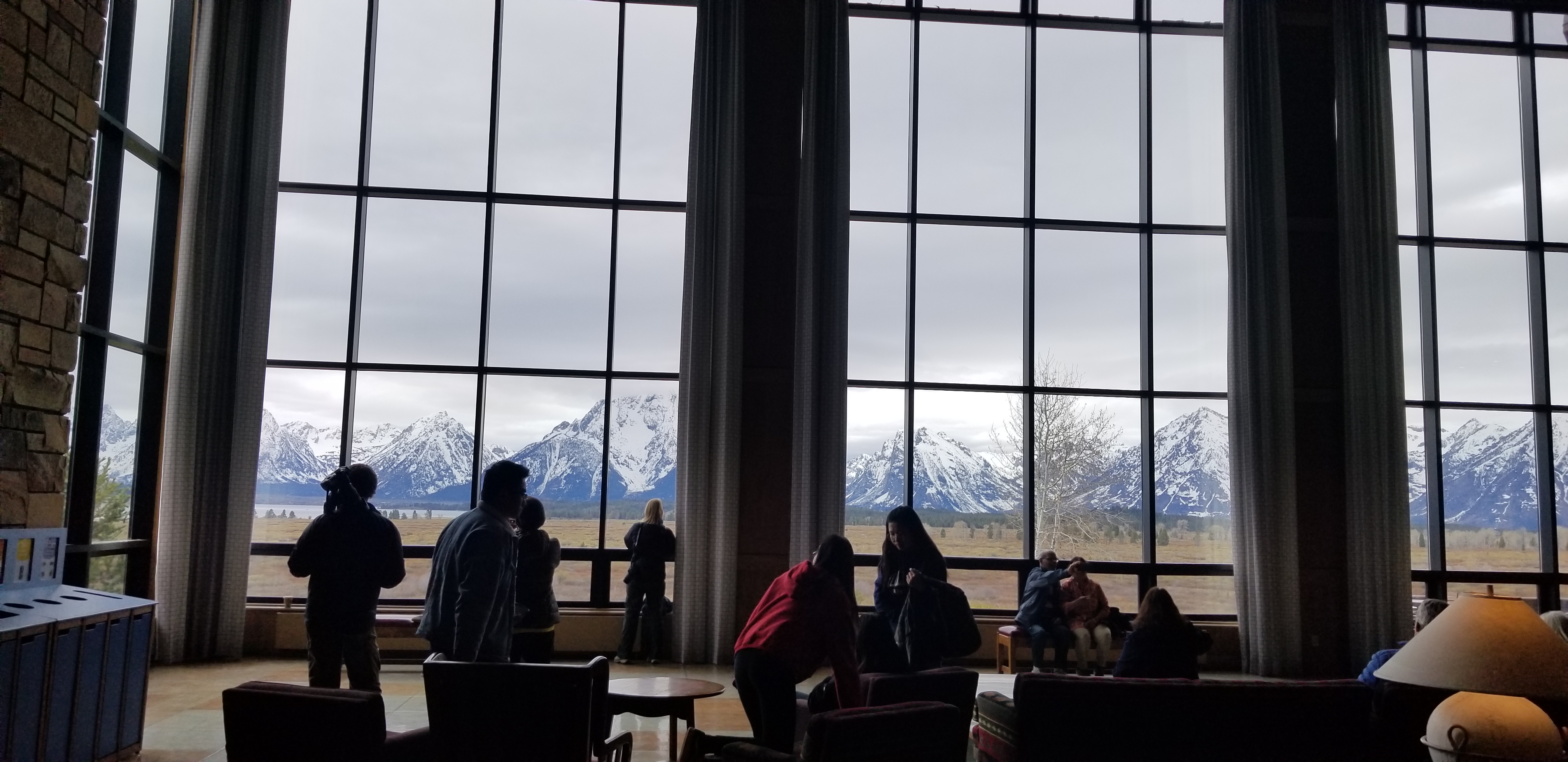
The small visitor center had the normal park video, which we watched, then ventured out to the overlook behind the center (after the obligatory t-shirt buying in the park store). The views are amazing and certainly makes this a must stop if you’re anywhere near Montrose. We then took the drive around the south rim to the various other overlooks. Most were within feet of the parking, but a couple required a walk of 100 yards or so to reach them. All views were well worth the walk. The park was easily experienced in less than a full day, unless you wish to take in any of the longer hikes or take the two hour drive over to the north rim.

Debbie, Julie, and Ashley at one of the overlooks at Black Canyon of the Gunnison N.P.
Painted Wall overlook at Black Canyon of the Gunnison N.P.

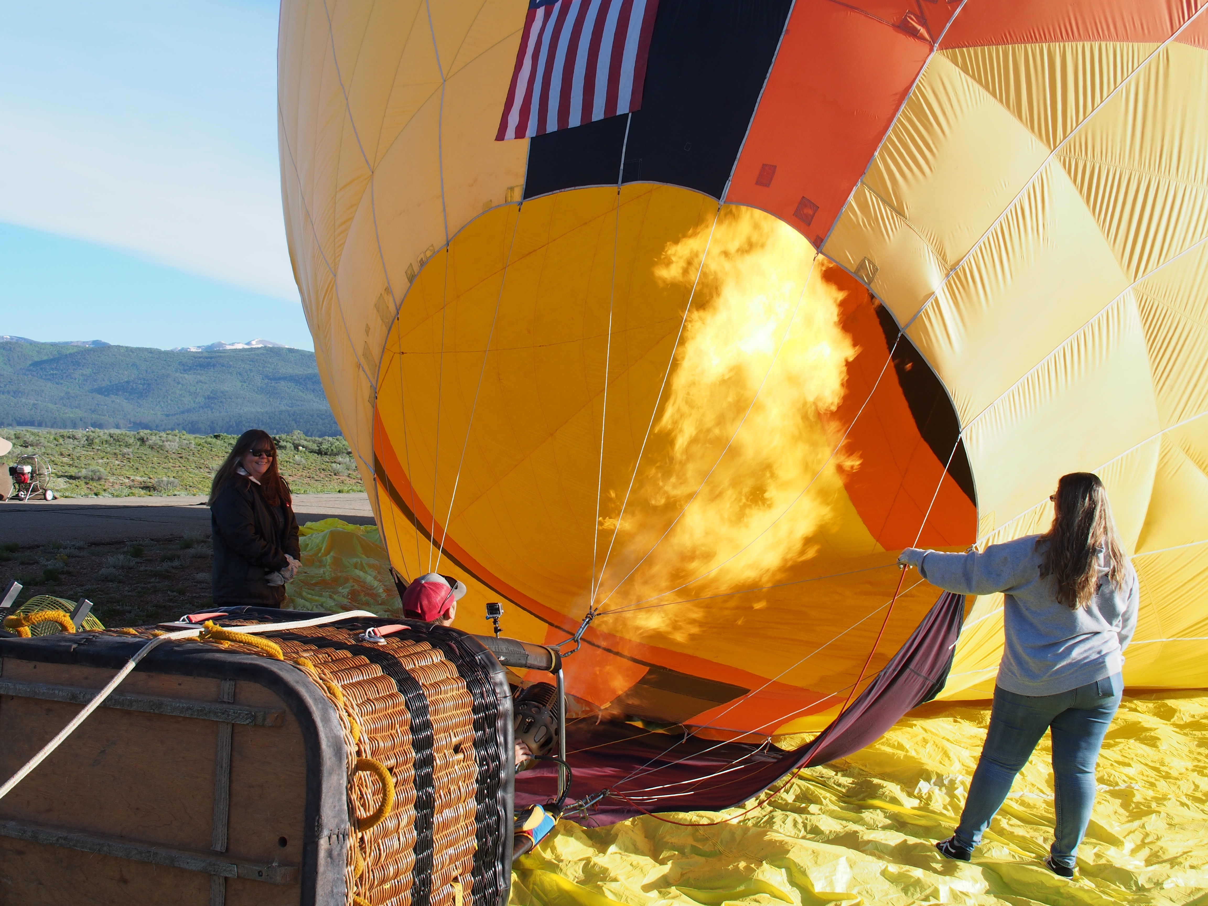
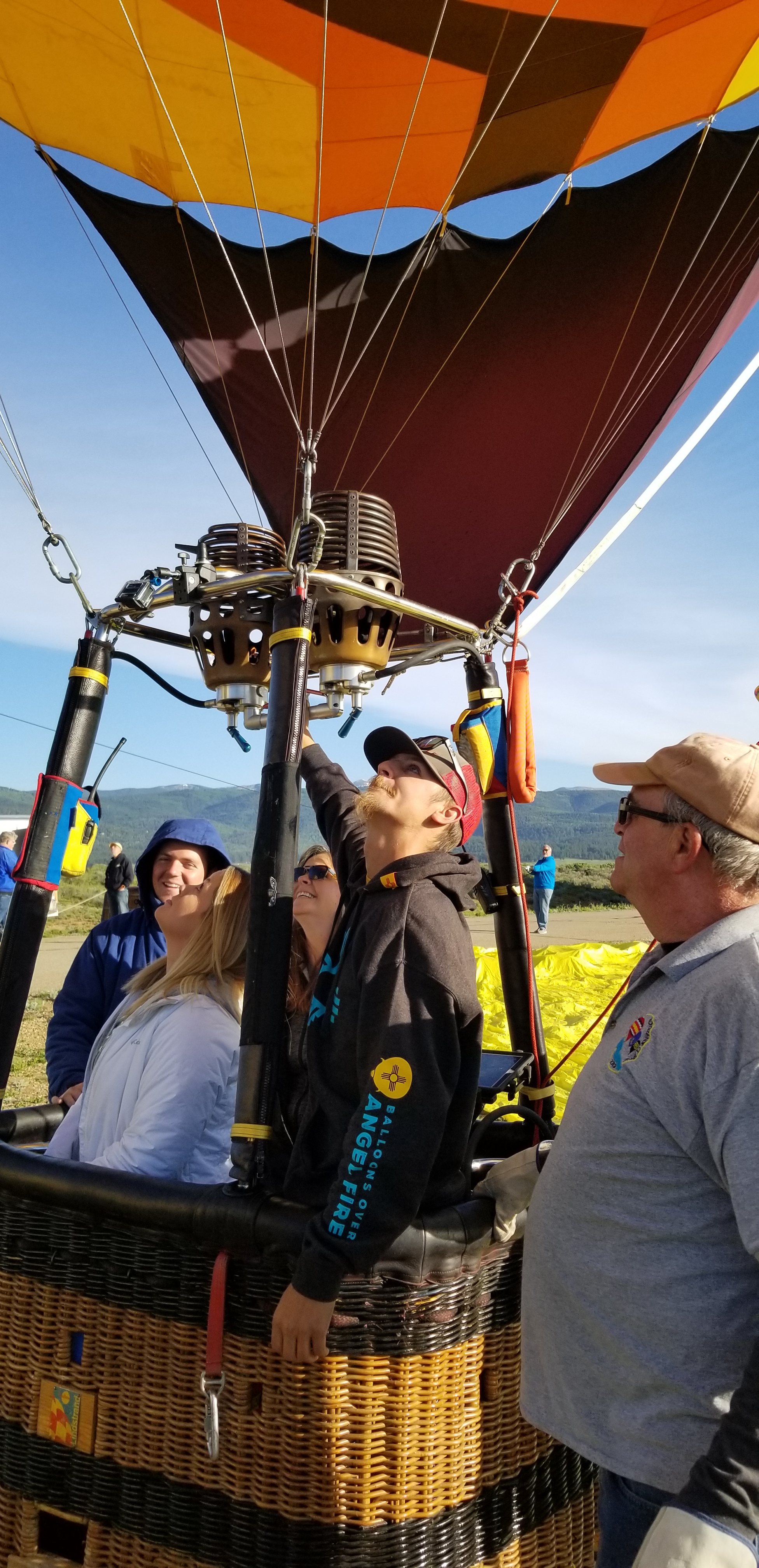
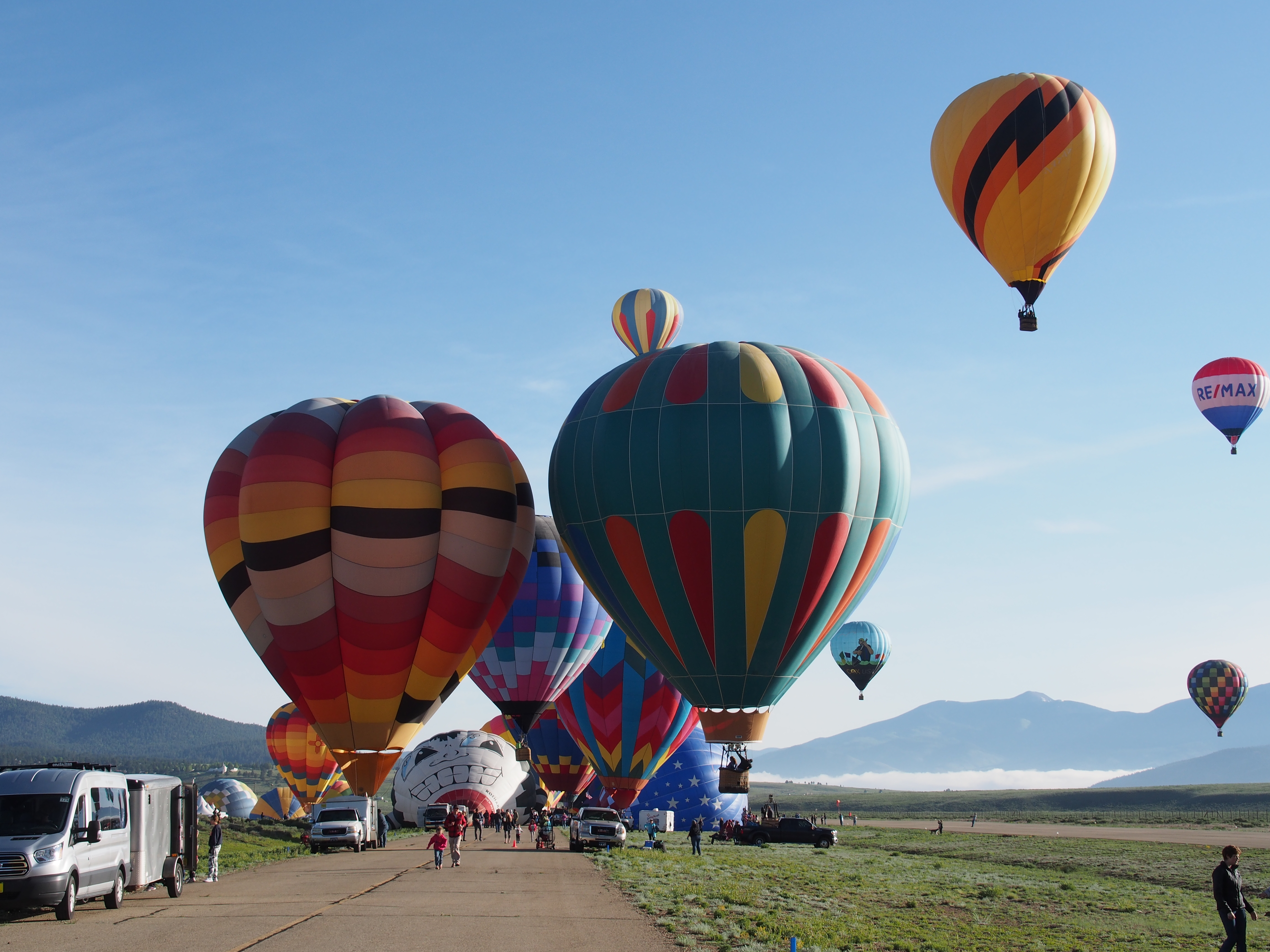
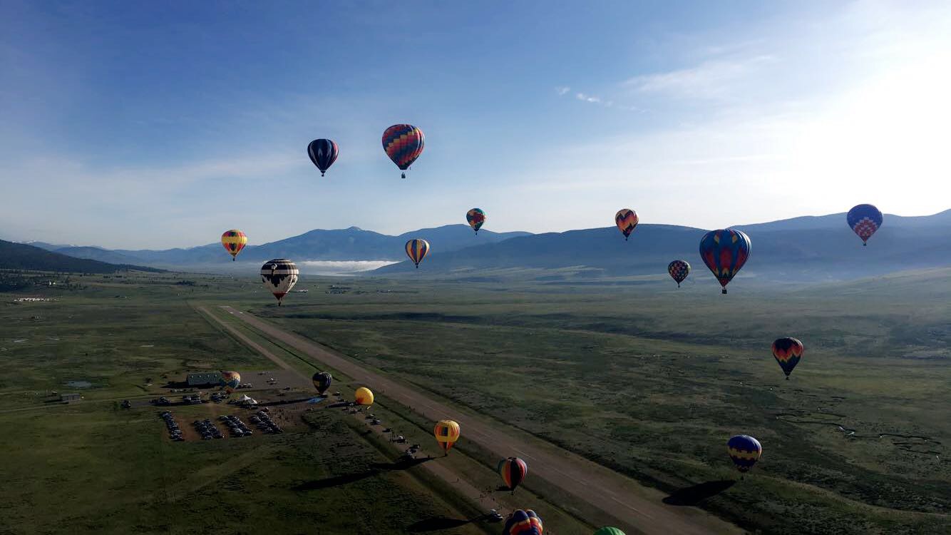
July 3 & 4, Angel Fire, NM

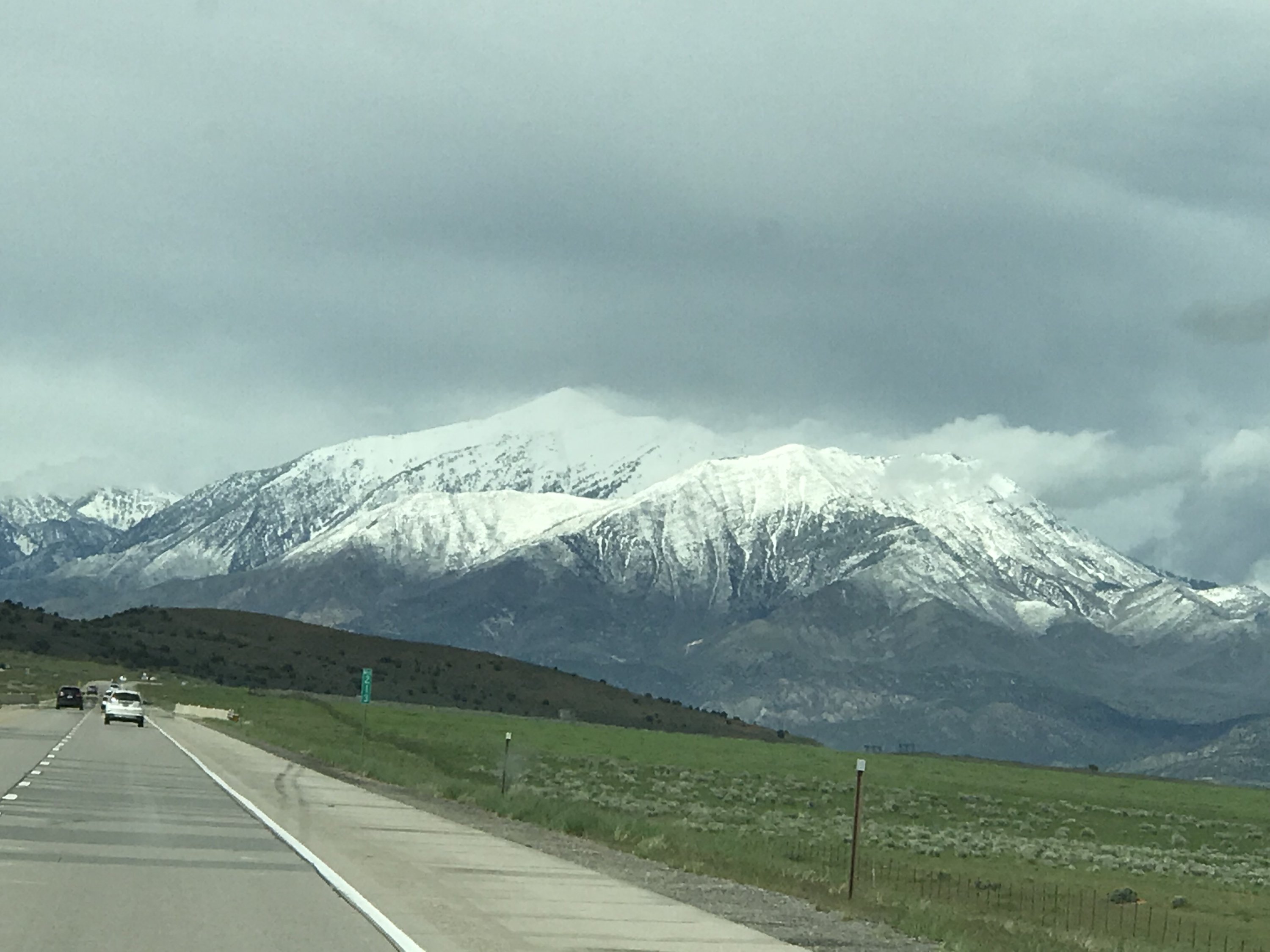
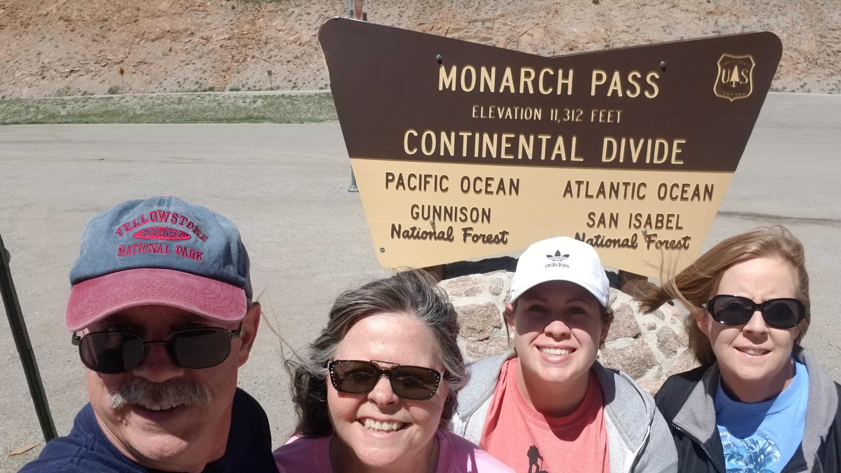
We set out early for Angel Fire, knowing that we were going to make a stop at Great Sand Dunes National Park along the way. The “highlight” of that drive was going up through Monarch Pass. Needless to say, Julie and Debbie weren’t enthused with the steepness of the drive nor the drop-offs along the side of the highway. At the 11,312′ summit, the temperature was quite cool and gave us a chance to relax a bit before heading back down the other side into Poncha Springs. Before long, the trip got a lot more flat (aka boring) as we headed to Great Sand Dunes National Park.

Chilly stop at the top of Monarch Pass.

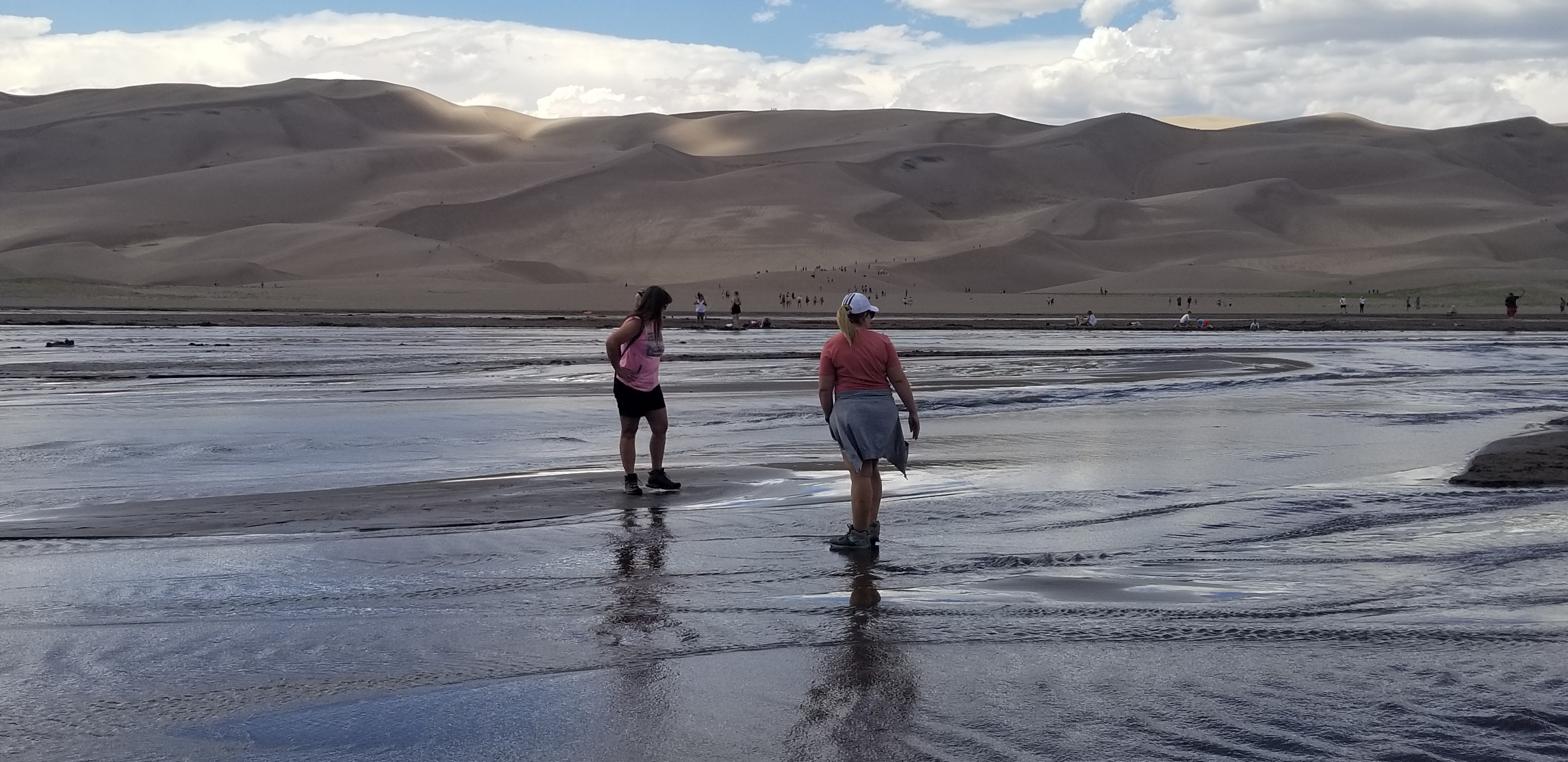
Great Sand Dunes National Park is an impressive field of 750′ high dunes that cover 30 square miles. It was too hot to spend any time climbing the dunes, but we did take the short hike down to Medano Creek that runs between the dunes and the Visitor Center. The creek is right at the base of the dunes and is a well used recreation area for families to play in the shallow water. The shallow creek is a couple of hundred feet wide and is known for a strange phenomenon that only happens a couple of places around the world. The creek has waves and I wish that I was able to attach a video that shows it.

Debbie and Ashley enjoying the waves in Medano Creek at Great Sand Dunes N.P.

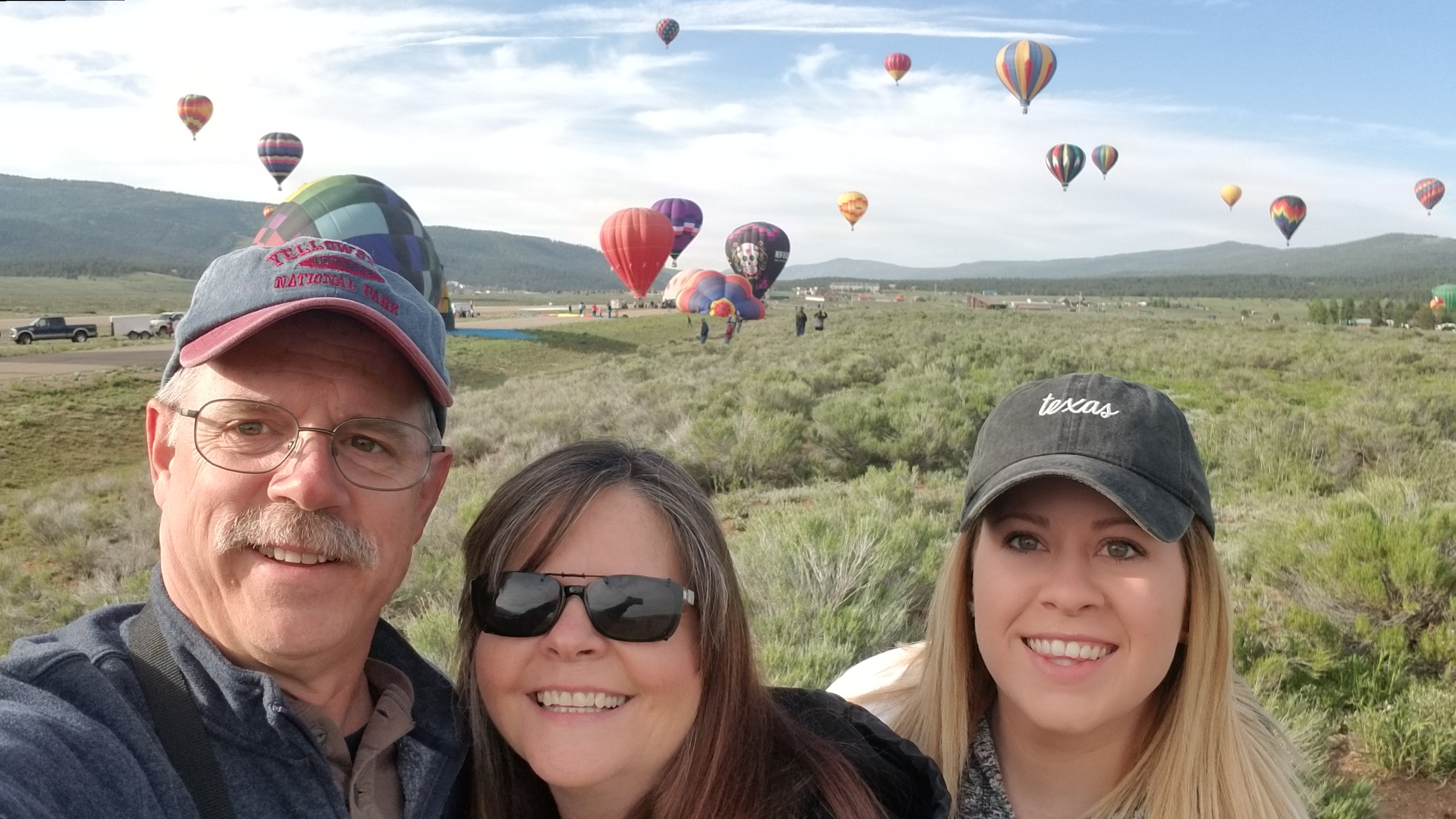
From there, we drove down through Questa and Red River, NM to Angel Fire. We planned to spend the Fourth of July there and see fireworks over Eagle Nest Lake. At the prescribed time, we drove towards Eagle Nest and parked with quite a few other people at a section of the state park at the south end of the lake. Unfortunately, the fireworks were launched at the north end of the lake and the view was less than spectacular.

July 5-6, Palo Duro Canyon State Park and Home

The next morning, we set out for Palo Duro Canyon State Park. We had purchased tickets to the see the musical TEXAS that is presented during the summer at an outdoor amphitheater down in the canyon. The weather was extremely hot when we arrived and ate a BBQ dinner before the play started. We had great seats and settled in for an enjoyable evening. It turned out that they have a fireworks display after the show, but only four times over the summer. We were lucky enough to be there on one of those nights. Unfortunately, we began seeing storm clouds moving in as the play progressed. Just as the show broke for intermission, it started to rain. Over the next few minutes, the rain got harder and lightning moved in. To our amazement, they started the second half of the show (at nearly 10:00 pm) with the actors standing in the rain and lightning flashing all around. We decided that we weren’t going to sit in the rain, so we headed back to our trailer that was about 4 miles down in the canyon. About 11:00, we began hearing the sounds of fireworks, so once again, we missed out on seeing fireworks.

The rain was pretty intense all night and we weren’t able to start breaking camp until nearly noon. This threw our whole schedule behind for the day, but with no more rain to deal with, we were able to get back home just about dark.

Summary

Our trip ended after 25 days of traveling, driving 5,495 miles (3,962 towing), and burning $1,615 worth of diesel fuel. We visited ten National Parks, several National Monuments or National Recreation Areas, and five state parks (one in each of our five states). We had a blast and are already starting plans for another trip later this summer/fall, plus a “big trip” for next summer (maybe east coast??).

NM, AZ, UT, CO National Parks; June 12 – July 6, 2019

Moab, UT (6/27/19-7/1/19)

The drive from Hatch, UT to Moab, UT was pretty interesting. Let me just put it this way; you need top off fuel in Richfield, UT if you plan to drive I-70 east from there to Green River, UT. Especially if you only have a 26 gallon tank on your F250. We had to stop at a scenic overlook and transfer fuel from my 5 gallon can in order to make it to Green River. The hills between those two towns are murder on fuel mileage. But, we eventually made it to Moab without further incident and set up at a very nice place on the south edge of town, called Spanish Trail RV Park.

While on the drive to Moab, Ashley called and made some reservations for a UTV tour for the next morning. Unlike most of the other excursions in town, you got to drive your own vehicle. The guide, Kent, drove his vehicle in the lead and Ashley drove right along behind with another three vehicles of customers behind. This turned out to be quite an exciting couple of hour; driving up huge rock faces and through some sandy draws of an area called Hell’s Revenge. The pictures just don’t do it justice as to just how steep and narrow some of the drive turned out to be. All in all, it was a great morning. Kent stopped regularly to provide us with information about the history of the area and the various rock formations. I’d highly recommend it if you’re in the area, but let me tell you, it’s HOT in Moab in late June. After the ride, we went back to our fifth wheel to try and stay cool during the heat of the day.

Following our guide in the Hell’s Revenge recreation area.

Just before 5:00, with the temperature still near 100, we drove over to Arches National Park which was just on the other end of town. The formations there area interesting and beautiful. We visited several of the formations and arches, all of which were on very short trails, so as to avoid the heat of the afternoon. We saw Balancing Rock, The Windows, and the pretty famous Double Arch, among a few others. Our next morning began fairly early. Debbie, Ashley, and I took the difficult and steep hike up to Delicate Arch, while Julie took the truck and explored several of the other arches and trails that were less strenuous. Delicate Arch is a beautiful formation, but the trek isn’t an easy one. We were amazed at how many people weren’t beginning the hike until very late morning when it was already getting so hot. Some were also not prepared, based on the shoes and clothes they were wearing, and the small amount of water they were carrying AND there were several small children in tow. I drank almost a gallon of water myself on that hike and we started about 8:00 am. Afterward, we took Julie on a short hike to be able to see Delicate Arch from below. From there, it was back to camp to cool off. We came back later in the day and saw a few more arches, including hiking to the famous Landscape Arch. It’s the longest natural arch in North America.

Ashley and Debbie standing under Delicate Arch.
Debbie and I at Landscape Arch.

Our last day in Moab included Canyonlands National Park and the beautiful Dead Horse Point State Park, which is as awe inspring as any of the National Parks. I highly recommend vising this state park if you haven’t seen it before. Canyonlands National Park has many great vista overlooks and you can also take a “high clearance vehicle” drive down into the canyons, but it’s a pretty long and narrow road with some shear cliffs to navigate. The ladies vetoed that drive, as could be expected. You can see why in the pics.

Dead Horse Point State Park
Canyonlands National Park

After Moab, we’re off to Colorado where we’ll be in search of some COOL weather.

NM, AZ, UT, CO National Parks; June 12 – July 6, 2019

Well, obviously I’m well behind in posting. It seems that we’ve been running from dawn to dark just about every day since leaving Angel Fire, NM after Debbie and Ashley got their hot air balloon ride on June 15. I’ll hit some of the highlights, then try to step it up and keep on track for the rest of our trip until we arrive home on July 6.

Carlsbad, NM (Carlsbad Caverns National Park)

After leaving Angel Fire on Sunday morning, we drove down to Carlsbad, NM. On Monday morning, we drove out to Carlsbad Caverns National Park and took the entire, self-guided walking tour that began at the natural cave entrance. Just like the last time we visited the caverns back in the late-80’s, we were well impressed with the caverns. We drove back out to the park in the late afternoon in an attempt to see the bats leave the caverns at sunset. Unfortunately, it appeared that a bad thunderstorm was moving in and, with all the lightening in the area, the bats delayed their exit and the rangers made us leave, for our own safety, of course.

Alamogordo, NM (White Sands National Monument)

On Wednesday, we left Carlsbad and decided to take the shorter route over the mountains through Cloudcroft, NM. It is a very steep and twisty drive, but Debbie and I drove it in the opposite direction last month, so I wasn’t too worried. As it turns out, that one specific day the road from Cloudcroft to Alamogordo was closed for road repairs. So, we were diverted north from Cloudcroft and it made the drive just as long as going through El Paso and took even longer.

Once we arrived at Oliver Lee Memorial State Park (which is quite pretty), we got set up and then headed down to White Sands National Monument. There, Ashley purchased a sled disc and we gave sand sledding a try. It was actually very fun, although tiring climbing back up the dunes after each ride. We then took a guided sunset hike with a very informative park ranger.

Ashley “sand sledding”.

St. Johns, AZ (stop-over point to Flagstaff, AZ)

On Thursday, we had no real plans. Our goal was to reach Lyman Lake State Park near St. Johns, AZ and the only real item of interest along the way was another stop at the Very Large Array at the National Radio Telescope Observatory. Debbie and I saw it last month, but thought it was a good spot for lunch and for Ashley to see it. We then moved on to St. Johns.

Flagstaff, AZ (Petrified Forest National Park, Sodona, AZ and Grand Canyon National Park)

Driving northwest from St. Johns on Friday, we took a detour though the Petrified Forest National Park and the Painted Desert. It’s a very beautiful area and we spent more time than anticipated at all of the stops throughout the park. After reaching the north end, we continued west on Interstate 40 towards Flagstaff. Unfortunately, as we approached Flagstaff, we got caught in a hunge traffic jam that was caused by two semis, one of which caught on fire. We also heard that there was a fatality involved.

That delay put us into Wood Mountain Campground just outside Flagstaff later than we expected, but we still had time to drive the VERY twisty route along 89A, south to Sodona for a nice dinner on the balcony of a restaurant called Sound Bites that Debbie and I found on our last trip. The views of the rocks were amazing as we ate dinner while the sun set. We drove back to the campground in the dark, which was a bit scary.

Friday was our one day trip to the south rim of Grand Canyon National Park. We visited several overlooks and did some hiking along the rim, before finishing up by watching sunset from Mohavi Point. It was beautiful and we took many pictures. Then a drive back to the campground, including a stop for some very good pizza in Tusayan, AZ.

Grand Canyon.

Hatch, AZ (Horsehoe Bend AZ, Zion and Bryce Canyon National Parks, Grand Staircase – Escalante National Monument)

Saturday (22nd) morning started out with a trip to the Flagstaff Airport to pick up my sister, and Ashley’s mom, Julie Warwick. From there, we headed north to Horseshoe Bend, near Page, AZ. It turns out that they’ve now build a parking lot and are in the process of building a visitor center. Of course, that means that they now charge admission. After we got in, we realized that we probably could have used our National Park pass to get in for free. There were a TON of people there. We then continued on through the southern portion of Grand Staircase-Escalante National Monument. The scenery is amazing through there. By afternoon, we reached our campground at Riverside Ranch RV Resort, just north of Hatch. This was to be our home base for a few days as we visited the parks in the area.

Horseshoe Bend.

Sunday (23rd), we drove into Zion National Park. We took a walk from the Visitor Center to the History Museum, then took the park shuttle to two different hiking trails; one to the Lower Emerald Pools, with its tiny trickle of a waterfall, and the other to Weeping Rock, where there was actually more water falling than at the falls of the Lower Emerald Pools.

On Monday (24th), we visited the less crowded, and evidently less visited, northern section of Zion National Park, called Kolob Canyon. There, we hiked the Timber Creek Overlook Trail. It’s a very nice, but small section of Zion, that doesn’t get much traffic. There was hike there up into a canyon that I definitely would like to do some day, but we just didn’t have the time on this day. From there, we drove through Red Canyon (National Forest Service) with its red hoodoos, then on down to Bryce National Park. After going to several of the overlooks at Bryce, Debbie, Ashley, and I hiked down into the canyon. It was pretty deep and strenuous, but we managed to do it and the view from down there really highlighted just how incredible and huge the formations really are. On Tuesday, (25th) on our way to Grand Staircase – Escalante National Monument, we stopped at a roadside area that was part of Bryce Canyon and hiked a short canyon trail to Mossy Cave and a waterfall.

Kolob Canyon portion of Zion National Park.

After we visited the Grand Staircase – Escalante Visitor Center, we took a 27 drive down a bumpy, graded, dirt road. Along the way, we stopped at an interesting area of rock formations called Devil’s Garden. At the end of our very bumpy, dusty ride, we hiked down into a very steep and hot canyon to explore Peek-a-Boo and Dry Fork slot canyons. Those were AMAZING. Peek-a-Boo reminded me somewhat of Antelope Canyon in northern Arizona. Dry Fork was much wider and deeper that Peek-a-Boo. After hiking back out, we took the 27 mile return trip on the same bumpy and dusty road.

Walking through Peek-a-Boo slot canyon.

Early Wednesday (26th), we returned to Zion where Ashley and I took on the daunting Angel’s Landing trail. If you aren’t familiar, please YouTube it. It’s a harrowing climb up a series of steep switchbacks to a point where you then hike a VERY narrow, steep and rocky climb to a most amazing view. Honestly, our pictures do not do this trail justice, so check it out YouTube. You’re basically waling along a narrow ledge with a 1,000 foot drop on one side and an 800 foot drop on the other. Debbie and Julie did some other hikes during the four hours that it took Ashley and I to complete the 2.6 mile long (each way), 1,488 foot climb to the top of Angels Landing. After eating lunch in the park, the four of us took the Riverside Trail up to an area called The Narrows, where Debbie and Julie hiked a ways up the famed slot canyon trail in the 46 degree water of the Virgin River. (Again, YouTube can be your friend in understanding this hike.)

A portion of the trail to Angels Landing!

Our trip is now scheduled to move on to Moab, UT on Thursday for a few days at Arches and Canyonlands National Parks and probably a visit to Dead Horse Point State Park.

NM, AZ, UT, CO National Parks; June 12 – July 6, 2019

Saturday, June 15, Angel Fire, NM

Debbie, Ashley, and I woke up early on the 15th in order to get over to the airport for the 6:15 a.m. pilots’ briefing. We were disappointed the previous day that wind came in and scrubbed plans for the balloons to fly, so we were pretty anxious that Saturday would be a better day. We weren’t disappointed when it was announced that the light winds were going to hold. With sunrise temps in the low 40’s., it seemed colder to me than it did the day before, even though it was actually warmer.

Our friend and balloon pilot, Morghan Chando, is known for being one of the first in the air, so we tagged along as his crew got his balloon out and ready to set up. Debbie got a big surprise when he asked her to help while they used a big fan to start getting his balloon inflated. You’d have thought that her face was going to crack from the huge smile she had as she got in there and helped. Ashley and I hung around and took pictures for posterity.

Morghan had some sponsors that were to be his passengers for the day, so Debbie and Ashley didn’t actually get to fly on Saturday, but we got to be really up close and personal as his balloon, along with 39 others were stood up and launched. Once they were all in the air and moving away from the field, we decided to grab some breakfast and take the chair lift to the top of the ski mountain. We took a short hike at the summit, mostly following the disc golf course. It was actually quite chilly up there and it began to rain a little, but there was also thunder in the area. We decided to catch the lift back down the mountain, but were told that they’d shut the mountain down and that we’d be taking a 30 minute, extremely bumpy, mini-bus ride back down. Once down, we made another drive back up to Red River where we had expected to meet up with Morghan, only to find that they had already returned to Angel Fire. But, we did end up eating dinner with Morghan and Nick, one of his crew. They were supposed to have a mass glow at 9:00, whee everyone would stand up their balloon and light them up with there flames. Mother Nature didn’t want to cooperate and the rain that had moved in early in the day returned and scrubbed that event.

Sunday, June 15, Angel Fire, NM

At dinner on Saturday night, Morghan had told Debbie and Ashley that he was going to do his best to get them a ride on Sunday morning, so you can imagine the excitement around our place on Sunday morning. We again met over at the airport for the 6:15 a.m. briefing. The temperature was in the upper 30’s, but there wasn’t a breath of wind. In fact, the two pilot balloons or “pi-balls”, small helium filled balloons that are released to show how the wind is moving at different altitudes, went almost straight up, showing practically no movement away from the launch point until they had disappeared out of sight. With that, the launch order was given and the crowd of 40 balloon pilots and crews started getting their equipment set up. During the briefing, Morghan told Debbie and Ashley that they would indeed be flying with him, so off we went to help him get set up.

Once again Debbie helped with the inflation process and the balloon was stood up with Morghan in the basket at the burner controls. Ashley was the first passenger to climb aboard and Debbie followed closely behind. Those two were so excited and happy that they were going aloft! After a short safety briefing in the basket, and a couple of blasts from the burners, up and away they went. I did my best to take pictures and video of it all. They spent a little over 45 minutes moving up and down among all of the other balloons that were also launching. Since there was so little wind, most of the balloons stayed fairly close to the airport and their close proximity to one another made for some really nice pictures. Unfortunately, our plans to leave Angel Fire were already behind schedule, so I passed on a chance for a short hop myself and Morghan told me that we’d get it done the next time.

With that, we rushed back to the campground and packed everything up and headed out on an eight hour drive to Carlsbad, NM where we intend to visit the caverns on Monday.

Enjoying the Balloons Over Angel Fire festival.
Morghan’s balloon, Mojo’s Reverse Gravity Machine.
Chairlift to the top at Angel Fire.
It was cold on the chair lift.
View from the top.
Debbie lending a hand with setup.
Preparing for liftoff.
Got a jump on most of the field.
Debbie and Ashley’s view from above.
Having fun 1,000-feet up.
Thanks, Morghan, for a wonderful experience.

NM, AZ, UT, CO National Parks; June 12 – July 6, 2019

Angel Fire, NM, July 13/14

The weather here has been perfect so far, although cool in the mornings. Debbie has been communicating with a young balloon pilot (Morghan Chando) since last year’s disappointing festival and was hoping that she and Ashley would be able to get a balloon ride with him. Unfortunately for them, he was assigned a sponsor by the festival organizers and those folks were going to be his passengers for most, if not all, of his flights. (Maybe they’ll still get lucky.) Now, Debbie is looking into what it takes to sponsor a pilot for next year, lol.

The first morning appeared to my untrained eye to be ideal ballooning weather; temperature upper 30’s at sunup, clear, and a light, 3 mph wind. We arrived early and listened in on the 7:00 a.m. pilots’ briefing. It sounded to me like everything was ready to get started for flying, only to hear a “but” from the flight director. Winds were expected to pick up and it was decided that they wouldn’t fly for safety reasons. He did say that they believed both Saturday and Sunday would be great days for flying. Since there were a fair number of spectators present, a majority of the pilots did decide to “stand up” their balloons and put on a static display. It was fun being right in among the balloons as their crews got them unpacked and inflated. Debbie and Ashley hung right in close to Morghan’s balloon as it was stood up, all while I wandered around taking pictures.

Since the ballooning ended early for the day, we went back to the RV resort for a free waffle breakfast. We then took a drive up to Red River for their Arts and Wine Festival. After walking around and eating lunch in town, we set up our lawn chairs in the park and listened to some live music for the rest of the afternoon.

Debbie and Ashley watching how it’s done
Morghan’s balloon
Beautiful place for a balloon festival

NM, AZ, UT, CO National Parks; June 12 – July 6, 2019

Our next journey has begun. We’re taking a three-and-a-half week trip to visit several National Parks and National Monuments around the southwest. Our niece, Ashley Warwick, will be joining us for the entire trip and my sister, Julie Warwick, will be spending the last two weeks with us.

Wednesday, June 12

Debbie, Ashley, and I started out with the prerequisite drive across west Texas, through Clovis, NM, and north to Ute Lake State Park near Logan, NM. It’s a nice park and made for a good stopover point on our way to Angel Fire, NM.

Thursday, June 13

We left Logan, NM and headed towards Angel Fire, NM, via Springer. Much of the way was on NM state highways which made for a shorter trip. The “highlight” was a stretch along NM-39 that was marked “Rough Road Next 25 Miles”. I must say, they didn’t lie. That road was really bumpy, but even the other sections of the NM state highways that we traveled were all pretty rough. The switchback climb just west of the small town of Mosquero, NM offered some really great views back to the east.

Just after lunch, we arrived at the Angel Fire RV Resort where we’re staying for the next few day while we attend the Balloons Over Angel Fire balloon festival. Debbie and Ashley are hoping to catch a ride in one of the balloons. We also plan on taking a run up to Red River while we’re here.

Vegas, Yellowstone, Tetons Trip, 20-22, Journey Home

After almost three weeks on the road, it was time for us to head back home. We needed to get home for the high school graduation of our eldest granddaughter, Haley.

It happened once again. We got up early to close up the trailer and get on the road only to find that for the first day in Grand Teton National Park, the sky was clear and bright. There were very few clouds or mist on the mountains, almost no wind, and it was a crisp 37 degrees. So, after packing up, we drove back over to the restaurant for a “quick” breakfast that turned into a 75 minute marathon. Before leaving, I walked down to take a few pictures of the brightly lit mountains.

Final morning, Best view we had of the mountains.
Panoramic view of the Teton Range, final morning

Once finally on the road, we planned to drive down to Moran and then head southeast towards Fort Collins, CO and find us a place to stop for the night. Well, as soon as we had driven just a couple of miles, we came across a pretty good sized group of folks standing along the road with these HUGE telephoto lenses and cameras on tripods. The park rangers were blocking off parts of the road to keep people back. As we slowly slipped through the area, we saw that there were three bears, apparently grizzly, just off the road. I was able to grab my camera and snap one single shot before being instructed to move along.

Grizzly bears as we left GTNP.

We turned east at Moran and started through the pass towards Dubois. I must say that I have NEVER seen so much snow in one place. It was an amazing winter wonderland, and at the end of May. It was hard to find a place to pull off and take any pictures, but I did my best. The snow was several feet deep everywhere except the road. But, the drive through the pass was made with ease. There we actually people up in that area riding snowmobiles.

Snowmobile tracks. (Snow deeper later, but no place to pull off.)

We made our way across Wyoming towards Cheyenne through a brutal crosswind, but we pressed on. As we drove south of Cheyenne towards Ft. Collins, CO, storms began to spring up and we passed through several hail storms. Luckily, we didn’t have any damage, but we later heard that some other Grand Design owners that we just an hour or two behind us had major damage to their truck and trailer. So, with the weather looking like it might be better farther to the south, we pushed on and tried to outrun them. We were making pretty good time until we reached Denver where the traffic was truly horrible, especially for a Sunday afternoon, and it took us nearly two hours to clear town. We finally got through the all bad weather and spent the night “dry camping” at the Cracker Barrel in Pueblo, CO. Never again do I want to spend a full twelve hours driving well over 600 miles while pulling a 32′ fifth wheel trailer through wind, hail, and traffic!

Our next morning was pretty uneventful. Our destination was the Big Texan RV Resort (aka Amarillo RV Ranch) in Amarillo, TX. It was a pretty basic park and did its job of providing us a place to stay that had full hookups so that we could do a very thorough tank flushing on our last night. We were told that if we wanted the park to make the reservations for us, they’d drive us over to the Big Texan Steakhouse in a limousine, complete with a huge set of long horns on the grill. We passed and just took it easy.

Our final push home was from Amarillo, through Lubbock (where Haley will be going to school next year) and Abilene. We did stop just outside of Abilene to go through a truck wash and clean up both the trailer and our truck. It was much easier than doing it ourselves in the limited time we have available before leaving on our next trip. Arriving home, I took a quick look at the final numbers from our trip. In 22 days, we drove a total of 4,582 miles (not all of it towing) and spent $1,408 on diesel fuel, for just under $.31 per mile. I can probably use that number for future trip budgeting.

We had a great time on this trip and even though we saw many, many amazing things, there are plenty of reasons to go back to each of these places. I hope you found my tales interesting. If so, please feel free to comment below. Our next travel trailer trip begins next month and will include New Mexico, Arizona, Utah, Colorado, and of course, Texas, so stay tuned.

Vegas, Yellowstone, Tetons Trip, Days 17-19, to Grand Teton N.P.

I’m behind posting about the last few days of our trip while in Grand Teton National Park. Seems like we’ve been seeing a lot and I just didn’t get it done. Debbie told me that I’ve been too long-winded in my posts, so you can decide whether to take the time to read it or not. I just can’t seem to get everything we did into a few short sentences. We’ll see how successful I am in keeping this brief, but still share what we did and saw.

Thursday, June 23 (Day 17)

For the first time since we arrived in West Yellowstone, we woke up to find that it hadn’t snowed and the sun was coming up on a partly cloudy morning. This made sense because this was our day to leave and travel south to Colter Bay in Grand Teton National Park.

After consulting the Grand Design Owners Facebook page, it seemed that the unanimous opinion of those that had taken both paths from West Yellowstone to Grand Teton N.P. was to go through Yellowstone N.P. That turned out to be such an easy trip that I’d recommend that route to anyone needing to make the trip between Grand Teton and Yellowstone, even pulling a trailer.

The road out of the south end of Yellowstone becomes the John D. Rockefeller Jr. Memorial Parkway which had a lot of beautiful overlooks. In places, the snow along the side of the road was still 4-6 feet deep. But, leaving Yellowstone we ran into our old friend from the previous few days, snow, but it wasn’t heavy enough to cause us any issues.

We checked into the Colter Bay Village RV Park and found it to be a little crowded due to the upcoming holiday weekend. Although the spots were heavily wooded and not very level, we had no problems getting everything situated and hooked up. We discovered, however, that we had neither cell nor WiFi coverage (another reason for not posting lately). A short trip to the National Park Service Visitor Center in the Village provided us great maps of the trails and sights, along with a great view of the Teton Mountains.

View from near our campground at Colter Bay

With some daylight remaining, we took a quick drive south to the Jackson Lake Lodge. It’s a beautiful hotel with a grand lobby that faces the lake and mountains. They have a huge panoramic window on the back that I believe is 60 feet high and stretches all the way across the large lobby. We followed that with a scenic drive down Teton Park Road to Signal Mountain Road, which took us to the top of a smaller mountain that offered amazing views of both the Tetons and of the large valley that makes up much of Grand Teton National Park. We also drove south past Jenny Lake and down to Moose before turning back north along US-191, which is the main road though the park, until we came to the turnoff that leads over to Mormon Row and the often photographed Moulton Barn. Pictures there didn’t provide me the outcome that I wanted due to the fading light, so a return trip was in order. As we headed towards our campground, it seemed that everywhere we looked there were large herds of elk and an occasional Pronghorn antelope.

Jackson Lake Lodge.

We finished off the night eating dinner at the restaurant at Colter Bay Village and discovered that they actually had Wi-Fi. It was the first night that they were open for the season. Our waiter had just come to Grand Teton to work and we had quite the chuckle as he described how terrified he was while driving through the mountains from his home in the flatlands of Kansas.  All in all, a good starting day to our few days here.

Friday, June 24 (Day 18)

Our first full day at Grand Teton N.P. started out with cold, rain, and clouds, so we were slow to venture out. Once we did, we found that you couldn’t even see more than just the first few hundred feet of the mountains. We decided to plow ahead and visit some of the various visitor centers and other sights that didn’t necessarily involve looking at the Teton peaks, in spite of 37 degree temperatures and light rain.

The only part that we could see, had received a light coating of fresh snow. We veered off the main road to take the Jenny Lake scenic drive. It was very pretty and we decided that we’d need to come back when we could see the mountains along with the lake. The drive runs both directions along the lake from the north end of the drive to the Jenny Lake Lodge. After that the road to the south is one way, southbound, down to the Jenny Lake Visitor Center, which we found to still be closed for the season.

We made our way to the village of Moose and the Craig Thomas Discovery and Visitor Center. I’ve got to say that this is one of the nicest visitor centers that we’ve ever encountered, with a huge expanse of tall windows that directly face the Tetons. From there, we drove the Moose-Wilson road. This is a scenic drive that includes about 2 miles of unpaved road. We were told that we’d see moose there and weren’t disappointed; finding one moose hiding in the trees about 30 yards off the road. We took the turnoff to Teton Village in Jackson Hole where we had hoped to ride the gondola to the top of the ski mountain there, but since we couldn’t even see the top, we didn’t go.

From there, we went into the town of Jackson, which I don’t see as much more than a tourist trap. We stopped at the visitor center, where Debbie took some pictures of a Canadian goose and her freshly hatched offspring. It seemed that our luck had changed as the sun began to come out and the clouds that had been hiding the mountains all day began to clear. We thought this might give us some opportunities to take the Gros Ventre Road and circle back around to Mormon Row in hopes of getting some better pictures, which we did. We saw several more moose along the way, but unfortunately none of them yet had antlers (Debbie’s goal). We were able to get several good pictures of the Moulton Barn and mountains.

Canadian Goose and one of her new goslings
Moulton Barn on Mormon Row

We circled back to the Chapel of the Transfiguration, a small, old Episcopal church had a large window behind the alter that perfectly framed the Teton mountains. It was a very pretty chapel, but my pictures didn’t come out very well since I had left my flash back at camp. We followed that with an unpaved turnoff to Schwabacher Landing where the river there had a beaver dam and small lake, before moving on to the Snake River Overlook. This was the location of a famous Ansel Adams photograph that was sent into space on one of the Voyager spacecraft.

Chapel of the Transfiguration

Saturday, May 25 (Day 19)

Once again we started out with cold, wet, and cloudy weather, but decided we wanted to try to get some hiking in as it was still clearer than the day before. We went back to Jenny Lake and took a ferry across the 41 degree water to a trail to Hidden Falls and Inspiration Point. Even though it wasn’t perfect, it was a great hike where we almost immediately saw a moose laying just off the trail. There were many places where we the trail was covered in snow. Due to the crowd, we first bypassed the falls to go to Lower Inspiration Point where we found several marmots scampering among the rocks. Even though they didn’t seem to like our presence, I was able to get some good pictures. Heading back down the mountain, we did take the 60 yard, snow covered side trail to Hidden Falls. The view of the 200 foot waterfall certainly didn’t disappoint. With the return of more clouds and rain, we decided to loop back down to Jackson to pick up some propane since the campground was having issues with their equipment. As we left the south entrance of the park, we stopped along the road to watch a moose very near the truck. She seemed to be trying to figure out how to cross the road with all of the cars and ended up passing just in front of ours for some great pictures and video. A great ending to our last full day in Grand Teton National Park.

Marmot on Inspiration Point
Hidden Falls above Jenny Lake
Moose beside the car

If you have any comments, there’s a place to do that below.

Vegas, Yellowstone, Tetons Trip, Days 13-16, Yellowstone National Park

It’s been a few days since I posted anything, mainly because we’ve been pretty busy touring Yellowstone National Park, but I’ll try to catch you up. This post might be a little long-winded, so if you aren’t interested in my ramblings, at least take a look at some of the pictures at the bottom.

Sunday, the first day, started out with a surprise in the weather. We woke up to snow covering all of the pine trees here in the RV park, along with the grass and vehicles. It was just at freezing here in West Yellowstone, MT and the forecast wasn’t going to get much better. We decided that we didn’t come all this way to hide from the cold, so we headed off to the park. We started out going in through the west entrance, of course, and almost immediately had our first bison observation. A single bison was walking along the side of the road, paying no attention to the fact that cars were driving slowly by. But immediately after that, we came across a really large herd of them laying about in a field and Debbie needed her picture taken with them.

After turning south at Madison Junction, we noticed a side road turning off to go to Firehole Falls. The drive was beautiful with really nice falls. It seemed that most people just cruised on by, in a hurry to get down to Old Faithful, and missed out on this nice drive. We then headed on south to join the rest of those folks, but took time to stop and see the Fountain Paint Pots in the Lower Geyser Basin, then into the Midway Geyser Basin for a view of Grand Prismatic Spring. Lots of beautiful colors at both locations. Arriving at the Old Faithful Visitor Center in the Upper Geyser Basin, we not only watched the famous geyser erupt, but we spent a good bit of time wandering around the Upper Basin and viewing the many thermal features that are located behind Old Faithful.

Even though it was still cold, in the low 30’s, we pressed on towards Yellowstone Lake. Along the way, we stopped and viewed the Keppler Cascades, which is a pretty long series of waterfalls and rapids. Then, we arrived at the West Thumb Geyser Basin on the shores of a frozen Yellowstone Lake. It was interesting to see hot water boiling out of the ground right beside a huge frozen lake. The whole day was cold and damp, but it didn’t dampen our spirits as we enjoyed the many beautiful sights.

The second day started just like the first, with snow and 32 degree temps. The forecast the day didn’t look good, so we hung around and rested for a couple hours after breakfast. After a while, we decided that we just needed to head on into the park anyway. We went back into the park just as before, except this time we headed north from Madison Junction toward the Norris Geyser Basin and the Mammoth Hot Springs areas. The Norris Basin is a huge area of thermal activity and it took us a while to walk most of it. Of particular note at Norris was the Steamboat Geyser. It was a massive, continually blowing geyser that you could hear and see from all over the basin. (I have a video, but can’t seem to upload it here.) Moving north of Norris, we pulled off to view Gibbon Falls, which were spectacular.

From there, we continued up to Mammoth Hot Springs. We ran into an area where they were rebuilding the road. Single file northbound, then single file southbound, alternating. It was a muddy mess and the truck was quite the sight after going through it. The weather turned nasty as we got to Mammoth and we spent time in the visitor center until we gave up. Instead of viewing the spring, we headed just a few miles farther north to Gardiner, MT to see the historic Roosevelt Arch entrance. Once there, we walked in the cold rain just to take our picture there. On the way back, we passed some elk feeding alongside the road. All were female, so Debbie was a little disappointed that none of them had antlers. As we passed the Mammoth Hot Springs “mountain”, the rain broke so we decided to give the walk a try. Although much of the area is very beautiful, we found that a good part of it has actually become inactive and has dried up. Unfortunately, those areas just look like a bland, white wasteland. We were impressed with the size of the area and could only imagine how it must have once looked, but a little disappointed.

On the way back through the park to our campground, we came across a traffic jam. It turned out to be one of the famous Bison backups. After finally getting through that backup, we soon came across another slowdown, but this time it was caused by a bear happily munching grass right on the side of the road. Debbie was able to get a picture by hanging out of the window with her phone. That, along with the bison and elk, made three of the animals that she had on her bucket list.

On day three, we once again awoke to cold and snow. We set our sights on the Grand Canyon of the Yellowstone, east of the Norris Geyser Basin. After the visitor center visit, where snow was piled about six feet deep in the parking lot, we drove around to the South Rim Drive and got our first look at the Upper Falls. We wanted to hike the trail to Uncle Tom’s Overlook, but the trail was closed due to snow and mud. So, we drove on around to Artist Point. This is the spot from which most of the pictures you’ve seen of the Lower Falls have been taken. Fortunately for us, the weather and time of year greatly reduced the crowds throughout the park and we were able to take a lot of great pictures.

From there, we moved around to the north Rim and took the long hike down to the brink of the Lower Falls. The power 0f that water was impressive; I just wish I could have harnessed some of that power on the hike back up. We then decided to take the hike to Inspiration Point on the North Rim Trail, only to find at the end of the long muddy and snowy trek that Inspiration Point had been closed due to damage caused by the winter weather. It was disappointing because what we saw was the best, most modern overlook of any we’d experienced in the park. Because the trail was closed from that end, we were forced us to take a very long walk back around the road to get to our truck.

To close out the day, we decided to make a run through the Hayden Valley, known for all the animals, then down to Fishing Bridge and to Grant Village, only to find out that both areas and visitor centers were still closed until next weekend. On that drive, we ran into a huge snowstorm that lasted for much of the drive back around to the Old Faithful area. The flakes were huge and abundant, with snow covering all of the pine trees. As we headed towards the west exit, talking about the animals we’d seen, Debbie made the comment that she sure hoped we’d see a wolf, a bald eagle, and a moose (although not likely in Yellowstone). All of a sudden, we were surprised to see a bunch of cars stopped along the road with people watching a wolf down near the river. He appeared to be hunting for dinner in the grass. We made an immediate U-turn and I managed to get some long-range pictures. He headed off away from us, parallel to the road, so as I drove up to make another U-turn, I spotted a turn-out and thought maybe I’d be able to get another picture as he passed by me along the river below. As I got to the wall of the overlook, I was surprised to see that he was trotting by, literally within ten yards of me. I was so stunned that I didn’t even have my camera turned on. I was able to get it on and take another couple of pictures. A bit farther down the road, there was a huge crowd of people lining the road, many with huge telephoto lenses and tripods. They were watching an elk carcass along the edge of the opposite bank, waiting for a bear to arrive for dinner. While we didn’t see any bear, we did manage to spot a bald eagle sitting on the top of a dead tree, watching all of the craziness.

Day four once again began with snow and cold. After walking and hiking over 22 miles over the previous three days, we decided to just take a day off and do some grocery and souvenir shopping here in West Yellowstone. Tomorrow will be a travel day down to Colter Bay in Grand Tetons National Park. Now we just need to decide if we should take the short route through Yellowstone N.P., or take the long, “RV Garmin inspired” way around through Idaho.

Debbie’s First Bison Herd
Firehole Falls
Old Faithful
Keppler Cascades
Gibbon Falls
Roosevelt Arch at the North Entrance
Elk beside the road.
Terraces at Mammoth Hot Springs
Bison Traffic Jam
Black Bear
Upper Falls in Grand Canyon of the Yellowstone
View from Artist Point, Lower Falls in Grand Canyon of the Yellowstone
The snow let up a little for us to get a picture.
Wolf from Long Range
Wolf, after he almost ran over me.
Bald Eagle

Vegas, Yellowstone, Tetons Trip, Days 11/12 Off to Yellowstone

We started out Friday morning bright and early with a trip to get a new tire in Las Vegas before heading out. We needed to get rid of that failed tire as quickly as possible so that we could head as far towards West Yellowstone, MT as possible. Once we got to Discount Tire, I decided to just replace all four of those original tires with “the best” trailer tires available, Goodyear Endurance. The original Westlakes had nearly 13k miles on them and although the three good ones probably would have made the rest of the trip, we were planning on replacing them on the last day of our trip on our way back through Abilene anyway.

The morning was much cooler than we had been experiencing, especially after the wind had picked up so much on Thursday night. The guys at D.T. got us all changed out and we were on the road by 9:30.

It started out as a pretty nice day and it remained that way all the way to Salt Lake City. We saw some nice scenery as we drove northward. We had no planned camping spot since it was to just be a quick layover, and we ended up dry camping at the Cabela’s north of town. They allow campers to stay the night for free, although it cost us a lot more than any other campground we’ve ever stayed at. The forecast for Yellowstone had turned to cold and wet, so we bought a few essential items to keep from freezing during our visit. Evidently we didn’t pack enough really warm clothes. It started raining just as we finished shopping, so we grabbed some fast food and called it a night.

We woke up early this morning (Saturday) to cold, damp, cloudy weather and that pretty much didn’t change throughout the day. The drive north into and across the corner of Idaho, then into Montana, was really pretty, at least what we could see through the rain and clouds. There was lots of snow still on the mountains and along the road through the passes.

We made no real sightseeing stops today because we were trying to beat some forecasted bad weather for West Yellowstone that was to blow in later in the day. Well, as per my usual, it started to rain a bit as we pulled into the Grizzly RV Resort. I managed to get in and hooked up and the weather cleared briefly. We did some laundry before dinner, during which the rain really started.

They warned us that there was a possible freeze tonight and for us to disconnect our water line from their spigot before turning in. They have heated water connections, but we are responsible to make sure nothing froze overnight. So there I was, just before sunset, outside in 37 degree weather, fillng our fresh water tank and unhooking the water connection.

Well, we are off in the morning to head over to the park for our first of four days staying here, in spite of the fact that that the high is suppose to be in the mid-40’s. I’m hoping that the weather will cooperate.

Discount Tire, Las Vegas.

Southern Utah.

Just south of Salt Lake City.

Southeastern Idaho approaching Montana.

Grizzly RV Resort